Difference between revisions of "Sensitive waters and other receiving waters"
m |
m |
||
| (7 intermediate revisions by the same user not shown) | |||
| Line 5: | Line 5: | ||
*'''Mississippi national river and recreation area Mississippi River critical area'''. For more information see [https://www.nps.gov/miss/learn/management/bomcrit.htm] and [http://www.dnr.state.mn.us/waters/watermgmt_section/critical_area/index.html]. | *'''Mississippi national river and recreation area Mississippi River critical area'''. For more information see [https://www.nps.gov/miss/learn/management/bomcrit.htm] and [http://www.dnr.state.mn.us/waters/watermgmt_section/critical_area/index.html]. | ||
*'''Minnesota coastal program boundaries'''. For more information see [http://www.dnr.state.mn.us/waters/lakesuperior/index.html]. | *'''Minnesota coastal program boundaries'''. For more information see [http://www.dnr.state.mn.us/waters/lakesuperior/index.html]. | ||
| − | *'''Minnesota calcareous fens'''. For more information see [ | + | *'''Minnesota calcareous fens'''. For more information see [https://files.dnr.state.mn.us/eco/wetlands/calcareous_fen_list.pdf list of calcareous fens] and [https://files.dnr.state.mn.us/natural_resources/water/wetlands/calcareous_fen_fact_sheet.pdf fact sheet on calcareous fens] |
<!--*'''Metropolitan Council priority lakes'''. For more information see [http://www.metrocouncil.org/planning/environment/WRMPP/WRMPPMay2005_Appendices2.pdf]--> | <!--*'''Metropolitan Council priority lakes'''. For more information see [http://www.metrocouncil.org/planning/environment/WRMPP/WRMPPMay2005_Appendices2.pdf]--> | ||
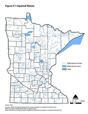
| − | *'''Minnesota impaired waters'''. For more information see [ | + | *'''Minnesota impaired waters'''. For more information see [https://www.pca.state.mn.us/water/total-maximum-daily-load-tmdl-projects] |
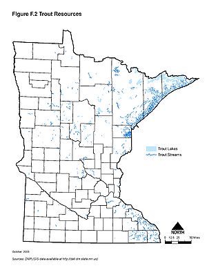
*'''Minnesota trout resources'''. For more information see [http://www.dnr.state.mn.us/fishing/trout_lakes/list.html]. For listed trout lakes and trout streams see [https://www.revisor.mn.gov/rules/?id=6264.0050]. | *'''Minnesota trout resources'''. For more information see [http://www.dnr.state.mn.us/fishing/trout_lakes/list.html]. For listed trout lakes and trout streams see [https://www.revisor.mn.gov/rules/?id=6264.0050]. | ||
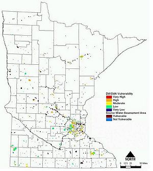
| − | *'''Minnesota source water protection areas'''. For more information see [ | + | *'''Minnesota source water protection areas'''. For more information see [https://www.health.state.mn.us/communities/environment/water/swp/mapviewer.html] or [https://www.health.state.mn.us/communities/environment/water/swp/index.htm] |
*'''Minnesota scientific and natural areas'''. For more information see [http://www.dnr.state.mn.us/snas/list.html] | *'''Minnesota scientific and natural areas'''. For more information see [http://www.dnr.state.mn.us/snas/list.html] | ||
Additional information can be found on the following topics: | Additional information can be found on the following topics: | ||
| − | *[https://www.revisor.mn.gov/rules/ | + | *[https://www.revisor.mn.gov/rules/pdf/7050.0180/2014-01-18%2007:04:14+00:00 Nondegradation for Outstanding Resource Value Waters] |
*[http://www.dnr.state.mn.us/waters/watermgmt_section/pwi/maps.html Public water inventory maps] | *[http://www.dnr.state.mn.us/waters/watermgmt_section/pwi/maps.html Public water inventory maps] | ||
| + | |||
| + | {{alert|Some of the maps shown below may be outdated, such as the Impaired Waters map, which is from 2014. We recommend using the links above if you need the most recent information.|alert-warning}} | ||
{{alert|To view the title of an image hold the mouse over the image. To view the image click on the image. Most views show higher resolution depictions of the image.|alert-info}} | {{alert|To view the title of an image hold the mouse over the image. To view the image click on the image. Most views show higher resolution depictions of the image.|alert-info}} | ||
| Line 28: | Line 30: | ||
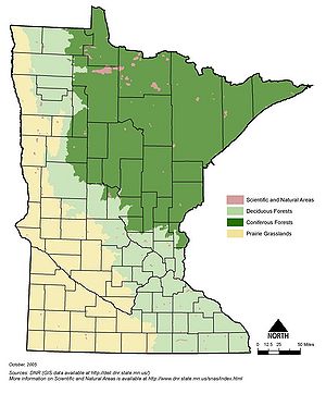
[[File:Minnesota scientific and natural areas.jpg|300px|alt=map showing the location of Minnesota's scientific and natural areas|Map showing the location of Minnesota's scientific and natural areas]] | [[File:Minnesota scientific and natural areas.jpg|300px|alt=map showing the location of Minnesota's scientific and natural areas|Map showing the location of Minnesota's scientific and natural areas]] | ||
| − | [[ | + | [[Category:Level 3 - General information, reference, tables, images, and archives/Images/Maps]] |
Latest revision as of 22:19, 19 December 2022
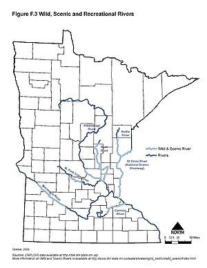
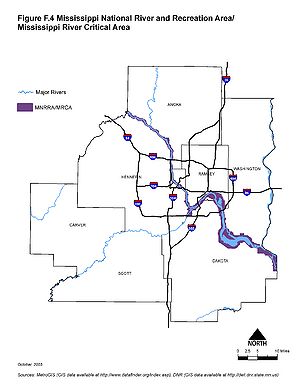
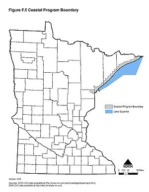
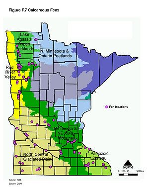
Information: This page contains the following maps showing Minnesota's sensitive waters:
- Minnesota wild and scenic rivers. For more information see [1].
- Mississippi national river and recreation area Mississippi River critical area. For more information see [2] and [3].
- Minnesota coastal program boundaries. For more information see [4].
- Minnesota calcareous fens. For more information see list of calcareous fens and fact sheet on calcareous fens
- Minnesota impaired waters. For more information see [5]
- Minnesota trout resources. For more information see [6]. For listed trout lakes and trout streams see [7].
- Minnesota source water protection areas. For more information see [8] or [9]
- Minnesota scientific and natural areas. For more information see [10]
Additional information can be found on the following topics:
Caution: Some of the maps shown below may be outdated, such as the Impaired Waters map, which is from 2014. We recommend using the links above if you need the most recent information.
Information: To view the title of an image hold the mouse over the image. To view the image click on the image. Most views show higher resolution depictions of the image.
This page was last edited on 19 December 2022, at 22:19.

