Difference between revisions of "Temporary construction erosion and sediment control"
m |
PKalinosky (talk | contribs) (→Overview of temporary sediment control practices: Deleted duplicate image.) |
||
| (20 intermediate revisions by one other user not shown) | |||
| Line 1: | Line 1: | ||
| − | {{alert| | + | {{alert|The information on this page is from the original Minnesota Stormwater Manual (2005). For updated information on construction stormwater best management practices we recommend the following links.|alert-warning}} |
| − | + | *[[Erosion prevention practices]] - Links to a page that provides a portal to information on individual erosion prevention practices | |
| + | *[[Sediment control practices]] - Links to a page that provides a portal to information on individual sediment control practices | ||
| + | *[[General principles for erosion prevention and sediment control at construction sites in Minnesota]] | ||
Temporary construction erosion and sediment control is the practice of preventing or reducing the movement of sediment from a site during construction through the implementation of man-made structures, land management techniques, or natural processes. This page does not contain detail on the use of specific BMPs but instead merely discusses their use and refers the reader to other useful resources for detail. | Temporary construction erosion and sediment control is the practice of preventing or reducing the movement of sediment from a site during construction through the implementation of man-made structures, land management techniques, or natural processes. This page does not contain detail on the use of specific BMPs but instead merely discusses their use and refers the reader to other useful resources for detail. | ||
| − | |||
| − | |||
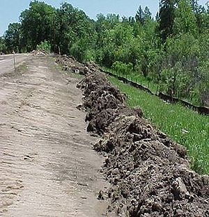
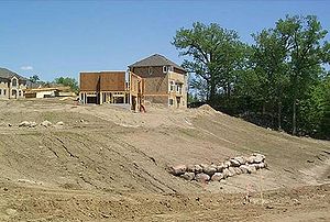
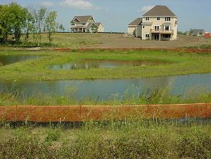
<font size=3>[[File:Example of vegetated buffers.jpg|thumb|300px|alt=photo showing an example of a vegetated buffer|An example of a vegetated buffer adjacent to a construction site.]]</font size> | <font size=3>[[File:Example of vegetated buffers.jpg|thumb|300px|alt=photo showing an example of a vegetated buffer|An example of a vegetated buffer adjacent to a construction site.]]</font size> | ||
| Line 13: | Line 13: | ||
=='''Planning'''== | =='''Planning'''== | ||
| − | |||
To establish a construction plan that will minimize sediment movement, designers will need information on existing site conditions and neighboring resources that require special consideration including water bodies, natural areas, bluffs and other highly erodible or sensitive areas. Construction activities should be designed in a manner that minimizes overall soil disturbance and phases areas of disturbance such that the amount of land disturbed at any one time is reduced. This type of planning will limit the need for larger structural sediment control solutions. Additionally, the designer should determine which local, state, and federal agencies require permits for the type of work planned. The site plan will need to account for the requirements of all agencies issuing permits. | To establish a construction plan that will minimize sediment movement, designers will need information on existing site conditions and neighboring resources that require special consideration including water bodies, natural areas, bluffs and other highly erodible or sensitive areas. Construction activities should be designed in a manner that minimizes overall soil disturbance and phases areas of disturbance such that the amount of land disturbed at any one time is reduced. This type of planning will limit the need for larger structural sediment control solutions. Additionally, the designer should determine which local, state, and federal agencies require permits for the type of work planned. The site plan will need to account for the requirements of all agencies issuing permits. | ||
=='''Permits'''== | =='''Permits'''== | ||
| − | Projects disturbing 1 acre or more of land or a common plan of development or sale that disturbs greater than 1 acre will require a National Pollutant Discharge Elimination System (NPDES) [ | + | Projects disturbing 1 acre or more of land or a common plan of development or sale that disturbs greater than 1 acre will require a National Pollutant Discharge Elimination System (NPDES) [https://stormwater.pca.state.mn.us/index.php?title=2018_Minnesota_Construction_Stormwater_Permit Construction Stormwater Permit] from the Minnesota Pollution Control Agency (MPCA). The size threshold can be smaller if the site is a part of a “common plan of development or sale” and if the larger common plan will ultimately disturb more than 1 acre. The permit requires the establishment of a Stormwater Pollution Prevention Plan (SWPPP) for the construction site. |
Other Minnesota agencies requiring permits typically might include watersheds, municipalities, and soil and water conservation districts. | Other Minnesota agencies requiring permits typically might include watersheds, municipalities, and soil and water conservation districts. | ||
| Line 26: | Line 25: | ||
=='''Sequencing activities'''== | =='''Sequencing activities'''== | ||
| − | |||
The practices included in the site plan and SWPPP will need to control runoff, stabilize slopes and exposed soils, and limit the movement of soils into drainage systems and natural areas. A key factor in accomplishing these goals is the sequencing of construction activities such that the minimum possible area is disturbed at any one time. Initial site work should include establishing protective buffer zones adjacent to onsite resources that require protection and setting up perimeter sediment controls. | The practices included in the site plan and SWPPP will need to control runoff, stabilize slopes and exposed soils, and limit the movement of soils into drainage systems and natural areas. A key factor in accomplishing these goals is the sequencing of construction activities such that the minimum possible area is disturbed at any one time. Initial site work should include establishing protective buffer zones adjacent to onsite resources that require protection and setting up perimeter sediment controls. | ||
| − | During the course of construction, a variety of erosion prevention and sediment control practices may be necessary in order to stabilize slopes and drainageways, protect inlets to the storm water conveyance system, limit gully formation, and capture sediment. Several practices can be used as temporary erosion and sediment control practices and these can be used to meet NPDES requirements | + | During the course of construction, a variety of erosion prevention and sediment control practices may be necessary in order to stabilize slopes and drainageways, protect inlets to the storm water conveyance system, limit gully formation, and capture sediment. Several practices can be used as temporary erosion and sediment control practices and these can be used to meet NPDES requirements. Temporary seeding is not erosion protection or sediment control until vegetation is established or until the area is protected with an erosion control blanket. Projects that are actively under construction in winter/frozen months should include additional inspection and clean-up activities. Temporary sediment basins should be sized to include extra storage for [[Cold climate impact on runoff management|snowmelt]]. |
=='''Inspection and maintenance'''== | =='''Inspection and maintenance'''== | ||
| − | |||
A final key element to ensure effectiveness of the erosion and sediment control plan is the implementation of an inspection and maintenance program. Frequent inspection and maintenance activities ensure that the installed temporary sediment control practices are operating effectively throughout the course of the project. | A final key element to ensure effectiveness of the erosion and sediment control plan is the implementation of an inspection and maintenance program. Frequent inspection and maintenance activities ensure that the installed temporary sediment control practices are operating effectively throughout the course of the project. | ||
| Line 45: | Line 42: | ||
***Around Trees, Water Bodies, Natural Areas | ***Around Trees, Water Bodies, Natural Areas | ||
**Method: Vegetated buffers are areas designated to remain undisturbed in order to protect trees, lakes, bluffs, or natural areas. Buffers should be marked and maintained around all resources requiring protection. | **Method: Vegetated buffers are areas designated to remain undisturbed in order to protect trees, lakes, bluffs, or natural areas. Buffers should be marked and maintained around all resources requiring protection. | ||
| − | |||
| − | |||
| − | |||
| − | |||
| − | |||
| − | |||
<font size=3>[[File:Example of silt fence.jpg|thumb|200px|alt=photo illustrating a silt fence|Photo illustrating a silt fence]]</font size> | <font size=3>[[File:Example of silt fence.jpg|thumb|200px|alt=photo illustrating a silt fence|Photo illustrating a silt fence]]</font size> | ||
| Line 61: | Line 52: | ||
***Other: Drainage System Inlets | ***Other: Drainage System Inlets | ||
**Method: Silt fence filters sediment from runoff by allowing water to pass through a geotextile fabric or by creating a pool to allow sediment to drop out of the water column. Silt fence is installed primarily at downslope boundaries of the work area but can also be used for inlet protection, and around the perimeter of stockpiles | **Method: Silt fence filters sediment from runoff by allowing water to pass through a geotextile fabric or by creating a pool to allow sediment to drop out of the water column. Silt fence is installed primarily at downslope boundaries of the work area but can also be used for inlet protection, and around the perimeter of stockpiles | ||
| − | |||
| − | |||
| − | |||
| − | |||
| − | |||
| − | |||
<font size=3>[[File:Example of fiber log.jpg|thumb|200px|alt=photo illustrating a silt fence|Photo illustrating a fiber log]]</font size> | <font size=3>[[File:Example of fiber log.jpg|thumb|200px|alt=photo illustrating a silt fence|Photo illustrating a fiber log]]</font size> | ||
| Line 80: | Line 65: | ||
** Method | ** Method | ||
*** Fiber logs include straw, wood, or coconut fiber logs, compost logs, and rock logs that slow water and filter sediment. Fiber logs are used for inlet protection, ditch checks, and as perimeter control where silt fence is infeasible. | *** Fiber logs include straw, wood, or coconut fiber logs, compost logs, and rock logs that slow water and filter sediment. Fiber logs are used for inlet protection, ditch checks, and as perimeter control where silt fence is infeasible. | ||
| − | |||
| − | |||
| − | |||
| − | |||
| − | |||
| − | |||
| − | |||
| − | |||
| − | |||
| − | |||
| − | |||
| − | |||
| − | |||
<font size=3>[[File:Example of road construction entrance 1.jpg|thumb|200px|alt=photo illustrating a Rock Construction Entrance|Photo illustrating a rock construction entrance]]</font size> | <font size=3>[[File:Example of road construction entrance 1.jpg|thumb|200px|alt=photo illustrating a Rock Construction Entrance|Photo illustrating a rock construction entrance]]</font size> | ||
| Line 102: | Line 74: | ||
** Method | ** Method | ||
*** A rock construction entrance is a bed of rocks that helps to remove sediment from vehicle tires. Rock construction entrances should be placed at all site access points. The use of 1 1/2 inch – 3 inch clear aggregate is recommended. Periodic cleaning or replacement is recommended | *** A rock construction entrance is a bed of rocks that helps to remove sediment from vehicle tires. Rock construction entrances should be placed at all site access points. The use of 1 1/2 inch – 3 inch clear aggregate is recommended. Periodic cleaning or replacement is recommended | ||
| − | |||
| − | |||
| − | |||
| − | |||
| − | |||
| − | |||
| − | |||
| − | |||
* '''Grade Breaks''' | * '''Grade Breaks''' | ||
| Line 117: | Line 81: | ||
** Method | ** Method | ||
*** Grade breaks are changes in slope that break up concentrated flow, preventing the formation of gullies. Grade breaks should be incorporated into long slopes | *** Grade breaks are changes in slope that break up concentrated flow, preventing the formation of gullies. Grade breaks should be incorporated into long slopes | ||
| − | |||
| − | |||
| − | |||
| − | |||
| − | |||
| − | |||
| − | |||
| − | |||
| − | |||
<font size=3>[[File:Example of temporary seeding.jpg|thumb|200px|alt=photo illustrating Grade Breaks|Photo illustrating temporary seeding]]</font size> | <font size=3>[[File:Example of temporary seeding.jpg|thumb|200px|alt=photo illustrating Grade Breaks|Photo illustrating temporary seeding]]</font size> | ||
| Line 138: | Line 93: | ||
** Method | ** Method | ||
*** Temporary seeding allows plants to stabilize the soil through vegetation and root growth. A large variety of plants are available for temporary seeding of different conditions; the most common are rye grass, winter wheat, and oats. | *** Temporary seeding allows plants to stabilize the soil through vegetation and root growth. A large variety of plants are available for temporary seeding of different conditions; the most common are rye grass, winter wheat, and oats. | ||
| − | |||
| − | |||
| − | |||
| − | |||
| − | |||
| − | |||
| − | |||
| − | |||
| − | |||
| − | |||
<font size=3>[[File:Example of erosion control blanket.jpg|thumb|200px|alt=photo illustrating Grade Breaks|Photo illustrating an erosion control blanket]]</font size> | <font size=3>[[File:Example of erosion control blanket.jpg|thumb|200px|alt=photo illustrating Grade Breaks|Photo illustrating an erosion control blanket]]</font size> | ||
| Line 160: | Line 105: | ||
** Method | ** Method | ||
*** Erosion control blanket is a mat made of netting layered with straw, wood, coconut or man-made fibers that prevents erosion by sheltering the soil from rainfall and runoff while holding moisture for establishing plants. Blankets are installed in channels | *** Erosion control blanket is a mat made of netting layered with straw, wood, coconut or man-made fibers that prevents erosion by sheltering the soil from rainfall and runoff while holding moisture for establishing plants. Blankets are installed in channels | ||
| − | |||
| − | |||
| − | |||
| − | |||
| − | |||
| − | |||
| − | |||
| − | |||
| − | |||
<font size=3>[[File:Example of mulch road.jpg|thumb|200px|alt=photo illustrating Grade Breaks|Photo illustrating mulch]]</font size> | <font size=3>[[File:Example of mulch road.jpg|thumb|200px|alt=photo illustrating Grade Breaks|Photo illustrating mulch]]</font size> | ||
| − | |||
* '''Mulch''' | * '''Mulch''' | ||
| Line 179: | Line 114: | ||
** Method | ** Method | ||
*** Mulch is wood fibers, compost, wood chips, straw, or hay that is applied as a cover to disturbed soil. Mulch reduces erosion by absorbing energy from rainfall and runoff and provides protection and moisture for the establishment of vegetation, when properly disc anchored or spread. | *** Mulch is wood fibers, compost, wood chips, straw, or hay that is applied as a cover to disturbed soil. Mulch reduces erosion by absorbing energy from rainfall and runoff and provides protection and moisture for the establishment of vegetation, when properly disc anchored or spread. | ||
| − | |||
| − | |||
| − | |||
| − | |||
| − | |||
| − | |||
| − | |||
| − | |||
| − | |||
| − | |||
<font size=3>[[File:Erosion hydraulic mulch spraying.jpg|thumb|200px|alt=photo illustrating Hydraulic Mulch|Photo illustrating hydraulic mulch]]</font size> | <font size=3>[[File:Erosion hydraulic mulch spraying.jpg|thumb|200px|alt=photo illustrating Hydraulic Mulch|Photo illustrating hydraulic mulch]]</font size> | ||
| − | |||
* '''Hydraulic Mulch''' | * '''Hydraulic Mulch''' | ||
| Line 199: | Line 123: | ||
** Method | ** Method | ||
*** Hydraulic mulches for erosion control are typically comprised of wood fibers and are applied by hydroseeding equipment. Hydraulic mulches are typically used in areas with steeper slopes or where equipment access would be difficult. | *** Hydraulic mulches for erosion control are typically comprised of wood fibers and are applied by hydroseeding equipment. Hydraulic mulches are typically used in areas with steeper slopes or where equipment access would be difficult. | ||
| − | |||
| − | |||
| − | |||
| − | |||
| − | |||
| − | |||
| − | |||
| − | |||
| − | |||
| − | |||
<font size=3>[[File:Example of temporary down drain.jpg|thumb|200px|alt=photo illustrating Temporary Pipe Downdrains|Photo illustrating temporary down drains]]</font size> | <font size=3>[[File:Example of temporary down drain.jpg|thumb|200px|alt=photo illustrating Temporary Pipe Downdrains|Photo illustrating temporary down drains]]</font size> | ||
| − | |||
| − | |||
* '''Temporary Pipe Downdrains''' | * '''Temporary Pipe Downdrains''' | ||
| Line 220: | Line 132: | ||
** Method | ** Method | ||
*** A temporary pipe downdrain conveys runoff down slopes in a pipe so that runoff will not cause erosion. Pipe downdrains are installed where concentrated flow would drain onto a disturbed slope | *** A temporary pipe downdrain conveys runoff down slopes in a pipe so that runoff will not cause erosion. Pipe downdrains are installed where concentrated flow would drain onto a disturbed slope | ||
| − | |||
| − | |||
<font size=3>[[File:Example of floatation silt curtain.jpg|thumb|200px|alt=photo illustrating Temporary Pipe Downdrains|Photo illustrating floatation silt curtain]]</font size> | <font size=3>[[File:Example of floatation silt curtain.jpg|thumb|200px|alt=photo illustrating Temporary Pipe Downdrains|Photo illustrating floatation silt curtain]]</font size> | ||
| Line 243: | Line 153: | ||
** Method | ** Method | ||
*** Rock and compost bags are filled bags that are used to filter water, control ditch grade, or to provide inlet protection | *** Rock and compost bags are filled bags that are used to filter water, control ditch grade, or to provide inlet protection | ||
| − | + | ||
| − | |||
| − | |||
| − | |||
| − | |||
<font size=3>[[File:Example of rock check dam.jpg|thumb|200px|alt=photo illustrating Temporary Pipe Downdrains|Photo illustrating rock check dam]]</font size> | <font size=3>[[File:Example of rock check dam.jpg|thumb|200px|alt=photo illustrating Temporary Pipe Downdrains|Photo illustrating rock check dam]]</font size> | ||
| − | |||
* '''Rock Check Dam''' | * '''Rock Check Dam''' | ||
| Line 257: | Line 162: | ||
** Method | ** Method | ||
*** Rock check dams are rocks piled across a ditch to slow flows and capture sediment. Rock checks are installed perpendicular to flow and should be wide enough to ensure that flow remains in the center. | *** Rock check dams are rocks piled across a ditch to slow flows and capture sediment. Rock checks are installed perpendicular to flow and should be wide enough to ensure that flow remains in the center. | ||
| − | + | ||
| − | |||
| − | |||
| − | |||
| − | |||
<font size=3>[[File:Example of rip rap.jpg|thumb|200px|alt=photo illustrating Riprap|Photo illustrating riprap]]</font size> | <font size=3>[[File:Example of rip rap.jpg|thumb|200px|alt=photo illustrating Riprap|Photo illustrating riprap]]</font size> | ||
| − | |||
* '''Riprap''' | * '''Riprap''' | ||
| Line 272: | Line 172: | ||
** Method | ** Method | ||
*** Riprap is appropriately sized rocks that reduce the energy of fast moving flows. Riprap is used along channels and at outfalls | *** Riprap is appropriately sized rocks that reduce the energy of fast moving flows. Riprap is used along channels and at outfalls | ||
| − | |||
| − | |||
| − | |||
| − | |||
| − | |||
| − | |||
| − | |||
| − | |||
* '''Temporary Sedimentation Basin''' | * '''Temporary Sedimentation Basin''' | ||
| Line 288: | Line 180: | ||
** Method | ** Method | ||
*** Temporary sedimentation basins are depressions that capture runoff to slow the flow of water and allow sediment to settle out | *** Temporary sedimentation basins are depressions that capture runoff to slow the flow of water and allow sediment to settle out | ||
| − | |||
| − | |||
| − | |||
| − | |||
| − | |||
<font size=3>[[File:Example of filter bag.jpg|thumb|200px|alt=photo illustrating a Temporary Sedimentation Basin|Photo illustrating filter bag]]</font size> | <font size=3>[[File:Example of filter bag.jpg|thumb|200px|alt=photo illustrating a Temporary Sedimentation Basin|Photo illustrating filter bag]]</font size> | ||
| − | |||
* '''Filter Bag''' | * '''Filter Bag''' | ||
** Areas to Use | ** Areas to Use | ||
| Line 302: | Line 188: | ||
** Method | ** Method | ||
*** Filter bags are mesh bags that capture sediment but allow water to pass through. Filter bags are installed in storm drain inlets. | *** Filter bags are mesh bags that capture sediment but allow water to pass through. Filter bags are installed in storm drain inlets. | ||
| − | |||
| − | |||
| − | |||
| − | |||
| − | |||
| − | |||
=='''References'''== | =='''References'''== | ||
| Line 314: | Line 194: | ||
*Minnesota Erosion Control Association and Minnesota Department of Transportation, 2001. ''Erosion & Sediment Control Certification & ETeam Training Program 2001''. | *Minnesota Erosion Control Association and Minnesota Department of Transportation, 2001. ''Erosion & Sediment Control Certification & ETeam Training Program 2001''. | ||
*Minnesota Local Road Research Board], Federal Highway Administration, and Minnesota Department of Transportation. 2003. [http://www.lrrb.org/media/reports/200308.pdf Erosion Control Handbook for Local Roads]. Manual Number 2003-08. | *Minnesota Local Road Research Board], Federal Highway Administration, and Minnesota Department of Transportation. 2003. [http://www.lrrb.org/media/reports/200308.pdf Erosion Control Handbook for Local Roads]. Manual Number 2003-08. | ||
| − | *Minnesota Pollution Control Agency | + | *Minnesota Pollution Control Agency. [https://stormwater.pca.state.mn.us/index.php?title=2018_Minnesota_Construction_Stormwater_Permit 2018 NPDES General Permit for Storm Water Discharges From Construction Activities]. |
| − | *Minnesota Pollution Control Agency, 2000. [ | + | *Minnesota Pollution Control Agency, 2000. [https://stormwater.pca.state.mn.us/index.php?title=Protecting_Water_Quality_in_Urban_Areas%3A_Best_Management_Practices_for_Dealing_with_Storm_Water_Runoff_from_Urban%2C_Suburban%2C_and_Developing_Areas_of_Minnesota Protecting Water Quality in Urban Areas]. |
| − | *Minnesota Pollution Control Agency, 2004. [ | + | *Minnesota Pollution Control Agency, 2004. [https://www.pca.state.mn.us/sites/default/files/wq-strm2-09.pdf Stormwater Compliance Assistance Toolkit for Small Construction Operators]. |
| − | |||
| − | [[Category: | + | [[Category:Level 3 - Best management practices/Construction practices/Erosion prevention practices]] |
| + | [[Category:Level 3 - Best management practices/Construction practices/Sediment control practices]] | ||
Latest revision as of 16:51, 6 March 2024
- Erosion prevention practices - Links to a page that provides a portal to information on individual erosion prevention practices
- Sediment control practices - Links to a page that provides a portal to information on individual sediment control practices
- General principles for erosion prevention and sediment control at construction sites in Minnesota
Temporary construction erosion and sediment control is the practice of preventing or reducing the movement of sediment from a site during construction through the implementation of man-made structures, land management techniques, or natural processes. This page does not contain detail on the use of specific BMPs but instead merely discusses their use and refers the reader to other useful resources for detail.
Contents
Introduction
Temporary construction erosion and sediment control limits the amount of sediment that is carried into lakes, streams and rivers by storm water runoff. Sediment carries nutrients and pollutants that degrade water resources and harm aquatic wildlife. Proper planning of construction site activities greatly reduces the impact of soil disturbance activities on nearby resources and diminishes the need for costly restorations. A construction plan that limits sediment disturbance in potential problem areas and uses effective temporary sediment control practices will lessen negative impacts to local water resources and natural areas.
Planning
To establish a construction plan that will minimize sediment movement, designers will need information on existing site conditions and neighboring resources that require special consideration including water bodies, natural areas, bluffs and other highly erodible or sensitive areas. Construction activities should be designed in a manner that minimizes overall soil disturbance and phases areas of disturbance such that the amount of land disturbed at any one time is reduced. This type of planning will limit the need for larger structural sediment control solutions. Additionally, the designer should determine which local, state, and federal agencies require permits for the type of work planned. The site plan will need to account for the requirements of all agencies issuing permits.
Permits
Projects disturbing 1 acre or more of land or a common plan of development or sale that disturbs greater than 1 acre will require a National Pollutant Discharge Elimination System (NPDES) Construction Stormwater Permit from the Minnesota Pollution Control Agency (MPCA). The size threshold can be smaller if the site is a part of a “common plan of development or sale” and if the larger common plan will ultimately disturb more than 1 acre. The permit requires the establishment of a Stormwater Pollution Prevention Plan (SWPPP) for the construction site.
Other Minnesota agencies requiring permits typically might include watersheds, municipalities, and soil and water conservation districts.
Sequencing activities
The practices included in the site plan and SWPPP will need to control runoff, stabilize slopes and exposed soils, and limit the movement of soils into drainage systems and natural areas. A key factor in accomplishing these goals is the sequencing of construction activities such that the minimum possible area is disturbed at any one time. Initial site work should include establishing protective buffer zones adjacent to onsite resources that require protection and setting up perimeter sediment controls.
During the course of construction, a variety of erosion prevention and sediment control practices may be necessary in order to stabilize slopes and drainageways, protect inlets to the storm water conveyance system, limit gully formation, and capture sediment. Several practices can be used as temporary erosion and sediment control practices and these can be used to meet NPDES requirements. Temporary seeding is not erosion protection or sediment control until vegetation is established or until the area is protected with an erosion control blanket. Projects that are actively under construction in winter/frozen months should include additional inspection and clean-up activities. Temporary sediment basins should be sized to include extra storage for snowmelt.
Inspection and maintenance
A final key element to ensure effectiveness of the erosion and sediment control plan is the implementation of an inspection and maintenance program. Frequent inspection and maintenance activities ensure that the installed temporary sediment control practices are operating effectively throughout the course of the project.
Overview of temporary sediment control practices
- Vegetated Buffers
- Uses: erosion control
- Areas to Use
- Perimeter
- Slopes
- Drainageways
- Around Trees, Water Bodies, Natural Areas
- Method: Vegetated buffers are areas designated to remain undisturbed in order to protect trees, lakes, bluffs, or natural areas. Buffers should be marked and maintained around all resources requiring protection.
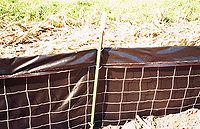
- Silt Fence
- Uses: sediment control
- Areas to Use
- Perimeter
- Slopes
- Drainageways
- Other: Drainage System Inlets
- Method: Silt fence filters sediment from runoff by allowing water to pass through a geotextile fabric or by creating a pool to allow sediment to drop out of the water column. Silt fence is installed primarily at downslope boundaries of the work area but can also be used for inlet protection, and around the perimeter of stockpiles
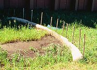
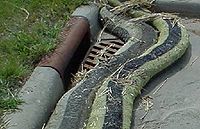
- Fiber Log
- Areas to Use
- Sediment Control
- Perimeter
- Slopes
- Drainageways
- Other
- Drainage System Inlets
- Method
- Fiber logs include straw, wood, or coconut fiber logs, compost logs, and rock logs that slow water and filter sediment. Fiber logs are used for inlet protection, ditch checks, and as perimeter control where silt fence is infeasible.
- Areas to Use
- Rock Construction Entrance
- Areas to Use
- Sediment Control
- Perimeter
- Method
- A rock construction entrance is a bed of rocks that helps to remove sediment from vehicle tires. Rock construction entrances should be placed at all site access points. The use of 1 1/2 inch – 3 inch clear aggregate is recommended. Periodic cleaning or replacement is recommended
- Areas to Use
- Grade Breaks
- Areas to Use
- Sediment Control
- Slopes
- Method
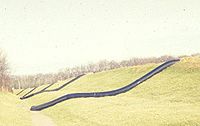
- Grade breaks are changes in slope that break up concentrated flow, preventing the formation of gullies. Grade breaks should be incorporated into long slopes
- Areas to Use
- Temporary Seeding
- Areas to Use
- Erosion Protection
- Sediment Control
- Perimeter
- Slopes
- Drainageways
- Method
- Temporary seeding allows plants to stabilize the soil through vegetation and root growth. A large variety of plants are available for temporary seeding of different conditions; the most common are rye grass, winter wheat, and oats.
- Areas to Use
- Erosion Control Blanket
- Areas to Use
- Erosion Protection
- Sediment Control
- Perimeter
- Slopes
- Drainageways
- Method
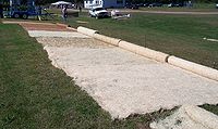
- Erosion control blanket is a mat made of netting layered with straw, wood, coconut or man-made fibers that prevents erosion by sheltering the soil from rainfall and runoff while holding moisture for establishing plants. Blankets are installed in channels
- Areas to Use
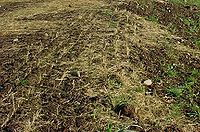
- Mulch
- Areas to Use
- Erosion Protection
- Slopes
- Method
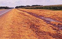
- Mulch is wood fibers, compost, wood chips, straw, or hay that is applied as a cover to disturbed soil. Mulch reduces erosion by absorbing energy from rainfall and runoff and provides protection and moisture for the establishment of vegetation, when properly disc anchored or spread.
- Areas to Use
- Hydraulic Mulch
- Areas to Use
- Erosion Protection
- Slopes
- Method
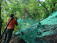
- Hydraulic mulches for erosion control are typically comprised of wood fibers and are applied by hydroseeding equipment. Hydraulic mulches are typically used in areas with steeper slopes or where equipment access would be difficult.
- Areas to Use
- Temporary Pipe Downdrains
- Areas to Use
- Erosion Protection
- Slopes
- Method
- A temporary pipe downdrain conveys runoff down slopes in a pipe so that runoff will not cause erosion. Pipe downdrains are installed where concentrated flow would drain onto a disturbed slope
- Areas to Use
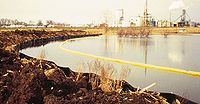
- Floatation Silt Curtain
- Areas to Use
- Sediment Control
- Other
- Lakes, Wetlands, Streams
- Method
- Floatation silt curtain is fabric fence installed in water bodies to contain sediment near the banks of the work area. Must be used in conjunction with other sediment control techniques
- Areas to Use
- Rock or Compost Bags
- Areas to Use
- Sediment Control
- Slopes
- Other
- Drainage System Inlets
- Method
- Rock and compost bags are filled bags that are used to filter water, control ditch grade, or to provide inlet protection
- Areas to Use
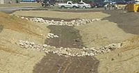
- Rock Check Dam
- Areas to Use
- Sediment Control
- Drainageways
- Method
- Rock check dams are rocks piled across a ditch to slow flows and capture sediment. Rock checks are installed perpendicular to flow and should be wide enough to ensure that flow remains in the center.
- Areas to Use
- Riprap
- Areas to Use
- Erosion Protection
- Other
- Drainage System Inlets
- Method
- Riprap is appropriately sized rocks that reduce the energy of fast moving flows. Riprap is used along channels and at outfalls
- Areas to Use
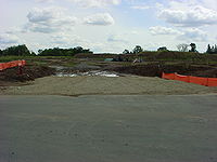
- Temporary Sedimentation Basin
- Areas to Use
- Sediment Control
- Other
- Throughout Site
- Method
- Temporary sedimentation basins are depressions that capture runoff to slow the flow of water and allow sediment to settle out
- Areas to Use
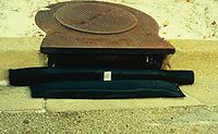
- Filter Bag
- Areas to Use
- Sediment Control
- Other
- Drainage System Inlets
- Method
- Filter bags are mesh bags that capture sediment but allow water to pass through. Filter bags are installed in storm drain inlets.
- Areas to Use
References
- Minnesota Department of Transportation. 2003. 2003 Seeding Manual.
- Minnesota Department of Transportation]. 2000. Mn/DOT Standard Specifications for Construction.
- Minnesota Erosion Control Association and Minnesota Department of Transportation, 2001. Erosion & Sediment Control Certification & ETeam Training Program 2001.
- Minnesota Local Road Research Board], Federal Highway Administration, and Minnesota Department of Transportation. 2003. Erosion Control Handbook for Local Roads. Manual Number 2003-08.
- Minnesota Pollution Control Agency. 2018 NPDES General Permit for Storm Water Discharges From Construction Activities.
- Minnesota Pollution Control Agency, 2000. Protecting Water Quality in Urban Areas.
- Minnesota Pollution Control Agency, 2004. Stormwater Compliance Assistance Toolkit for Small Construction Operators.
This page was last edited on 6 March 2024, at 16:51.
