Difference between revisions of "Miscellaneous maps"
(Created page with "This page contains the following maps: *Minnesota land surface elevation *Minnesota land cover *Minnesota Anoka sand plain [[Minnesota land surface elevation.jpg|300px|alt=m...") |
m |
||
| (5 intermediate revisions by the same user not shown) | |||
| Line 1: | Line 1: | ||
| − | This page contains | + | {{alert|This page contains various miscellaneous maps illustrating Minnesota features.|alert-info}} |
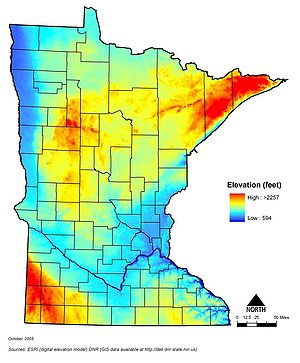
*Minnesota land surface elevation | *Minnesota land surface elevation | ||
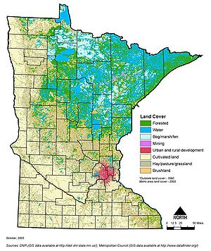
*Minnesota land cover | *Minnesota land cover | ||
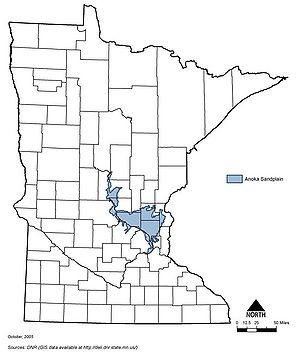
*Minnesota Anoka sand plain | *Minnesota Anoka sand plain | ||
| + | {{alert|To view the title of an image hold the mouse over the image. To view the image click on the image. Most views show higher resolution depictions of the image.|alert-info}} | ||
| − | [[Minnesota land surface elevation.jpg|300px|alt=map showing land surface elevation in Minnesota| | + | [[File:Minnesota land surface elevation.jpg|300px|alt=map showing land surface elevation in Minnesota|Map showing land surface elevation in Minnesota]] |
| − | [[Minnesota land cover.jpg|300px|alt=map showing Minnesota's land cover|Map showing Minnesota's land cover]] | + | [[File:Minnesota land cover.jpg|300px|alt=map showing Minnesota's land cover|Map showing Minnesota's land cover]] |
| − | [[Minnesota Anoka sand plain.jpg|300px|alt=map showing location of the Anoka sand plain in Minnesota|Map showing location of the Anoka sand plain in Minnesota]] | + | [[File:Minnesota Anoka sand plain.jpg|300px|alt=map showing location of the Anoka sand plain in Minnesota|Map showing location of the Anoka sand plain in Minnesota]] |
| + | |||
| + | [[Category:Level 3 - General information, reference, tables, images, and archives/Images/Maps]] | ||
Latest revision as of 22:18, 19 December 2022
Information: This page contains various miscellaneous maps illustrating Minnesota features.
- Minnesota land surface elevation
- Minnesota land cover
- Minnesota Anoka sand plain
Information: To view the title of an image hold the mouse over the image. To view the image click on the image. Most views show higher resolution depictions of the image.
This page was last edited on 19 December 2022, at 22:18.


