m |
|||
Line 1: | Line 1: | ||
− | + | Perimeter control has been established around an infiltration BMP to keep sediment and runoff completely away from the infiltration area until permanent vegetation has been established. Silt fence properly installed and maintained |
Perimeter control has been established around an infiltration BMP to keep sediment and runoff completely away from the infiltration area until permanent vegetation has been established. Silt fence properly installed and maintained
Click on a date/time to view the file as it appeared at that time.
Date/Time | Thumbnail | Dimensions | User | Comment | |
---|---|---|---|---|---|
current | 15:26, 5 May 2016 | 
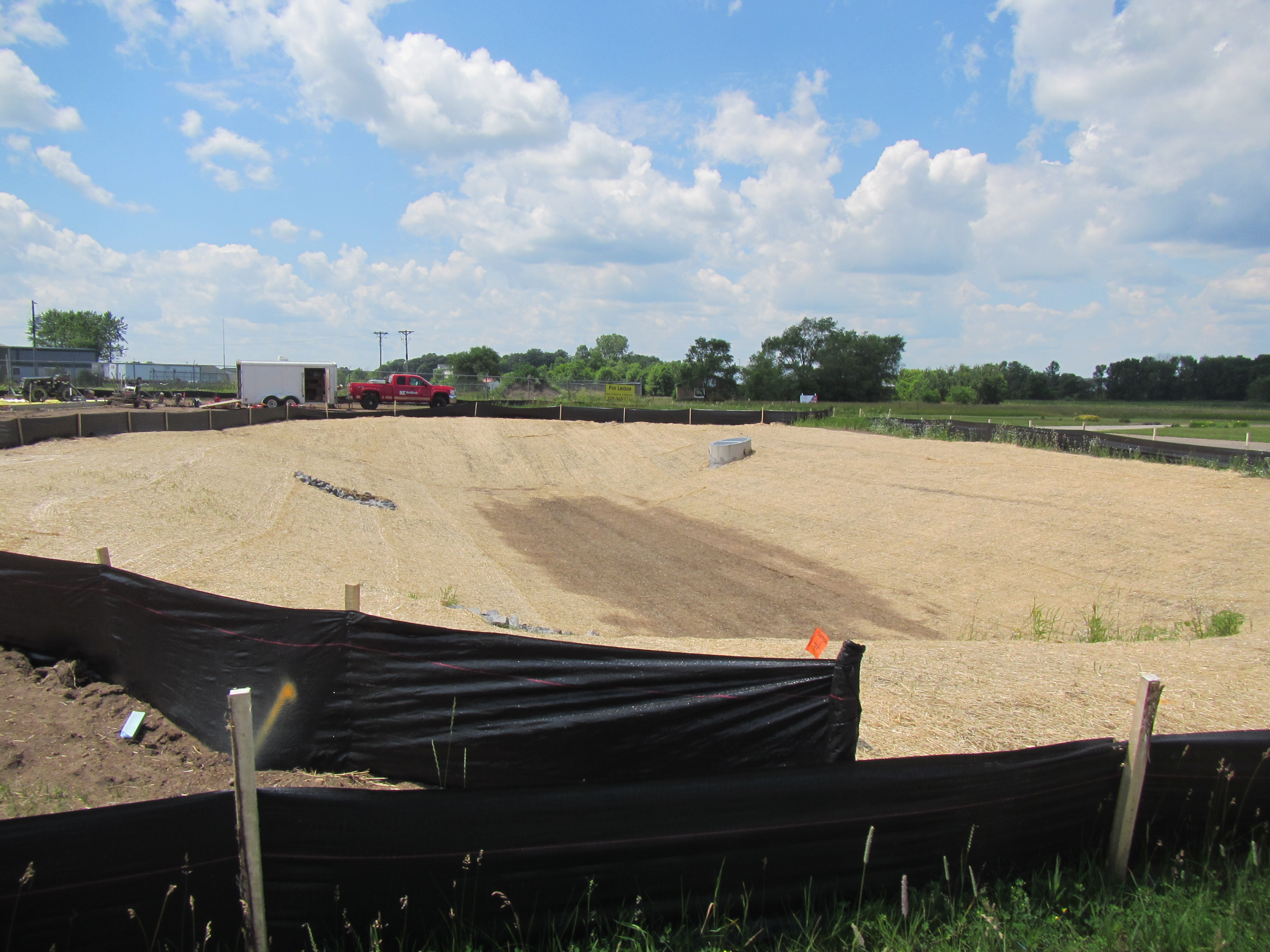
4,000 × 3,000 (2.52 MB) | PLeegar (talk | contribs) |
You cannot overwrite this file.
There are no pages that use this file.
This file contains additional information, probably added from the digital camera or scanner used to create or digitize it.
If the file has been modified from its original state, some details may not fully reflect the modified file.
Camera manufacturer | Canon |
---|---|
Camera model | Canon PowerShot D20 |
Exposure time | 1/320 sec (0.003125) |
F Number | f/8 |
ISO speed rating | 125 |
Date and time of data generation | 13:40, 23 June 2015 |
Lens focal length | 5 mm |
Latitude | 45° 34′ 8.28″ N |
Longitude | 94° 18′ 6.6″ W |
Altitude | 334.2 meters above sea level |
Orientation | Normal |
Horizontal resolution | 180 dpi |
Vertical resolution | 180 dpi |
File change date and time | 13:40, 23 June 2015 |
Y and C positioning | Co-sited |
Exif version | 2.3 |
Date and time of digitizing | 13:40, 23 June 2015 |
Meaning of each component |
|
Image compression mode | 3 |
APEX shutter speed | 8.3125 |
APEX aperture | 6 |
APEX exposure bias | 0 |
Maximum land aperture | 3.9375 APEX (f/3.91) |
Metering mode | Pattern |
Flash | Flash did not fire, auto mode |
Supported Flashpix version | 0,100 |
Color space | sRGB |
Focal plane X resolution | 16,393.442622951 |
Focal plane Y resolution | 16,393.442622951 |
Focal plane resolution unit | inches |
Sensing method | One-chip color area sensor |
File source | Digital still camera |
Custom image processing | Normal process |
Exposure mode | Auto exposure |
White balance | Auto white balance |
Digital zoom ratio | 1 |
Scene capture type | Standard |
GPS time (atomic clock) | 18:45 |
Receiver status | Measurement in progress |
Geodetic survey data used | WGS-84 |
GPS date | 23 June 2015 |
GPS tag version | 0.0.3.2 |
Rating (out of 5) | 0 |
This page was last edited on 10 January 2017, at 13:51.