Difference between revisions of "Watershed maps"
m |
m |
||
| Line 10: | Line 10: | ||
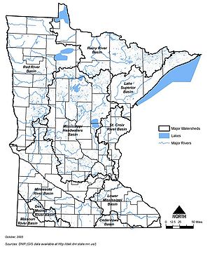
[[File:Minnesota major river basins.jpg|300px|alt=map showing location of major river basins in Minnesota|Map showing location of major river basins in Minnesota]] | [[File:Minnesota major river basins.jpg|300px|alt=map showing location of major river basins in Minnesota|Map showing location of major river basins in Minnesota]] | ||
| − | [[ | + | [[Category:Level 3 - General information, reference, tables, images, and archives/Images/General]] |
Revision as of 20:20, 6 December 2022
Information: This page contains the following maps showing watershed information for Minnesota:
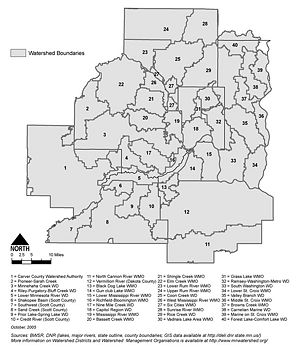
- Location of watershed districts and watershed management organizations in the seven county Metropolitan Area
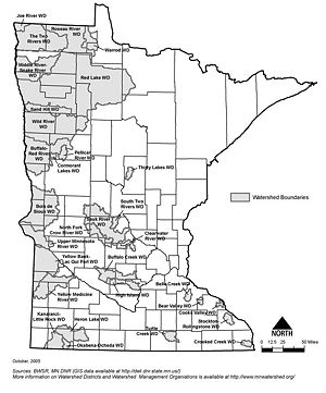
- Location of out-state watershed districts in Minnesota
- Map showing location of major river basins in Minnesota
Information: To view the title of an image hold the mouse over the image. To view the image click on the image. Most views show higher resolution depictions of the image.


