Difference between revisions of "Virtual tours"
(Created page with "file:Washington Conservation District map.png|thumb|400 px|alt=BMP map for Washington Conservation District|<font size=3>Enlarged screenshot of map showing [https://www.mapf...") |
m |
||
| Line 8: | Line 8: | ||
*[http://crwd.maps.arcgis.com/apps/webappviewer/index.html?id=44ddc5553af0490b835f206e180c5161 Capitol Region Watershed District] | *[http://crwd.maps.arcgis.com/apps/webappviewer/index.html?id=44ddc5553af0490b835f206e180c5161 Capitol Region Watershed District] | ||
*[https://www.mapfeeder.net/wcdbmp/ Washington Conservation District] - (see image at right) | *[https://www.mapfeeder.net/wcdbmp/ Washington Conservation District] - (see image at right) | ||
| + | *[http://www.minnehahacreek.org/maps Minnehaha Creek Watershed District] | ||
Revision as of 14:03, 29 April 2016

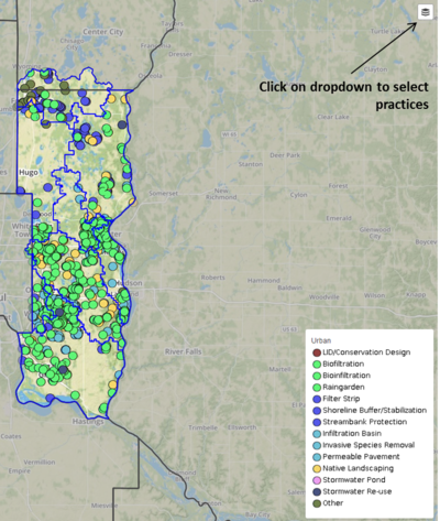
Enlarged screenshot of map showing management practices within the Washington Conservation District. Note the dropdown button in the upper right portion of the screen, which allows you to select the type of practice you are interested in.
This page includes links to other organization’s web sites in Minnesota that have virtual tours-good maps of their stormwater BMP’s.
- Dakota County Soil and Water Conservation District: Virtual Conservation Tour (2015): An annual Virtual Conservation Tour highlighting successful conservation projects installed by the Dakota County Soil and Water Conservation District (SWCD) in 2015.
- Mississippi Watershed Management Organization
- Ramsey-Washington Metro Watershed District
- Capitol Region Watershed District
- Washington Conservation District - (see image at right)
- Minnehaha Creek Watershed District