
Difference between revisions of "Sensitive waters and other receiving waters"
m |
m |
||
| Line 1: | Line 1: | ||
This page contains the following maps: | This page contains the following maps: | ||
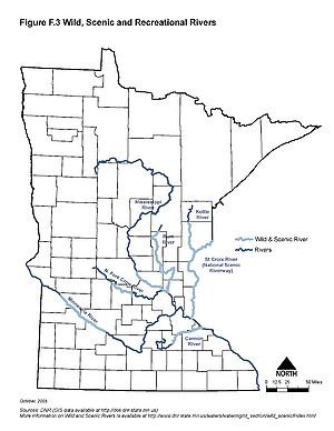
| − | *'''Minnesota wild and scenic rivers''' | + | *'''Minnesota wild and scenic rivers'''. For more information see [http://www.dnr.state.mn.us/waters/watermgmt_section/wild_scenic/index.html]. |
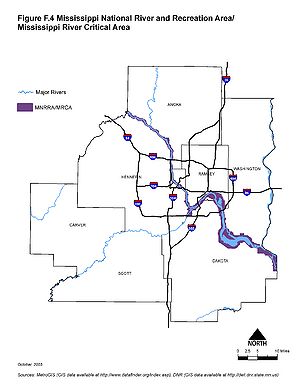
| − | *'''Mississippi national river and recreation area Mississippi River critical area''' | + | *'''Mississippi national river and recreation area Mississippi River critical area'''. For more information see [http://www.nps.gov/miss/index.htm] and [http://www.dnr.state.mn.us/waters/watermgmt_section/critical_area/index.html]. |
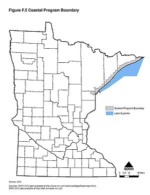
*'''Minnesota coastal program boundaries''' | *'''Minnesota coastal program boundaries''' | ||
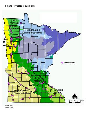
| − | *'''Minnesota calcareous fens'''. For more information see | + | *'''Minnesota calcareous fens'''. For more information see [http://www.pca.state.mn.us/index.php/view-document.html?gid=11831 list of calcareous fens] and [http://www.bwsr.state.mn.us/wetlands/Calc_fen-factsheet.pdf fact sheet on calcareous fens] |
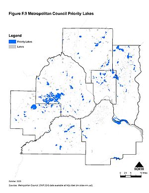
| − | + | *'''Metropolitan Council priority lakes'''. For more information see [http://www.metrocouncil.org/planning/environment/WRMPP/WRMPPMay2005_Appendices2.pdf] | |
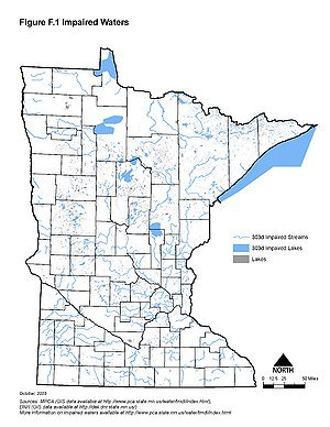
| − | + | *'''Minnesota impaired waters'''. For more information see [http://www.pca.state.mn.us/index.php/water/water-types-and-programs/minnesotas-impaired-waters-and-tmdls/minnesotas-impaired-waters-and-total-maximum-daily-loads-tmdls.html] | |
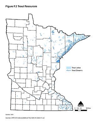
| − | *'''Metropolitan Council priority lakes''' | + | *'''Minnesota trout resources'''. For more information see [http://www.dnr.state.mn.us/fishing/trout_lakes/list.html]. |
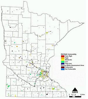
| − | *'''Minnesota impaired waters'''. | + | *'''Minnesota source water protection areas'''. For more information see [http://www.health.state.mn.us/divs/eh/water/swp/index.htm]. |
| − | *'''Minnesota trout resources''' | + | *'''Minnesota scientific and natural areas'''. For more information see [http://www.dnr.state.mn.us/snas/list.html] |
| − | *'''Minnesota source water protection areas''' | + | |
| + | Additional information can be found at the following locations: | ||
| + | *[https://www.revisor.mn.gov/rules/?id=7050.0180 Nondegradation for Outstanding Resource Value Waters] | ||
| + | *[http://www.dnr.state.mn.us/waters/watermgmt_section/pwi/maps.html Public water inventory maps] | ||
| + | |||
{{alert|To view the title of an image hold the mouse over the image. To view the image click on the image. Most views show higher resolution depictions of the image.|alert-info}} | {{alert|To view the title of an image hold the mouse over the image. To view the image click on the image. Most views show higher resolution depictions of the image.|alert-info}} | ||
| Line 21: | Line 25: | ||
[[File:Minnesota trout resources.jpg|300px|alt=map showing the location of Minnesota's trout waters|Map showing the location of Minnesota's trout waters]] | [[File:Minnesota trout resources.jpg|300px|alt=map showing the location of Minnesota's trout waters|Map showing the location of Minnesota's trout waters]] | ||
[[File:Source water protection areas.jpg|300px|alt=map showing the location of Minnesota's source water protection areas|Map showing the location of Minnesota's source water protection areas]] | [[File:Source water protection areas.jpg|300px|alt=map showing the location of Minnesota's source water protection areas|Map showing the location of Minnesota's source water protection areas]] | ||
| + | [[File:Minnesota scientific and natural areas|300px|alt=map showing the location of Minnesota's scientific and natural areas|Map showing the location of Minnesota's scientific and natural areas]] | ||
Revision as of 19:56, 18 December 2012
This page contains the following maps:
- Minnesota wild and scenic rivers. For more information see [1].
- Mississippi national river and recreation area Mississippi River critical area. For more information see [2] and [3].
- Minnesota coastal program boundaries
- Minnesota calcareous fens. For more information see list of calcareous fens and fact sheet on calcareous fens
- Metropolitan Council priority lakes. For more information see [4]
- Minnesota impaired waters. For more information see [5]
- Minnesota trout resources. For more information see [6].
- Minnesota source water protection areas. For more information see [7].
- Minnesota scientific and natural areas. For more information see [8]
Additional information can be found at the following locations:
Information: To view the title of an image hold the mouse over the image. To view the image click on the image. Most views show higher resolution depictions of the image.
 Map showing the location of Minnesota's scientific and natural areas