![]()
MIME search
This page enables the filtering of files for their MIME type.
Input: contenttype/subtype or contenttype/*, e.g. image/jpeg.
Showing below up to 50 results in range #701 to #750.
View (previous 50 | next 50) (20 | 50 | 100 | 250 | 500)
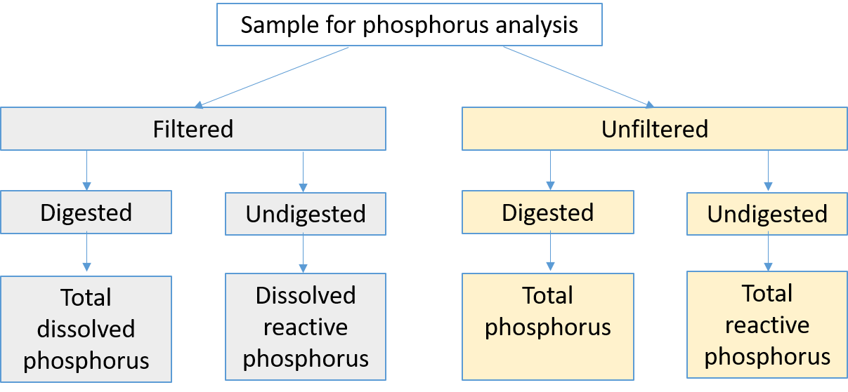
- (download) Phosphorus speciation.png . . 1,207 × 559 . . 30 KB . . Mtrojan . . 15:10, 24 February 2020
- (download) Phosphosorb.png . . 3,936 × 2,011 . . 69 KB . . Mtrojan . . 00:49, 30 October 2021
- (download) Piped inflow 2.png . . 1,906 × 807 . . 486 KB . . Mtrojan . . 13:02, 30 November 2020
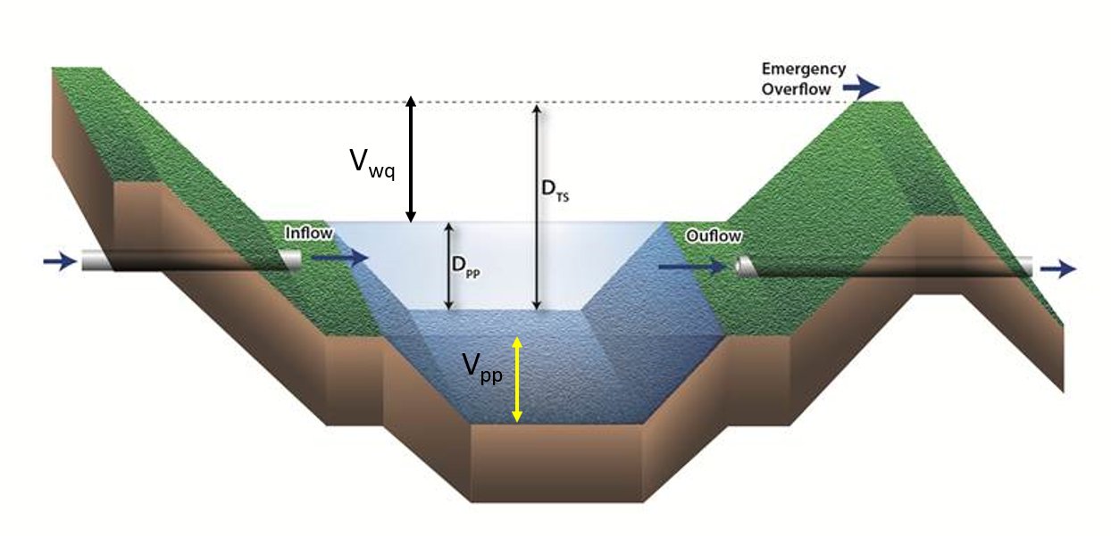
- (download) Plan and profile view of a wet pond.png . . 902 × 720 . . 244 KB . . Admin . . 14:45, 2 November 2012
- (download) Plan and section view of the infiltration basin.png . . 924 × 595 . . 156 KB . . PLeegar . . 20:01, 19 July 2016
- (download) Plan layout of infiltration and reuse systems.png . . 924 × 606 . . 141 KB . . PLeegar . . 18:30, 19 July 2016
- (download) Planning ahead effective way to minimize erosion and sedimentation.PNG . . 368 × 391 . . 341 KB . . PLeegar . . 19:40, 1 March 2016
- (download) Plot of construction and maintenance costs for wet basin.png . . 1,333 × 949 . . 168 KB . . Mtrojan . . 14:53, 3 January 2013
- (download) PollutantLoadSummary.png . . 679 × 583 . . 35 KB . . Jstock . . 21:03, 14 January 2015
- (download) Pollutant removal numbers.png . . 1,561 × 958 . . 290 KB . . Mtrojan . . 17:27, 14 July 2017
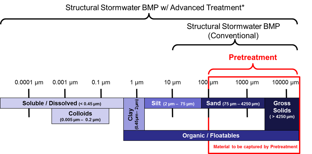
- (download) Pollutant spectrum and treatment ranges 2.png . . 1,024 × 505 . . 75 KB . . Mtrojan . . 14:10, 25 July 2016
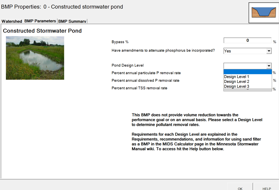
- (download) Pond design level screen shot.png . . 955 × 652 . . 247 KB . . Mtrojan . . 22:57, 16 March 2021
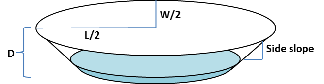
- (download) Pond dimensions.png . . 658 × 171 . . 21 KB . . Mtrojan . . 01:59, 22 November 2020
- (download) Pond dimensions b.png . . 1,244 × 601 . . 640 KB . . Mtrojan . . 01:57, 22 November 2020
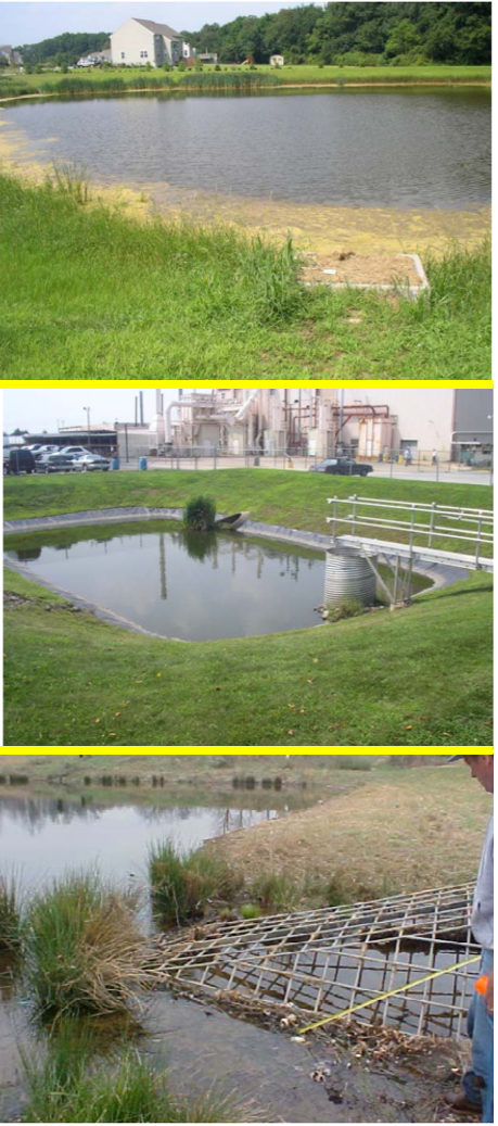
- (download) Pond issues.png . . 459 × 1,037 . . 1.16 MB . . Mtrojan . . 18:13, 23 November 2020
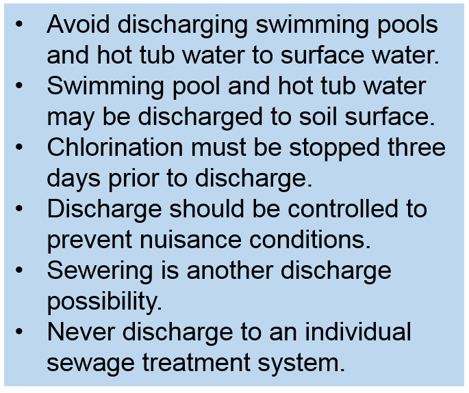
- (download) Pool fact sheet.png . . 685 × 575 . . 41 KB . . Mtrojan . . 13:37, 12 March 2019
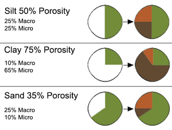
- (download) Porosity.png . . 581 × 440 . . 91 KB . . Mtrojan . . 20:39, 16 June 2021
- (download) Port for underground tank.png . . 976 × 824 . . 1.68 MB . . Mtrojan . . 20:16, 24 May 2016
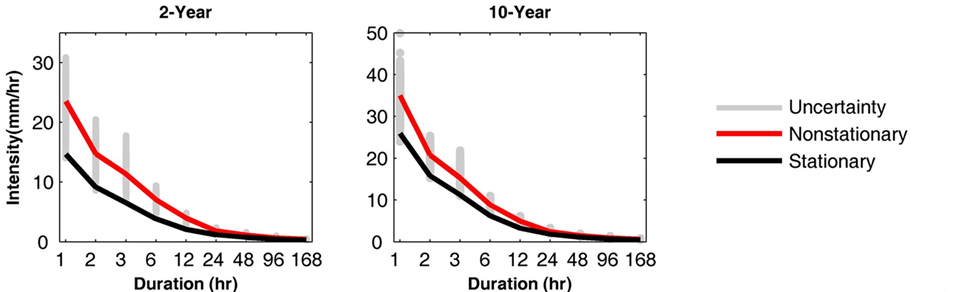
- (download) Potential IDF curve change.png . . 975 × 292 . . 74 KB . . AHinz . . 16:17, 27 February 2024
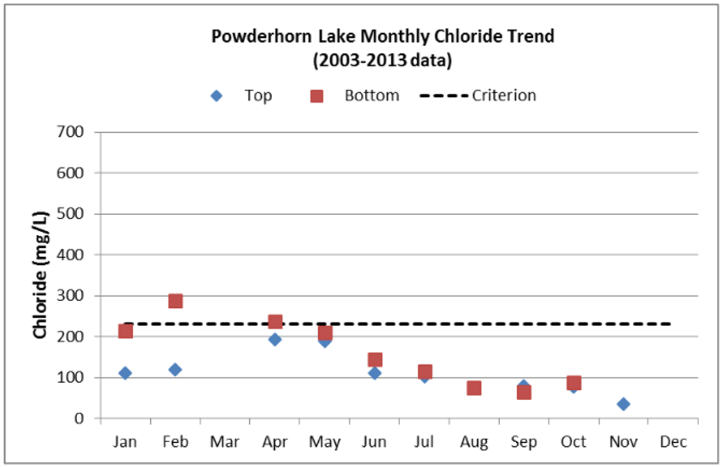
- (download) Powderhorn Lake chloride trend.png . . 1,047 × 678 . . 97 KB . . Mtrojan . . 16:56, 26 April 2017
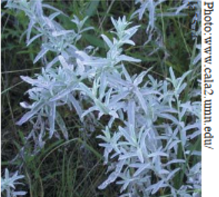
- (download) Prairie sage.png . . 307 × 277 . . 255 KB . . Mtrojan . . 20:22, 26 March 2018
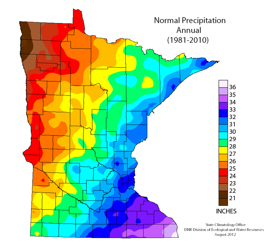
- (download) Precipitation 1981 to 2010.png . . 875 × 800 . . 143 KB . . Mtrojan . . 14:40, 10 March 2014
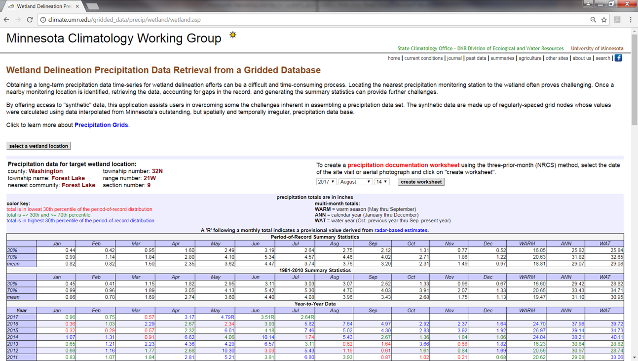
- (download) Precipitation data retrieval.png . . 1,293 × 731 . . 543 KB . . Mtrojan . . 18:49, 23 October 2017
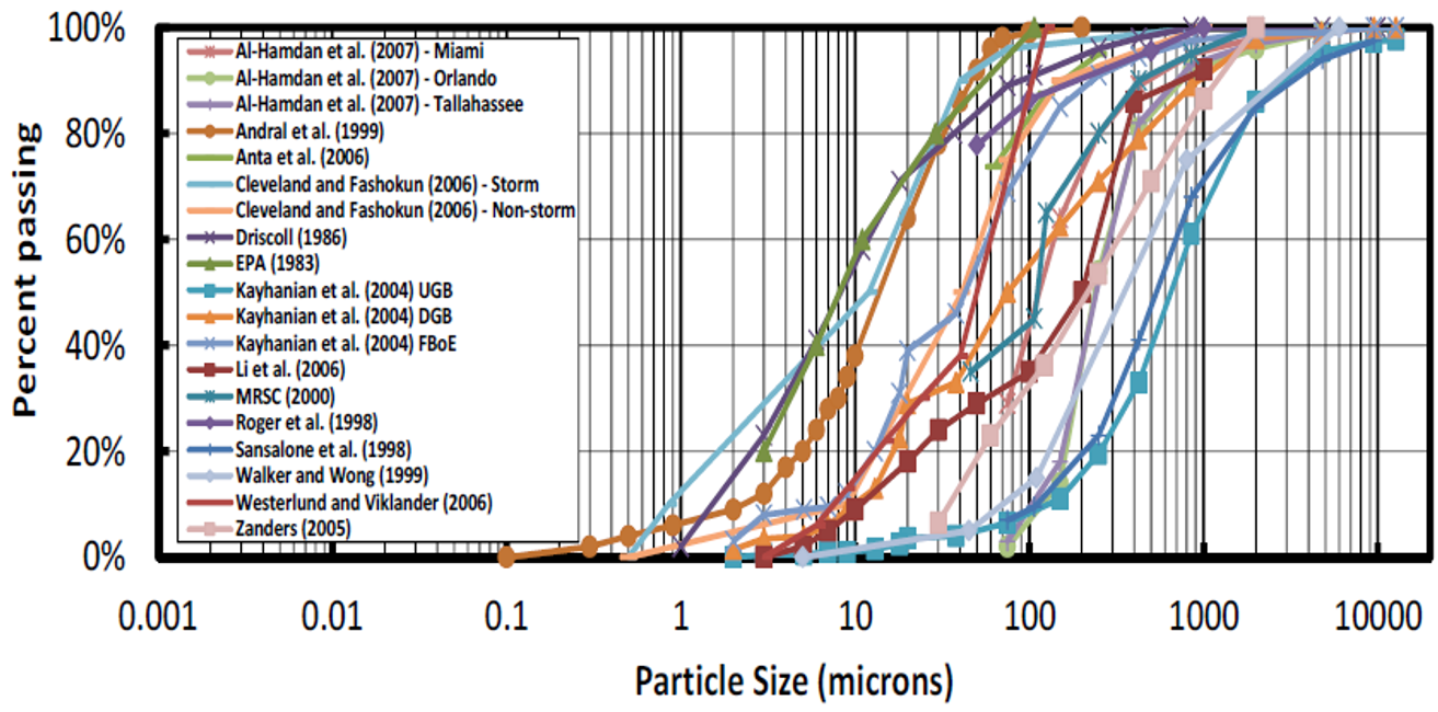
- (download) Pretreament sizing PSD.png . . 1,313 × 650 . . 594 KB . . Mtrojan . . 14:42, 2 October 2019
- (download) Pretreatment overview2.png . . 445 × 988 . . 1.09 MB . . Mtrojan . . 14:11, 14 July 2016
- (download) Pretreatment screen 3.png . . 394 × 821 . . 631 KB . . Mtrojan . . 14:17, 15 July 2016
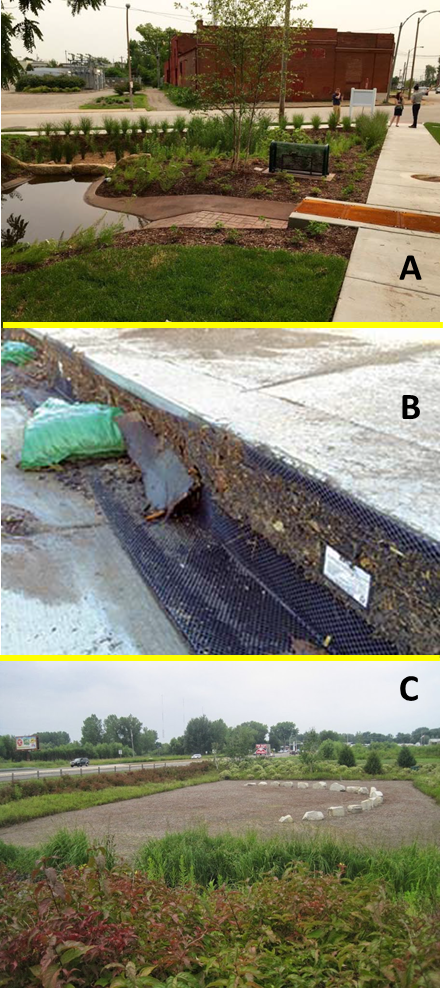
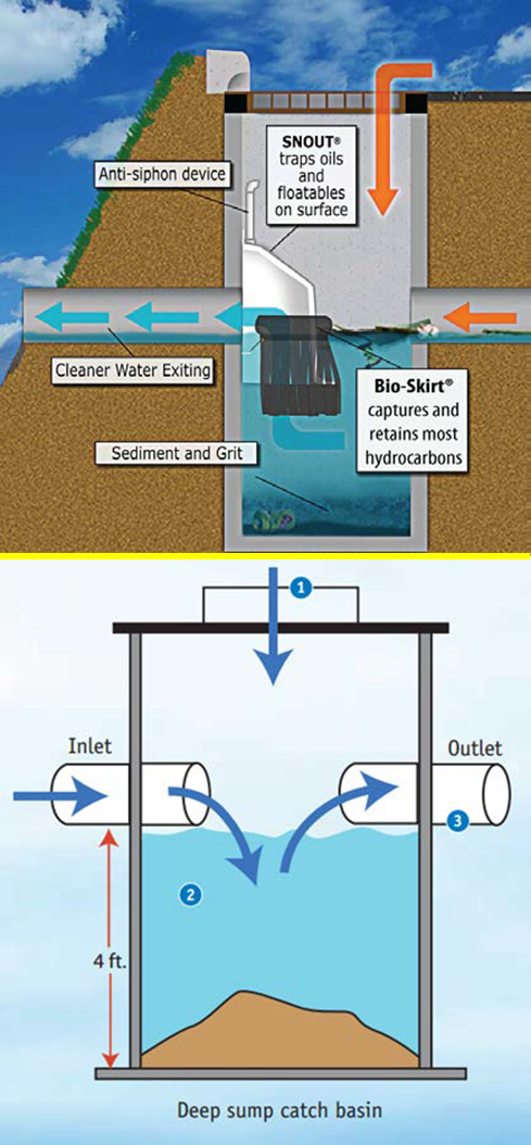
- (download) Pretreatment types nonproprietary.png . . 489 × 1,054 . . 728 KB . . Mtrojan . . 19:11, 6 June 2016
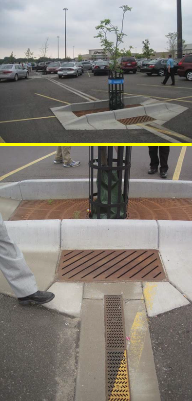
- (download) Pretreatment types proprietary.png . . 551 × 804 . . 697 KB . . Mtrojan . . 19:11, 6 June 2016
- (download) Problem 1-1.png . . 1,205 × 871 . . 240 KB . . Mtrojan . . 19:53, 6 December 2017
- (download) Problem 1-2.png . . 1,092 × 763 . . 164 KB . . Mtrojan . . 21:44, 6 December 2017
- (download) Problem 1-3.png . . 1,047 × 758 . . 156 KB . . Mtrojan . . 22:33, 6 December 2017
- (download) Problem 2-1.png . . 824 × 489 . . 97 KB . . Mtrojan . . 17:10, 11 December 2017
- (download) Problem 2-1b.png . . 994 × 829 . . 176 KB . . Mtrojan . . 20:08, 11 December 2017
- (download) Problem 2-2.png . . 1,074 × 881 . . 227 KB . . Mtrojan . . 21:36, 11 December 2017
- (download) Problem 2-3.png . . 1,021 × 859 . . 166 KB . . Mtrojan . . 13:39, 12 December 2017
- (download) Problem 2-4.png . . 1,198 × 860 . . 195 KB . . Mtrojan . . 14:19, 12 December 2017
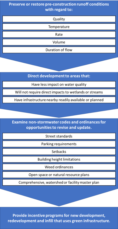
- (download) Procedures to control stormwater runoff and promote green stormwater infrastructure.png . . 492 × 951 . . 120 KB . . Mtrojan . . 21:05, 8 June 2022
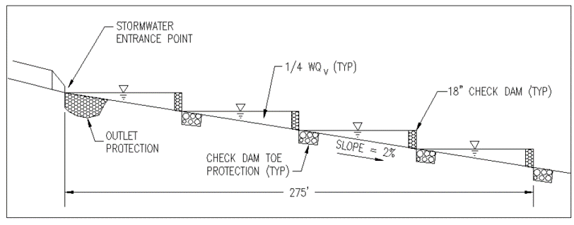
- (download) Profile of Swale with earthern check dams.png . . 626 × 337 . . 15 KB . . Mtrojan . . 15:47, 28 March 2018
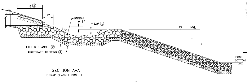
- (download) Profile of a riprap lined channel.png . . 797 × 268 . . 42 KB . . SConnolly . . 12:59, 11 March 2019
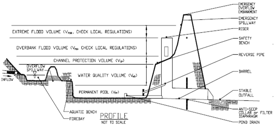
- (download) Profile of a wet pond.png . . 958 × 457 . . 128 KB . . Admin . . 15:01, 2 November 2012
- (download) Profile of swale with structural check dams.png . . 812 × 319 . . 20 KB . . Mtrojan . . 15:53, 27 March 2018
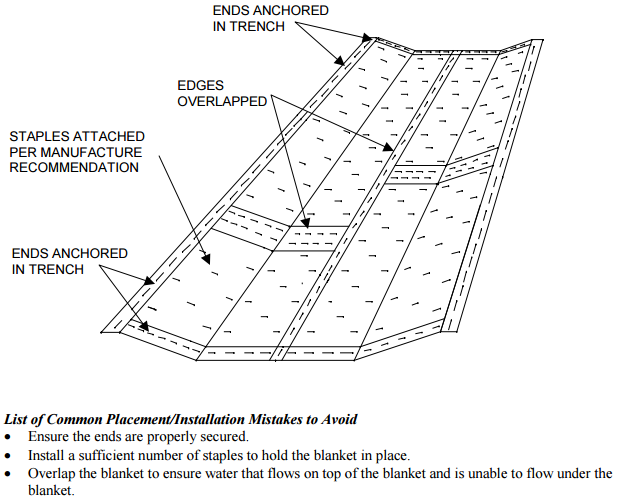
- (download) Proper installation of erosion control blanket.png . . 622 × 503 . . 84 KB . . PLeegar . . 18:20, 2 November 2016
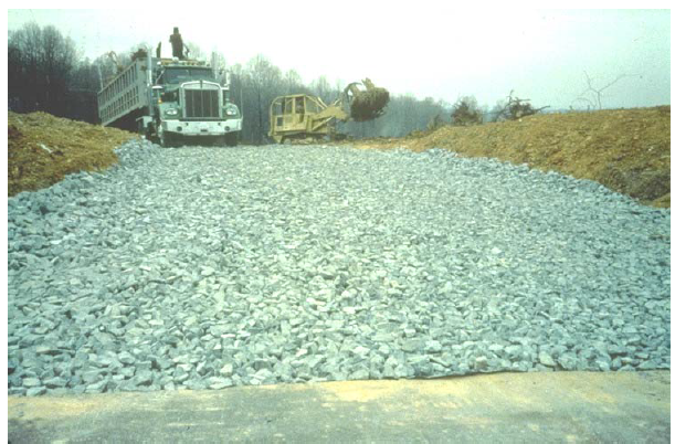
- (download) Properly installed rock construction entrance.PNG . . 611 × 402 . . 566 KB . . PLeegar . . 20:20, 13 February 2017
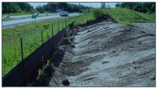
- (download) Properly installed silt fence.PNG . . 614 × 347 . . 509 KB . . PLeegar . . 20:13, 13 February 2017
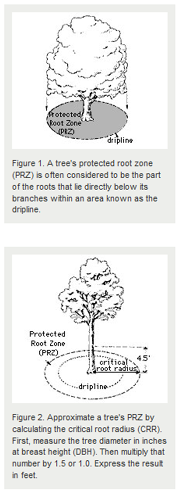
- (download) Protected root zone.png . . 369 × 991 . . 206 KB . . Mtrojan . . 14:03, 24 October 2014
- (download) Protecting water quality urban areas.png . . 431 × 463 . . 38 KB . . Mtrojan . . 13:30, 26 July 2022
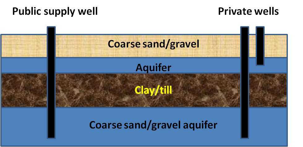
- (download) Public and private wells.png . . 979 × 477 . . 129 KB . . Mtrojan . . 12:54, 20 August 2018
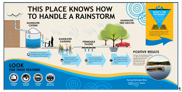
- (download) Public education graphic on display at main entrance to Maplewood Mall.PNG . . 763 × 386 . . 402 KB . . PLeegar . . 15:11, 1 July 2015
- (download) Q1.png . . 898 × 656 . . 50 KB . . Cmcfadden . . 21:29, 2 January 2018
- (download) Q10.png . . 899 × 644 . . 25 KB . . Cmcfadden . . 21:32, 2 January 2018