![]()
Search results
Create the page "Swale" on this wiki! See also the search results found.
Page title matches
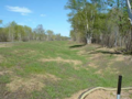
File:Highway swale 2.png ...el 3 - General information, reference, tables, images, and archives/Images/Swale photos]](344 × 259 (234 KB)) - 21:27, 15 December 2022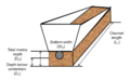
File:MIDS swale dimensions.png (745 × 462 (169 KB)) - 22:45, 13 December 2022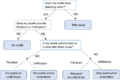
File:Swale terminology flowchart.png (950 × 641 (32 KB)) - 20:01, 28 March 2018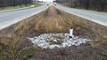
File:Dry swale with underdrain.jpg ...el 3 - General information, reference, tables, images, and archives/Images/Swale photos]](1,650 × 929 (582 KB)) - 21:24, 15 December 2022
File:Wet swale section.png (1,403 × 867 (166 KB)) - 19:00, 18 April 2018
File:Wet swale wiki.docx (132 KB) - 15:23, 20 July 2022
File:Swale main channel.png (1,128 × 697 (278 KB)) - 17:22, 10 February 2017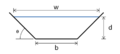
File:Swale cross-section.png (454 × 203 (10 KB)) - 20:29, 27 March 2018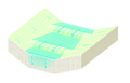
File:Dry Swale and Check Dam.jpg (1,266 × 808 (1.3 MB)) - 18:48, 26 May 2016
File:Swale side slope.png (1,187 × 727 (187 KB)) - 17:23, 10 February 2017
File:Swale check icon.png (1,301 × 794 (700 KB)) - 17:58, 15 August 2022
File:Dry Swale with Check Dam.PNG (901 × 513 (407 KB)) - 18:11, 31 May 2016
File:Wet swale figure 3.jpg ...el 3 - General information, reference, tables, images, and archives/Images/Swale photos]](612 × 352 (37 KB)) - 01:39, 8 February 2023File:9 - Swale Main Channel.docx (292 KB) - 02:01, 3 April 2023
File:Schematic for example swale calculations.png (800 × 322 (78 KB)) - 17:58, 15 December 2022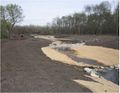
File:Wet swale figure 4.jpg ...el 3 - General information, reference, tables, images, and archives/Images/Swale photos]](673 × 524 (47 KB)) - 01:39, 8 February 2023
File:Watershed tab swale with underdrain.png (1,006 × 707 (111 KB)) - 23:00, 13 December 2022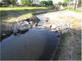
File:Wet swale figure 5.jpg ...el 3 - General information, reference, tables, images, and archives/Images/Swale photos]](877 × 658 (93 KB)) - 01:40, 8 February 2023
File:Symbol for swale with underdrain.png (345 × 225 (45 KB)) - 22:56, 13 December 2022
File:Wet swale figure 6.jpg ...el 3 - General information, reference, tables, images, and archives/Images/Swale photos]](957 × 640 (160 KB)) - 01:40, 8 February 2023


Page text matches
File:Swale at Lino Lakes city hall.jpg ...el 3 - General information, reference, tables, images, and archives/Images/Swale photos]](1,024 × 768 (1.02 MB)) - 21:29, 15 December 2022
File:Partial excavation for future dry swale.png ...el 3 - General information, reference, tables, images, and archives/Images/Swale photos]](620 × 462 (864 KB)) - 21:28, 15 December 2022
File:Wet swale.jpg ...el 3 - General information, reference, tables, images, and archives/Images/Swale photos]](602 × 453 (85 KB)) - 21:30, 15 December 2022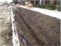
File:Dry swale infiltration area excavated and finished with hand tools.png ...el 3 - General information, reference, tables, images, and archives/Images/Swale photos]](676 × 506 (839 KB)) - 21:23, 15 December 2022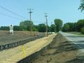
File:Silt fence used to protect swale .jpg ...el 3 - General information, reference, tables, images, and archives/Images/Swale photos]](501 × 381 (61 KB)) - 21:28, 15 December 2022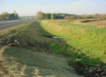
File:Highway swale.png ...el 3 - General information, reference, tables, images, and archives/Images/Swale photos]](341 × 248 (206 KB)) - 21:27, 15 December 2022
File:Dry swale with check dams complete with.png ...el 3 - General information, reference, tables, images, and archives/Images/Swale photos]](694 × 456 (762 KB)) - 21:23, 15 December 2022
File:Erosion control mat used to protect swale side slopes.jpg ...el 3 - General information, reference, tables, images, and archives/Images/Swale photos]](510 × 354 (47 KB)) - 21:24, 15 December 2022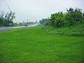
File:Swale city of Woodbury.jpg ...el 3 - General information, reference, tables, images, and archives/Images/Swale photos]](1,024 × 768 (760 KB)) - 21:29, 15 December 2022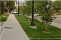
File:Dry swale with check dams complete with trees.png ...el 3 - General information, reference, tables, images, and archives/Images/Swale photos]](694 × 456 (762 KB)) - 21:23, 15 December 2022
File:Concrete check dams.jpg ...el 3 - General information, reference, tables, images, and archives/Images/Swale photos]](1,650 × 928 (595 KB)) - 17:52, 20 December 2022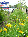
File:Vegetated swale city of Wayzata.jpg ...el 3 - General information, reference, tables, images, and archives/Images/Swale photos]](960 × 1,280 (1 MB)) - 19:03, 15 August 2022
File:Dry and wet swales.png ...el 3 - General information, reference, tables, images, and archives/Images/Swale photos]](973 × 325 (856 KB)) - 21:22, 15 December 2022File:Highway swale 2.png ...el 3 - General information, reference, tables, images, and archives/Images/Swale photos]](344 × 259 (234 KB)) - 21:27, 15 December 2022File:Dry swale with underdrain.jpg ...el 3 - General information, reference, tables, images, and archives/Images/Swale photos]](1,650 × 929 (582 KB)) - 21:24, 15 December 2022
File:Screening assessment example 3.png ...by infiltration. The mounding analysis indicated that a mound beneath the swale would extend onto the railroad corridor. It is therefore appropriate to not(1,190 × 922 (2.17 MB)) - 18:15, 20 December 2022File:MIDS WET Swale Sections.dwg [[Category:Level 3 - Best management practices/Structural practices/Wet swale]](743 KB) - 01:08, 19 December 2022File:MIDS Dry Swale Sections.dwg [[Category:Level 3 - Best management practices/Structural practices/Dry swale]](855 KB) - 01:08, 19 December 2022File:Dry swale operation and maintenance checklist.xlsx [[Category:Level 3 - Best management practices/Structural practices/Dry swale]](13 KB) - 17:25, 2 April 2023File:Dry swale - construction inspection checklist.xlsx [[Category:Level 3 - Best management practices/Structural practices/Dry swale]](14 KB) - 17:25, 2 April 2023


