Navigation
Main page
Table of contents
Index (Categories)
What's new
Response to comments
Future updates
Events
In the News
Funding
Recent changes
Help
Export to pdf
Tools
Special pages
MPCA Links
MPCA Homepage
Stormwater
Policies / Disclaimers
Minnesota Stormwater Manual
Search Help
Log in
Search:
Search
Gallery of new files
Special:NewFiles
This special page shows the last uploaded files.
Filter
Filename (or a part of it):
IP address or username
Show uploads by bots
Media type:
3D
Audio
Bitmap images
Compressed formats
Drawings (vector images)
Executables
Office
Rich media
Textual
Unknown
Videos
From date:
To date:
Search
Calculator comparison 3.png
Mtrojan
21:56, 21 January 2016
480 × 360; 16 KB
Calculator comparison 2.png
Mtrojan
21:50, 21 January 2016
480 × 360; 15 KB
Calculator comparison 1.png
Mtrojan
21:49, 21 January 2016
480 × 360; 15 KB
Schematic for disconnection credit 2.png
Mtrojan
21:09, 20 January 2016
1,257 × 501; 44 KB
Groundwater Mounding Parameters Table 2015-06-30.docx
Mtrojan
16:08, 20 January 2016
; 103 KB
Infiltration paper 2.docx
Mtrojan
16:08, 20 January 2016
; 2.48 MB
Infiltration paper 1.docx
Mtrojan
16:08, 20 January 2016
; 4.14 MB
MIDS definitions.docx
Mtrojan
20:06, 12 January 2016
; 28 KB
Ponding in infiltration practice 2.jpg
Mtrojan
21:47, 31 December 2015
608 × 456; 57 KB
Soil ripping.png
Mtrojan
21:02, 31 December 2015
511 × 1,001; 1.28 MB
Sparse vegetation and erosed surface in infiltration basin.jpg
Mtrojan
15:21, 31 December 2015
1,000 × 750; 169 KB
Ponding in infiltration practice 1.jpg
Mtrojan
15:21, 31 December 2015
950 × 713; 127 KB
Compaction tester.jpg
Mtrojan
15:19, 31 December 2015
961 × 721; 161 KB
Atlas 14 Grand Marais.png
Mtrojan
14:02, 17 December 2015
649 × 799; 200 KB
Atlas 14 St Cloud.png
Mtrojan
13:59, 17 December 2015
651 × 802; 203 KB
Atlas 14 Brainerd.png
Mtrojan
13:57, 17 December 2015
648 × 799; 202 KB
Atlas 14 Duluth.png
Mtrojan
13:55, 17 December 2015
650 × 800; 136 KB
Atlas 14 International Falls.png
Mtrojan
13:53, 17 December 2015
650 × 800; 132 KB
Atlas 14 Crookston.png
Mtrojan
13:53, 17 December 2015
650 × 800; 130 KB
Atlas 14 Morris.png
Mtrojan
13:49, 17 December 2015
649 × 799; 201 KB
Atlas 14 Marshall.png
Mtrojan
13:47, 17 December 2015
652 × 803; 206 KB
Atlas 14 Rochester airport.png
Mtrojan
13:43, 17 December 2015
649 × 799; 206 KB
Atlas 14 MSP airport.png
Mtrojan
13:40, 17 December 2015
650 × 799; 187 KB
Wellhead protection example.png
Mtrojan
13:23, 21 October 2015
741 × 914; 262 KB
Chloride concentrations in runoff.png
Mtrojan
15:50, 25 September 2015
1,209 × 642; 71 KB
Depth to water schematic.jpg
Mtrojan
19:24, 23 September 2015
527 × 489; 20 KB
Mounding analysis results.png
Mtrojan
21:22, 18 August 2015
1,083 × 717; 47 KB
St. Cloud rainfall frequencies.png
Mtrojan
12:29, 20 July 2015
1,418 × 919; 273 KB
Thief River Falls rainfall frequencies.png
Mtrojan
12:28, 20 July 2015
1,417 × 927; 238 KB
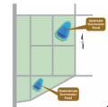
New Development Stormwater Ponds in Series Treatment Train MIDS Calculator Schematic.PNG
PLeegar
19:08, 16 July 2015
347 × 225; 16 KB
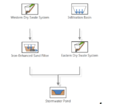
New Development Varied BMP Treatment Train MIDS Calculator Schematic.PNG
PLeegar
19:03, 16 July 2015
444 × 384; 35 KB
Stormwater Pond in Heritage Park.png
Mtrojan
15:40, 16 July 2015
510 × 679; 890 KB
Stormwater Filters in Heritage Park.png
Mtrojan
15:39, 16 July 2015
762 × 510; 962 KB
Stormwater Level Spreader in Heritage Park.png
Mtrojan
15:36, 16 July 2015
615 × 461; 808 KB
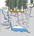
Illustration of karst features.jpg
Mtrojan
15:26, 16 July 2015
224 × 232; 11 KB
Stormwater Pond Level 3 Design Parameters.PNG
PLeegar
22:10, 15 July 2015
381 × 242; 49 KB
Typical Stormwater Pond Configuration.PNG
PLeegar
21:58, 15 July 2015
499 × 251; 141 KB
Typical Iron-Enhanced Sand Filter Configuration.PNG
PLeegar
21:12, 15 July 2015
571 × 349; 251 KB
New Development Scenario Stormwater Ponds in Series Approach BMP Layout.PNG
PLeegar
21:45, 14 July 2015
392 × 390; 186 KB
New Development Scenario Varied BMP Approach BMP Layout.PNG
PLeegar
21:41, 14 July 2015
507 × 388; 192 KB
New Residential Development Scenario Base.PNG
PLeegar
20:52, 14 July 2015
541 × 401; 54 KB
Completed MWMO backyard on Mississippi River.PNG
PLeegar
18:43, 2 July 2015
574 × 273; 404 KB
Sidewalk trench drains at MWMO facility.PNG
PLeegar
18:41, 2 July 2015
418 × 315; 346 KB
Rainwater cistern at MWMO facility.PNG
PLeegar
18:38, 2 July 2015
316 × 411; 326 KB
Stormwater management system at MWMO facility.PNG
PLeegar
18:36, 2 July 2015
516 × 353; 183 KB
Established south infiltration basin at Empire WWTF.PNG
PLeegar
18:24, 2 July 2015
402 × 297; 257 KB
Established stormwater swale at Empire WWTF.PNG
PLeegar
18:21, 2 July 2015
443 × 310; 316 KB
Permeable paver installation at Empire WWTF.PNG
PLeegar
18:19, 2 July 2015
543 × 408; 525 KB
Maintenance of Empire WWTF green roof.PNG
PLeegar
16:41, 1 July 2015
541 × 411; 584 KB
Layout of stormwater practices at Empire WWTF.PNG
PLeegar
16:34, 1 July 2015
673 × 479; 658 KB
(
newest
|
oldest
) View (
newer 50
|
older 50
) (
20
|
50
|
100
|
250
|
500
)
Search:
Search
Privacy policy