![]()
Gallery of new files
This special page shows the last uploaded files.
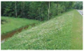
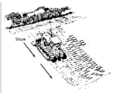
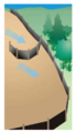
 BMPs temporarily stabilize and permanently establish vegetation.PNG PLeegar
22:17, 1 March 2016
199 × 123; 65 KB
 Hydrodraulic soil stabilizers promote the rapid growth of vegetation and prevent erosion.PNG PLeegar
20:22, 1 March 2016
412 × 290; 261 KB
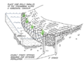
 Slope tracking roughens the surface of a slope and decreases the velocity of runoff.PNG PLeegar
20:18, 1 March 2016
478 × 369; 37 KB
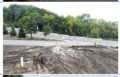
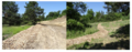
 Leave as much vegetation on a site as possible to reduce the overall disturbed area.PNG PLeegar
20:15, 1 March 2016
475 × 333; 354 KB
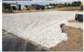
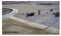
 Planning ahead effective way to minimize erosion and sedimentation.PNG PLeegar
19:40, 1 March 2016
368 × 391; 341 KB
 Recover and recycle wash water back into the truck.PNG PLeegar
21:13, 29 February 2016
447 × 342; 350 KB
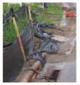
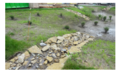
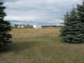
 System that has been properly protected after construction.PNG PLeegar
20:54, 29 February 2016
206 × 129; 57 KB
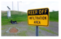
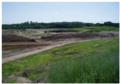
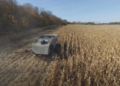
 Heavy equipment work from outside infiltration basin so soils not compacted.PNG PLeegar
20:48, 29 February 2016
208 × 125; 66 KB
 Heavy equipment will compact soils and infiltration rates will decrease or stop.PNG PLeegar
20:40, 29 February 2016
212 × 126; 67 KB
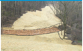
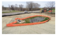
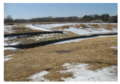
 Basin captures rainfall from a small rain event but it doesn’t infiltrate.PNG PLeegar
20:37, 29 February 2016
208 × 132; 67 KB
 Basin captures rainfall from a small rain event but it doesn’t infiltrate..PNG PLeegar
20:36, 29 February 2016
208 × 132; 67 KB
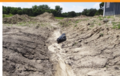
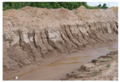
 Inlets to the infiltration basin were not protected.PNG PLeegar
20:31, 29 February 2016
207 × 124; 66 KB

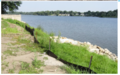
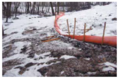
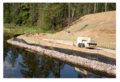 Move perimeter controls up the bank as the bank is stabilized.PNG PLeegar
17:28, 29 February 2016
443 × 304; 343 KB
 Relying on floating curtain as down gradient perimeter control.PNG PLeegar
17:25, 29 February 2016
599 × 360; 532 KB
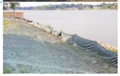
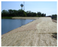
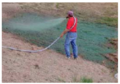
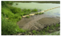
 Floating silt curtain for work in the water as secondary containment.PNG PLeegar
17:23, 29 February 2016
861 × 572; 651 KB
 Regular maintenance is needed to ensure that a site’s perimeter control is functioning properly.PNG PLeegar
17:12, 29 February 2016
384 × 254; 242 KB
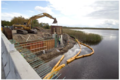
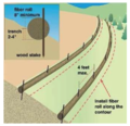 Install biorolls or other sediment controls along the contour of the slope.PNG PLeegar
17:03, 29 February 2016
486 × 468; 367 KB


