Navigation
Main page
Table of contents
Index (Categories)
What's new
Response to comments
Future updates
Events
In the News
Funding
Recent changes
Help
Export to pdf
Tools
Special pages
Printable version
MPCA Links
MPCA Homepage
Stormwater
Policies / Disclaimers
Minnesota Stormwater Manual
Search Help
Log in
Search:
Search
Gallery of new files
Special:NewFiles
This special page shows the last uploaded files.
Filter
Filename (or a part of it):
IP address or username
Show uploads by bots
Media type:
3D
Audio
Bitmap images
Compressed formats
Drawings (vector images)
Executables
Office
Rich media
Textual
Unknown
Videos
From date:
To date:
Search
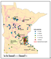
Hardness values of drinking water supply wells in Minnesota.PNG
PLeegar
20:05, 14 March 2016
575 × 728; 242 KB
Hardness values of drinking water supply wells in the TCMA.PNG
PLeegar
19:59, 14 March 2016
569 × 446; 98 KB
Road Salt Sales Trend in the United States.PNG
PLeegar
19:51, 14 March 2016
422 × 279; 30 KB
Distribution of NaCl in the TCMA (Figure adapted from Sander et al.PNG
PLeegar
19:46, 14 March 2016
517 × 360; 40 KB
Land Use in the TCMA (based on the National Land Cover Database from 2011.PNG
PLeegar
19:40, 14 March 2016
590 × 439; 433 KB
Conceptual model of anthropogenic sources of chloride and pathways.PNG
PLeegar
19:38, 14 March 2016
567 × 251; 41 KB
Chloride concentrations in ambient groundwater from the sand and gravel aquifers.PNG
PLeegar
19:34, 14 March 2016
567 × 662; 374 KB
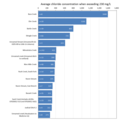
Comparison of Impaired Streams in the TCMA.PNG
PLeegar
18:52, 14 March 2016
599 × 601; 56 KB
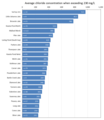
Comparison of Impaired Lakes and Wetlands in the TCMA.PNG
PLeegar
16:47, 14 March 2016
523 × 605; 61 KB
2014 Chloride Assessment Results in the TCMA.PNG
PLeegar
16:43, 14 March 2016
554 × 713; 743 KB
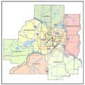
Twin Cities 7-County Metropolitan Area (TCMA).PNG
PLeegar
15:46, 14 March 2016
288 × 287; 108 KB
Corrosion from deicers.png
Mtrojan
17:42, 9 March 2016
866 × 323; 355 KB
Chloride in groundwater.png
Mtrojan
14:50, 9 March 2016
796 × 427; 235 KB
Damaged vegetation.jpg
Mtrojan
22:26, 8 March 2016
275 × 202; 29 KB
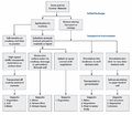
Environmental transport flowchart.jpg
Mtrojan
22:20, 8 March 2016
1,254 × 1,087; 205 KB
Video - sidewalks 2.png
Mtrojan
16:05, 8 March 2016
1,269 × 623; 1.02 MB
Video - sidewalks 1.png
Mtrojan
16:05, 8 March 2016
1,269 × 623; 985 KB
Video - residents.png
Mtrojan
15:23, 8 March 2016
1,275 × 625; 971 KB
Example plume 4.png
Mtrojan
20:21, 7 March 2016
1,258 × 667; 434 KB
Example plume 3.png
Mtrojan
20:21, 7 March 2016
1,281 × 657; 318 KB
Example plume 2.png
Mtrojan
20:20, 7 March 2016
1,282 × 678; 369 KB
Example plume 1.png
Mtrojan
20:20, 7 March 2016
604 × 662; 688 KB
Self-contained washout facility.PNG
PLeegar
19:58, 7 March 2016
468 × 449; 465 KB
Extenders can direct water from your roof gutters.PNG
PLeegar
23:02, 2 March 2016
529 × 360; 460 KB
A vehicle wash rack may be needed to remove sediment from tires.PNG
PLeegar
22:44, 2 March 2016
501 × 331; 362 KB
Vehicle tracking pad should be at least 50 feet in length.PNG
PLeegar
22:41, 2 March 2016
512 × 520; 453 KB
Vehicle tracking pads remove mud from tires.PNG
PLeegar
22:15, 2 March 2016
409 × 274; 223 KB
A road near Elba Minnesota, was damaged by flashfloods in August 2007.PNG
PLeegar
22:04, 2 March 2016
412 × 366; 355 KB
Stormwater inlet protection BMPs can be inserted into a catch basin.PNG
PLeegar
21:58, 2 March 2016
414 × 326; 354 KB
Maximum extent of mound.png
Mtrojan
19:20, 2 March 2016
990 × 567; 186 KB
Road salt training certificate holders.xlsx
Mtrojan
15:19, 2 March 2016
; 603 KB
Final stabilization.PNG
PLeegar
20:33, 1 March 2016
505 × 309; 377 KB
Erosion control blanket stabilizes pond slopes.PNG
PLeegar
20:25, 1 March 2016
415 × 331; 301 KB
Hydrodraulic soil stabilizers promote the rapid growth of vegetation and prevent erosion.PNG
PLeegar
20:22, 1 March 2016
412 × 290; 261 KB
Slope tracking roughens the surface of a slope and decreases the velocity of runoff.PNG
PLeegar
20:18, 1 March 2016
478 × 369; 37 KB
Leave as much vegetation on a site as possible to reduce the overall disturbed area.PNG
PLeegar
20:15, 1 March 2016
475 × 333; 354 KB
Subsoil erosion at a construction site.PNG
PLeegar
19:58, 1 March 2016
418 × 284; 296 KB
Planning ahead effective way to minimize erosion and sedimentation.PNG
PLeegar
19:40, 1 March 2016
368 × 391; 341 KB
Riparian buffers.PNG
PLeegar
17:53, 1 March 2016
867 × 339; 757 KB
Recover and recycle wash water back into the truck.PNG
PLeegar
21:13, 29 February 2016
447 × 342; 350 KB
System that has been properly protected after construction.PNG
PLeegar
20:54, 29 February 2016
206 × 129; 57 KB
Identifying infiltration areas with signs.PNG
PLeegar
20:51, 29 February 2016
201 × 131; 56 KB
Heavy equipment work from outside infiltration basin so soils not compacted.PNG
PLeegar
20:48, 29 February 2016
208 × 125; 66 KB
Heavy equipment will compact soils and infiltration rates will decrease or stop.PNG
PLeegar
20:40, 29 February 2016
212 × 126; 67 KB
Basin captures rainfall from a small rain event but it doesn’t infiltrate.PNG
PLeegar
20:37, 29 February 2016
208 × 132; 67 KB
Sediment entering the basin clogs the system.PNG
PLeegar
20:33, 29 February 2016
211 × 132; 61 KB
Inlets to the infiltration basin were not protected.PNG
PLeegar
20:31, 29 February 2016
207 × 124; 66 KB
Pervious pavers.PNG
PLeegar
19:37, 29 February 2016
471 × 279; 311 KB
Wq-strm2-12.docx
PLeegar
19:08, 29 February 2016
; 54 KB
Move perimeter controls up the bank as the bank is stabilized.PNG
PLeegar
17:28, 29 February 2016
443 × 304; 343 KB
(
newest
|
oldest
) View (
newer 50
|
older 50
) (
20
|
50
|
100
|
250
|
500
)
Search:
Search
Privacy policy