Summary of Information to Include on a Boring Log
Summary of information to include on a boring log. To enlarge an image, click on the image.
Link to this table
| Include on log | Description | Example / Photo |
|---|---|---|
| Boring name or number | Important to identify and distinguish each boring with a unique name | Most borings start with B or BH and end with a number Example: B-01 or BH01 |
| Project name, number, client, and city or county | Information is used identification purposes and for sample storage | |
| Boring coordinates and ground surface elevation | Each hole should be located and verified with coordinates in case of discrepancies If possible, record ground surface elevation with GPS Locations should be shown on a figure or map | Include Datum (NAD29 vs NAD83, NAVD 1929 or NAVD 1988) Understand coordinate systems. For example. UTM is in meters while Lat/long is in degrees or deg/min/sec |
| Start and end date and time | Helpful for tracking how long drilling is taking per borehole A known date can help identify the project for future reference | |
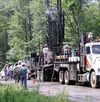
| Type of drill rig and boring depth | Will be used to determine the hammer efficiency if performing blow counts. Examples include:
|
Rotosonic drill on truck rig. Source: United States Geological Survey - Eastern Mineral and Environmental Resources Science Center |
| Drilling method | Record method used or depth where there is any change in the method being used. Different drilling methods may require different sampling techniques or procedures. Drilling methods include: Hollow Stem Auger, Direct Push Technology, Mud Rotary, Rotosonic, Air Rotary, ODEX. | |
| Sampling method and sample type |
|
Source: Photo courtesy of Barr Engineering |
| Sample recovery | Record recovery of samples for comparison to length of drilled sample Note assumed reasoning for poor recovery (i.e. bedrock, gravel stuck in splitspoon) | For example, the split-spoon was pounded 18" but only 10" of soil was recovered in the sampler |
| Soil Density or Consistency | Different characterization of coarse and fine grained samples Based on N-value of sample | |
| Color | Most colors should be earth tones with descriptors. Include all mottling or redoximorphic feature colors. Note iron staining or oxidized areas for indication of previously wet soil that has been dried out | Source:North Carolina State Cooperative Extension Resources |
| Grain size | For granular samples only (not for silts and clays). Can be called: very fine-, fine-, medium-, coarse-, or very coarse-grained | Source: Virginia Cooperative Extension - Virginia tech/Virginia State University |
| Particle shape | Can be angular, subangular, subrounded, or rounded. Important for understanding deposition environment and weathering of soil. | |
| Soil classification |
|
Source:USDA-NRCS |
| Sedimentary structure | Refers to bedding and laminations in the soil. Provides insight to origin of soils or potential weathering or chemical reactions experienced. Provides insight to geologic hazards (i.e. weak soil layers, collapsibility) |
Source: Ontario Ministry of Agriculture Food and Rural Affairs |
| Layer boundaries and thickness | Note stratigraphy breaks on logs. Unless transition is obvious while drilling, assume it is halfway between sampling intervals. | |
| Blow Counts | The number of hammer blows to pound the split-spoon 6, 12, 18, and 24 inches into the soil. The 6 to 12 and 12 to 18 inch blow counts are added and recorded as the n-value for that split-spoon. "Refusal" or termination of borehole occurs if the hammer does not advance for >50 blows/6 inches. Note the advancement (e.g. 50/2"). | |
| Depth to bedrock and/or refusal | "Refusal" or termination of borehole occurs if the hammer does not advance for >50 blows/6 inches. Note the advancement (e.g. 50/2"). Note refusal on logs. Note sample recovery if refusal is reached in a split spoon interval. | |
| Depth of groundwater | Record during and after drilling Note perched layers of water in sand or lignite. Record cave-in depth in unstable boreholes. Note if water isn't encountered. Saturated silts will have high dilatancy. | Source: U.S. EPA |
| Plasticity | Plasticity helps determine if a clay is lean (low plasticity) or fat (high plasticity). Is very dependent on moisture content (i.e. dry fat clay can seem like it has low plasticity) | |
| Moisture | Provides indication of water table. For each sample identify if it is moist, wet, or saturated. | |
| Inclusions | Used to describe the secondary components in a soil sample.
|
Source: United States Geological Survey |
| Topsoil thickness | Helpful to know how much topsoil stripping may be necessary. Note organic material if present or not. | Photo: Pat Dumas. Creative Commons BY-NC-SA (cropped). |
| Photographs | Pictures should be taken of each borehole location. Take photo of stake and all four directions. Record and photograph any crop damage. Photograph any interesting soil samples that may be of concern |
This page was last edited on 2 August 2022, at 18:11.


