File:Screening assessment example 2.png

Original file (1,280 × 857 pixels, file size: 2.71 MB, MIME type: image/png)
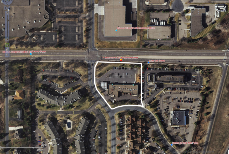
In this screening assessment example, permeable pavement is proposed for the parking area shown inside the white polygon. The surrounding neighborhood is multi-family residential, commercial business, and industrial. A major transportation corridor is adjacent to the property with the proposed BMP. Using What's in my Neighborhood, there was a tank leak site located on the property. The MPCA issued a closure letter 20 years ago indicating the site had been adequately addressed. A small quantity hazardous waste generator was identified on an adjacent property but was found to have no history of contamination. A loading dock to the northeast was investigated and found to have no history of contamination. Infiltration is acceptable at this site.
File history
Click on a date/time to view the file as it appeared at that time.
| Date/Time | Thumbnail | Dimensions | User | Comment | |
|---|---|---|---|---|---|
| current | 14:44, 25 May 2016 |  | 1,280 × 857 (2.71 MB) | Mtrojan (talk | contribs) | |
| 14:37, 25 May 2016 |  | 1,280 × 857 (2.71 MB) | Mtrojan (talk | contribs) |
You cannot overwrite this file.
File usage
The following page uses this file:
Metadata
This page was last edited on 20 December 2022, at 18:15.