![]()
File:Screening assessment example 3.png

Original file (1,190 × 922 pixels, file size: 2.17 MB, MIME type: image/png)
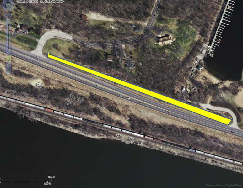
In this screening assessment example, a swale with check dams over permeable soils is proposed and shown in yellow. No current or past contamination is associated with the site. A site visit confirms there are fuel tanks 150 feet away at the marina to the north and stained soils along the railroad corridor to the south. Since groundwater flow is to the south toward the river, a mounding analysis was conducted to determine if groundwater beneath the railroad corridor would be impacted by infiltration. The mounding analysis indicated that a mound beneath the swale would extend onto the railroad corridor. It is therefore appropriate to not infiltrate at this site. If the owner continued to pursue infiltration, a Phase 1 or Phase 2 investigation is highly recommended.
File history
Click on a date/time to view the file as it appeared at that time.
| Date/Time | Thumbnail | Dimensions | User | Comment | |
|---|---|---|---|---|---|
| current | 15:38, 25 May 2016 | | 1,190 × 922 (2.17 MB) | Mtrojan (talk | contribs) |
You cannot overwrite this file.
File usage
The following page uses this file:
Metadata
This page was last edited on 20 December 2022, at 18:15.