![]()
Difference between revisions of "Images, CAD drawings"
(Created page with "===Computer-aided design and drafting (CAD/CADD) drawings=== *CADD images for individual best management practices *Links to .dwg files") |
m (→General images) |
||
| (29 intermediate revisions by the same user not shown) | |||
| Line 1: | Line 1: | ||
| − | + | The Manual contains more than 1000 images, including photos, schematics, graphs, CADD images, and so on. This page attempts to provide easier access to these images by providing links to categories or groups of images. | |
| + | |||
| + | ==Computer-aided design and drafting (CAD/CADD) drawings== | ||
*[[CADD images for individual best management practices]] | *[[CADD images for individual best management practices]] | ||
*[[Links to .dwg files]] | *[[Links to .dwg files]] | ||
| + | |||
| + | ==Photos== | ||
| + | *[https://stormwater.pca.state.mn.us/index.php?title=Category:Level_3_-_General_information,_reference,_tables,_images,_and_archives/Images/Best_management_practice_photos Photos of best management practices] | ||
| + | *[https://stormwater.pca.state.mn.us/index.php?title=Category:Level_3_-_General_information,_reference,_tables,_images,_and_archives/Images/Photo_galleries Photo galleries] | ||
| + | *[https://stormwater.pca.state.mn.us/index.php?title=Category:Level_3_-_General_information,_reference,_tables,_images,_and_archives/Images/Construction_stormwater_photos construction stormwater photos] | ||
| + | *[https://stormwater.pca.state.mn.us/index.php?title=Category:Level_3_-_General_information,_reference,_tables,_images,_and_archives/Images/Vegetation_photos Vegetation photos] | ||
| + | *[https://stormwater.pca.state.mn.us/index.php?title=Category:Level_3_-_General_information,_reference,_tables,_images,_and_archives/Images/Soil_and_media_photos Soil and media photos] | ||
| + | *[https://stormwater.pca.state.mn.us/index.php?title=Category:Level_3_-_General_information,_reference,_tables,_images,_and_archives/Images/Pollution_prevention_source_control_photos Pollution prevention photos] | ||
| + | *[https://stormwater.pca.state.mn.us/index.php?title=Category:Level_3_-_General_information,_reference,_tables,_images,_and_archives/Images/Winter,_deicing Winter, road salt photos] | ||
| + | |||
| + | ==Schematics== | ||
| + | *[https://stormwater.pca.state.mn.us/index.php?title=Category:Level_3_-_General_information,_reference,_tables,_images,_and_archives/Images/Schematic_-_CADD_detail CADD details] | ||
| + | *[https://stormwater.pca.state.mn.us/index.php?title=Category:Level_3_-_General_information,_reference,_tables,_images,_and_archives/Images/Schematic_-_MIDs Minimal Impact Design Standards (MIDS) calculator schematics] | ||
| + | *[https://stormwater.pca.state.mn.us/index.php?title=Category:Level_3_-_General_information,_reference,_tables,_images,_and_archives/Images/Schematic_-_bmps Best management practices] | ||
| + | *[https://stormwater.pca.state.mn.us/index.php?title=Category:Level_3_-_General_information,_reference,_tables,_images,_and_archives/Images/Schematic_-_hydrology,_soils,_media Hydrology, soil, media] | ||
| + | *[https://stormwater.pca.state.mn.us/index.php?title=Category:Level_3_-_General_information,_reference,_tables,_images,_and_archives/Images/Schematic_-_stormwater_management Stormwater management] | ||
| + | |||
| + | ==[https://stormwater.pca.state.mn.us/index.php?title=Category:Level_3_-_General_information,_reference,_tables,_images,_and_archives/Images/Graphs Graphs]== | ||
| + | |||
| + | ==[https://stormwater.pca.state.mn.us/index.php?title=Category:Level_3_-_General_information,_reference,_tables,_images,_and_archives/Images/Maps Maps]== | ||
| + | |||
| + | ==[https://stormwater.pca.state.mn.us/index.php?title=Category:Level_2_-_General_information,_reference,_tables,_images,_and_archives/Images All images]== | ||
| + | |||
| + | <gallery caption="Examples of types of images found in the Manual. Click on an image for enlarged view." widths="160px"> | ||
| + | File:Bioinfiltration.png|alt=image of bioinfiltration device|Example of a CADD image for bioinfiltration | ||
| + | file:Marquette avenue 5.jpg|alt=tree trench photo|Example of a photo of a tree trench | ||
| + | file:Hunt Utilities Group Green Roof Details.jpg|alt=green roof schematic|Example of a schematic for green roofs | ||
| + | file:Snowmelt infiltration based on soil moisture content.png|alt=snowmelt graph|Example of a graph showing snowmelt equivalent | ||
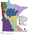
| + | file:Minnesota ecoregion sections.jpg|alt=ecoregion map|Example of a map showing ecoregions | ||
| + | </gallery> | ||
| + | |||
| + | [[Category:Level 3 - General information, reference, tables, images, and archives/Images/Schematic - CADD detail]] | ||
Latest revision as of 14:51, 22 January 2023
The Manual contains more than 1000 images, including photos, schematics, graphs, CADD images, and so on. This page attempts to provide easier access to these images by providing links to categories or groups of images.
Contents
Computer-aided design and drafting (CAD/CADD) drawings
Photos
- Photos of best management practices
- Photo galleries
- construction stormwater photos
- Vegetation photos
- Soil and media photos
- Pollution prevention photos
- Winter, road salt photos
Schematics
- CADD details
- Minimal Impact Design Standards (MIDS) calculator schematics
- Best management practices
- Hydrology, soil, media
- Stormwater management
Graphs
Maps
All images
- Examples of types of images found in the Manual. Click on an image for enlarged view.
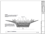
Example of a CADD image for bioinfiltration
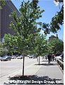
Example of a photo of a tree trench
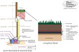
Example of a schematic for green roofs
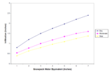
Example of a graph showing snowmelt equivalent
Example of a map showing ecoregions


This page was last edited on 22 January 2023, at 14:51.