Navigation
Main page
Table of contents
Index (Categories)
What's new
Response to comments
Future updates
Events
In the News
Funding
Recent changes
Help
Export to pdf
Tools
User contributions
Logs
View user groups
Special pages
Printable version
MPCA Links
MPCA Homepage
Stormwater
Policies / Disclaimers
Minnesota Stormwater Manual
Search Help
Log in
Search:
Search
Uploads by PLeegar
Special:ListFiles
This special page shows all uploaded files.
File list
Items per page:
20
50
100
250
500
Search for media name:
Username:
Include old versions of files
Go
First page
Previous page
Next page
Last page
Date
Name
Thumbnail
Size
Description
Versions
14:35, 22 June 2015
Ultra-Urban Scenario BMP Layout.PNG
(
file
)
49 KB
1
14:29, 22 June 2015
Ultra-Urban Scenario Street Level BMP Placement Schematic.PNG
(
file
)
21 KB
1
14:10, 22 June 2015
Ultra-Urban Scenario Base.PNG
(
file
)
26 KB
1
16:32, 19 June 2015
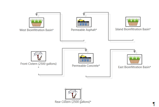
Site with Limited Infiltration Capacity BMP Treatment Train MIDS Calculator Schematic.PNG
(
file
)
66 KB
1
16:10, 19 June 2015
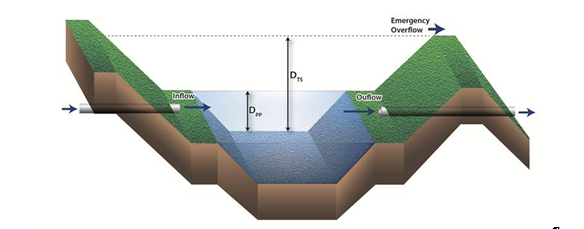
Typical Stormwater Wetland Configuration.PNG
(
file
)
129 KB
1
14:42, 19 June 2015
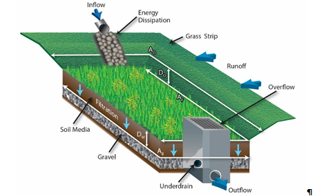
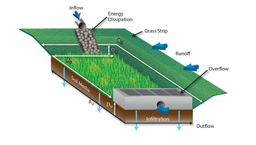
Typical Biofiltration Configuration.PNG
(
file
)
168 KB
1
13:46, 19 June 2015
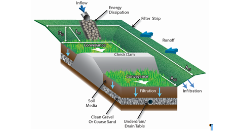
Typical Grass Channel & Dry Swale Configuration.PNG
(
file
)
106 KB
1
22:06, 18 June 2015
Site with Limited Infiltration Capacity Scenario BMP Layout.PNG
(
file
)
201 KB
1
21:56, 18 June 2015
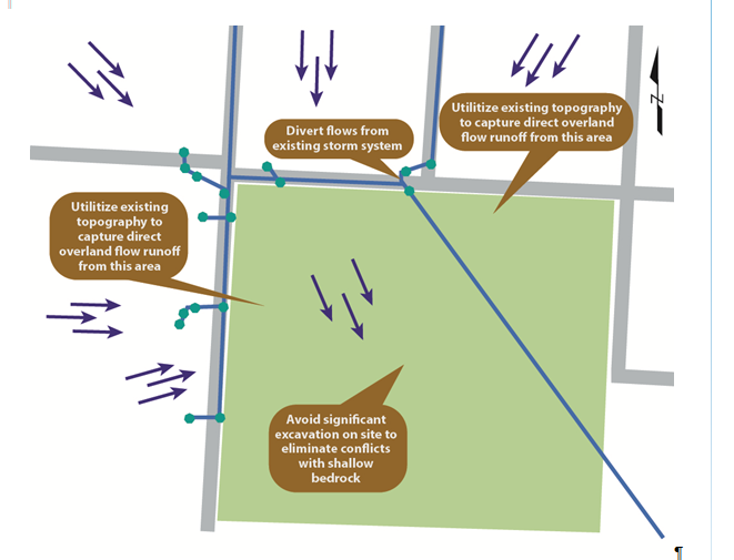
Site with Limited Infiltration Capacity Scenario Site Constraints.PNG
(
file
)
144 KB
1
21:43, 18 June 2015
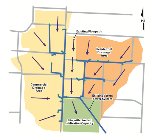
Site with Limited Infiltration Capacity Scenario Base.PNG
(
file
)
135 KB
1
19:33, 18 June 2015
Urban Retrofit BMP Treatment Train MIDS Calculator Schematic.PNG
(
file
)
44 KB
1
15:32, 18 June 2015
Typical Bioretention Configuration.PNG
(
file
)
150 KB
1
22:02, 17 June 2015
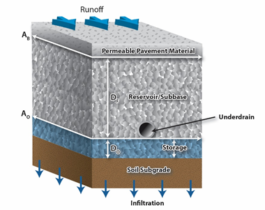
Typical Permeable Pavement with Underdrain Configuration.PNG
(
file
)
127 KB
1
21:47, 17 June 2015
Retrofit Scenario BMP Layout.PNG
(
file
)
125 KB
1
18:45, 17 June 2015
Retrofit Scenario BMP Placement & Site Constraints.png
(
file
)
96 KB
1
18:30, 17 June 2015
Retrofit Scenario Base.PNG
(
file
)
79 KB
1
20:37, 4 June 2015
Watershed scale stormwater treatment train.PNG
(
file
)
1.06 MB
1
20:16, 4 June 2015
Watershed scale stormwater treatment train..PNG
(
file
)
1.06 MB
1
19:06, 4 June 2015
Watershed scale stormwater treatment train.jpg
(
file
)
490 KB
1
15:41, 13 March 2015
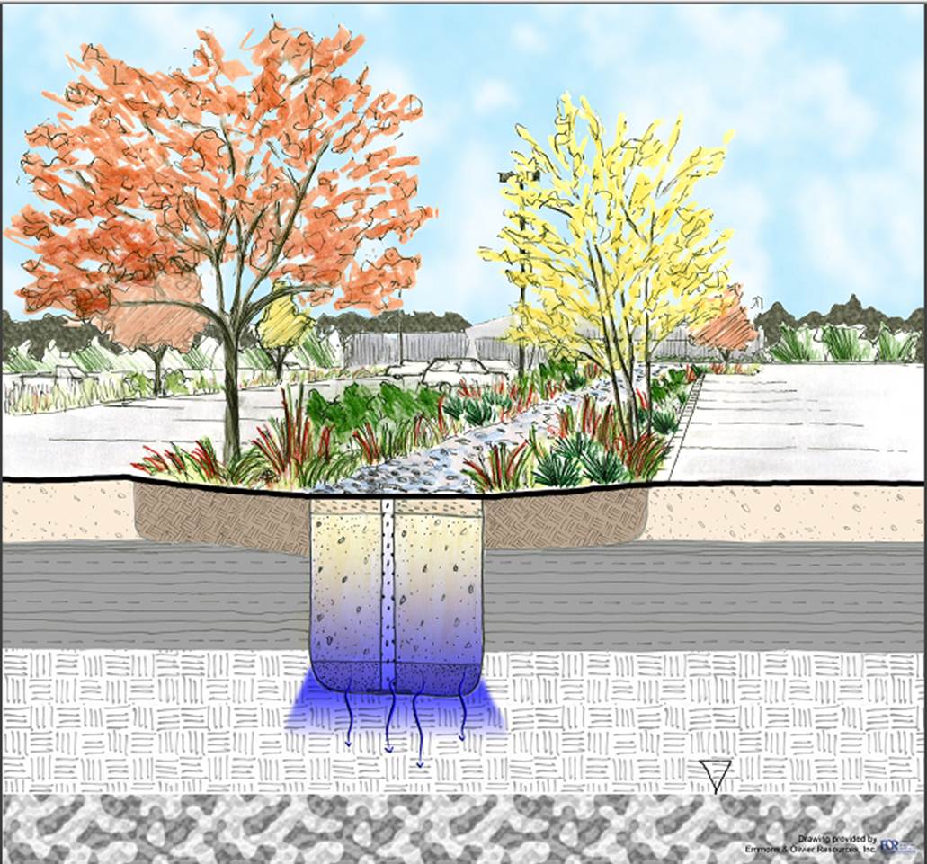
Infiltration Basin Detailed Cross Section.png
(
file
)
210 KB
1
15:06, 10 March 2015
Dry swale credit picture 1.jpg
(
file
)
55 KB
1
19:12, 4 September 2013
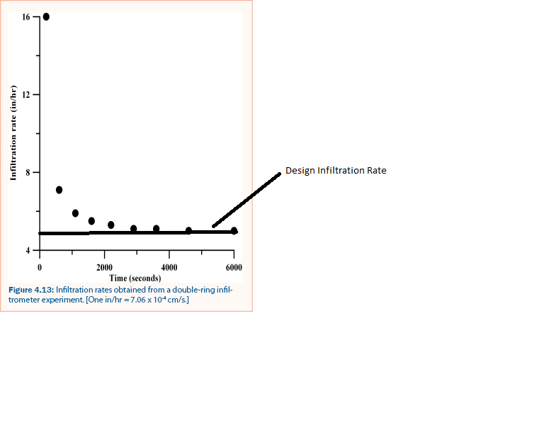
Infiltration Rate - double-ring infiltrometer.png
(
file
)
38 KB
1
13:22, 2 July 2013
CSW permit authorization.png
(
file
)
298 KB
1
19:10, 18 June 2013
Stormwater reuse for irrigation performance curve – watershed 100 percent impervious.png
(
file
)
38 KB
2
19:10, 18 June 2013
Stormwater reuse for irrigation performance curve – watershed 90 percent impervious.png
(
file
)
38 KB
1
19:09, 18 June 2013
Stormwater reuse for irrigation performance curve – watershed 70 percent impervious.png
(
file
)
41 KB
2
19:09, 18 June 2013
Stormwater reuse for irrigation performance curve – watershed 50 percent impervious.png
(
file
)
42 KB
1
19:08, 18 June 2013
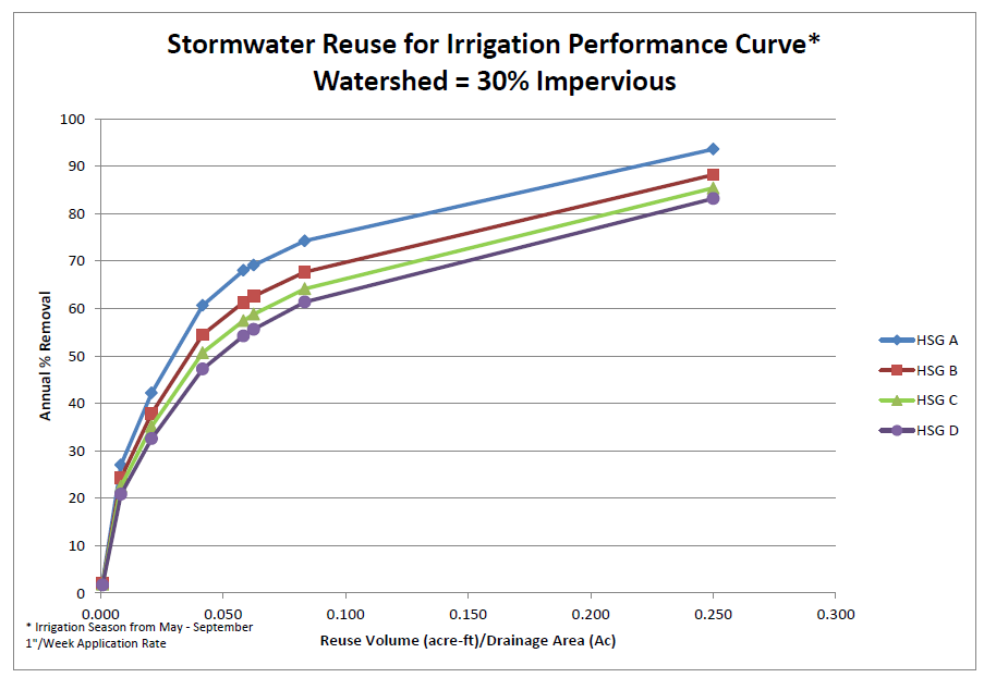
Stormwater reuse for irrigation performance curve – watershed 30 percent impervious.png
(
file
)
46 KB
1
19:08, 18 June 2013
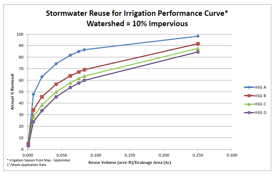
Stormwater reuse for irrigation performance curve – watershed 10 percent impervious.png
(
file
)
44 KB
1
19:08, 18 June 2013
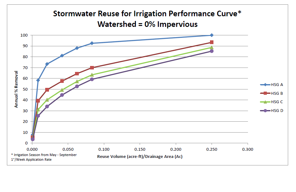
Stormwater reuse for irrigation performance curve – watershed 0 percent impervious.png
(
file
)
45 KB
1
16:36, 18 June 2013
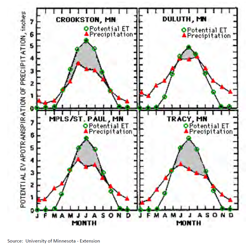
Average monthly evapotranspiration and precipitation values for four sites in Minnesota.png
(
file
)
803 KB
1
16:14, 18 June 2013
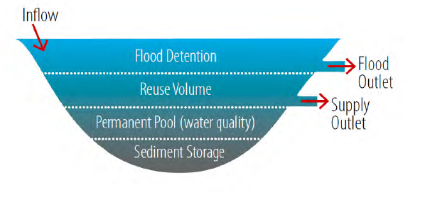
Example of a stormwater pond designed specifically for stormwater reuse v2.png
(
file
)
160 KB
1
16:11, 18 June 2013
Example of a stormwater pond designed specifically for stormwater reuse.png
(
file
)
139 KB
2
13:30, 28 May 2013
MS4 authorization Page.png
(
file
)
466 KB
1
14:54, 25 April 2013
Calcareous fens list.xlsx
(
file
)
20 KB
1
13:31, 25 April 2013
Online logo.jpg
(
file
)
3 KB
1
21:40, 15 April 2013
303-d listed waters with stressors specified in CSW permit.xls
(
file
)
334 KB
2
20:35, 15 April 2013
CSW Special waters as of 4-15-2013.pdf
(
file
)
106 KB
1
19:00, 21 March 2013
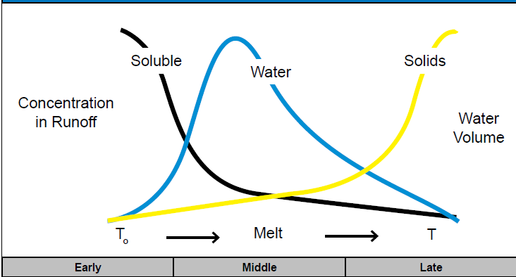
General Pollutant Movement from a Snowpack 1.PNG
(
file
)
22 KB
1
18:57, 21 March 2013
General Pollutant Movement from a Snowpack.PNG
(
file
)
22 KB
2
16:48, 21 March 2013
Seasonal Operation for Snowmelt Runoff Management.PNG
(
file
)
32 KB
2
20:14, 14 March 2013
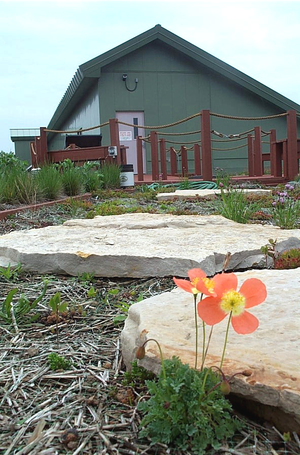
Green roofs 2.jpg
(
file
)
426 KB
1
15:21, 12 February 2013
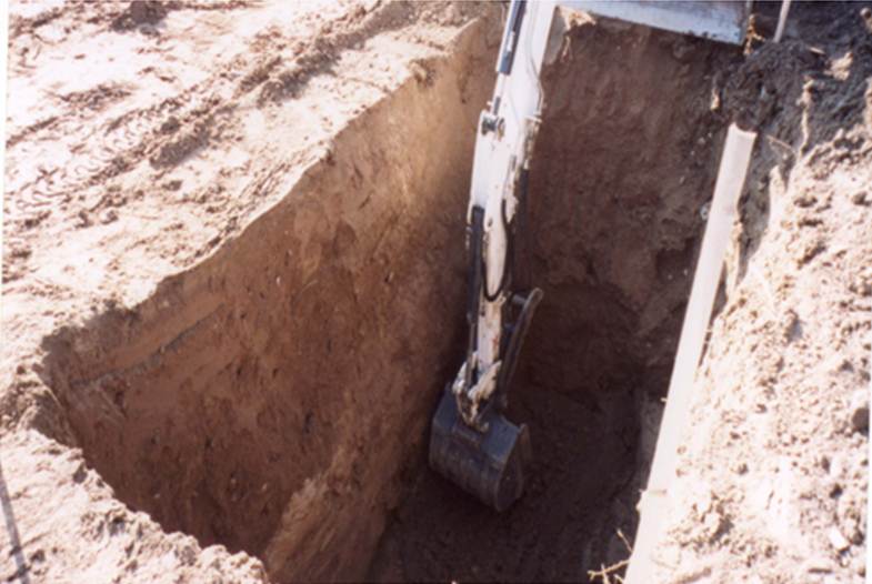
Trench-infiltration.jpg
(
file
)
170 KB
1
19:03, 5 February 2013
Underground storage and infiltration - Stillwater.jpg
(
file
)
819 KB
1
19:03, 5 February 2013
Trench-storm.jpg
(
file
)
2.4 MB
1
19:02, 5 February 2013
Trench-storage.jpg
(
file
)
2.15 MB
1
19:02, 5 February 2013
Infiltration trench Lino Lakes.jpg
(
file
)
821 KB
1
19:02, 5 February 2013
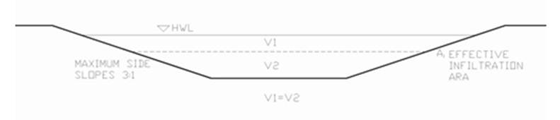
Effective infiltration area for side slopes less than 1-3.jpg
(
file
)
8 KB
1
19:01, 5 February 2013
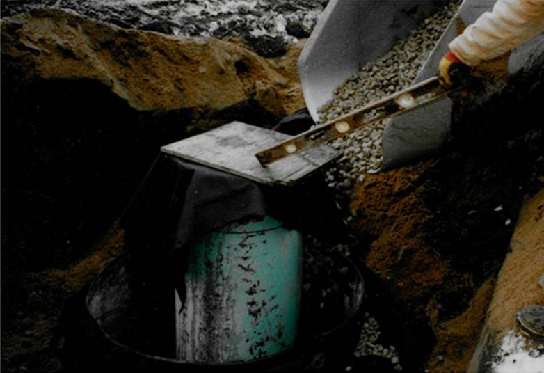
Construction of infiltration trench 2.jpg
(
file
)
46 KB
1
19:01, 5 February 2013
Construction of infiltration trench 1.jpg
(
file
)
55 KB
1
First page
Previous page
Next page
Last page
Search:
Search
Privacy policy


