![]()
Uploads by PLeegar
This special page shows all uploaded files.
| Date | Name | Thumbnail | Size | Description | Versions |
|---|---|---|---|---|---|
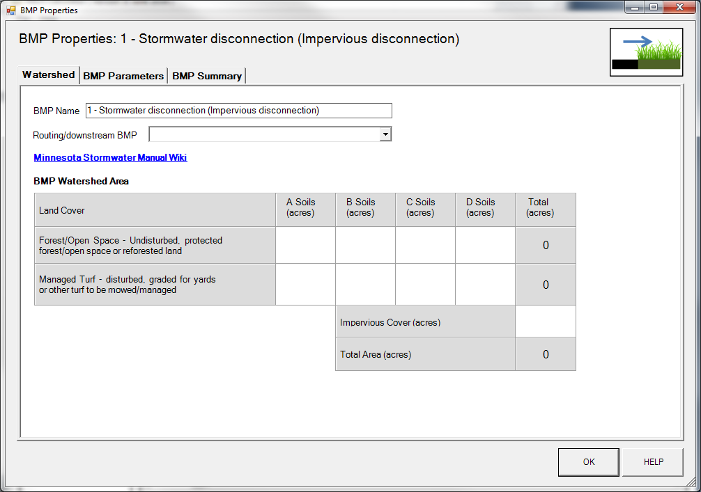
| 18:43, 29 June 2016 | BMP properties - Stormwater disconnection.png (file) |  |
61 KB | 1 | |
| 18:38, 29 June 2016 | Symbol for Stormwater Disconnection in MIDS calculator.png (file) |  |
28 KB | 1 | |
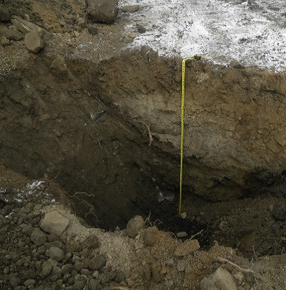
| 20:49, 21 June 2016 | Log of borring B-02.PNG (file) |  |
163 KB | 1 | |
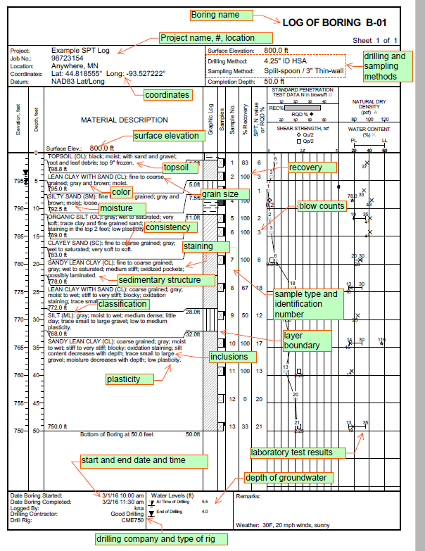
| 20:37, 21 June 2016 | Log of borring B-01.PNG (file) |  |
160 KB | 1 | |
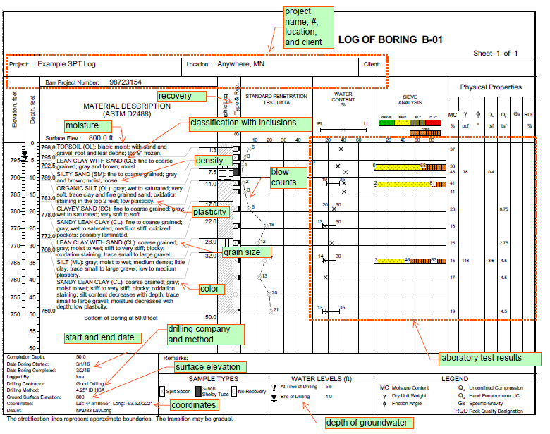
| 20:34, 21 June 2016 | Log of borring R-01.PNG (file) |  |
116 KB | 1 | |
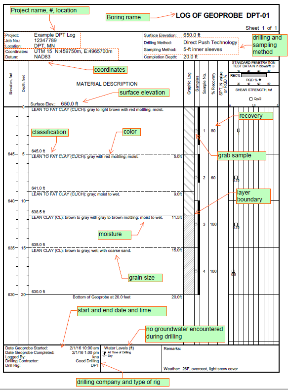
| 20:31, 21 June 2016 | Log of geoprobe DPT-01.PNG (file) |  |
107 KB | 1 | |
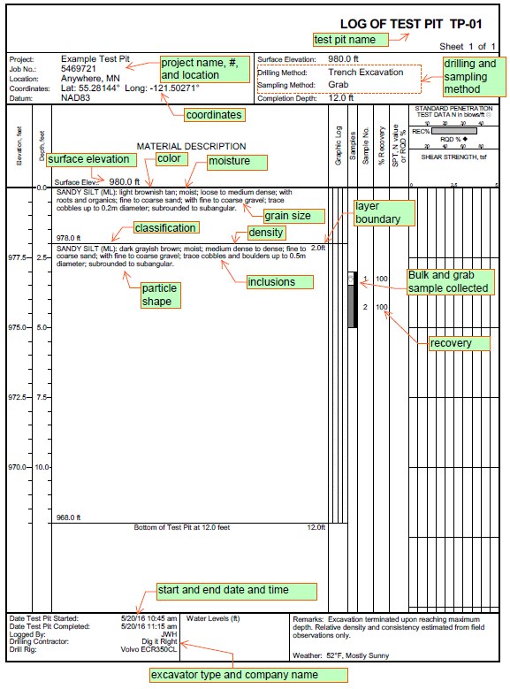
| 20:26, 21 June 2016 | Log of test pit TP-01.PNG (file) |  |
105 KB | 1 | |
| 20:23, 21 June 2016 | Photographs.PNG (file) |  |
28 KB | 1 | |
| 20:22, 21 June 2016 | Topsoil thickness.png (file) |  |
34 KB | 1 | |
| 20:20, 21 June 2016 | Inclusions.png (file) |  |
77 KB | 1 | |
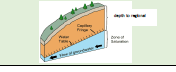
| 20:18, 21 June 2016 | Depth of groundwater.PNG (file) |  |
6 KB | 1 | |
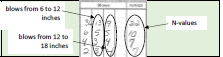
| 20:16, 21 June 2016 | Blow Counts.PNG (file) | 8 KB | 1 | ||
| 20:14, 21 June 2016 | Layer boundaries and thickness.png (file) | 613 KB | 1 | ||
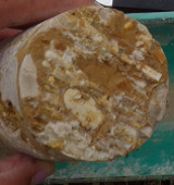
| 20:12, 21 June 2016 | Sedimentary structure.png (file) |  |
344 KB | 1 | |
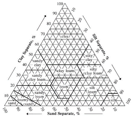
| 20:10, 21 June 2016 | Soil classification.png (file) |  |
150 KB | 1 | |
| 20:08, 21 June 2016 | Grain Size.PNG (file) |  |
42 KB | 1 | |
| 20:06, 21 June 2016 | Color.png (file) |  |
150 KB | 1 | |
| 20:04, 21 June 2016 | Sampling method and sample type.png (file) |  |
561 KB | 1 | |
| 20:02, 21 June 2016 | Soil Density or Consistency.PNG (file) |  |
7 KB | 1 | |
| 19:36, 21 June 2016 | Sampling method and sample type.PNG (file) |  |
7 KB | 1 | |
| 19:32, 21 June 2016 | Start and end date and time.png (file) | 17 KB | 1 | ||
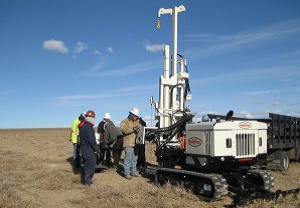
| 19:29, 21 June 2016 | Types of drill rig and boring depth.png (file) |  |
23 KB | 1 | |
| 19:26, 21 June 2016 | Type of drill rig and boring depth 1.png (file) |  |
186 KB | 2 | |
| 19:23, 21 June 2016 | Type of drill rig and boring depth 2.png (file) |  |
228 KB | 2 | |
| 19:15, 21 June 2016 | Standard Penetration.png (file) |  |
147 KB | 1 | |
| 19:13, 21 June 2016 | Rotosonic.png (file) |  |
170 KB | 1 | |
| 19:11, 21 June 2016 | Direct Push Technology.png (file) |  |
147 KB | 1 | |
| 18:33, 21 June 2016 | Excavation Test Pit or Trench.png (file) |  |
430 KB | 1 | |
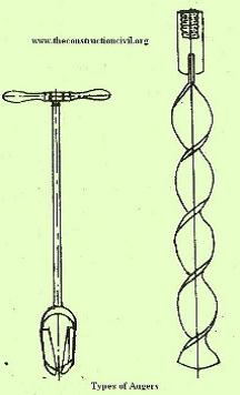
| 18:30, 21 June 2016 | Hand held or machine auger.png (file) |  |
86 KB | 1 | |
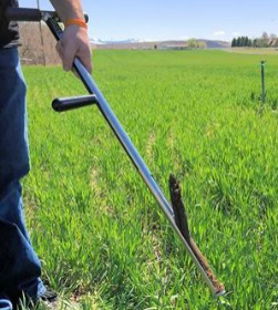
| 18:22, 21 June 2016 | Soil Probe.png (file) |  |
201 KB | 1 | |
| 18:11, 31 May 2016 | Dry Swale with Check Dam.PNG (file) |  |
407 KB | 2 | |
| 19:42, 26 May 2016 | Infiltration Basin.png (file) | Error creating thumbnail: File with dimensions greater than 12.5 MP |
320 KB | 2 | |
| 18:55, 26 May 2016 | Tree Trench3.jpg (file) |  |
1.28 MB | 1 | |
| 18:52, 26 May 2016 | Permeable Paver.png (file) | Error creating thumbnail: File with dimensions greater than 12.5 MP |
540 KB | 1 | |
| 18:48, 26 May 2016 | Dry Swale and Check Dam.jpg (file) |  |
1.3 MB | 1 | |
| 18:45, 26 May 2016 | Underground Infiltration System.png (file) | Error creating thumbnail: File with dimensions greater than 12.5 MP |
692 KB | 1 | |
| 18:41, 26 May 2016 | Dry Well.png (file) | Error creating thumbnail: File with dimensions greater than 12.5 MP |
472 KB | 1 | |
| 18:38, 26 May 2016 | Infiltration Trench.png (file) | Error creating thumbnail: File with dimensions greater than 12.5 MP |
1.08 MB | 1 | |
| 18:30, 26 May 2016 | Bioinfiltration Basin.png (file) | Error creating thumbnail: File with dimensions greater than 12.5 MP |
469 KB | 1 | |
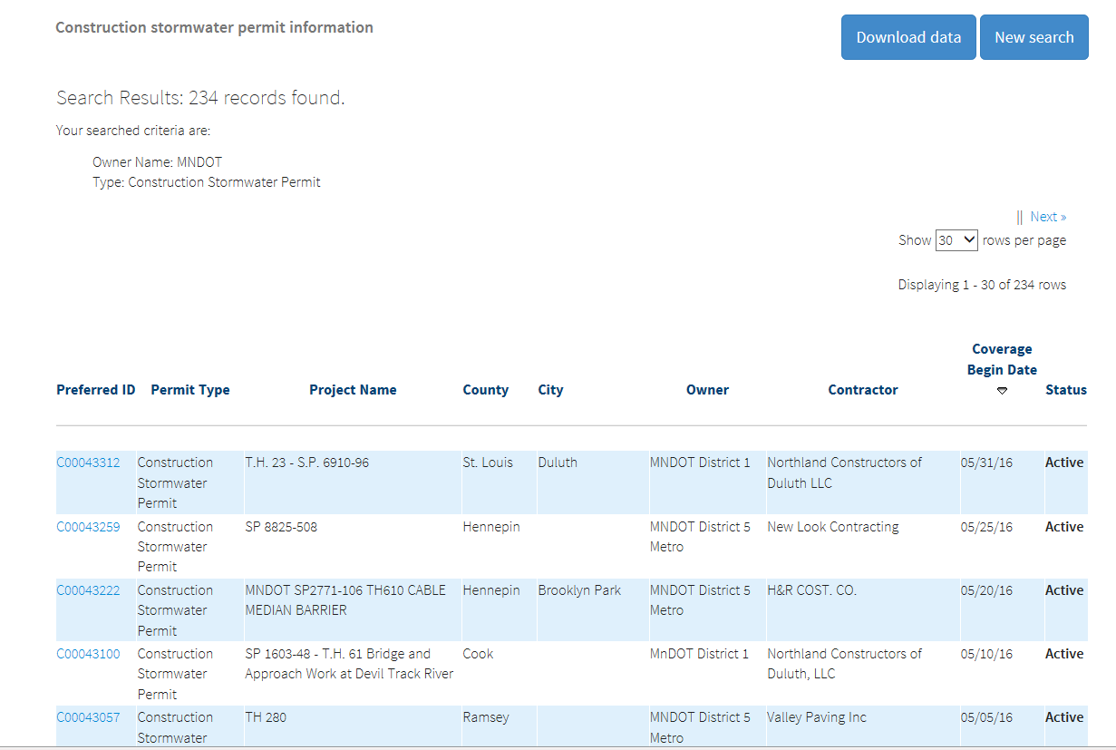
| 16:07, 25 May 2016 | CSW search tool result set.PNG (file) |  |
58 KB | 1 | |
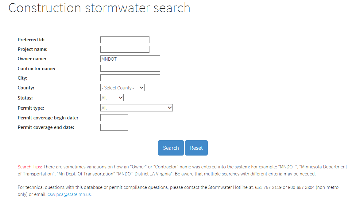
| 16:00, 25 May 2016 | CSW search tool.PNG (file) |  |
38 KB | 1 | |
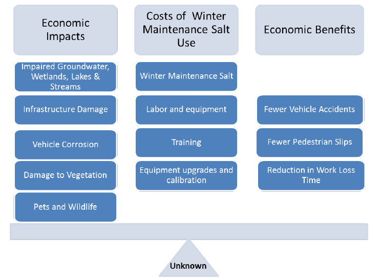
| 21:52, 16 May 2016 | Cost Considerations Related to Winter Maintenance Salt Use.PNG (file) |  |
44 KB | 1 | |
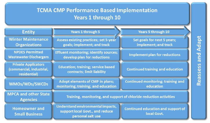
| 20:52, 16 May 2016 | Implementation Strategy to meet the TCMA Chloride TMDLs.PNG (file) |  |
340 KB | 1 | |
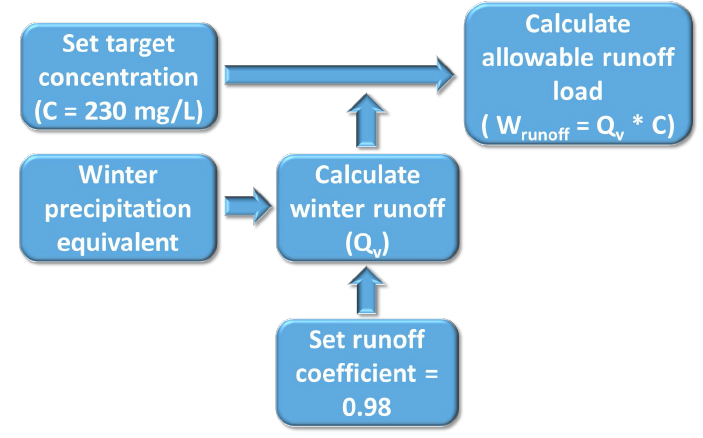
| 18:39, 16 May 2016 | Model schematic for allowable runoff load for stream TMDLs in the TCMA.PNG (file) |  |
159 KB | 1 | |
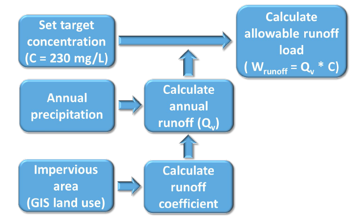
| 18:35, 16 May 2016 | Model schematic for allowable runoff load for lake and wetland TMDLs in the TCMA.PNG (file) |  |
182 KB | 1 | |
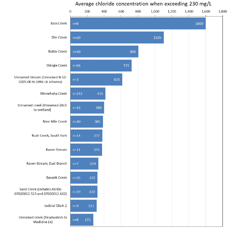
| 16:23, 16 May 2016 | Comparison of Impaired Streams in the TCMA 2003-2013.PNG (file) |  |
45 KB | 1 | |
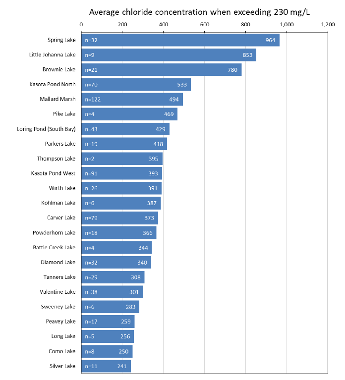
| 16:04, 16 May 2016 | Comparison of Impaired Lakes and Wetlands in the TCMA from 2003-2013.PNG (file) |  |
48 KB | 1 | |
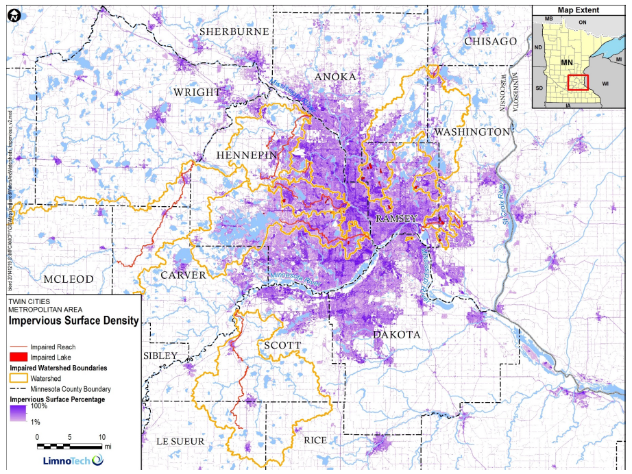
| 16:00, 16 May 2016 | Percent Impervious in the TCMA.PNG (file) |  |
1.33 MB | 1 | |
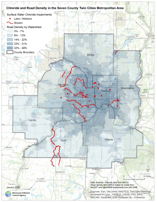
| 15:54, 16 May 2016 | Chloride Impairments and Road Density in the TCMA.PNG (file) |  |
989 KB | 2 | |
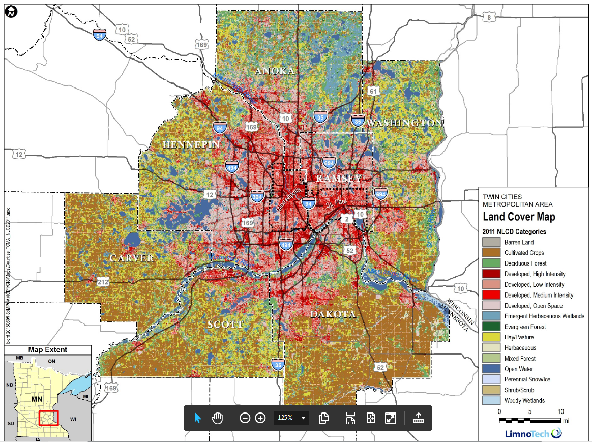
| 15:46, 16 May 2016 | Land Use in the TCMA.PNG (file) |  |
1.66 MB | 1 |