![]()
Search results
Create the page "Stormwater general information" on this wiki! See also the search results found.
File:Treatment train schematic.png ...o follow the treatment train approach. Under the treatment train approach, stormwater management begins with simple methods that minimize the amount of runoff th *[[Stormwater re-use and rainwater harvesting|stormwater re-use and rainwater harvesting]]; and(1,296 × 981 (975 KB)) - 01:21, 19 December 2022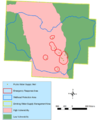
File:Wellhead protection example.png ...al information, reference, tables, images, and archives/Images/Schematic - stormwater management(741 × 914 (262 KB)) - 17:17, 20 December 2022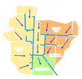
File:Limited infiltration site layout.jpg ...al information, reference, tables, images, and archives/Images/Schematic - stormwater management]](851 × 826 (891 KB)) - 01:17, 19 December 2022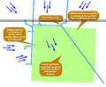
File:Limited infiltration site constraints.jpg ...al information, reference, tables, images, and archives/Images/Schematic - stormwater management]](1,000 × 826 (997 KB)) - 01:17, 19 December 2022
File:Comparison of predevelopment, conventional and open space designs.jpg ...al information, reference, tables, images, and archives/Images/Schematic - stormwater management]](608 × 723 (66 KB)) - 17:20, 15 December 2022
File:Ultra-Urban Scenario Base.PNG ...al information, reference, tables, images, and archives/Images/Schematic - stormwater management]](529 × 334 (26 KB)) - 01:20, 19 December 2022
File:Limited infiltration site proposed layout.jpg ...al information, reference, tables, images, and archives/Images/Schematic - stormwater management]](1,094 × 862 (1.09 MB)) - 01:17, 19 December 2022
File:Example of traditional and bsd road designs.jpg ...al information, reference, tables, images, and archives/Images/Schematic - stormwater management]](961 × 451 (38 KB)) - 17:20, 15 December 2022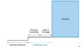
File:Ultra-Urban Scenario Street Level BMP Placement Schematic.PNG ...al information, reference, tables, images, and archives/Images/Schematic - stormwater management]](548 × 319 (21 KB)) - 01:20, 19 December 2022
File:Parking Lot Scenario Base.PNG ...al information, reference, tables, images, and archives/Images/Schematic - stormwater management]](533 × 364 (90 KB)) - 01:18, 19 December 2022
File:Potential planting areas at development site.jpg ...al information, reference, tables, images, and archives/Images/Schematic - stormwater management]](958 × 720 (117 KB)) - 17:20, 15 December 2022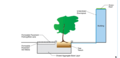
File:Ultra-Urban Scenario BMP Layout.PNG ...al information, reference, tables, images, and archives/Images/Schematic - stormwater management]](613 × 296 (49 KB)) - 01:21, 19 December 2022
File:Parking Lot Scenario BMP Placement & Site Constraints.PNG ...al information, reference, tables, images, and archives/Images/Schematic - stormwater management]](530 × 350 (68 KB)) - 01:18, 19 December 2022
File:Schematic of conventional subdivision.jpg ...al information, reference, tables, images, and archives/Images/Schematic - stormwater management]](962 × 718 (109 KB)) - 17:20, 15 December 2022
File:Retrofit Scenario Base.PNG ...al information, reference, tables, images, and archives/Images/Schematic - stormwater management]](604 × 409 (79 KB)) - 01:19, 19 December 2022
File:Pocket park.jpg ...al information, reference, tables, images, and archives/Images/Schematic - stormwater management]](684 × 512 (126 KB)) - 21:59, 19 December 2022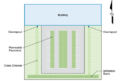
File:Parking Lot Scenario BMP Layout.PNG ...al information, reference, tables, images, and archives/Images/Schematic - stormwater management]](490 × 331 (87 KB)) - 01:18, 19 December 2022
File:Three zone stream buffer system.jpg ...al information, reference, tables, images, and archives/Images/Schematic - stormwater management]](959 × 540 (37 KB)) - 17:20, 15 December 2022
File:Retrofit Scenario BMP Placement & Site Constraints.png ...al information, reference, tables, images, and archives/Images/Schematic - stormwater management]](597 × 423 (96 KB)) - 01:19, 19 December 2022
File:New Residential Development Scenario Base.PNG ...al information, reference, tables, images, and archives/Images/Schematic - stormwater management]](541 × 401 (54 KB)) - 01:18, 19 December 2022
File:Turn around options residential streets.jpg ...al information, reference, tables, images, and archives/Images/Schematic - stormwater management]](958 × 376 (35 KB)) - 17:21, 15 December 2022
File:Retrofit Scenario BMP Layout.PNG ...al information, reference, tables, images, and archives/Images/Schematic - stormwater management]](586 × 430 (125 KB)) - 01:19, 19 December 2022
File:Better site design principles.jpg ...al information, reference, tables, images, and archives/Images/Schematic - stormwater management]](1,127 × 612 (69 KB)) - 17:19, 15 December 2022
File:New Development Scenario Varied BMP Approach BMP Layout.PNG ...al information, reference, tables, images, and archives/Images/Schematic - stormwater management]](507 × 388 (192 KB)) - 01:18, 19 December 2022
File:Better site design practices.jpg ...al information, reference, tables, images, and archives/Images/Schematic - stormwater management]](1,041 × 947 (117 KB)) - 17:19, 15 December 2022
File:Burnsville control and treatment design.jpg ...al information, reference, tables, images, and archives/Images/Schematic - stormwater management]](736 × 888 (139 KB)) - 17:19, 15 December 2022
File:New Development Scenario Stormwater Ponds in Series Approach BMP Layout.PNG ...al information, reference, tables, images, and archives/Images/Schematic - stormwater management]](392 × 390 (186 KB)) - 01:17, 19 December 2022
File:Dwsma 5.png ...al information, reference, tables, images, and archives/Images/Schematic - stormwater management]](1,584 × 791 (1.75 MB)) - 17:14, 20 December 2022
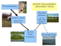
File:Heritage Park treatment train schematic.png ...al information, reference, tables, images, and archives/Images/Schematic - stormwater management]](629 × 285 (408 KB)) - 01:18, 19 December 2022
File:Common operations for assessing pshs.png ...al information, reference, tables, images, and archives/Images/Schematic - stormwater management]](745 × 345 (721 KB)) - 17:18, 20 December 2022
File:Figure02 CRWDEducationEvent.JPG ...eral information, reference, tables, images, and archives/Images/Municipal stormwater (MS4) photos]](770 × 304 (53 KB)) - 14:49, 9 February 2023
File:Figure01 WebAdvertisingBanners.JPG ...eral information, reference, tables, images, and archives/Images/Municipal stormwater (MS4) photos]](807 × 411 (86 KB)) - 14:48, 9 February 2023
File:Figure02 AquariumPhotobooth.JPG ...eral information, reference, tables, images, and archives/Images/Municipal stormwater (MS4) photos]](639 × 513 (72 KB)) - 14:48, 9 February 2023
File:RochesterAudit.jpg ...eral information, reference, tables, images, and archives/Images/Municipal stormwater (MS4) photos]](621 × 295 (66 KB)) - 14:48, 9 February 2023
File:IDDEDieTest.jpg ...eral information, reference, tables, images, and archives/Images/Municipal stormwater (MS4) photos]](2,688 × 1,520 (2.11 MB)) - 14:47, 9 February 2023
File:100 0120.JPG ...eral information, reference, tables, images, and archives/Images/Municipal stormwater (MS4) photos]](1,501 × 1,833 (968 KB)) - 14:46, 9 February 2023
File:StormwaterStenciling.jpeg ...eral information, reference, tables, images, and archives/Images/Municipal stormwater (MS4) photos]](4,032 × 3,024 (5.3 MB)) - 14:48, 9 February 2023
File:IDDE Sample.jpg ...eral information, reference, tables, images, and archives/Images/Municipal stormwater (MS4) photos]](680 × 360 (84 KB)) - 14:49, 9 February 2023
File:Permit constraints profile view 2.png ...al information, reference, tables, images, and archives/Images/Schematic - stormwater management]](1,278 × 530 (245 KB)) - 17:13, 20 December 2022
File:Traditional and conservation design development.png ...edicated as a community amenity. Flexible lot design allows less roads and stormwater infrastructure to be built, reducing imperviousness and infrastructure cost ...al information, reference, tables, images, and archives/Images/Schematic - stormwater management]](490 × 916 (577 KB)) - 17:21, 15 December 2022
File:Tree trench schematic with interception.png ...ield capacity of the media drains to the underdrain and is returned to the stormwater conveyance system. It therefore receives no credit. ...is water therefore also comprises a credit. For specific calculations and information on soil properties, see the discussion in the section on [[Calculating cred(863 × 811 (793 KB)) - 22:23, 15 December 2022
File:General information page image.png ...ovide overview information on a topic, links, references, or other general information. Technical pages provide specifications, technical methods, and technical s [[Category:Level 2 - General information, reference, tables, images, and archives/Reference]](281 × 289 (65 KB)) - 20:02, 20 December 2022
File:Technical information page image.png ...ovide overview information on a topic, links, references, or other general information. Technical pages provide specifications, technical methods, and technical s [[Category:Level 2 - General information, reference, tables, images, and archives/Reference]](524 × 346 (428 KB)) - 16:57, 20 December 2022
File:Erosion control blanket 1.jpg ...area and has been installed properly, according to the MPCA’s Construction Stormwater Manual. No rills or gullies are forming under blanket. [[Category:Level 3 - General information, reference, tables, images, and archives/Images/Erosion prevention photos]](1,334 × 873 (131 KB)) - 16:15, 19 December 2022
File:Erosion control blanket 2.jpg ...area and has been installed properly, according to the MPCA’s Construction Stormwater Manual. No rills or gullies are forming under blanket. [[Category:Level 3 - General information, reference, tables, images, and archives/Images/Erosion prevention photos]](1,334 × 875 (168 KB)) - 16:15, 19 December 2022
File:Permanent Stormwater Basin.jpg This sediment basin was converted to a permanent (post-construction) stormwater basin after the contributing drainage area was fully stabilized. Note the e [[Category:Level 3 - General information, reference, tables, images, and archives/Images/Sediment control photos]](1,008 × 669 (252 KB)) - 16:33, 19 December 2022
File:Example of dumspter management at psh.png ...al information, reference, tables, images, and archives/Images/Schematic - stormwater management]] [[Category:Level 3 - General information, reference, tables, images, and archives/Images/Pollution prevention source(747 × 431 (723 KB)) - 17:19, 20 December 2022
File:Examples of common pollution prevention practices.png [[Category:Level 3 - General information, reference, tables, images, and archives/Images/Pollution prevention source ...al information, reference, tables, images, and archives/Images/Schematic - stormwater management]](746 × 250 (269 KB)) - 17:19, 20 December 2022
File:Contaminant feature.png [[Category:Level 3 - General information, reference, tables, images, and archives/Images/Schematic - hydrology, soil ...al information, reference, tables, images, and archives/Images/Schematic - stormwater management]](1,238 × 560 (152 KB)) - 18:17, 20 December 2022
File:Multiple benefits.jpg ...al information, reference, tables, images, and archives/Images/Schematic - stormwater management]] [[Category:Level 3 - General information, reference, tables, images, and archives/Images/Schematic - bmps]](345 × 450 (48 KB)) - 21:59, 19 December 2022


