Difference between revisions of "Plants for swales"
m |
m (→Related pages) |
||
| (26 intermediate revisions by the same user not shown) | |||
| Line 1: | Line 1: | ||
[[File:Plants for stormwater design.jpg|300px|thumb|alt=image of plant book|<font size=3>The tables and content on this page have been adapted from [https://www.pca.state.mn.us/sites/default/files/pfsd-section1.pdf “Plants for Stormwater Design: Species Selection for the Upper Midwest”] (Daniel Shaw and Rusty Schmidt, Minnesota Pollution Control Agency, 2003).</font size>]] | [[File:Plants for stormwater design.jpg|300px|thumb|alt=image of plant book|<font size=3>The tables and content on this page have been adapted from [https://www.pca.state.mn.us/sites/default/files/pfsd-section1.pdf “Plants for Stormwater Design: Species Selection for the Upper Midwest”] (Daniel Shaw and Rusty Schmidt, Minnesota Pollution Control Agency, 2003).</font size>]] | ||
| + | |||
| + | {{alert|Swales can be an important tool for retention and detention of stormwater runoff. Depending on design and construction, swales may provide additional benefits, including cleaner air, carbon sequestration, improved biological habitat, and aesthetic value. See the section [[Green Stormwater Infrastructure (GSI) and sustainable stormwater management]].|alert-success}} | ||
The tables and content on this page have been adapted from [https://www.pca.state.mn.us/sites/default/files/pfsd-section1.pdf “Plants for Stormwater Design: Species Selection for the Upper Midwest”] (Daniel Shaw and Rusty Schmidt, Minnesota Pollution Control Agency, 2003). To obtain a free copy of this guidebook, telephone (651) 297-8679 or write to Operations and Environmental Review Section, Regional Environmental Management Division, Minnesota Pollution Control Agency, 520 Lafayette Rd. N., Saint Paul, MN 55103-1402. | The tables and content on this page have been adapted from [https://www.pca.state.mn.us/sites/default/files/pfsd-section1.pdf “Plants for Stormwater Design: Species Selection for the Upper Midwest”] (Daniel Shaw and Rusty Schmidt, Minnesota Pollution Control Agency, 2003). To obtain a free copy of this guidebook, telephone (651) 297-8679 or write to Operations and Environmental Review Section, Regional Environmental Management Division, Minnesota Pollution Control Agency, 520 Lafayette Rd. N., Saint Paul, MN 55103-1402. | ||
| Line 318: | Line 320: | ||
| ''Sorghastrum nutans'' || Indian grass | | ''Sorghastrum nutans'' || Indian grass | ||
|} | |} | ||
| − | |||
| − | |||
| − | |||
The emergent zone of a wet pond is generally 0 to 18 inches deep. It is often designed as benches within ponds to optimize the area for emergent plants. This zone is most common to Swale designs from the center of the Swale to, typically, the water quality stage elevation. Emergent plants are important for wildlife and evapotranspiration. They also provide habitat for phytoplankton, which play an important role in nutrient removal (Ogle and Hoag 2000). A wide variety of wetland species are adapted to the emergent zone. However, large fluctuations in water level and pollutants within wet ponds may limit the number of species. | The emergent zone of a wet pond is generally 0 to 18 inches deep. It is often designed as benches within ponds to optimize the area for emergent plants. This zone is most common to Swale designs from the center of the Swale to, typically, the water quality stage elevation. Emergent plants are important for wildlife and evapotranspiration. They also provide habitat for phytoplankton, which play an important role in nutrient removal (Ogle and Hoag 2000). A wide variety of wetland species are adapted to the emergent zone. However, large fluctuations in water level and pollutants within wet ponds may limit the number of species. | ||
| Line 333: | Line 332: | ||
The upland zone is seldom or never inundated. A wide variety of species are well adapted to the upland zone and their selection will depend on the site conditions. | The upland zone is seldom or never inundated. A wide variety of species are well adapted to the upland zone and their selection will depend on the site conditions. | ||
| − | [[File:Culvers root.png | + | <gallery caption="Images of Zone 2 and 3 plants for swales. Click on an image for enlarged view." widths="140px"> |
| − | + | File:Marsh marigold.png|alt=plant photo|Marsh marigold, Zone 2. From [https://www.pca.state.mn.us/sites/default/files/pfsd-section1.pdf Shaw and Schmidt] (2003). | |
| − | + | File:river bulrush.png|alt=plant photo|River bulrush sedge, Zones 2 and 3. From [https://www.pca.state.mn.us/sites/default/files/pfsd-section1.pdf Shaw and Schmidt] (2003). | |
| − | + | File:Awl fruited sedge.png|alt=plant photo|Awl-fruited sedge, Zone 3. From [https://www.pca.state.mn.us/sites/default/files/pfsd-section1.pdf Shaw and Schmidt] (2003). | |
| − | + | File:Culvers root.png|alt=plant photo|Culver's root, Zone 3. From [https://www.pca.state.mn.us/sites/default/files/pfsd-section1.pdf Shaw and Schmidt] (2003). | |
| − | + | File:Switchgrass.png|alt=plant photo|Switchgrass, Zone 3, 4. From [https://www.pca.state.mn.us/sites/default/files/pfsd-section1.pdf Shaw and Schmidt] (2003). | |
| − | + | </gallery> | |
| − | + | ||
| − | + | <gallery caption="Images of Zone 4 plants for swales. Click on an image for enlarged view." widths="140px"> | |
| − | + | File:Obedient plant.png|alt=plant photo|Obedient plant, Zone 4. From [https://www.pca.state.mn.us/sites/default/files/pfsd-section1.pdf Shaw and Schmidt] (2003). | |
| + | File:Canada anemone.png|alt=plant photo|Canada anemone, Zone 4. From [https://www.pca.state.mn.us/sites/default/files/pfsd-section1.pdf Shaw and Schmidt] (2003). | ||
| + | File:Black chokecherry.png|alt=plant photo|Black chokecherry, Zone 4. From [https://www.pca.state.mn.us/sites/default/files/pfsd-section1.pdf Shaw and Schmidt] (2003). | ||
| + | File:Cardinal flower.png|alt=plant photo|Cardinal flower, Zone 4. From [https://www.pca.state.mn.us/sites/default/files/pfsd-section1.pdf Shaw and Schmidt] (2003). | ||
| + | </gallery> | ||
| + | |||
| + | <gallery caption="Images of Zone 5 plants for swales. Click on an image for enlarged view." widths="140px"> | ||
| + | File:Smooth aster.png|alt=plant photo|Smooth aster, Zone 5. From [https://www.pca.state.mn.us/sites/default/files/pfsd-section1.pdf Shaw and Schmidt] (2003). | ||
| + | File:Butterfly milkweed.png|alt=plant photo|Butterfly milkweed, Zone 5. From [https://www.pca.state.mn.us/sites/default/files/pfsd-section1.pdf Shaw and Schmidt] (2003). | ||
| + | File:Big bluestem.png|alt=plant photo|Big bluestem, Zone 5. From [https://www.pca.state.mn.us/sites/default/files/pfsd-section1.pdf Shaw and Schmidt] (2003). | ||
| + | File:Yellow coneflower.png|alt=plant photo|Yellow coneflower, Zone 5. From [https://www.pca.state.mn.us/sites/default/files/pfsd-section1.pdf Shaw and Schmidt] (2003). | ||
| + | </gallery> | ||
| + | |||
| + | ==Plants for wet and dry swales== | ||
| + | [[File:Dry and wet swales.png|500 px|thumb|alt=dry and wet swale photo|<font size=3>Dry swale and wet swale (no check dams). Dry swales must drain within 48 hours to meet permit requirements and therefore typically utilize Zones 4 and 5 plants. Wet swales are always wet and utilize Zones 2, 3, and occasionally Zone 4 plants.</font size>]] | ||
| − | {| class="wikitable" style="float: | + | Dry swales, sometimes called grass swales, are similar to bioretention cells but are configured as shallow, linear channels. They typically have vegetative cover. Dry swales may be constructed as filtration or infiltration practices, depending on soils. If soils are highly permeable (A or B soils), runoff infiltrates into underlying soils. In less permeable soils, runoff is treated by engineered soil media and flows into an underdrain, which conveys treated runoff back to the conveyance system further downstream. Check dams incorporated into the swale design allow water to pool up and infiltrate into the underlying soil or engineered media, thus increasing the volume of water treated. |
| + | |||
| + | Wet swales occur when the water table is located very close to the surface or water does not readily drain out of the swale. A wet swale acts as a very long and linear shallow biofiltration or linear wetland treatment system. Wet swales do not provide volume reduction and have limited treatment capability. Incorporation of check dams into the design allows treatment of a portion or all of the water quality volume within a series of cells created by the check dams. Wet swales planted with emergent wetland plant species provide improved pollutant removal. Wet swales may be used as pretreatment practices. Wet swales are commonly used for drainage areas less than 5 acres in size. | ||
| + | |||
| + | {| class="wikitable" style="float:right; margin-left: 10px; width:750px;" | ||
|- | |- | ||
| colspan=2 | <font size=4>'''Select wet swale-appropriate plants'''</font size> | | colspan=2 | <font size=4>'''Select wet swale-appropriate plants'''</font size> | ||
| Line 612: | Line 629: | ||
|} | |} | ||
| − | <gallery caption=" | + | <gallery caption="Appropriate plants for dry swales. Click on an image for enlarged view." widths="140px"> |
File:Flat-topped goldenrod.png|alt=plant photo|Flat-topped goldenrod | File:Flat-topped goldenrod.png|alt=plant photo|Flat-topped goldenrod | ||
File:Creeping bentgrass.jpg|alt=plant photo|Creeping bentgrass. Source: [https://u.osu.edu/athleticfieldmanagement/2017/04/06/selective-creeping-bentgrass-control/ The Ohio State University] | File:Creeping bentgrass.jpg|alt=plant photo|Creeping bentgrass. Source: [https://u.osu.edu/athleticfieldmanagement/2017/04/06/selective-creeping-bentgrass-control/ The Ohio State University] | ||
| Line 624: | Line 641: | ||
File:Culvers root.png|alt=plant photo|Culver's root | File:Culvers root.png|alt=plant photo|Culver's root | ||
File:Obedient plant.png|alt=plant photo|Obedient plant | File:Obedient plant.png|alt=plant photo|Obedient plant | ||
| + | File:Speckled alder.jpg|alt=photo speckled alder|Speckled alder (University WI Green Bay) | ||
</gallery> | </gallery> | ||
| Line 629: | Line 647: | ||
File:Mountain mint.png|alt=plant photo|Mountain mint | File:Mountain mint.png|alt=plant photo|Mountain mint | ||
File:Green bulrush.png|alt=plant photo|Green bulrush | File:Green bulrush.png|alt=plant photo|Green bulrush | ||
| − | File:Blue lobelia. | + | File:Blue lobelia.png|alt=plant photo|Blue lobelia |
File:Prairie sage.png|alt=plant photo|Prairie sage | File:Prairie sage.png|alt=plant photo|Prairie sage | ||
</gallery> | </gallery> | ||
| Line 640: | Line 658: | ||
</gallery> | </gallery> | ||
| − | + | ==Pollinator specific plants== | |
| + | <gallery caption="Pollinator-specific plants. Click on an image for enlarged view." widths="140px"> | ||
| + | File:Black chokecherry.png|alt=plant photo|Black chokecherry, Spring. From [https://www.pca.state.mn.us/sites/default/files/pfsd-section1.pdf Shaw and Schmidt] (2003). | ||
| + | File:Butterfly milkweed.png|alt=plant photo|Butterfly milkweed, Summer. From [https://www.pca.state.mn.us/sites/default/files/pfsd-section1.pdf Shaw and Schmidt] (2003). | ||
| + | File:Stiff goldenrod.png|alt=photo stiff goldenrod|Stiff goldenrod, Fall. From [https://www.pca.state.mn.us/sites/default/files/pfsd-section1.pdf Shaw and Schmidt] (2003). | ||
| + | File:Obedient plant.png|alt=plant photo|Obedient plant | ||
| + | </gallery> | ||
| + | |||
| + | The [https://www.dot.state.mn.us/environment/erosion/pdf/native-seed-mix-dm.pdf MNDOT Seeding Manual] also provides standard seed mixes designed for the conditions and locations shown in the tables below, as well as application rates and specifications. | ||
| + | |||
| + | {{:Pollinator specific plants}} | ||
==Additional links and information== | ==Additional links and information== | ||
| Line 659: | Line 687: | ||
==Related pages== | ==Related pages== | ||
| − | *[[Terminology for swales (grass channels)]] | + | '''Dry swales''' |
| + | *[[Terminology for swales|Terminology for swales (grass channels)]] | ||
*[[Overview for dry swale (grass swale)]] | *[[Overview for dry swale (grass swale)]] | ||
*[[BMPs for stormwater infiltration|Types of infiltration]] | *[[BMPs for stormwater infiltration|Types of infiltration]] | ||
| Line 668: | Line 697: | ||
*[[Assessing the performance of dry swale (grass swale)]] | *[[Assessing the performance of dry swale (grass swale)]] | ||
*[[Calculating credits for dry swale (grass swale)]] | *[[Calculating credits for dry swale (grass swale)]] | ||
| + | *[[Cost considerations for dry swale (grass swale)]] | ||
| + | *[[Case studies for dry swale (grass swale)]] | ||
*[[Plants for swales]] | *[[Plants for swales]] | ||
| − | *[[ | + | *[[Check dams for stormwater swales]] |
| − | *[[ | + | *[[External resources for swales|External resources for dry swale (grass swale)]] |
| − | |||
*[[References for dry swale (grass swale)]] | *[[References for dry swale (grass swale)]] | ||
*[https://stormwater.pca.state.mn.us/index.php?title=Requirements,_recommendations_and_information_for_using_swale_without_an_underdrain_as_a_BMP_in_the_MIDS_calculator Requirements, recommendations and information for using dry swale (grass swale) without an underdrain in the MIDS calculator] | *[https://stormwater.pca.state.mn.us/index.php?title=Requirements,_recommendations_and_information_for_using_swale_without_an_underdrain_as_a_BMP_in_the_MIDS_calculator Requirements, recommendations and information for using dry swale (grass swale) without an underdrain in the MIDS calculator] | ||
*[https://stormwater.pca.state.mn.us/index.php?title=Requirements,_recommendations_and_information_for_using_swale_with_an_underdrain_as_a_BMP_in_the_MIDS_calculator Requirements, recommendations and information for using dry swale (grass swale) with an underdrain in the MIDS calculator] | *[https://stormwater.pca.state.mn.us/index.php?title=Requirements,_recommendations_and_information_for_using_swale_with_an_underdrain_as_a_BMP_in_the_MIDS_calculator Requirements, recommendations and information for using dry swale (grass swale) with an underdrain in the MIDS calculator] | ||
*[[Requirements, recommendations and information for using swale side slope as a BMP in the MIDS calculator]] | *[[Requirements, recommendations and information for using swale side slope as a BMP in the MIDS calculator]] | ||
| − | |||
| − | [[Category: | + | '''Wet swales''' |
| + | *[[Terminology for swales]] | ||
| + | *[[Overview for wet swale (wetland channel)]] | ||
| + | *[[BMPs for stormwater filtration|Types of filtration]] | ||
| + | *[[Design criteria for wet swale (wetland channel)]] | ||
| + | *[[Construction specifications for wet swale (wetland channel)]] | ||
| + | *[[Operation and maintenance of wet swale (wetland channel)]] | ||
| + | *[[Assessing the performance of wet swale (wetland channel)]] | ||
| + | *[[Plants for swales]] | ||
| + | *[[Check dams for stormwater swales]] | ||
| + | *[[Calculating credits for wet swale (wetland channel)]] | ||
| + | *[https://stormwater.pca.state.mn.us/index.php?title=Cost_considerations_for_dry_swale_(grass_swale) Cost considerations] | ||
| + | *[[External resources for wet swale (wetland channel)]] | ||
| + | *[[References for dry swale (grass sawale)|References for wet swale (wetland channel)]] | ||
| + | *[https://stormwater.pca.state.mn.us/index.php?title=Requirements,_recommendations_and_information_for_using_wet_swale_as_a_BMP_in_the_MIDS_calculator Requirements, recommendations and information for using wet swale in the MIDS calculator] | ||
| + | *[[Requirements, recommendations and information for using swale side slope as a BMP in the MIDS calculator]] | ||
| + | |||
| + | '''High-gradient stormwater step-pool swale''' | ||
| + | *[[Terminology for swales]] | ||
| + | *[[Overview for high-gradient stormwater step-pool swale]] | ||
| + | *[[BMPs for stormwater infiltration|Types of infiltration]] | ||
| + | *[[BMPs for stormwater filtration|Types of filtration]] | ||
| + | *[[Design criteria for high-gradient stormwater step-pool swale]] | ||
| + | *[[Construction specifications for high-gradient stormwater step-pool swale]] | ||
| + | *[[Operation and maintenance of high-gradient stormwater step-pool swale]] | ||
| + | *[[Assessing the performance of high-gradient stormwater step-pool swale]] | ||
| + | *[[Calculating credits for high-gradient stormwater step-pool swale]] | ||
| + | *[[Check dams for stormwater swales]] | ||
| + | *[[Plants for swales]] | ||
| + | *[https://stormwater.pca.state.mn.us/index.php?title=Cost_considerations_for_dry_swale_(grass_swale) Cost considerations] | ||
| + | *[[External resources for high-gradient stormwater step-pool swale]] | ||
| + | *[[References for high-gradient stormwater step-pool swale]] | ||
| + | |||
| + | Stormwater step pools are currently not included as a BMP in the MIDS calculator. The swale main channel BMP can be used, but the maximum allowable slope is 4 percent. To dtermine volume retention for slopes greater than 4 percent, you will need to develop a relationship between the slope and volume retained. To do this, determine volume retention at 0.5 percent slope increments for your site at slopes ranging from 0.5 to 4 percent. Determine the appropriate regression for volume retention and slope and calculate the volume retained at the slope for your site. The relationship is not linear. Links to MIDS calculator information are provided below. | ||
| + | *[https://stormwater.pca.state.mn.us/index.php?title=Requirements,_recommendations_and_information_for_using_swale_without_an_underdrain_as_a_BMP_in_the_MIDS_calculator Requirements, recommendations and information for using dry swale (grass swale) without an underdrain in the MIDS calculator] | ||
| + | *[https://stormwater.pca.state.mn.us/index.php?title=Requirements,_recommendations_and_information_for_using_swale_with_an_underdrain_as_a_BMP_in_the_MIDS_calculator Requirements, recommendations and information for using dry swale (grass swale) with an underdrain in the MIDS calculator] | ||
| + | *[[Requirements, recommendations and information for using swale side slope as a BMP in the MIDS calculator]] | ||
| + | |||
| + | [[Category:Level 3 - Best management practices/Structural practices/Wet swale]] | ||
| + | [[Category:Level 2 - Technical and specific topic information/vegetation]] | ||
</noinclude> | </noinclude> | ||
Latest revision as of 17:15, 8 December 2022
The tables and content on this page have been adapted from “Plants for Stormwater Design: Species Selection for the Upper Midwest” (Daniel Shaw and Rusty Schmidt, Minnesota Pollution Control Agency, 2003). To obtain a free copy of this guidebook, telephone (651) 297-8679 or write to Operations and Environmental Review Section, Regional Environmental Management Division, Minnesota Pollution Control Agency, 520 Lafayette Rd. N., Saint Paul, MN 55103-1402.
- Zone 1: Submergent zone; 1.5 to 6 feet of water
- Zone 2: Emergent zone; 0 to 18 inches of water
- Zone 3: Wet meadow zone; permanent moistue
- Zone 4: Floodplain zone; flooded during snowmelt and large storms
- Zone 5:Upland zone; seldom or never inundated (the upland zone includes prairie and forest plant communities)
Zone 1 (Submergent zone) – The submergent zone is found in areas of 3-6 feet of water in wet ponds. Therefore, it is an unlikely zone to include in a Swale design, though exceptions may occur. Submergent vegetation makes up this zone because emergent vegetation generally does not grow deeper than 3 feet. Submergent species may float free in the water column or may root in the pool bottom and have stems and leaves that generally stay under water. Submergent species are important for wildlife habitat and pollutant removal, especially nitrates and phosphorus. Submergent species are not readily available from native plant nurseries and can be difficult to plant. Many submergent species establish on their own (Ogle and Hoag 2000).
Zone 2 (Emergent zone) – The emergent zone of a wet pond is generally 0 to 18 inches deep. It is often designed as benches within ponds to optimize the area for emergent plants. This zone is most common to Swale designs from the center of the Swale to, typically, the water quality stage elevation. Emergent plants are important for wildlife and evapotranspiration. They also provide habitat for phytoplankton, which play an important role in nutrient removal (Ogle and Hoag 2000). A wide variety of wetland species are adapted to the emergent zone. However, large fluctuations in water level and pollutants within wet ponds may limit the number of species.
Zone 3 (Wet meadow zone) – The wet meadow zone is a constantly moist area that can become inundated. The transition area between open water and the shoreline is prone to erosion. Therefore, it is an important area for plant establishment. This zone extends from Zone 2 to the Zone 4 and is common in swale designs. In addition to wet-meadow grasses, sedges, flowers and shrubs, such as dogwoods, willows, buttonbush and chokeberry, are well suited to this zone.
Zone 4 (Floodplain zone) – The floodplain zone is normally dry but may flood during snowmelt and after large storms. This zone can occur in Swales designed with 2-stages of inundation; one for water quality storage and the second for channel protection storage. It should be noted that small depression storage can be built into this zone as wetland storage areas for additional treatment and habitat enhancement. These depressions would be considered either Zone 1-3, depending on depth and duration of inundation. Floodplain zones are generally flat terraces and are common along rivers and streams. If a wet pond has a steep side slope, it may go directly from zone 3 (wet meadow zone) to zone 5 (upland zone) without having a floodplain zone. Floodplain species must be adapted to extremes in hydrology; they may be inundated for long periods in the spring and be dry during the summer. The ability of floodplain species to handle extremes in hydrology make them well suited to the edges of wet ponds and detention ponds.
Zone 5 (Upland zone) – The upland zone is seldom or never inundated. A wide variety of species are well adapted to the upland zone and their selection will depend on the site conditions.
Contents
Zone 2 (Emergent zone)
| Zone 2 - Emergent zone (0 - 18 inches of water) | |
| Scientific name | Common name |
| Forbs and ferns | |
| Acorus calamus | Sweet flag |
| Alisma trivale | Water plantain |
| Caltha palustris | Marsh marigold |
| Polygonum amphibium | Water smartweed |
| Pontederia cordata | Pickerelweed |
| Sagittaria latifolia | Broadleaved arrowhead |
| Sparganium eurycarpum | Giant burreed |
| Grasses, sedges, and rushes | |
| Carex aquatilis | Water sedge |
| Carex lacustris | Lake sedge |
| Carex stricta | Tussock sedge |
| Juncus balticus | Baltic rush |
| Juncus effusus | Soft rush |
| Scirpus acutus | Hardstem bulrush |
| Scirpus Fluviatilis | River bulrush |
| Scirpus pungens | Three-square bulrush |
| Scirpus validus | Soft-stem bulrush |
| Zone 3 - Wet meadow zone; permanent moisture | |
| Scientific name | Common name |
| Trees and shrubs | |
| Amorpha fruticosa | Indigo bush |
| Salex nigra | Black willow |
| Sambucus pubens | Red-berried elder |
| Forbs and ferns | |
| Thalictrum dasycarpum | Tall meadowrue |
| Verbena hastata | Blue vervain |
| Vernonia fasciculata | Ironweed |
| Veronicastrum virginicum | Culver's root |
| Grasses, sedges, and rushes | |
| Andropogon gerardii | Big bluestem |
| Bromus ciliatus | Fringed brome |
| Calamagrostis canadensis | Canada blue-joint grass |
| Carex bebbii | Bebb's sedge |
| Carex comosa | Bottlebrush sedge |
| Carex crinita | Caterpillar sedge |
| Carex hystericina | Porcupine sedge |
| Carex languinosa | Wooly sedge |
| Carex lasiocarpa | Wooly needle sedge |
| Carex retrorsa | Retrorse sedge |
| Carex stipata | Awl-fruited sedge |
| Carex vulpinoidea | Fox sedge |
| Eleocharis obtusa | Blunt spikerush |
| Equisetum fluviatile | Horsetail |
| Glyceria grandis | Giant manna grass |
| Glyceria striata | Fowl manna grass |
| Juncus balticus | Baltic rush |
| Juncus effusus | Soft rush |
| Juncus torreyi | Torrey rush |
| Leersia oryzoides | Rice-cut grass |
| Panicum virgatum | Switchgrass |
| Scirpus atrovirens | Green bulrush |
| Scirpus cyperinus | Woolgrass |
| Scirpus fluviatilis | River bulrush |
| Scirpus pungens | Three-square bulrush |
| Scirpus validus | Soft-stem bulrush |
| Spartina pectinata | Prairie cord grass |
| Zone 4 - Floodplain zone; flooded during snowmelt and large storms | |
| Scientific name | Common name |
| Trees and shrubs | |
| Acer saccharinum | Silver maple |
| Alnus incana | Speckled alder |
| Amorpha fruticosa | Indigo bush |
| Aronia melanocarpa | Black chokecherry |
| Betula nigra | River birch |
| Celtis occidentalis | Hackberry |
| Cephalanthus occidentalis | Buttonbush |
| Cornus amomum | Silky dogwood |
| Cornus sericea | Red-osier dogwood |
| Fraxinus nigra | Black ash |
| Fraxinus pennsylvanica | Green ash |
| Physocarpus opulifolius | Ninebark |
| Populus deltoides | Eastern cottonwood |
| Quercus bicolor | Swamp white oak |
| Salix discolor | Pussy willow |
| Salix exigua | Sandbar willow |
| Salix nigra | Black willow |
| Sambucus pubens | Red-berried elder |
| Spiraea alba | Meadowsweet |
| Viburnum lentago | Nannyberry |
| Viburnum trilobum | High bush cranberry |
| Forbs and ferns | |
| Anemone canadensis | Canada anemone |
| Aster lucidulus | Swamp aster |
| Aster puniceus | Red-stemmed aster |
| Boltonia asteroides | Boltonia |
| Impatiens capensis | Jewelweed |
| Lobelia cardinalis | Cardinal flower |
| Lobelia siphilitica | Blue lobelia |
| Lysimachia thrysiflora | Tufted loosestrife |
| Physostegia virginiana | Obedient plant |
| Potentilla palustris | Marsh cinquefoil |
| Scutterlaria lateriflora | Mad-dog skullcap |
| Silphium perfoliatum | Cup plant |
| Symplocarpus foetidus | Skunk cabbage |
| Vernonia fasciculata | Ironweed |
| Grasses, sedges, and rushes | |
| Carex comosa | Bottlebrush sedge |
| Elymus virginicus | Virginia wild rye |
| Leersia oryzoides | Rice-cut grass |
| Panicum virgatum | Switchgrass |
| Scirpus atrovirens | Green bulrush |
| Spartina pectinata | Prairie cord grass |
| Zone 5 - Upland zone; seldom or never inundated | |
| Scientific name | Common name |
| Trees and shrubs | |
| Cornus racemosa | Gray dogwood |
| Populus tremuloides | Quaking aspen |
| Quercus bicolor | Swamp white oak |
| Viburnum lentago | Nannyberry |
| Viburnum trilobum | High bush cranberry |
| Forbs and ferns | |
| Agastache foeniculum | Giant hyssop |
| Allium stellatum | Prairie wild onion |
| Arisaema triphyllum | Jack-in-the-pulpit |
| Artemisia ludoviciana | Prairie sage |
| Asclepias tuberosa | Butterfly milkweed |
| Aster laevis | Smooth aster |
| Aster lanceolatus (simplex) | Pacicled aster |
| Aster macrophyllus | Bigleaf aster |
| Aster pilosus | Frost aster |
| Athyrium filix-femina | Lady fern |
| Boltonia asteroides | Boltonia |
| Epilobium angustifolium | Fireweed |
| Galium boreale | Northern bedstraw |
| Helianthus grosseserratus | Sawtooth sunflower |
| Heuchera richardsonii | Prairie alumroot |
| Monarda fistulosa | Wild bergamot |
| Onoclea sensibilis | Sensitive fern |
| Potentilla palustris | Marsh cinquefoil |
| Pteridium aquilinum | Bracken fern |
| Pycnanthemum virginianum | Mountain mint |
| Ratibida pinnata | Yellow coneflower |
| Rudbeckia subtomentosa | Brown-eyed susan |
| Smilacina racemosa | False Solomon's seal |
| Solidago flexicaulis | Zig-zag goldenrod |
| Solidago riddellii | Riddell's goldenrod |
| Solidago rigida | Stiff goldenrod |
| Tradescantia ohiensis | Ohio spiderwort |
| Veronicastrum virginicum | Culver's root |
| Grasses, sedges, and rushes | |
| Andropogon gerardii | Big bluestem |
| Panicum virgatum | Switchgrass |
| Schizachyrium scoparium | Little bluestem |
| Sorghastrum nutans | Indian grass |
The emergent zone of a wet pond is generally 0 to 18 inches deep. It is often designed as benches within ponds to optimize the area for emergent plants. This zone is most common to Swale designs from the center of the Swale to, typically, the water quality stage elevation. Emergent plants are important for wildlife and evapotranspiration. They also provide habitat for phytoplankton, which play an important role in nutrient removal (Ogle and Hoag 2000). A wide variety of wetland species are adapted to the emergent zone. However, large fluctuations in water level and pollutants within wet ponds may limit the number of species.
Zone 3 (Wet meadow zone)
The wet meadow zone is a constantly moist area that can become inundated. The transition area between open water and the shoreline is prone to erosion. Therefore, it is an important area for plant establishment. This zone extends from Zone 2 to the Zone 4 and is common in swale designs. In addition to wet-meadow grasses, sedges, flowers and shrubs, such as dogwoods, willows, buttonbush and chokeberry, are well suited to this zone.
Zone 4 (Floodplain zone)
The floodplain zone is normally dry but may flood during snowmelt and after large storms. This zone can occur in Swales designed with 2-stages of inundation; one for water quality storage and the second for channel protection storage. It should be noted that small depression storage can be built into this zone as wetland storage areas for additional treatment and habitat enhancement. These depressions would be considered either Zone 1-3, depending on depth and duration of inundation. Floodplain zones are generally flat terraces and are common along rivers and streams. If a wet pond has a steep side slope, it may go directly from zone 3 (wet meadow zone) to zone 5 (upland zone) without having a floodplain zone. Floodplain species must be adapted to extremes in hydrology; they may be inundated for long periods in the spring and be dry during the summer. The ability of floodplain species to handle extremes in hydrology make them well suited to the edges of wet ponds and detention ponds.
Zone 5 (Upland zone)
The upland zone is seldom or never inundated. A wide variety of species are well adapted to the upland zone and their selection will depend on the site conditions.
- Images of Zone 2 and 3 plants for swales. Click on an image for enlarged view.
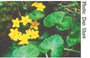
Marsh marigold, Zone 2. From Shaw and Schmidt (2003).
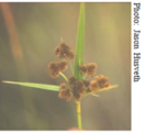
River bulrush sedge, Zones 2 and 3. From Shaw and Schmidt (2003).
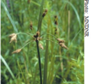
Awl-fruited sedge, Zone 3. From Shaw and Schmidt (2003).
Culver's root, Zone 3. From Shaw and Schmidt (2003).
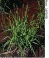
Switchgrass, Zone 3, 4. From Shaw and Schmidt (2003).
- Images of Zone 4 plants for swales. Click on an image for enlarged view.
Obedient plant, Zone 4. From Shaw and Schmidt (2003).
Canada anemone, Zone 4. From Shaw and Schmidt (2003).
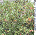
Black chokecherry, Zone 4. From Shaw and Schmidt (2003).
Cardinal flower, Zone 4. From Shaw and Schmidt (2003).
- Images of Zone 5 plants for swales. Click on an image for enlarged view.
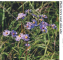
Smooth aster, Zone 5. From Shaw and Schmidt (2003).
Butterfly milkweed, Zone 5. From Shaw and Schmidt (2003).
Big bluestem, Zone 5. From Shaw and Schmidt (2003).
Yellow coneflower, Zone 5. From Shaw and Schmidt (2003).
Plants for wet and dry swales
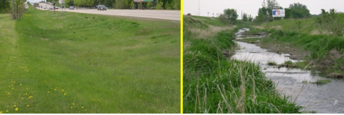
Dry swales, sometimes called grass swales, are similar to bioretention cells but are configured as shallow, linear channels. They typically have vegetative cover. Dry swales may be constructed as filtration or infiltration practices, depending on soils. If soils are highly permeable (A or B soils), runoff infiltrates into underlying soils. In less permeable soils, runoff is treated by engineered soil media and flows into an underdrain, which conveys treated runoff back to the conveyance system further downstream. Check dams incorporated into the swale design allow water to pool up and infiltrate into the underlying soil or engineered media, thus increasing the volume of water treated.
Wet swales occur when the water table is located very close to the surface or water does not readily drain out of the swale. A wet swale acts as a very long and linear shallow biofiltration or linear wetland treatment system. Wet swales do not provide volume reduction and have limited treatment capability. Incorporation of check dams into the design allows treatment of a portion or all of the water quality volume within a series of cells created by the check dams. Wet swales planted with emergent wetland plant species provide improved pollutant removal. Wet swales may be used as pretreatment practices. Wet swales are commonly used for drainage areas less than 5 acres in size.
| Select wet swale-appropriate plants | |
| Scientific name | Common name |
| Trees and shrubs | |
| Alnus incana | Speckled alder |
| Amorpha fruticosa | Indigo bush |
| Aronia melanocarpa | Black chokecherry |
| Betula nigra | River birch |
| Cephalanthus occidentalis | Buttonbush |
| Cornus amomum | Silky dogwood |
| Cornus racemosa | Gray dogwood |
| Cornus sericea | Red-osier dogwood |
| Ilex verticillata | Winterberry |
| Larix laricina | Tamarck |
| Physocarpus opulifolius | Ninebark |
| Salix discolor | Pussy willow |
| Salix exigua | Sandbar willow |
| Sambucus pubens | Red-berried elder |
| Spiraea alba | Meadowsweet |
| Viburnum lentago | Nannyberry |
| Viburnum trilobum | High bush cranberry |
| Forbs and ferns | |
| Agastache foeniculum | Giant hyssop |
| Alisma trivale | Water plantain |
| Anemone canadensis | Canada anemone |
| Angelica atropurpurea | Angelica |
| Artemisia ludoviciana | Prairie sage |
| Asclepias incarnata | Marsh milkweed |
| Aster lanceolatus (simplex) | Panicle aster |
| Aster lucidulus | Swamp aster |
| Aster novae-angliae | New England aster |
| Aster puniceus | Red-stemmed aster |
| Boltonia asteroides | Boltonia |
| Caltha palustris | Marsh marigold |
| Chelone glabra | Turtlehead |
| Equisetum fluviatile | Horsetail |
| Eryngium yuccifolium | Rattlesnake master |
| Eupatorium maculatum | Joe-pye-weed |
| Eupatorium perfoliatum | Bonset |
| Euthanmia graminifolia | Grass-leaved goldenrod |
| Gentiana andrewsii | Bottle gentian |
| Helenium autumnale | Sneezeweed |
| Helianthus grosseserratus | Sawtooth sunflower |
| Impatiens capensis | Jewelweed |
| Iris versicolor | Blueflag |
| Liatris ligulistylis | Meadow blazingstar |
| Liatris pychnostachya | Prairie blazingstar |
| Lilium superbum | Turks-cap lily |
| Lobelia cardinalis | Cardinal flower |
| Lobelia siphilitica | Blue lobelia |
| Lysimachia thrysiflora | Tufted loosestrife |
| Monarda fistulosa | Wild bergamot |
| Onoclea sensibilis | Sensitive fern |
| Osmunda regalis | Royal fern |
| Physostegia virginiana | Obedient plant |
| Polygonum amphibium | Water smartweed |
| Pontederia cordata | Pickerelweed |
| Potentilla palustris | Marsh cinquefoil |
| Pycnanthemum virginianum | Mountain mint |
| Rudbeckia subtomentosa | Brown-eyed Susan |
| Sagittaria latifolia | Broadleaved arrowhead |
| Scutterlaria lateriflora | Mad-dog skullcap |
| Silphium perfoliatum | Cup plant |
| Solidago rigida | Stiff goldenrod |
| Sparganium eurycarpum | Giant burreed |
| Symplocarpus foetidus | Skunk cabbage |
| Thalictrum dasycarpum | Tall meadowrue |
| Tradescantia ohiensis | Ohio spiderwort |
| Verbena hastata | Blue vervain |
| Vernonia fasciculata | Ironweed |
| Veronicastrum virginicum | Culver's root |
| Zizia aurea | Golden alexanders |
| Grasses, sedges, and rushes | |
| Andropogon gerardii | Big bluestem |
| Bromus ciliatus | Fringed brome |
| Calamagrostis canadensis | Canada blue-joint grass |
| Carex aquatilis | Water sedge |
| Bebb's sedge | |
| Carex comosa | Bottlebrush sedge |
| Carex crinita | Caterpillar sedge |
| Carex hystericina | Porcupine sedge |
| Carex lacustris | Lake sedge |
| Carex languinosa | Wooly sedge |
| Carex lasiocarpa | Wooly needle sedge |
| Carex retrorsa | Retrorse sedge |
| Carex stipata | Awl-fruited sedge |
| Carex stricta | Tussock sedge |
| Carex vulpinoidea | Fox sedge |
| Eleocharis obtusa | Blunt spikerush |
| Elymus virginicus | Virginia wild rye |
| Glyceria grandis | Giant manna grass |
| Glyceria striata | Fowl manna grass |
| Juncus balticus | Baltic rush |
| Juncus effusus | Soft rush |
| Juncus torreyi | Torrey rush |
| Leersia oryzoides | Rice-cut grass |
| Panicum virgatum | Switchgrass |
| Scirpus acutus | Hardstem bulrush |
| Scirpus atrovirens | Green bulrush |
| Scirpus cyperinus | Woolgrass |
| Scirpus fluviatilis | River bulrush |
| Scirpus pungens | Three-square bulrush |
| Scirpus validus | Soft-stem bulrush |
| Spartina pectinata | Prairie cord grass |
| Typha latifolia | Broadleaved cattail |
| Select dry swale-appropriate plants | |
| Scientific name | Common name |
| Forbs and ferns | |
| Anemone canadensis | Canada anemone |
| Artemisia ludoviciana | Prairie sage |
| Asclepias incarnata | Marsh milkweed |
| Aster puniceus | Red-stemmed aster |
| Euthanmia graminifolia | Flat-top goldenrod |
| Lobelia siphilitica | Blue lobelia |
| Pycnanthemum virginianum | Mountain mint |
| Verbena hastata | Blue vervain |
| Grasses, sedges, and rushes | |
| Andropogon gerardii | Big bluestem |
| Bromus ciliatus | Fringed brome |
| Calamagrostis canadensis | Canada blue-joint grass |
| Carex bebbii | Bebb's sedge |
| Carex vulpinoidea | Fox sedge |
| Elymus virginicus | Virginia wild rye |
| Glyceria striata | Fowl manna grass |
| Juncus effusus | Soft rush |
| Panicum virgatum | Switchgrass |
| Scirpus atrovirens | Green bulrush |
| Spartina pectinata | Prairie cord grass |
| Useful sod-forming grasses | |
| Agrostis palustris | Creeping bentgrass |
| Elymus sp. | Wheat-grass |
| Poa palustris | Fowl bluegrass |
- Appropriate plants for dry swales. Click on an image for enlarged view.
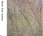
Creeping bentgrass. Source: The Ohio State University
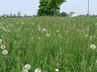
Fowl meadow grass. Source: Ontario Ministry of Food, Agriculture, and Rural Affairs
- Wet swale appropriate plants. Click on an image for enlarged view.
- Plants appropriate for either dry or wet swales. Click on an image for enlarged view.
- Plants appropriate for either dry or wet swales. Click on an image for enlarged view.
Pollinator specific plants
- Pollinator-specific plants. Click on an image for enlarged view.
Black chokecherry, Spring. From Shaw and Schmidt (2003).
Butterfly milkweed, Summer. From Shaw and Schmidt (2003).
Stiff goldenrod, Fall. From Shaw and Schmidt (2003).
The MNDOT Seeding Manual also provides standard seed mixes designed for the conditions and locations shown in the tables below, as well as application rates and specifications.
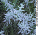
Pollinator specific plants. Source: BWSR Pollinator Toolbox
Link to this table
| Spring | Summer | Fall |
|---|---|---|
|
Alumroot |
Angelica Bedstaws (Galium sp.) |
American Vetch |
*High value for Pollinator Species
^Shade-tolerant species
Additional links and information
- Minnesota plant lists
- Salt tolerant plants
- Pollinator friendly Best Management Practices for stormwater management
- Bioretention
- Trees
Note that while the resources below provide extensive information on plants that can be used in swales, some of the references are for other areas of the country. If using these resources, ensure the information is applicable to Minnesota.
- Plants for Stormwater Design - Shaw and Schmidt
- StormWater Plant materials - Boise Public Works
- Vegetated swale - Spence restoration Nursery
- Plants for vegetated swales - StopWaste
- Native plant landscaping contacts - Minnesota Department of Natural Resources
Related pages
Dry swales
- Terminology for swales (grass channels)
- Overview for dry swale (grass swale)
- Types of infiltration
- Types of filtration
- Design criteria for dry swale (grass swale)
- Construction specifications for dry swale (grass swale)
- Operation and maintenance of dry swale (grass swale)
- Assessing the performance of dry swale (grass swale)
- Calculating credits for dry swale (grass swale)
- Cost considerations for dry swale (grass swale)
- Case studies for dry swale (grass swale)
- Plants for swales
- Check dams for stormwater swales
- External resources for dry swale (grass swale)
- References for dry swale (grass swale)
- Requirements, recommendations and information for using dry swale (grass swale) without an underdrain in the MIDS calculator
- Requirements, recommendations and information for using dry swale (grass swale) with an underdrain in the MIDS calculator
- Requirements, recommendations and information for using swale side slope as a BMP in the MIDS calculator
Wet swales
- Terminology for swales
- Overview for wet swale (wetland channel)
- Types of filtration
- Design criteria for wet swale (wetland channel)
- Construction specifications for wet swale (wetland channel)
- Operation and maintenance of wet swale (wetland channel)
- Assessing the performance of wet swale (wetland channel)
- Plants for swales
- Check dams for stormwater swales
- Calculating credits for wet swale (wetland channel)
- Cost considerations
- External resources for wet swale (wetland channel)
- References for wet swale (wetland channel)
- Requirements, recommendations and information for using wet swale in the MIDS calculator
- Requirements, recommendations and information for using swale side slope as a BMP in the MIDS calculator
High-gradient stormwater step-pool swale
- Terminology for swales
- Overview for high-gradient stormwater step-pool swale
- Types of infiltration
- Types of filtration
- Design criteria for high-gradient stormwater step-pool swale
- Construction specifications for high-gradient stormwater step-pool swale
- Operation and maintenance of high-gradient stormwater step-pool swale
- Assessing the performance of high-gradient stormwater step-pool swale
- Calculating credits for high-gradient stormwater step-pool swale
- Check dams for stormwater swales
- Plants for swales
- Cost considerations
- External resources for high-gradient stormwater step-pool swale
- References for high-gradient stormwater step-pool swale
Stormwater step pools are currently not included as a BMP in the MIDS calculator. The swale main channel BMP can be used, but the maximum allowable slope is 4 percent. To dtermine volume retention for slopes greater than 4 percent, you will need to develop a relationship between the slope and volume retained. To do this, determine volume retention at 0.5 percent slope increments for your site at slopes ranging from 0.5 to 4 percent. Determine the appropriate regression for volume retention and slope and calculate the volume retained at the slope for your site. The relationship is not linear. Links to MIDS calculator information are provided below.
- Requirements, recommendations and information for using dry swale (grass swale) without an underdrain in the MIDS calculator
- Requirements, recommendations and information for using dry swale (grass swale) with an underdrain in the MIDS calculator
- Requirements, recommendations and information for using swale side slope as a BMP in the MIDS calculator
This page was last edited on 8 December 2022, at 17:15.

