Difference between revisions of "Miscellaneous maps"
(Created page with "This page contains the following maps: *Minnesota land surface elevation *Minnesota land cover *Minnesota Anoka sand plain [[Minnesota land surface elevation.jpg|300px|alt=m...") |
m |
||
| Line 4: | Line 4: | ||
*Minnesota Anoka sand plain | *Minnesota Anoka sand plain | ||
| + | {{alert|To view the title of an image hold the mouse over the image. To view the image click on the image. Most views show higher resolution depictions of the image.|alert-info}} | ||
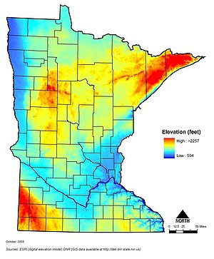
| − | [[Minnesota land surface elevation.jpg|300px|alt=map showing land surface elevation in Minnesota|map showing land surface elevation in Minnesota]] | + | [[File:Minnesota land surface elevation.jpg|300px|alt=map showing land surface elevation in Minnesota|map showing land surface elevation in Minnesota]] |
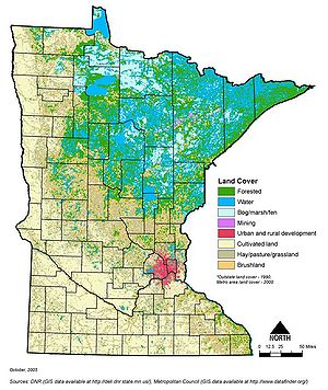
| − | [[Minnesota land cover.jpg|300px|alt=map showing Minnesota's land cover|Map showing Minnesota's land cover]] | + | [[File:Minnesota land cover.jpg|300px|alt=map showing Minnesota's land cover|Map showing Minnesota's land cover]] |
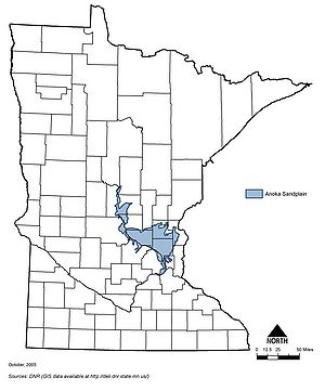
| − | [[Minnesota Anoka sand plain.jpg|300px|alt=map showing location of the Anoka sand plain in Minnesota|Map showing location of the Anoka sand plain in Minnesota]] | + | [[File:Minnesota Anoka sand plain.jpg|300px|alt=map showing location of the Anoka sand plain in Minnesota|Map showing location of the Anoka sand plain in Minnesota]] |


