Difference between revisions of "Guidance and examples for using the MPCA Estimator"
m |
m |
||
| Line 110: | Line 110: | ||
===Section 1: Calculation of unadjusted total loads=== | ===Section 1: Calculation of unadjusted total loads=== | ||
| − | [[File:Estimator section 1 a.png|500px|thumb|alt=screen shot of simple estimator|<font size=3>Screen shot of Section 1 of the Estimator. Unadjusted pollutant loads are calculated in this section. Note that defaults values exist in many of the yellow cells, but the user can change these cells. To avoid a calculation error, the default area for each land use is 0.00001 acres, which creates a small amount of pollutant load. Values in red are calculated and cannot be changed by the | + | [[File:Estimator section 1 a.png|500px|thumb|alt=screen shot of simple estimator|<font size=3>Screen shot of Section 1 of the Estimator. Unadjusted pollutant loads are calculated in this section. Note that defaults values exist in many of the yellow cells, but the user can change these cells. To avoid a calculation error, the default area for each land use is 0.00001 acres, which creates a small amount of pollutant load. Values in red are calculated and cannot be changed by the user. Grey cells cannot be edited. White cells are input cells for the user.</font size>]] |
[[File:Estimator section 1 b.png|500px|thumb|alt=screen shot of simple estimator|<font size=3>Screen shot of Section 1 of the Estimator. In this image, the user has changed some of the default emcs for phosphorus. Note an alert box is shown in those rows where a default has changed. In this example, the user provides a note explaining the emcs are based on monitoring data.</font size>]] | [[File:Estimator section 1 b.png|500px|thumb|alt=screen shot of simple estimator|<font size=3>Screen shot of Section 1 of the Estimator. In this image, the user has changed some of the default emcs for phosphorus. Note an alert box is shown in those rows where a default has changed. In this example, the user provides a note explaining the emcs are based on monitoring data.</font size>]] | ||
| Line 121: | Line 121: | ||
'''Column A - Land use''' | '''Column A - Land use''' | ||
| − | *Description: This column contains various classifications for land use. Only classifications having adequate information for pollutant concentrations in the literature were included. The | + | *Description: This column contains various classifications for land use. Only classifications having adequate information for pollutant concentrations in the literature were included. The user may include additional land uses if adequate information exists for pollutant concentrations in runoff from that land use. The user may also include just a single land use to represent the entire area within the TMDL Project watershed, although this may require estimates of pollutant concentrations and runoff coefficients for areas with multiple land uses. |
| − | *Input: Land use category. Options include commercial, industrial, institutional, multi-use, municipal, open space, residential, park, agriculture, transportation, and water. The | + | *Input: Land use category. Options include commercial, industrial, institutional, multi-use, municipal, open space, residential, park, agriculture, transportation, and water. The user may input up to five other land use classifications. |
| − | *Source of Information: MPCA input or | + | *Source of Information: MPCA input or user input. |
'''Columns B and C, Rows 6 through 23 - Event mean concentrations''' | '''Columns B and C, Rows 6 through 23 - Event mean concentrations''' | ||
| Line 139: | Line 139: | ||
'''Column E, Rows 6 through 23 - Annual precipitation''' | '''Column E, Rows 6 through 23 - Annual precipitation''' | ||
*Description: Total annual precipitation in subwatershed. | *Description: Total annual precipitation in subwatershed. | ||
| − | '''Note: The default value is 30.65 inches per year, which is the average annual precipitation at the Minneapolis-St. Paul International airport. The | + | '''Note: The default value is 30.65 inches per year, which is the average annual precipitation at the Minneapolis-St. Paul International airport. The user should input the appropriate value for their location. The references below can be used to determine this value.''' |
*Input: Annual rainfall, in inches | *Input: Annual rainfall, in inches | ||
*Sources of Information: | *Sources of Information: | ||
| Line 154: | Line 154: | ||
'''Columns G and H, Rows 6 through 24 - Pollutant loads''' | '''Columns G and H, Rows 6 through 24 - Pollutant loads''' | ||
*Description: The calculated load of the various pollutants of concern. Note that the values contained in Row 24 are the total values for all the land uses. Loading values take into consideration the concentration of pollutant in the stormwater runoff, drainage area, annual rainfall, and runoff coefficient. | *Description: The calculated load of the various pollutants of concern. Note that the values contained in Row 24 are the total values for all the land uses. Loading values take into consideration the concentration of pollutant in the stormwater runoff, drainage area, annual rainfall, and runoff coefficient. | ||
| − | :'''This is the base loading from which reductions are made. The | + | :'''This is the base loading from which reductions are made. The user should therefore not change the inputs once the initial calculations are made because it may affect the calculations for pollutant reductions.''' |
*Input: None | *Input: None | ||
*Source of Information: The values in these cells are calculated based on the information entered in the previous cells | *Source of Information: The values in these cells are calculated based on the information entered in the previous cells | ||
| Line 210: | Line 210: | ||
*Description: The area, in acres, treated by the BMP, for different land uses. Land uses are listed in Column A. | *Description: The area, in acres, treated by the BMP, for different land uses. Land uses are listed in Column A. | ||
| − | These cells represent the area tributary to a BMP, which may not be the entire area for the type of land use. Not all cells need to be filled in. The | + | These cells represent the area tributary to a BMP, which may not be the entire area for the type of land use. Not all cells need to be filled in. The user should only enter data in the cells relating to the specific BMPs and the land use classification of the BMPs’ drainage area. |
| − | If the | + | If the user attempts to enter BMP acreages greater than the land use area, an error message is generated in Column L since one BMP cannot treat an area greater than the land use area. If the user enters a total acreage for all BMPs that exceeds the area of the land use, a warning message will be generated. This warning does not prevent the user from proceeding, since the total acreage for multiple BMPs may exceed the total land use acreage. For example, assume runoff from a 1 acre commercial area drains to an underground infiltration BMP. The area may also include a 0.2 acre green roof, resulting in 1.2 acres of BMP for the 1 acre commercial area. Generally, it is unlikely the BMP acreage will exceed the land use area. |
*Input: The area, in acres, tributary to the BMP. Different BMPs are contained in different columns. | *Input: The area, in acres, tributary to the BMP. Different BMPs are contained in different columns. | ||
**Column B: Biofiltration (bioretention with underdrain) | **Column B: Biofiltration (bioretention with underdrain) | ||
| Line 229: | Line 229: | ||
'''Row 66''' | '''Row 66''' | ||
*Description: The removal efficiencies for listed BMPs | *Description: The removal efficiencies for listed BMPs | ||
| − | *Input: None or | + | *Input: None or user input. Removal efficiencies are based on information from the Minnesota Stormwater Manual and the Minimal Impact Design Standards (MIDS) calculator. BMP database sources shown below include compilations of data from multiple studies. The user may input other values based on field studies or published BMP performance data. If the user changes the default value, an alert displays in Column L informing the user that they changed a default. The maximum value is 1.0 and an error will generate if the user attempts to enter a value greater than 1. |
| − | With the biofiltration BMP, the | + | With the biofiltration BMP, the user will select the removal efficiency based on the type of media present within the BMP. If the media mix used is C or D, or if another mix is used that has a phosphorus content of 30 mg/kg or less per the Mehlich 3 test, then the user should select the phosphorus removal fraction of 0.44. If another media type is present that has a phosphorus content greater than 30 mg/kg then the user should select a phosphorus removal fraction of 0. |
{{alert|The Estimator assumes engineered media utilized in a filtration practice will not leach phosphorus. For more information, see [[Engineered (bioretention) media mixes for stormwater applications]].|alert-warning}} | {{alert|The Estimator assumes engineered media utilized in a filtration practice will not leach phosphorus. For more information, see [[Engineered (bioretention) media mixes for stormwater applications]].|alert-warning}} | ||
Typically a manufacturer will supply the pollutant removal data for their device. The International BMP Database, USEPA Verified Technologies, Washington State's TAPE Program, and New Jersey's NJCAT Program have pollutant removal information that can be used to verify manufacturer’s data. | Typically a manufacturer will supply the pollutant removal data for their device. The International BMP Database, USEPA Verified Technologies, Washington State's TAPE Program, and New Jersey's NJCAT Program have pollutant removal information that can be used to verify manufacturer’s data. | ||
| − | *Source of Information: MPCA Input, but | + | *Source of Information: MPCA Input, but user can change the value. |
Links to additional information | Links to additional information | ||
| Line 249: | Line 249: | ||
'''Row 67''' | '''Row 67''' | ||
*Description: The fraction of the annual runoff that is treated by the BMP. This is based on the amount of total runoff that enters the BMP. | *Description: The fraction of the annual runoff that is treated by the BMP. This is based on the amount of total runoff that enters the BMP. | ||
| − | *Input: None or | + | *Input: None or user input. If the user changes the default value, an alert displays in Column L informing the user that they changed a default. The maximum value is 1.0 and an error will generate if the user attempts to enter a value greater than 1. |
| − | *Source of Information: MPCA Input, but | + | *Source of Information: MPCA Input, but user can change the value. The default value is set for 1.0 for wet basins and wetlands based on the assumption that all annual runoff passes through these BMPs. The default value is set at 0.9 for the remaining BMPs assuming [https://stormwater.pca.state.mn.us/index.php?title=Design_infiltration_rate_as_a_function_of_soil_texture_for_bioretention_in_Minnesota B soils] and the BMPs are designed to treat 1.0 inches of runoff from impervious surfaces. One inch is the most common performance goal, but this value must be changed if other performance goals are used. The user should also consider adjusting this value based on soil type curve numbers. The value would be adjusted upward for coarser soils and for areas with increased impervious cover, assuming bmps are sized to treat runoff from impervious surfaces. The user can calculate annual runoff treated by a BMP by using the [[MIDS calculator]], or can estimate the value from the following data from the Minneapolis-St. Paul International Airport. For more guidance, [https://stormwater.pca.state.mn.us/index.php?title=Guidance_and_examples_for_using_the_MPCA_Estimator#Adjusting_the_fraction_of_annual_water_treated_and_infiltrated_in_a_BMP link here]. |
{{:Daily precipitation vs annual runoff MSP airport}} | {{:Daily precipitation vs annual runoff MSP airport}} | ||
| Line 256: | Line 256: | ||
'''Row 68''' | '''Row 68''' | ||
*Description: The fraction of the treated water that is infiltrated by the BMP. Defaults are 90 percent for all infiltration BMPs, 20 percent for biofiltration practices, 20 percent for permeable pavement with an underdrain, and 0 percent for the remaining bmps. All of the water captured by an infiltration BMP is assumed to infiltrate into the soil underlying the BMP. If an infiltration practice is sized to capture more or less than 90 percent of annual runoff, this value should be adjusted accordingly. The [[MIDS calculator]] can be used to estimate volume loss in BMPs with an underdrain. Typical infiltration in a BMP with an underdrain and an underlying D soil will be about 20 percent (0.20); thus the 20 percent value for biofiltration and permeable pavement with an underdrain. The assumption that no water infiltrates in the remaining BMPs is a conservative assumption, since some water always infiltrates through the bottom unless the BMP is lined. If the user changes the default value, an alert displays in Column L. | *Description: The fraction of the treated water that is infiltrated by the BMP. Defaults are 90 percent for all infiltration BMPs, 20 percent for biofiltration practices, 20 percent for permeable pavement with an underdrain, and 0 percent for the remaining bmps. All of the water captured by an infiltration BMP is assumed to infiltrate into the soil underlying the BMP. If an infiltration practice is sized to capture more or less than 90 percent of annual runoff, this value should be adjusted accordingly. The [[MIDS calculator]] can be used to estimate volume loss in BMPs with an underdrain. Typical infiltration in a BMP with an underdrain and an underlying D soil will be about 20 percent (0.20); thus the 20 percent value for biofiltration and permeable pavement with an underdrain. The assumption that no water infiltrates in the remaining BMPs is a conservative assumption, since some water always infiltrates through the bottom unless the BMP is lined. If the user changes the default value, an alert displays in Column L. | ||
| − | *Input: None or | + | *Input: None or user input. If the user changes the default value, an alert displays in Column L informing the user that they changed a default. The maximum value is 1.0 and an error will generate if the user attempts to enter a value greater than 1. |
| − | *Source of Information: MPCA Input, but | + | *Source of Information: MPCA Input, but user can change the value. |
'''Row 69''' | '''Row 69''' | ||
| Line 297: | Line 297: | ||
*Description: The area, in acres, treated by the BMP, for different land uses. Land uses are listed in Column A. | *Description: The area, in acres, treated by the BMP, for different land uses. Land uses are listed in Column A. | ||
| − | These cells represent the area tributary to a BMP, which may not be the entire area for the type of land use. Not all cells need to be filled in. The | + | These cells represent the area tributary to a BMP, which may not be the entire area for the type of land use. Not all cells need to be filled in. The user should only enter data in the cells relating to the specific BMPs and the land use classification of the BMPs’ drainage area. |
| − | If the | + | If the user attempts to enter BMP acreages greater than the land use area, an error message is generated since one BMP cannot treat an area greater than the land use area. If the user enters a total acreage for all BMPs that exceeds the area of the land use, a warning message will be generated. This warning does not prevent the user from proceeding, since the total acreage for multiple BMPs may exceed the total land use acreage. For example, assume runoff from a 1 acre commercial area drains to an underground infiltration BMP. The area may also include a 0.2 acre green roof, resulting in 1.2 acres of BMP for the 1 acre commercial area. Generally, it is unlikely the BMP acreage will exceed the land use area. |
*Input: The area, in acres, tributary to the BMP. Different BMPs are contained in different columns. | *Input: The area, in acres, tributary to the BMP. Different BMPs are contained in different columns. | ||
**Column B: Biofiltration (bioretention with underdrain) | **Column B: Biofiltration (bioretention with underdrain) | ||
| Line 316: | Line 316: | ||
'''Row 91''' | '''Row 91''' | ||
*Description: The removal efficiencies for listed BMPs | *Description: The removal efficiencies for listed BMPs | ||
| − | *Input: None or | + | *Input: None or user input. Removal efficiencies are based on information from the Minnesota Stormwater Manual and the Minimal Impact Design Standards (MIDS) calculator. BMP database sources shown below include compilations of data from multiple studies. The user may input other values based on field studies or published BMP performance data. If the user changes the default value, an alert displays in Column L informing the user that they changed a default. The maximum value is 1.0 and an error will generate if the user attempts to enter a value greater than 1. |
Typically a manufacturer will supply the pollutant removal data for their device. The International BMP Database, USEPA Verified Technologies, Washington State's TAPE Program, and New Jersey's NJCAT Program have pollutant removal information that can be used to verify manufacturer’s data. | Typically a manufacturer will supply the pollutant removal data for their device. The International BMP Database, USEPA Verified Technologies, Washington State's TAPE Program, and New Jersey's NJCAT Program have pollutant removal information that can be used to verify manufacturer’s data. | ||
| − | Sources of Information: MPCA Input, but | + | Sources of Information: MPCA Input, but user can change the value. |
Links to additional information | Links to additional information | ||
| Line 333: | Line 333: | ||
'''Row 92''' | '''Row 92''' | ||
*Description: The fraction of the annual runoff that is treated by the BMP. This is based on the amount of total runoff that enters the BMP. | *Description: The fraction of the annual runoff that is treated by the BMP. This is based on the amount of total runoff that enters the BMP. | ||
| − | *Input: None or | + | *Input: None or user input. If the user changes the default value, an alert displays in Column L informing the user that they changed a default. The maximum value is 1.0 and an error will generate if the user attempts to enter a value greater than 1. |
| − | *Source of Information: MPCA Input, but | + | *Source of Information: MPCA Input, but user can change the value. The default value is set for 1.0 for wet basins and wetlands based on the assumption that all annual runoff passes through these BMPs. The default value is set at 0.9 for the remaining BMPs assuming [https://stormwater.pca.state.mn.us/index.php?title=Design_infiltration_rate_as_a_function_of_soil_texture_for_bioretention_in_Minnesota B soils] and the BMPs are designed to treat 1.0 inches of runoff from impervious surfaces. One inch is the most common performance goal, but this value must be changed if other performance goals are used. The user should also consider adjusting this value based on soil type curve numbers. The value would be adjusted upward for coarser soils and for areas with increased impervious cover, assuming bmps are sized to treat runoff from impervious surfaces. The user can calculate annual runoff treated by a BMP by using the [[MIDS calculator]], or can estimate the value from the following data from the Minneapolis-St. Paul International Airport. |
{{:Daily precipitation vs annual runoff MSP airport}} | {{:Daily precipitation vs annual runoff MSP airport}} | ||
| Line 340: | Line 340: | ||
'''Row 93''' | '''Row 93''' | ||
*Description: The fraction of the treated water that is infiltrated by the BMP. Defaults are 90 percent for all infiltration BMPs, 20 percent for biofiltration practices, 20 percent for permeable pavement with an underdrain, and 0 percent for the remaining bmps. All of the water captured by an infiltration BMP is assumed to infiltrate into the soil underlying the BMP. If an infiltration practice is sized to capture more or less than 90 percent of annual runoff, this value should be adjusted accordingly. The [[MIDS calculator]] can be used to estimate volume loss in BMPs with an underdrain. Typical infiltration in a BMP with an underdrain and an underlying D soil will be about 20 percent (0.20); thus the 20 percent value for biofiltration and permeable pavement with an underdrain. The assumption that no water infiltrates in the remaining BMPs is a conservative assumption, since some water always infiltrates through the bottom unless the BMP is lined. If the user changes the default value, an alert displays in Column L. | *Description: The fraction of the treated water that is infiltrated by the BMP. Defaults are 90 percent for all infiltration BMPs, 20 percent for biofiltration practices, 20 percent for permeable pavement with an underdrain, and 0 percent for the remaining bmps. All of the water captured by an infiltration BMP is assumed to infiltrate into the soil underlying the BMP. If an infiltration practice is sized to capture more or less than 90 percent of annual runoff, this value should be adjusted accordingly. The [[MIDS calculator]] can be used to estimate volume loss in BMPs with an underdrain. Typical infiltration in a BMP with an underdrain and an underlying D soil will be about 20 percent (0.20); thus the 20 percent value for biofiltration and permeable pavement with an underdrain. The assumption that no water infiltrates in the remaining BMPs is a conservative assumption, since some water always infiltrates through the bottom unless the BMP is lined. If the user changes the default value, an alert displays in Column L. | ||
| − | *Input: None or | + | *Input: None or user input. If the user changes the default value, an alert displays in Column L informing the user that they changed a default. The maximum value is 1.0 and an error will generate if the user attempts to enter a value greater than 1. |
| − | *Source of Information: MPCA Input, but | + | *Source of Information: MPCA Input, but user can change the value. |
'''Row 94''' | '''Row 94''' | ||
| Line 358: | Line 358: | ||
This section of each of the 10 calculation worksheets contains default values for BMP performance (treatment fractions), event mean concentrations (EMCs), and runoff coefficients. The values for fraction treated are only for the water that is filtered and are expressed as fractions, which represents the fraction of pollutant that is removed by the BMP. A value of 0.50, for example, means the BMP removes half of the pollutant. For infiltration, the fraction represents the fraction of water that is infiltrated. All pollutant is considered removed for infiltration practices. The equations built in to the Estimator account for this complete removal for infiltrated water. Removal values are shown for TP and TSS. | This section of each of the 10 calculation worksheets contains default values for BMP performance (treatment fractions), event mean concentrations (EMCs), and runoff coefficients. The values for fraction treated are only for the water that is filtered and are expressed as fractions, which represents the fraction of pollutant that is removed by the BMP. A value of 0.50, for example, means the BMP removes half of the pollutant. For infiltration, the fraction represents the fraction of water that is infiltrated. All pollutant is considered removed for infiltration practices. The equations built in to the Estimator account for this complete removal for infiltrated water. Removal values are shown for TP and TSS. | ||
| − | Users cannot change the values in this section. The values are used as a check. When a user changes a default in Sections 1, 2, 3, or 4, comparison of the changed value with the defaults in Section 5 trgger a warning that the | + | Users cannot change the values in this section. The values are used as a check. When a user changes a default in Sections 1, 2, 3, or 4, comparison of the changed value with the defaults in Section 5 trgger a warning that the user changed a default value. |
[https://stormwater.pca.state.mn.us/index.php?title=Guidance_and_examples_for_using_the_MPCA_Estimator#Tips_for_using_the_Estimator This section] provides additional information and links to information on emcs, runoff coefficients, pollutant removal, and treatment fractions. | [https://stormwater.pca.state.mn.us/index.php?title=Guidance_and_examples_for_using_the_MPCA_Estimator#Tips_for_using_the_Estimator This section] provides additional information and links to information on emcs, runoff coefficients, pollutant removal, and treatment fractions. | ||
| Line 442: | Line 442: | ||
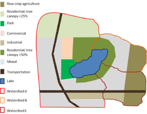
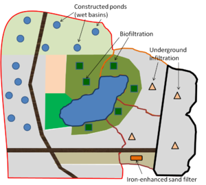
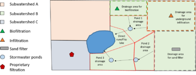
[[File:Example Step 2.png|thumb|300px|alt=schematic for example|<font size=3>Actions implemented and accounted for in calculating adjusted loads. The implemented actions include enhanced street sweeping in the residential area with >50% tree canopy, an impervious disconnection program in the commercial area of subwatershed A, and conversion of agricultural land to mixed land use.</font size>]] | [[File:Example Step 2.png|thumb|300px|alt=schematic for example|<font size=3>Actions implemented and accounted for in calculating adjusted loads. The implemented actions include enhanced street sweeping in the residential area with >50% tree canopy, an impervious disconnection program in the commercial area of subwatershed A, and conversion of agricultural land to mixed land use.</font size>]] | ||
| − | Section 2 of each calculation worksheet allows the | + | Section 2 of each calculation worksheet allows the user to enter data that results in adjustments to the total load. In this example, the following actions were implemented (see adjacent image). |
*In the residential areas with >50% tree canopy coverage, an enhanced street sweeping program was implemented. This consisted of street sweeping at the time of fall leaf drop, rather than the once-a-fall sweeping program previously implemented. Measurements of street sweeping material collected during this time indicate this effort reduced annual loading by about 17 percent. Since the Estimator does not allow direct changes in loading, we adjusted the emc downward until we achieved a 17 percent reduction in loading. To accomplish this, we adjusted the emc from 0.35 mg/L to 0.30 mg/L. This resulted in a phosphorus decrease of 18.79 pounds in subwatershed A, 18.79 pounds in subwatershed B, and 7.51 pounds in Subwatersdhed C, for a total reduction of 45.09 pounds. | *In the residential areas with >50% tree canopy coverage, an enhanced street sweeping program was implemented. This consisted of street sweeping at the time of fall leaf drop, rather than the once-a-fall sweeping program previously implemented. Measurements of street sweeping material collected during this time indicate this effort reduced annual loading by about 17 percent. Since the Estimator does not allow direct changes in loading, we adjusted the emc downward until we achieved a 17 percent reduction in loading. To accomplish this, we adjusted the emc from 0.35 mg/L to 0.30 mg/L. This resulted in a phosphorus decrease of 18.79 pounds in subwatershed A, 18.79 pounds in subwatershed B, and 7.51 pounds in Subwatersdhed C, for a total reduction of 45.09 pounds. | ||
| Line 526: | Line 526: | ||
**175 acres draining to Pond 3 plus drainage from Pond 2 | **175 acres draining to Pond 3 plus drainage from Pond 2 | ||
**70 acres of direct runoff (untreated) | **70 acres of direct runoff (untreated) | ||
| − | *Subwatershed C: 200 acres of ultra-urban land use treated by proprietary underground filtration practices. We entered this land use as a | + | *Subwatershed C: 200 acres of ultra-urban land use treated by proprietary underground filtration practices. We entered this land use as a user-defined land use and adjusted the runoff coefficient to 0.90 to reflect the impervious cover. The emc was assumed to 0.24 mg/L. |
There are thus 9 separate areas where calculations will be made (subwatershed A and C and seven (7) areas in subwatershed B | There are thus 9 separate areas where calculations will be made (subwatershed A and C and seven (7) areas in subwatershed B | ||
| Line 588: | Line 588: | ||
City A comprises 585 acres within the Lake 1 watershed. The breakdown by specific land use is shown in the summary table above. The City has implemented 5 BMPs within the watershed that can be included in the MPCA Estimator. | City A comprises 585 acres within the Lake 1 watershed. The breakdown by specific land use is shown in the summary table above. The City has implemented 5 BMPs within the watershed that can be included in the MPCA Estimator. | ||
| − | *INF3 and INF4 are infiltration BMPs (permeable pavement) in a high density residential area. The drainage area to INF3 is 0.9 acres and the drainage area to INF4 is 1.3 acres. The | + | *INF3 and INF4 are infiltration BMPs (permeable pavement) in a high density residential area. The drainage area to INF3 is 0.9 acres and the drainage area to INF4 is 1.3 acres. The user therefore enters 2.2 acres in Row 28, Column C of the worksheet (Infiltration (BMP with no underdrain), high density residential land use). |
| − | *FIL3 is a media filter located within a high density residential area. The drainage area served by the BMP is 2.3 acres. The | + | *FIL3 is a media filter located within a high density residential area. The drainage area served by the BMP is 2.3 acres. The user enters 2.3 in Row 28, Column G (sand filter, high density residential land use). |
| − | *CB1 is a constructed wetland. Total drainage to the wetland is 3.2 acres, with 2 acres from a medium density residential area and 1.2 acres from a low density residential area. The | + | *CB1 is a constructed wetland. Total drainage to the wetland is 3.2 acres, with 2 acres from a medium density residential area and 1.2 acres from a low density residential area. The user enters 1.2 in Row 29, Column J (wetland, low density residential land use) and 2 in Row 30, Column J (wetland, medium density residential). |
| − | *S1 is a swale that drains 1.6 acres, of which 1.1 is commercial land use and 0.5 acres is transportation land use. The | + | *S1 is a swale that drains 1.6 acres, of which 1.1 is commercial land use and 0.5 acres is transportation land use. The user enters 1.1 in Row 22, Column H (swale, commercial land use) and 0.5 in Row 31, Column H (swale, transportation land use). |
[[File:Create a new worksheet.PNG|300px|thumb|left|alt=screen shot showing how to create new worksheet|<font size=3>Screen shot illustrating how to create a new worksheet tab in the TMDL spreadsheet. The contents of the estimator tab can be copied into this worksheet, allowing multiple runs of the estimator in the same spreadsheet. There is no practical limit to the number of new worksheets that can be added to the spreadsheet.</font size>]] | [[File:Create a new worksheet.PNG|300px|thumb|left|alt=screen shot showing how to create new worksheet|<font size=3>Screen shot illustrating how to create a new worksheet tab in the TMDL spreadsheet. The contents of the estimator tab can be copied into this worksheet, allowing multiple runs of the estimator in the same spreadsheet. There is no practical limit to the number of new worksheets that can be added to the spreadsheet.</font size>]] | ||
| − | Using the defaults in the worksheet, reductions in phosphorus loading are shown in Rows 37 (total pounds reduced) and 38 (Percent load reduced). The total load reduction for all BMPs is 5.875 pounds, or about 1.00 percent of the original loading of 586.45 pounds. The | + | Using the defaults in the worksheet, reductions in phosphorus loading are shown in Rows 37 (total pounds reduced) and 38 (Percent load reduced). The total load reduction for all BMPs is 5.875 pounds, or about 1.00 percent of the original loading of 586.45 pounds. The user can enter either the pounds reduced (5.875) or the percent reduced (1.00) in the ''Cumulative reductions'' tab. |
| − | The estimator only allows the user to estimate loads for one impaired water at a time. The | + | The estimator only allows the user to estimate loads for one impaired water at a time. The user should either save the worksheet as a separate Excel file, keep a record of the inputs used for this impairment, or insert additional estimator worksheets into the spreadsheet. To create additional estimator worksheets within the spreadsheet, on the '''Home''' tab in Excel, click on '''Insert''' and select '''Insert Sheet'''. Then Copy the contents of the ''MPCA estimator'' tab into the new worksheet. Tabs within the spreadsheet can be renamed by double clicking on the tab at the bottom of the screen and then typing in a new name. See the image to the left and Excel Help for more information. |
| − | A new version of the estimator is run for the Lake 2 watershed. City A comprises 84 acres of this watershed and has implemented just one BMP that can be used in the estimator. This is a bioinfiltration BMP that drains 2 acres of medium density residential area. this is an infiltration BMP, so the | + | A new version of the estimator is run for the Lake 2 watershed. City A comprises 84 acres of this watershed and has implemented just one BMP that can be used in the estimator. This is a bioinfiltration BMP that drains 2 acres of medium density residential area. this is an infiltration BMP, so the user enters 2 in row 30, Column C (Infiltration (BMP with no underdrain), Residential - medium density). this BMP results in a reduction of 2.004 pounds of phosphorus, or 2.46 percent of the original load of 81.33 pounds. |
City A may conduct additional BMPs that decrease pollutant load. If these BMPs can be quantified, they can be entered as '''Other''' BMPs in the worksheet. | City A may conduct additional BMPs that decrease pollutant load. If these BMPs can be quantified, they can be entered as '''Other''' BMPs in the worksheet. | ||
===City C=== | ===City C=== | ||
| − | City C comprises 297 acres of the Lake 2 watershed. The City has implemented one BMP that can be used in the estimator. This is a dry pond that drains 8 acres of medium density residential land use. The | + | City C comprises 297 acres of the Lake 2 watershed. The City has implemented one BMP that can be used in the estimator. This is a dry pond that drains 8 acres of medium density residential land use. The user enters 8 in Row 30, Column I (Wet basin, Residential - medium density). The resulting decrease in phosphorus loading is 4.453 pounds or 1.39 percent of the initial load of 319.67 pounds. This example again utilizes the default values in the worksheet. |
| − | As with City A, the estimator can only be used for one impaired water at a time. The | + | As with City A, the estimator can only be used for one impaired water at a time. The user must therefore run the estimator separately for Lake 3 and Stream 1. |
| − | City C comprises 366 acres of the Lake 3 watershed. The City has implemented two BMPs, an underground sand filter that serves 5 acres of medium density residential land use, and a 12 acre dry swale that serves 10 acres of commercial development and 2 acres of transportation. The | + | City C comprises 366 acres of the Lake 3 watershed. The City has implemented two BMPs, an underground sand filter that serves 5 acres of medium density residential land use, and a 12 acre dry swale that serves 10 acres of commercial development and 2 acres of transportation. The user enters 5 in Row 30, Column G (Sand filter, residential - medium density), 10 in Row 22 Column H (Swale, Commercial), and 2 in Row 31, Column H (Swale, Transportation). The resulting total decrease in phosphorus load is 9.087 pounds or 2.24 percent of the total load of 405.62 pounds. |
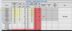
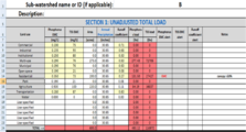
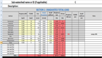
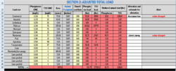
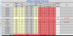
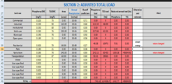
| − | City C comprises 427 acres of the Stream 1 watershed (127 acres in the Oasis Lake watershed and 300 acres in the Lake 3 watershed). The City has implemented a dry swale that drains 10 acres of commercial land and 2 acres of transportation land use, and a tree trench that drains 8 acres of commercial land and 7 acres of industrial land. For the tree trench, the user enters 8 in Row 22, Column C (Commercial; Infiltration) and 7 in Row 23, Column C (industrial; infiltration). For the dry swale the | + | City C comprises 427 acres of the Stream 1 watershed (127 acres in the Oasis Lake watershed and 300 acres in the Lake 3 watershed). The City has implemented a dry swale that drains 10 acres of commercial land and 2 acres of transportation land use, and a tree trench that drains 8 acres of commercial land and 7 acres of industrial land. For the tree trench, the user enters 8 in Row 22, Column C (Commercial; Infiltration) and 7 in Row 23, Column C (industrial; infiltration). For the dry swale the user enters 10 in Row 22, Column H (Commercial; Swale) and 2 in Row 31, Column H (transportation; Swale). The resulting decrease in TSS load is 21,885.4 pounds or 9.78 percent of the initial load of 223,855 pounds. The decrease in E. coli load is 3.12 percent of the initial load. Note the swale does not reduce any of the E. coli load. |
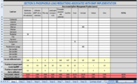
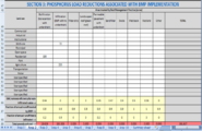
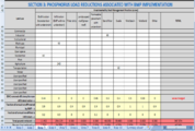
<gallery caption="Screen shots of estimator results for City C. Click on an image for a larger view." widths="200px"> | <gallery caption="Screen shots of estimator results for City C. Click on an image for a larger view." widths="200px"> | ||
| Line 625: | Line 625: | ||
The MS4 College is a non-traditional regulated MS4. The area of the college is 84 acres and the college owns and operates the stormwater conveyance within the campus boundaries. The entire acreage of the college lies within the Lake 1 watershed. Land use within the campus consists of 15 acres of park and 69 acres of institutional land use. | The MS4 College is a non-traditional regulated MS4. The area of the college is 84 acres and the college owns and operates the stormwater conveyance within the campus boundaries. The entire acreage of the college lies within the Lake 1 watershed. Land use within the campus consists of 15 acres of park and 69 acres of institutional land use. | ||
| − | The college has constructed and operates one BMP (FIL1). The BMP is a perimeter sand filter that accepts runoff from a 3 acre area. The land use contributing runoff to the BMP is institutional. The | + | The college has constructed and operates one BMP (FIL1). The BMP is a perimeter sand filter that accepts runoff from a 3 acre area. The land use contributing runoff to the BMP is institutional. The user therefore enters 3 in row 24, Column G of the estimator (Sand filter, Institutional). The BMP decreases phosphorus loading by 1.391 pounds, or 1.77 percent from the initial load of 78.75 pounds. |
===Entering results into the Cumulative reductions tab=== | ===Entering results into the Cumulative reductions tab=== | ||
Revision as of 20:31, 25 March 2020
The MPCA Simple estimator is an Excel-based tool that utilizes the Simple Method to estimate total suspended solid and/or total phosphorus loads and load reductions associated with implementation of best management practices (BMPs). The spreadsheet includes the following features.
|
This page provides guidance on the use of the MPCA Simple Estimator for calculating total phosphorus and total suspended solids (TSS) pollutant loads and reductions in loads associated with implementation of best management practices (BMPs). It assists MS4 (Municipal Separate Storm Sewer System) permittees in the completion of the Commissioner-approved TMDL Annual Reporting Form ( TMDL Form).
This guidance applies to Version 3 of the Estimator.
Contents
- 1 Estimator downloads and links to resources
- 2 Opening the MPCA Simple Estimator
- 3 General description of the MPCA Simple Estimator
- 4 Structure of the MPCA Estimator spreadsheet
- 5 Information worksheet
- 6 Notes sheet
- 7 Worksheet
- 8 Summary sheet
- 9 Calculation worksheets
- 9.1 Section 1: Calculation of unadjusted total loads
- 9.2 Section 2: Calculation of adjusted total loads
- 9.3 Section 3: Calculations for phosphorus load reductions associated with BMP implementation
- 9.4 Section 4: Calculations for TSS load reductions associated with BMP implementation
- 9.5 Section 5: Default values for BMP and land use inputs
- 10 Tips for using the Estimator
- 10.1 Addressing treatment trains
- 10.2 Adjusting EMCs (event mean concentrations)
- 10.3 Adjusting the fraction of annual water treated and infiltrated in a BMP
- 10.4 Adjusting the pollutant removal fraction
- 10.5 Addressing BMPs not included in the Estimator
- 10.6 Adjusting for impervious and pervious surface
- 11 Example 1: using the MPCA Estimator with multiple subwatersheds
- 12 Example 2: Treatment trains, non-structural practices, and other structural BMPs
Estimator downloads and links to resources
- Download Version 3 of the estimator here: File:MPCA simple estimator version 3.xlsx
- Download Version 2 of the MPCA Estimator here: File:MPCA Estimator-2.xlsx
A quick guide for the Estimator is available Quick Guide: MPCA Estimator tab.
NOTE: This page is a User's Guide that explains the various cells and worksheets in the Estimator. Guidance for using the Estimator for permit compliance and case studies are found at the following links
- Recommendations and guidance for utilizing the MPCA Simple Estimator to meet TMDL permit requirements
- Case study for using the MPCA Simple Estimator to meet TMDL permit requirements
Opening the MPCA Simple Estimator
If the Version 3 of the Estimator you open has macros enabled, you will see an information box stating the following:
"This spreadsheet contains several default values, such as pollutant concentrations, curve numbers, and BMP pollutant removal efficiency. It is important to adjust those values, as appropriate, to your site conditions. Read the information tab in the spreadsheet for more information."
Click OK to open the spreadsheet.
General description of the MPCA Simple Estimator
The MPCA Estimator spreadsheet presents a calculator approach to computing pollutant loading and the pollutant load reduction for total phosphorus (TP) and total suspended solids (TSS)(Note: the Estimator may not be used for any other pollutants). For MS4 permittees reporting on TMDL wasteload allocations (WLAs), results from the Estimator can be used in the Cumulative reductions tab of the Annual Report form. The Estimator applies load reductions to specific structural stormwater BMPs but can be used to estimate reductions associated with other BMPs such as street sweeping, impervious surface disconnection, and changes in land use. It is a simplistic tool and should not be used for modeling a stormwater system or selecting BMPs.
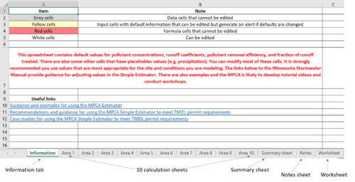
When working in the Estimator, the following color coding applies.
- Grey cells have fixed information and cannot be edited
- White cells can be edited by the user
- Yellow cells contain default values that the user can edit. Editing the defaults triggers an alert informing the user that the default has been modified.
- Red cells contain formulas that result in calculated pollutant reductions; these cells cannot be edited
The Estimator utilizes the Simple Method to estimate pollutant loads for total phosphorus and total suspended solids (TSS). BMPs (best management practices) included in the Estimator are biofiltration (bioretention with an underdrain), infiltration (a bmp with no underdrain), filter strip, landscaped roof ( green roof), permeable pavement with an underdrain, sand filter, swale, wet basin ( wet pond), and stormwater wetland. Users may include other BMPs if they have reliable data on pollutant removal efficiency.
The Estimator allows the user to make calculations for 10 areas (e.g. subwatersheds). Within each area the Estimator computes pollutant reduction using BMP performance data as published in this manual. The Estimator computes the load reduction according to the formula
- Load Reduction for a BMP = Load in – Load out = (EMC in * Volume in) – (EMC out * Volume out).
This is then converted to a percentage reduction
- % Reduction = Load Reduction ÷ Load in.
The cumulative reduction is the sum of load reduced for all BMPs across all 10 areas (worksheets). For MS4 permittees with WLAs, this computed reduction can be input into the Cumulative reductions tab of the TMDL Annual Report form.
The Estimator can only be used for one TMDL at a time. If a Permittee has multiple TMDLs and chooses to use the Estimator, separate calculations must be made for each TMDL.
Structure of the MPCA Estimator spreadsheet
The MPCA Simple Estimator (Estimator) spreadsheet contains 14 worksheets.
- 1 worksheet providing information about the spreadsheet
- 10 worksheets where data are entered and calculations made
- 1 summary worksheet
- 1 notes sheet
- 1 worksheet
Information worksheet
The information worksheet provides some basic information about the Estimator and includes links that may be useful.
Notes sheet
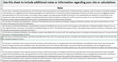
There is limited space to include notes on the ten calculation worksheets. The notes page allows the user to include additional information and details about inputs, assumptions, and calculations used in the calculation worksheets.
Worksheet
This is a blank worksheet where users may perform calculations that may be necessary in using the calculation worksheets, or where information or data can be stored.
Summary sheet
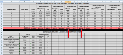
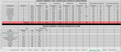
This is a protected worksheet that provides summary information, including initial loads for total phosphorus and TSS, reductions in loads associated with BMP implementation, percent reduction in loads, final loading rate (lb/ac/yr), and removal by different BMP types. Data are shown by area and for the entire site.
Calculation worksheets
Each of the 10 calculation worksheets represents a subwatershed. The user is not obligated to use 10 worksheets for their study area. We encourage the user to use separate worksheets for the following conditions.
- The study area has multiple well-defined subwatersheds.
- Contributing areas to BMPs in downstream portions of treatment trains should be treated as subwatersheds and should not include the area contributing to upstream BMPs in the treatment train, particularly if significant amounts of runoff are being treated by the upstream BMPs.
- To more accurately reflect differences in land use. Although the Estimator provides flexibility in selecting land uses, certain situations may be better dealt with by treating land uses as different subwatersheds. For example, a single residential area highly impacted by emerald ash borers may be treated as a separate subwatershed from an adjacent residential area where tree canopy will remain intact (i.e. due to significant differences in event mean concentrations).
The 10 calculation worksheets are identical and each contains 5 sections, described below.
- Calculation of unadjusted total loads for total phosphorus (TP) and total suspended solids (TSS)
- Calculation of adjusted total loads for TP and TSS
- Calculation of TP loading reductions associated with implementation of best management practices (BMPs)
- Calculation of TSS loading reductions associated with implementation of best management practices (BMPs)
- BMP and land use input values
Each of these sections is described below.
Section 1: Calculation of unadjusted total loads
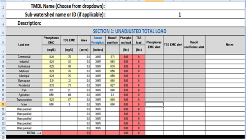
In this section, the total unadjusted load, in pounds, is calculated for the area considered. Unadjusted means there is no consideration of reductions associated with structural stormwater BMPs or with practices such as street sweeping, pollution prevention, changes in land use, etc.
This section comprises Cells A5 through M24 of each of the 10 calculation worksheets. In this section, the user inputs land area, in acres, associated with different land uses within the area being considered. The user inputs annual precipitation, in inches. A link provides access to precipitation information if the user does not know the precipitation for the subwatershed. The section contains default values for TP and TSS event mean concentrations (mg/L) and default values for runoff coefficients. EMCs and runoff coefficients can be changed by the user. Changing a default value triggers an alert box informing the user that the default has been changed.
Column A - Land use
- Description: This column contains various classifications for land use. Only classifications having adequate information for pollutant concentrations in the literature were included. The user may include additional land uses if adequate information exists for pollutant concentrations in runoff from that land use. The user may also include just a single land use to represent the entire area within the TMDL Project watershed, although this may require estimates of pollutant concentrations and runoff coefficients for areas with multiple land uses.
- Input: Land use category. Options include commercial, industrial, institutional, multi-use, municipal, open space, residential, park, agriculture, transportation, and water. The user may input up to five other land use classifications.
- Source of Information: MPCA input or user input.
Columns B and C, Rows 6 through 23 - Event mean concentrations
- Description: The influent event mean concentration (EMCs) of the pollutants of concern for each classification of land use listed in Column A.
- Input: Default value with an option for the user to enter a different value. If the user changes an emc for commercial, industrial, institutional, multi-use, municipal, residential, open space, or transportation, an alert displays in Column I or Column J, informing the user that they have changed the default emc. The user can change emcs for water, park, transportation, or user-specified land uses without an alert.
- Source of Information: We conducted a literature review to develop information on emcs. We selected default values based on analysis of data from the literature review and using best professional judgement. Information on emcs, including a summary of the literature review, ranges in emcs for different land uses, and guidance for adjusting an emc is found at these links.
Column D, Rows 6 through 23 - Area of specified land use
- Description: Area of specific land use within the subwatershed, in acres.
- Input: Drainage area, in acres. A value must be entered into this cell for the pollutant reduction to be calculated. Cells are therefore populated with a default value of 0.000001 acres to avoid returning an error in the calculations.
- Source of Information: User. TMDL reports provide maps and acreages for TMDL study areas. Shapefiles of TMDL study areas can be found at [1].
Column E, Rows 6 through 23 - Annual precipitation
- Description: Total annual precipitation in subwatershed.
Note: The default value is 30.65 inches per year, which is the average annual precipitation at the Minneapolis-St. Paul International airport. The user should input the appropriate value for their location. The references below can be used to determine this value.
- Input: Annual rainfall, in inches
- Sources of Information:
- TMDL study
- Minnesota Climatology Working Group
- MPCA Stormwater Manual
- U.S. Climate data
Column F, Rows 6 through 23 - runoff coefficients
- Description: Standard runoff coefficient for each type of land use.
- Input: Default value with an option for the user to enter a different value. If the user changes the default, an alert displays in Column K informing the user that the default has changed.
- Source of Information: MPCA input values based on literature. The default is set at the median. For a discussion of runoff coefficients, see [2]. For a table of runoff coefficients for different soils and slopes, link here.
Columns G and H, Rows 6 through 24 - Pollutant loads
- Description: The calculated load of the various pollutants of concern. Note that the values contained in Row 24 are the total values for all the land uses. Loading values take into consideration the concentration of pollutant in the stormwater runoff, drainage area, annual rainfall, and runoff coefficient.
- This is the base loading from which reductions are made. The user should therefore not change the inputs once the initial calculations are made because it may affect the calculations for pollutant reductions.
- Input: None
- Source of Information: The values in these cells are calculated based on the information entered in the previous cells
Columns I, J, K, rows 8 through 14 and row 17 - If the user changes a default value for emc or runoff coefficient in one of these rows, an alert is displayed.
Column L, Rows 8 through 23 - The user may enter notes. For example, if a default value is changed, the user may explain the rationale for the change.
Column M, Rows 8 through 24 - This column displays calculated runoff volumes in cubic feet. The Simple Method is used to generate this value. These cells are protected.
Section 2: Calculation of adjusted total loads
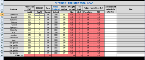
This section of the 10 calculation worksheets contains information and calculations for adjustments to the total loads calculated in the previous section (Unadjusted total loads). It comprises Cells A26 through M45.
Adjusted total loads account for changes in event mean concentration or runoff coefficient values used in the section "Unadjusted total loads". Examples of practices or actions that result in changes in EMC or runoff coefficients include but are not limited to the following.
- Street sweeping: Enhancing an existing street sweeping program, or initiating street sweeping will lower the emc in runoff. Alternatively, reducing street sweeping will increase the emc.
- Implementation of pollution prevention practices: Practices that reduce TP and/or TSS loads will lower the emc. Note that many of these practices are difficult to quantify and the user should base the decision to modify the emc on monitoring data or a literature review. An example would be a neighborhood leaf pickup program.
- Land use change: A change in land use may result in a change in emc and/or a change in runoff coefficient. This may result in an increase or decrease in total load.
- Altered land use practices: This potentially includes a wide range of practices that may affect the emc or runoff coefficient. Examples include disconnection of impervious surfaces, reduction in impervious surfaces, and changes in lawn practices (e.g. increased yard waste composting).
The user will adjust appropriate emcs in Cells B29 through C44, and/or adjust the appropriate runoff coefficients in cells F29 through F44. Changing a value in one of these cells (shaded yellow) displays an alert box in Column L warning the user that the default has been changed. The user should provide a description or rationale in the appropriate cell in Column K. Column M displays calculated runoff volumes in cubic feet. The Simple Method is used to generate this value.
The adjacent figure illustrates three example adjustments. In an industrial area, an impervious disconnection program was implemented. This could consist of, for example, a roof disconnection program where roof runoff is diverted to pervious surfaces. In residential areas, enhanced street sweeping lowered the emc. An enhanced street sweeping program might consist, for example, of more intensive sweeping during fall leaf drop. Finally, agricultural land was developed and the emc was lowered for the developed area. For land use changes it is important to avoid double counting. For example, if the newly developed area incorporates infiltration practices, the effect of these practices should be reflected either in this section or in sections 3 or 4, where BMPs are entered, but not in both sections. Including this in both sections would be double counting.
Section 3: Calculations for phosphorus load reductions associated with BMP implementation
Sections 3 (total phosphorus) and 4 (TSS) address reductions in pollutant loading associated with implementation of structural BMPs. Below are some tips for entering data in these sections.
|
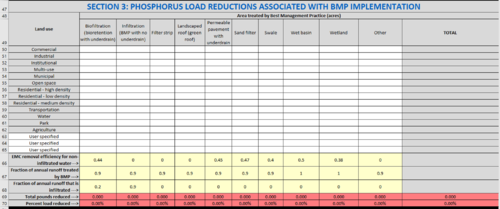
In this section of the worksheet the user enters acreages for BMPs implemented within each land use in the subwatershed. The section comprises Cells A47 through L70. The area treated by a BMP cannot exceed the total acreage within a specific land use (i.e. an error message is returned if the user attempts to enter an acreage greater than the total acres in a land use). If the cumulative acreage for multiple BMPs exceeds the total acreage within a land use, Column L returns a message stating the treated acres exceed the total acres for the land use.
Note: it is possible for treated acres to exceed total acres when multiple BMPs are employed. The warning alerts the user to this situation, in which case the user should ensure the entered values are correct. If treated acres do exceed total acres, the user should consider adjusting removal efficiencies for downstream BMPs that are receiving water treated by upstream BMPs.
Rows 48 through 65
- Description: The area, in acres, treated by the BMP, for different land uses. Land uses are listed in Column A.
These cells represent the area tributary to a BMP, which may not be the entire area for the type of land use. Not all cells need to be filled in. The user should only enter data in the cells relating to the specific BMPs and the land use classification of the BMPs’ drainage area.
If the user attempts to enter BMP acreages greater than the land use area, an error message is generated in Column L since one BMP cannot treat an area greater than the land use area. If the user enters a total acreage for all BMPs that exceeds the area of the land use, a warning message will be generated. This warning does not prevent the user from proceeding, since the total acreage for multiple BMPs may exceed the total land use acreage. For example, assume runoff from a 1 acre commercial area drains to an underground infiltration BMP. The area may also include a 0.2 acre green roof, resulting in 1.2 acres of BMP for the 1 acre commercial area. Generally, it is unlikely the BMP acreage will exceed the land use area.
- Input: The area, in acres, tributary to the BMP. Different BMPs are contained in different columns.
- Column B: Biofiltration (bioretention with underdrain)
- Column C: Infiltration (BMP with no underdrain)
- Column D: Filter Strip
- Column E: Landscaped roof (Green roof)
- Column F: Permeable pavement with underdrain
- Column G: Sand filter
- Column H: Swale
- Column I: Wet basin
- Column J: Wetland
- Column K: Other
- Column L: Displays an alert if total acres treated exceed the acres for a specific land use
- Source of Information: User
Row 66
- Description: The removal efficiencies for listed BMPs
- Input: None or user input. Removal efficiencies are based on information from the Minnesota Stormwater Manual and the Minimal Impact Design Standards (MIDS) calculator. BMP database sources shown below include compilations of data from multiple studies. The user may input other values based on field studies or published BMP performance data. If the user changes the default value, an alert displays in Column L informing the user that they changed a default. The maximum value is 1.0 and an error will generate if the user attempts to enter a value greater than 1.
With the biofiltration BMP, the user will select the removal efficiency based on the type of media present within the BMP. If the media mix used is C or D, or if another mix is used that has a phosphorus content of 30 mg/kg or less per the Mehlich 3 test, then the user should select the phosphorus removal fraction of 0.44. If another media type is present that has a phosphorus content greater than 30 mg/kg then the user should select a phosphorus removal fraction of 0.
Typically a manufacturer will supply the pollutant removal data for their device. The International BMP Database, USEPA Verified Technologies, Washington State's TAPE Program, and New Jersey's NJCAT Program have pollutant removal information that can be used to verify manufacturer’s data.
- Source of Information: MPCA Input, but user can change the value.
Links to additional information
- MN Stormwater Manual
- International BMP Database, 2012
- USEPA Verified Technologies
- Washington State TAPE program
- New Jersey NJCAT Program - Note that NJCAT utilizes lab testing only
- Center for Watershed Protection, 2000
- University of New Hampshire Stormwater Center Data Report, 2005
Row 67
- Description: The fraction of the annual runoff that is treated by the BMP. This is based on the amount of total runoff that enters the BMP.
- Input: None or user input. If the user changes the default value, an alert displays in Column L informing the user that they changed a default. The maximum value is 1.0 and an error will generate if the user attempts to enter a value greater than 1.
- Source of Information: MPCA Input, but user can change the value. The default value is set for 1.0 for wet basins and wetlands based on the assumption that all annual runoff passes through these BMPs. The default value is set at 0.9 for the remaining BMPs assuming B soils and the BMPs are designed to treat 1.0 inches of runoff from impervious surfaces. One inch is the most common performance goal, but this value must be changed if other performance goals are used. The user should also consider adjusting this value based on soil type curve numbers. The value would be adjusted upward for coarser soils and for areas with increased impervious cover, assuming bmps are sized to treat runoff from impervious surfaces. The user can calculate annual runoff treated by a BMP by using the MIDS calculator, or can estimate the value from the following data from the Minneapolis-St. Paul International Airport. For more guidance, link here.
Daily precipitation vs annual runoff MSP airport
Row 68
- Description: The fraction of the treated water that is infiltrated by the BMP. Defaults are 90 percent for all infiltration BMPs, 20 percent for biofiltration practices, 20 percent for permeable pavement with an underdrain, and 0 percent for the remaining bmps. All of the water captured by an infiltration BMP is assumed to infiltrate into the soil underlying the BMP. If an infiltration practice is sized to capture more or less than 90 percent of annual runoff, this value should be adjusted accordingly. The MIDS calculator can be used to estimate volume loss in BMPs with an underdrain. Typical infiltration in a BMP with an underdrain and an underlying D soil will be about 20 percent (0.20); thus the 20 percent value for biofiltration and permeable pavement with an underdrain. The assumption that no water infiltrates in the remaining BMPs is a conservative assumption, since some water always infiltrates through the bottom unless the BMP is lined. If the user changes the default value, an alert displays in Column L.
- Input: None or user input. If the user changes the default value, an alert displays in Column L informing the user that they changed a default. The maximum value is 1.0 and an error will generate if the user attempts to enter a value greater than 1.
- Source of Information: MPCA Input, but user can change the value.
Row 69
- Description: The total pollutant reduced (pounds) from each BMP type. The reduction equals the fraction of total area treated by the BMP within each land use multiplied by the removal efficiency of the BMP, summed across all land uses. The total reduction for all BMPs combined is calculated and shown in Column L.
- Input: None
- Source of Information: Auto-calculated
Row 70
- Description: The percent reduction in total load for the pollutant of concern from each BMP type. The percent reduction is calculated by dividing pounds reduced by total load and multiplying by 100. The total percent reduction for all BMPs combined is calculated and shown in Column L.
- Input: None
- Source of Information: Auto-calculated
Section 4: Calculations for TSS load reductions associated with BMP implementation
Sections 3 (total phosphorus) and 4 (TSS) address reductions in pollutant loading associated with implementation of structural BMPs. Below are some tips for entering data in these sections.
|
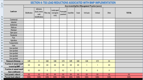
In this section of the worksheet the user enters acreages for BMPs implemented within each land use in the subwatershed. The section comprises Cells A72 through L95. The area treated by a BMP cannot exceed the total acreage within a specific land use (i.e. an error message is returned if the user attempts to enter an acreage greater than the total acres in a land use). If the cumulative acreage for multiple BMPs exceeds the total acreage within a land use, Column L returns a message stating the treated acres exceed the total acres for the land use.
Note: it is possible for treated acres to exceed total acres when multiple BMPs are employed. The warning alerts the user to this situation, in which case the user should ensure the entered values are correct. If treated acres do exceed total acres, the user should consider adjusting removal efficiencies for downstream BMPs that are receiving water treated by upstream BMPs.
Rows 72 through 90
- Description: The area, in acres, treated by the BMP, for different land uses. Land uses are listed in Column A.
These cells represent the area tributary to a BMP, which may not be the entire area for the type of land use. Not all cells need to be filled in. The user should only enter data in the cells relating to the specific BMPs and the land use classification of the BMPs’ drainage area.
If the user attempts to enter BMP acreages greater than the land use area, an error message is generated since one BMP cannot treat an area greater than the land use area. If the user enters a total acreage for all BMPs that exceeds the area of the land use, a warning message will be generated. This warning does not prevent the user from proceeding, since the total acreage for multiple BMPs may exceed the total land use acreage. For example, assume runoff from a 1 acre commercial area drains to an underground infiltration BMP. The area may also include a 0.2 acre green roof, resulting in 1.2 acres of BMP for the 1 acre commercial area. Generally, it is unlikely the BMP acreage will exceed the land use area.
- Input: The area, in acres, tributary to the BMP. Different BMPs are contained in different columns.
- Column B: Biofiltration (bioretention with underdrain)
- Column C: Infiltration (BMP with no underdrain)
- Column D: Filter Strip
- Column E: Landscaped roof (Green roof)
- Column F: Permeable pavement with underdrain
- Column G: Sand filter
- Column H: Swale
- Column I: Wet basin
- Column J: Wetland
- Column K: Other
- Column L: Displays an alert if total acres treated exceed the acres for a specific land use
- Source of Information: User
Row 91
- Description: The removal efficiencies for listed BMPs
- Input: None or user input. Removal efficiencies are based on information from the Minnesota Stormwater Manual and the Minimal Impact Design Standards (MIDS) calculator. BMP database sources shown below include compilations of data from multiple studies. The user may input other values based on field studies or published BMP performance data. If the user changes the default value, an alert displays in Column L informing the user that they changed a default. The maximum value is 1.0 and an error will generate if the user attempts to enter a value greater than 1.
Typically a manufacturer will supply the pollutant removal data for their device. The International BMP Database, USEPA Verified Technologies, Washington State's TAPE Program, and New Jersey's NJCAT Program have pollutant removal information that can be used to verify manufacturer’s data.
Sources of Information: MPCA Input, but user can change the value.
Links to additional information
- MN Stormwater Manual
- International BMP Database, 2012
- USEPA Verified Technologies
- Washington State TAPE program
- New Jersey NJCAT Program - Note that NJCAT utilizes lab testing only
- Center for Watershed Protection, 2000
- University of New Hampshire Stormwater Center Data Report, 2005
Row 92
- Description: The fraction of the annual runoff that is treated by the BMP. This is based on the amount of total runoff that enters the BMP.
- Input: None or user input. If the user changes the default value, an alert displays in Column L informing the user that they changed a default. The maximum value is 1.0 and an error will generate if the user attempts to enter a value greater than 1.
- Source of Information: MPCA Input, but user can change the value. The default value is set for 1.0 for wet basins and wetlands based on the assumption that all annual runoff passes through these BMPs. The default value is set at 0.9 for the remaining BMPs assuming B soils and the BMPs are designed to treat 1.0 inches of runoff from impervious surfaces. One inch is the most common performance goal, but this value must be changed if other performance goals are used. The user should also consider adjusting this value based on soil type curve numbers. The value would be adjusted upward for coarser soils and for areas with increased impervious cover, assuming bmps are sized to treat runoff from impervious surfaces. The user can calculate annual runoff treated by a BMP by using the MIDS calculator, or can estimate the value from the following data from the Minneapolis-St. Paul International Airport.
Daily precipitation vs annual runoff MSP airport
Row 93
- Description: The fraction of the treated water that is infiltrated by the BMP. Defaults are 90 percent for all infiltration BMPs, 20 percent for biofiltration practices, 20 percent for permeable pavement with an underdrain, and 0 percent for the remaining bmps. All of the water captured by an infiltration BMP is assumed to infiltrate into the soil underlying the BMP. If an infiltration practice is sized to capture more or less than 90 percent of annual runoff, this value should be adjusted accordingly. The MIDS calculator can be used to estimate volume loss in BMPs with an underdrain. Typical infiltration in a BMP with an underdrain and an underlying D soil will be about 20 percent (0.20); thus the 20 percent value for biofiltration and permeable pavement with an underdrain. The assumption that no water infiltrates in the remaining BMPs is a conservative assumption, since some water always infiltrates through the bottom unless the BMP is lined. If the user changes the default value, an alert displays in Column L.
- Input: None or user input. If the user changes the default value, an alert displays in Column L informing the user that they changed a default. The maximum value is 1.0 and an error will generate if the user attempts to enter a value greater than 1.
- Source of Information: MPCA Input, but user can change the value.
Row 94
- Description: The total pollutant reduced (pounds) from each BMP type. The reduction equals the fraction of total area treated by the BMP within each land use multiplied by the removal efficiency of the BMP, summed across all land uses. The total reduction for all BMPs combined is calculated and shown in Column L.
- Input: None.
- Source of Information: Auto-calculated
Row 95
- Description: The percent reduction in total load for the pollutant of concern from each BMP type. The percent reduction is calculated by dividing pounds reduced by total load and multiplying by 100. The total percent reduction for all BMPs combined is calculated and shown in Column L.
- Input: None
- Source of Information: Auto-calculated
Section 5: Default values for BMP and land use inputs
This section of each of the 10 calculation worksheets contains default values for BMP performance (treatment fractions), event mean concentrations (EMCs), and runoff coefficients. The values for fraction treated are only for the water that is filtered and are expressed as fractions, which represents the fraction of pollutant that is removed by the BMP. A value of 0.50, for example, means the BMP removes half of the pollutant. For infiltration, the fraction represents the fraction of water that is infiltrated. All pollutant is considered removed for infiltration practices. The equations built in to the Estimator account for this complete removal for infiltrated water. Removal values are shown for TP and TSS.
Users cannot change the values in this section. The values are used as a check. When a user changes a default in Sections 1, 2, 3, or 4, comparison of the changed value with the defaults in Section 5 trgger a warning that the user changed a default value.
This section provides additional information and links to information on emcs, runoff coefficients, pollutant removal, and treatment fractions.
Tips for using the Estimator
The Estimator is a simple tool based on simple assumptions. This section contains some tips for applying the tool to different situations that you may encounter.
Addressing treatment trains
The Estimator does not explicitly address stormwater treatment trains. It will therefore either underestimate or overestimate pollutant removal for BMPs that are in series, depending on how they are addressed in the spreadsheet. For example, in a treatment train consisting solely of ponds, the first pond removes the greatest fraction of pollutant concentration. Each pond in succession will treat less polluted water but will further the reduction in pollutant concentration flowing downstream. The Estimator doesn’t recognize the total number of BMPs on the ground so it cannot recognize BMPs as being connected. Therefore each pond is assumed to treat the same degree of polluted water regardless of how many are connected in a treatment train.
We recommend that BMPs in a treatment train be considered as possible separate sub-watersheds. Using this approach, only the area draining to a single BMP is considered in a worksheet.
If BMPs in a treatment train are not treated separately, adjusting the Estimator to more closely simulate pollutant removal for treatment trains can be challenging since the Estimator uses a lumped BMP approach in which all similar BMPs are lumped as a single BMP. For example, permeable pavement with no underdrain, bioinfiltration, and infiltration basins are all lumped together as infiltrator BMPs. Another complication is that each treatment train differs and attempting to model them as a single system creates inaccuracies.
Adjusting EMCs (event mean concentrations)
If you are calculating reductions in loading as a percent, there is no value in modifying the EMCs in the Estimator since the only factors affecting the percent removal are the BMP removal fraction and the fraction of runoff being treated by and/or infiltrating through the BMP. If you are calculating reductions in pounds or number of bacteria, the EMC affects the initial pollutant load. The higher the initial load the greater the reduction when the BMPs are applied. For more information on EMCs, go to the following links.
- Event mean concentrations of total suspended solids in stormwater runoff
- Event mean concentrations of total and dissolved phosphorus in stormwater runoff
Adjusting the fraction of annual water treated and infiltrated in a BMP
The default value for the fraction of runoff treated by BMPs is 0.9, except for wet basins (e.g. constructed ponds) and wetlands, where the value is 1.0.
- The 0.9 corresponds with treatment of the first 1 inch of runoff on B soils. This was determined through modeling with the Minimal Impact Design Standards (MIDS) Calculator. If you have a different performance goal (e.g. the 1.1 inch MIDS value), extensive pervious acreages, and/or different soils, we recommend adjusting this value. You can use the MIDS calculator to determine the appropriate value. We also provide some guidance below.
- The value of 1.0 for wet basins and wetlands assumes all runoff is treated by the BMP. This value should be changed if this condition is not accurate.
The table below can be used to determine the appropriate number. For example, if your soils were A rather than B, you should enter a value ranging from 0.92 to 0.96, depending on the specific soil type. If you had B soils but the water quality volume was 0.75 inches, the value should be changed to 0.81.
Similarly, the fraction of runoff that is infiltrated into an infiltrator BMP is 0.9. Again, this value should be adjusted if the water quality volume or soils differ from 1 inch and B soils or if there are significant pervious acreages contributing to runoff. The only other BMP in the Estimator that infiltrates water as the default is biofiltration. The infiltration fraction for this BMP is 0.2, which is based on data generated from MIDS calculator runs. Infiltration may occur in other BMPs, in particular permeable pavement with an underdrain and swales. A value of 0.2 can be entered for permeable pavement with underdrains to make it similar to biofiltration. An infiltration value for swales is difficult to generate because of the many potential swale configurations. The MIDS calculator is one tool that can be used to generate a value for fraction of water infiltrated in swales.
Annual volume, expressed as a percent of annual runoff, treated by a BMP as a function of soil and Water Quality Volume. See footnote1 for how these were determined.
Link to this table
| Soil | Water quality volume (VWQ) (inches) | ||||
|---|---|---|---|---|---|
| 0.5 | 0.75 | 1.00 | 1.25 | 1.50 | |
| A (GW) | 84 | 92 | 96 | 98 | 99 |
| A (SP) | 75 | 86 | 92 | 95 | 97 |
| B (SM) | 68 | 81 | 89 | 93 | 95 |
| B (MH) | 65 | 78 | 86 | 91 | 94 |
| C | 63 | 76 | 85 | 90 | 93 |
1Values were determined using the MIDS calculator. BMPs were sized to exactly meet the water quality volume for a 2 acre site with 1 acre of impervious, 1 acre of forested land, and annual rainfall of 31.9 inches.
Adjusting the pollutant removal fraction
The pollutant removal fraction is the most important factor affecting the calculations in the Estimator. The default values correspond with recommended values in the manual and represent well-defended data from the literature. The user can change the default, but any change should be supported with data. For further information on pollutant removal by BMPs, see the appropriate page in this manual on BMP pollutant credits. Each of the credit articles contains information to help determine the most appropriate value for pollutant removal for a specific BMP.
Addressing BMPs not included in the Estimator
The Estimator allows the user to enter an additional BMP beyond the default BMPs (called Other in the Estimator). Most urban BMPs fit into one of the default BMPs in the Estimator. There may be exceptions however, including but not limited to the following.
- Underground filtration practices (these are largely proprietary)
- Underground settling practices (these are largely proprietary)
- Floating treatment wetlands
- Enhanced pretreatment
If you can determine values for pollutant removal fraction, fraction of water that is treated, and fraction of water that is infiltrated for the BMP, you can include an additional BMP. If these values cannot be generated for the BMP, calculate pollutant removal independently and add that value to the value generated by the Estimator when reporting cumulative reductions on the Annual Report form. For example, assume you had an in-line treatment system that treated stormwater runoff in a part of your conveyance system. This BMP is not easily incorporated into the Estimator, but if you monitor the BMP and have pollutant removal information, you can simply add the removal amount to the amount calculated by the Estimator for the remainder of your system.
Adjusting for impervious and pervious surface
The Estimator uses runoff coefficients to estimate the fraction of rainfall that runs off for different land uses. Default values are typical values from the literature. Runoff coefficients can be changed in the Input values for MPCA Estimator tab. Increase the runoff coefficient if your land use has greater impervious surface, or decrease the coefficient if it has less impervious surface. Ranges of values for runoff coefficients can be found here.
Example 1: using the MPCA Estimator with multiple subwatersheds
This example utilizes a single site and proceeds through a series of implemented practices. To access the spreadsheet used for this example, click here File:MPCA simple estimator version 3 subwatershed example.xlsx
Step 1. Unadjusted load calculation and entering data for land uses
The adjacent image is used for this example and will be modified as adjustments are made and BMPs added. The entire project area consists of three subwatersheds. Land uses within the project area include the following.
- Residential with <25% tree canopy coverage
- Residential with >50% tree canopy coverage
- Industrial
- Commercial
- Park
- Transportation
- Mixed (multi-use)
- Agricultural
The entire area drains to a lake. The goal is to reduce phosphorus loading to the lake by 30 percent.
In this first step, we enter acreages for each of the three subwatersheds. These are shown in the adjacent image gallery. To account for the two different residential areas in subwatershed A, we change the default emc for residential to 0.350 mg/L for the high canopy area and add a residential land use with an emc of 0.275 for the low canopy area. For subwatersheds B and C, we change the default residential value to 0.35 mg/L to account for higher phosphorus inputs from trees in the high canopy areas. Alternatively, we could have made these adjustments for residential areas in the second section of the three worksheets (Adjusted loads). The total phosphorus load to the lake from all three watersheds is 2699.54 pounds. With a phosphorus reduction goal of 30 percent, this requires a 809.86 pound reduction in phosphorus loading.
- MIDS Calculator screen shots for unadjusted loads. Click on an image for enlarged view.
Step 2. Calculating adjusted loads
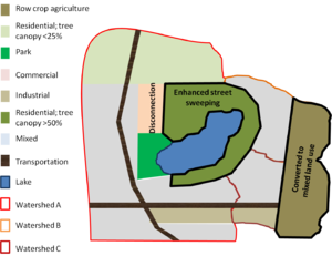
Section 2 of each calculation worksheet allows the user to enter data that results in adjustments to the total load. In this example, the following actions were implemented (see adjacent image).
- In the residential areas with >50% tree canopy coverage, an enhanced street sweeping program was implemented. This consisted of street sweeping at the time of fall leaf drop, rather than the once-a-fall sweeping program previously implemented. Measurements of street sweeping material collected during this time indicate this effort reduced annual loading by about 17 percent. Since the Estimator does not allow direct changes in loading, we adjusted the emc downward until we achieved a 17 percent reduction in loading. To accomplish this, we adjusted the emc from 0.35 mg/L to 0.30 mg/L. This resulted in a phosphorus decrease of 18.79 pounds in subwatershed A, 18.79 pounds in subwatershed B, and 7.51 pounds in Subwatersdhed C, for a total reduction of 45.09 pounds.
- In the commercial area of subwatershed A, a rooftop and parking lot disconnection effort was implemented. Runoff from these areas was diverted to pervious surfaces. The runoff coefficient was adjusted downward from 0.71 to 0.50 based on the calculated decrease in connected impervious surface. This resulted in a phosphorus decrease of 21.91 pounds.
- The agricultural areas in subwatersheds B and C was converted to mixed land use. We changed the emc and runoff coefficients from agricultural land use to the default values for mixed land use. Phosphorus loads increased by 137.76 pounds in subwatershed B and 150.28 pounds in subwatershed C. BMPs were implemented during the land use conversion, but these calculations are made in Section 3.
After these adjustments, the phosphorus load increased by 221.04 pounds, assuming no further BMPs were implemented. The adjacent photo gallery provides screen shots for each of the three subwatersheds.
- MIDS Calculator screen shots for adjusted loads. Click on an image for enlarged view.
Step 3. Entering structural best management practices (BMPs)
In this section, structural BMPs are entered for each of the subwatersheds. The adjacent schematic illustrates where BMPs are implemented, except for swales associated with transportation corridors. A summary of the implemented practices is provided below.
- Subwatershed A. This subwatershed consists primarily of Hydrologic Soil Group (HSG) C and D soils, making infiltration impractical.
- Stormwater runoff in much of the area is diverted to wet basins (constructed ponds). A total of 450 acres of mixed land use (multi-use) is treated by ponds and 400 acres of low canopy residential area is treated by ponds. This results in a phosphorus reduction of 330.31 pounds.
- Biofiltration practices (rain gardens, with an underdrain) are implemented for 100 acres of the residential, high canopy area, resulting in a phosphorus reduction of 28.63 pounds
- Swales treat 75 acres of runoff from transportation areas, resulting in a reduction of 42.08 pounds of phosphorus
- The total phosphorus reduction from these BMPs is 401.02 pounds
- Subwatershed B. This subwatershed includes HSG A, B, andC soils. Infiltration is therefore feasible in some of the area.
- Underground infiltration is utilized for 290 acres in the mixed land use areas, including the entire area where agricultural land was converted to mixed land use. This results in a reduction of 263.31 pounds of phosphorus.
- Biofiltration is utilized for 100 acres of residential land, resulting in a reduction of 28.63 pounds.
- The total phosphorus reduction in this subwatershed is 291.94 pounds.
- Subwatershed C. This subwatershed includes HSG A, B, andC soils. Infiltration is therefore feasible in some of the area.
- Underground infiltration is utilized for 280 acres in the mixed land use areas, including the entire area where agricultural land was converted to mixed land use. This results in a reduction of 254.23 pounds of phosphorus.
- Biofiltration is utilized for 40 acres of residential land, resulting in a reduction of 11.45 pounds.
- Swales are utilized in transportation corridors, treating 60 acres for a phosphorus reduction of 33.66 pounds
- Iron-enhanced sand filters treat 60 acres of runoff in the industrial area. Note the phosphorus removal efficiency of this practice was change from 0.47 to 0.80 due to the use of iron in the treatment. The total phosphorus reduction for this practice is 48.03 pounds.
- The total phosphorus reduction in this subwatershed is 347.37 pounds.
The total phosphorus reduction for the three subwatersheds is 819.29 pounds, which meets the target of 809.86 pounds. The adjacent image gallery provides screenshots from the Estimator for the three subwatersheds.
This example illustrates the following.
- Infiltration is a very effective practice for removing phosphorus
- Biofiltration in residential areas is only somewhat effective due to the low runoff coefficient; i.e. the practice does not treat a lot of runoff. For example, swales in subwatershed A remove more phosphorus even though swales are not particularly effective at removing phosphorus and less area is treated compared to residential land use. The higher removal is associated with the higher runoff coefficient for transportation, resulting in greater runoff volumes being treated.
- We assume the media mizes for biofiltration do not leach phosphorus. These would be Mixes C or D, or use of some material in the mix that does not leach phosphorus, such as coir or biochar.
- Iron enhanced treatment is an effective practice if large volumes of water can be treated in this manner. One concern with sand filters, however, is that large systems are needed to treat large runoff volumes.
- Additional practices, such impervious disconnection and use of permeable pavement, could further reduce phosphorus loading. These are practices that can be used at the individual homeowner scale.
NOTE: In Section 3, a total reduction of 1080.4 pounds is achieved with BMP implementation. However, phosphorus loading would increase with the land use conversion if no BMPs were implemented. This explains why the load reduction inSection 3 is greater than the net reduction of 819.29 pounds.
- MIDS Calculator screen shots for implementation of structural BMPs. Click on an image for enlarged view.
Review Summary Sheet
The adjacent image provides a screen shot of the Summary worksheet for this example. Note the following in the image.
- Data are shown for each subwatershed and for the entire site.
- Initial and final loads are shown, as well as the percent reduction achieved
- Loading rate, in pounds per acre, are included (both initial and final)
- Cumulative load reductions for the different BMPs are illustrated
- Note the efficiency of infiltration as a treatment practice
Note that we did not address total suspended solids in our calculations. The summary suggests TSS loads increased, but this is because we ignored calculations for TSS as it was not a pollutant of concern. To accurately reflect TSS, we would enter the BMP data for each subwatershed in Section 4 of each worksheet in the Estimator.
Example 2: Treatment trains, non-structural practices, and other structural BMPs
In this example we'll demonstrate how to use the Estimator for treatment trains, non-structural practices, and structural BMPs that are not included as defaults in the Estimator.
There are three subwatersheds. Subwatershed A consists of residential land use. A number of non-structural practices were implemented here, including enhanced street sweeping, neighborhood lawn leaf pick-up, an adopt-a-drain program, and impervious surface disconnection. Impervious surface disconnection included a rain barrel program and routing residential roof runoff to pervious areas. Subwatershed B consisted of mixed land use, including residential, commercial, industrial, and open space land uses as well as transportation and institutional areas. A stormwater treatment train approach is utilized in this subwatershed and includes an area where biofiltration practices were implemented, an area served by an underground infiltration system, and an area served by a sand filter. These areas drain to 3 regional ponds. Subwatershed C is an ultra-urban area with 80 percent impervious surface on HSG C soils, making infiltration infeasible. BMPs installed in this area include several proprietary underground filtration systems.
The adjacent schematic illustrates the entire site. The goal is to reduce phosphorus loading to the lake by 40 percent.
Step 1: Entering acreages and calculating unadjusted loads
The area includes the following.
- Subwatershed A: 300 acres of residential land use
- Subwatershed B: The entire area consists of mixed (multi-use) land use, but for calculation purposes we will use a separate worksheet in the Estimator for each of the following
- 70 acres draining to biofiltration
- 175 acres draining to underground infiltration
- 275 acres draining to sand filters
- 125 acres untreated runoff draining to Pond 1 plus drainage from the biofiltration and infiltration areas
- 125 acres draining to Pond 2 plus drainage from the sand filter area
- 175 acres draining to Pond 3 plus drainage from Pond 2
- 70 acres of direct runoff (untreated)
- Subwatershed C: 200 acres of ultra-urban land use treated by proprietary underground filtration practices. We entered this land use as a user-defined land use and adjusted the runoff coefficient to 0.90 to reflect the impervious cover. The emc was assumed to 0.24 mg/L.
There are thus 9 separate areas where calculations will be made (subwatershed A and C and seven (7) areas in subwatershed B
Step 2: calculating adjusted loads
This only applied to subwatershed A, where non-structural practices are implemented. Four non-structural practices are implemented in this subwatershed.
- Enhanced street sweeping, which consisted on timing fall sweeping with leaf drop.
- A neighborhood lawn leaf pickup program was implemented. It consisted of residents raking leaves off pervious surfaces (e.g. lawns), bagging the leaves, and placing them on the curb for pickup.
- An adopt-a-drain program was implemented and 80% of the drains in the subwatershed are cleaned on a routine basis.
- An impervious surface disconnection program was implemented and consisted of residents routing roof runoff to a pervious surface or to a rain barrel that discharged to a pervious surface. Approximately 50% of the homes in subwatershed A have roof disconnection practices.
Based on monitoring data and information from the literature, we adjusted the emc down from 0.325 mg/L to 0.26 mg/L and the runoff coefficient down from 0.26 to 0.22. Note that runoff from impervious to pervious surfaces typically does not remove all the runoff generated from the impervious surface. This is particularly true for lawns that are compacted.
The resulting phosphorus reduction is 63.77 pounds or 34.81 percent of the initial load.
Step 3: Accounting for load reductions by structural BMPs
Structural BMPs were implemented in subwatershed B and C. In subwatershed C, proprietary underground filtration practices were implemented and treat 150 of the 200 acres in the subwatershed. The treatment efficiency is assumed to 0.44, which is the same as biofiltration. The resulting load reduction is 89.27 pounds or 29.7 percent of the initial load.
Subwatershed B contains multiple BMPs configured as a treatment train. To account for this, we calculate loads separately for each practice (i.e. a separate worksheet is used for BMP in the Estimator).
- Direct runoff: 70 acres of the subwatershed runs off directly to the lake with no treatment
- Biofiltration: The biofiltration practices treat 90% (0.9) of annual runoff. Of this treated runoff, 20% (0.2) is infiltrated and 80% is filtered. Thus, of the original 70 acres, we assume 7 acres (10%) is untreated and goes to Pond 1. The filtered volume goes to Pond 1. We address these volumes in the calculations associated with Pond 1.
- Infiltration: The infiltration practice treats 90% (0.9) of annual runoff. The remaining volume is untreated. We therefore assume 17.5 acres of the 175 (10%) acre area is untreated and goes to Pond 1.
- Sand filters: Sand filters treat 90% (0.9) of the runoff. The remaining volume is untreated. We therefore assume 27.5 acres (10%) of the 275 acre area is untreated and goes to Pond 2.
- Pond 1: Pond 1 receives 125 acres of direct runoff and 24.5 acres of untreated water from the biofiltration and infiltration areas. Pond 1 also receives 56.7 acres of treated water from the biofiltration area. We reduced the emc of this water by 44% (0.44) to account for treatment by biofiltration and we changed the pond treatment efficiency to 0.25 to account for reduced treatment effectiveness associated with smaller particle sizes. We used the Other treatment to address this filtered water.
- Pond 2: Pond 2 receives 125 acres of direct runoff and 27.5 acres of untreated runoff from the sand filter area. Pond 1 also receives 247.5 acres of treated water from the biofiltration area. We reduced the emc of this water by 47% (0.47) to account for treatment by biofiltration and we changed the pond treatment efficiency to 0.25 to account for reduced treatment effectiveness associated with smaller particle sizes. We used the Other treatment to address this filtered water.
- Pond 3: Pond 3, there are 175 acres of runoff to the pond. There is also runoff from Pond 2, but we assume this water receives no additional treatment because it has already passed through two treatment practices upstream.
Reviewing results
The adjacent screen shot shows the results for each area, subwatershed, and by treatment practice. The final load of 974.93 pounds reflects a total reduction of 745.94 pounds. This is a 43.35 percent reduction in total phosphorus loading and meets the reduction goal of 40%. The greatest reductions, in terms of percent reduced, occurred in the area where infiltration practices were implemented, reflecting the effectiveness of these practices in reducing phosphorus loading. The reduced effectiveness of ponds 1 and 2 compared to pond 3 reflects the reduced effectiveness of BMPs located downstream of other BMPs. Treatment trains, however, have the advantage of providing redundant treatment and helping to meet challenging reduction goals. They also can reduce loading to the downstream BMPs and thus reduce the need for maintenance in the downstream BMPs.
The screen shot also shows final loading rates from each treatment area. The effectiveness of infiltration practices is again illustrated, with a final loading rate of 0.10 pounds per acre per year. Also note the relatively high loading rate from the ultra-urban area despite 75 percent of the area being treated by filtration practices. This reflects the importance of impervious surface in contributing to loading, since 90 percent of the area is impervious.
The notes page from the Estimator is also shown in an adjacent figure. This notes page is used to provide specific details or information relevant to the calculations made in the spreadsheet and worksheets.
