![]()
Category:Level 3 - General information, reference, tables, images, and archives/Images/Schematics

Schematics are artificial images (diagrams, graphs, etc.) that illustrate a topic or concept. This page provides links to schematics that do not fit into one of the other schematic categories (CADD, MIDS, hydrology and soil, management, and bmps).
Information: To determine what page the photo can be found on, click on an image to open the page, then in the left toolbar click on What links here.
Media in category "Level 3 - General information, reference, tables, images, and archives/Images/Schematics"
The following 16 files are in this category, out of 16 total.
 Agricultural shank designs.png 816 × 490; 54 KB
 Cap region figure 1.png 923 × 605; 94 KB
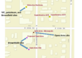
 CVS Pharmacy.png 1,373 × 418; 211 KB
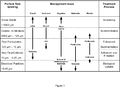
 Fine-tuning the program.PNG 633 × 278; 17 KB
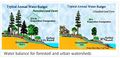 Forested urban water balance2.jpg 800 × 384; 60 KB
 Green line.png 1,967 × 882; 1.8 MB
 Lunds.png 806 × 541; 315 KB
 Minnetonka figure 2.jpg 975 × 549; 108 KB
 Open Arms.png 868 × 608; 343 KB
 Process and particle size.jpg 1,403 × 1,033; 209 KB
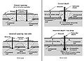
 Schematic of winged tip and conventional tip subsoiler.jpg 501 × 190; 18 KB
 Spacing and depth of subsoilers.jpg 451 × 327; 25 KB
 St paul figure 2.png 956 × 708; 526 KB
 Steps for Calebrating an auger or conveyor system.png 388 × 927; 37 KB
 Tanner alum treatment schematic.png 758 × 1,024; 545 KB
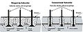
 Urban hydrology.jpg 660 × 450; 40 KB


This page was last edited on 9 February 2023, at 15:34.