Navigation
Main page
Table of contents
Index (Categories)
What's new
Response to comments
Future updates
Events
In the News
Funding
Recent changes
Help
Export to pdf
Tools
User contributions
Logs
View user groups
Special pages
MPCA Links
MPCA Homepage
Stormwater
Policies / Disclaimers
Minnesota Stormwater Manual
Search Help
Log in
Search:
Search
Uploads by PLeegar
Fact sheets for permeable pavement
>
Water quality benefits of Green Stormwater Infrastructure
>
Requirements, recommendations and information for using trees as a BMP in the MIDS calculator
>
Shallow groundwater
>
Special:ListFiles
This special page shows all uploaded files.
File list
Items per page:
20
50
100
250
500
Search for media name:
Username:
Include old versions of files
Go
First page
Previous page
Next page
Last page
Date
Name
Thumbnail
Size
Description
Versions
17:43, 23 January 2013
Better street parking lot deicing.jpg
(
file
)
152 KB
1
16:22, 23 January 2013
Better turf management.jpg
(
file
)
2 KB
1
13:33, 21 March 2017
Bike lane st paul.JPG
(
file
)
94 KB
1
18:30, 26 May 2016
Bioinfiltration Basin.png
(
file
)
Error creating thumbnail: File with dimensions greater than 12.5 MP
469 KB
1
16:48, 8 March 2017
Bioretention facility in St Paul MN.PNG
(
file
)
700 KB
1
17:54, 27 December 2012
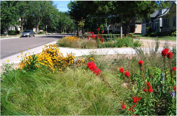
Bioretention parking lot island.jpg
(
file
)
536 KB
1
22:46, 1 February 2016
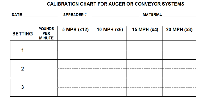
Blank Calibration chart for auger - conveyor manual systems.PNG
(
file
)
27 KB
1
20:16, 21 June 2016
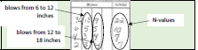
Blow Counts.PNG
(
file
)
8 KB
1
18:29, 5 May 2016
C00026211 025.JPG
(
file
)
1.57 MB
1
20:35, 15 April 2013
CSW Special waters as of 4-15-2013.pdf
(
file
)
106 KB
1
13:22, 2 July 2013
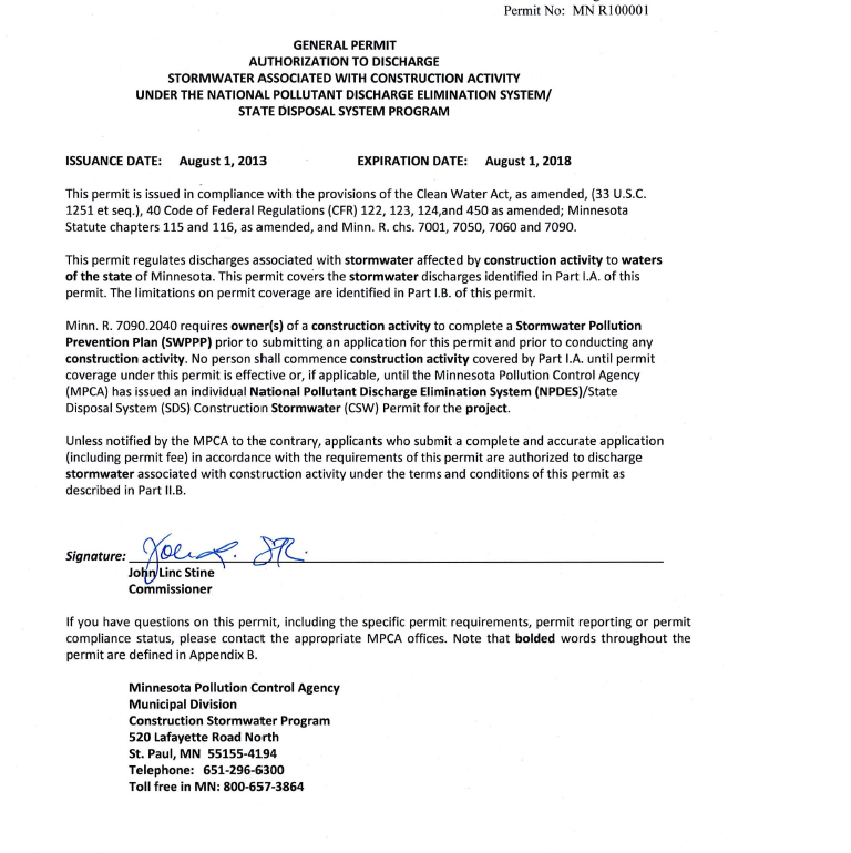
CSW permit authorization.png
(
file
)
298 KB
1
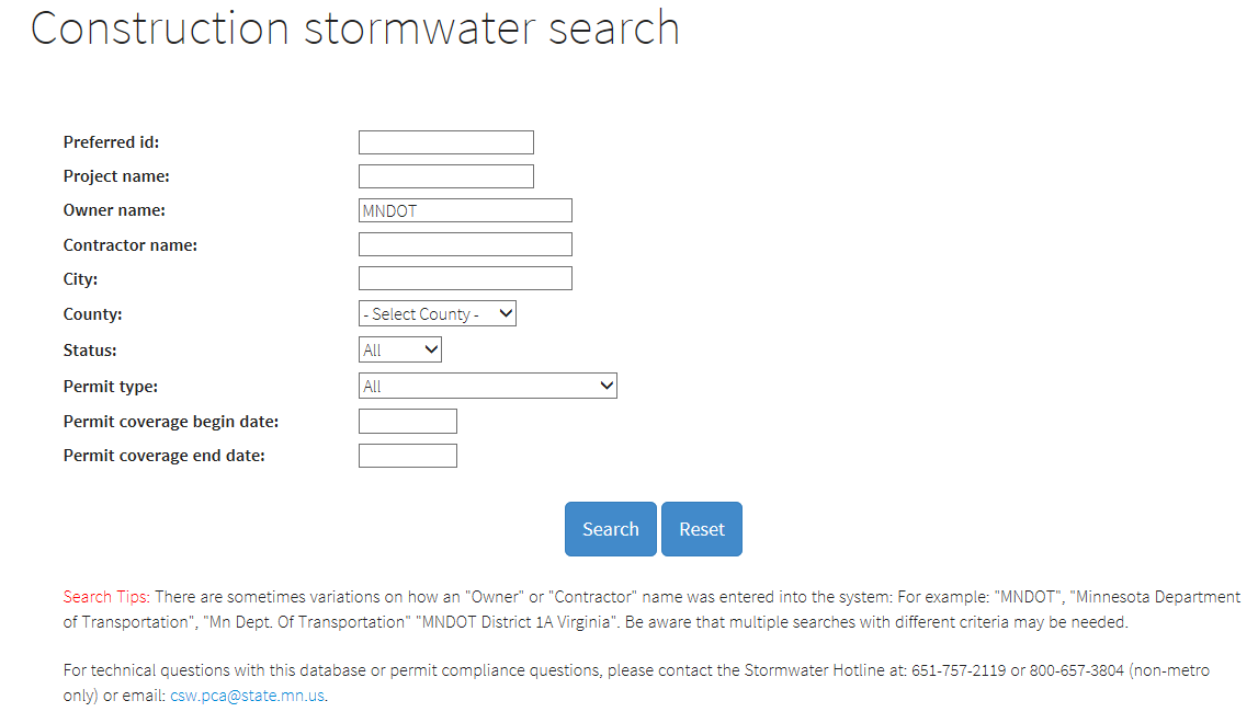
16:00, 25 May 2016
CSW search tool.PNG
(
file
)
38 KB
1
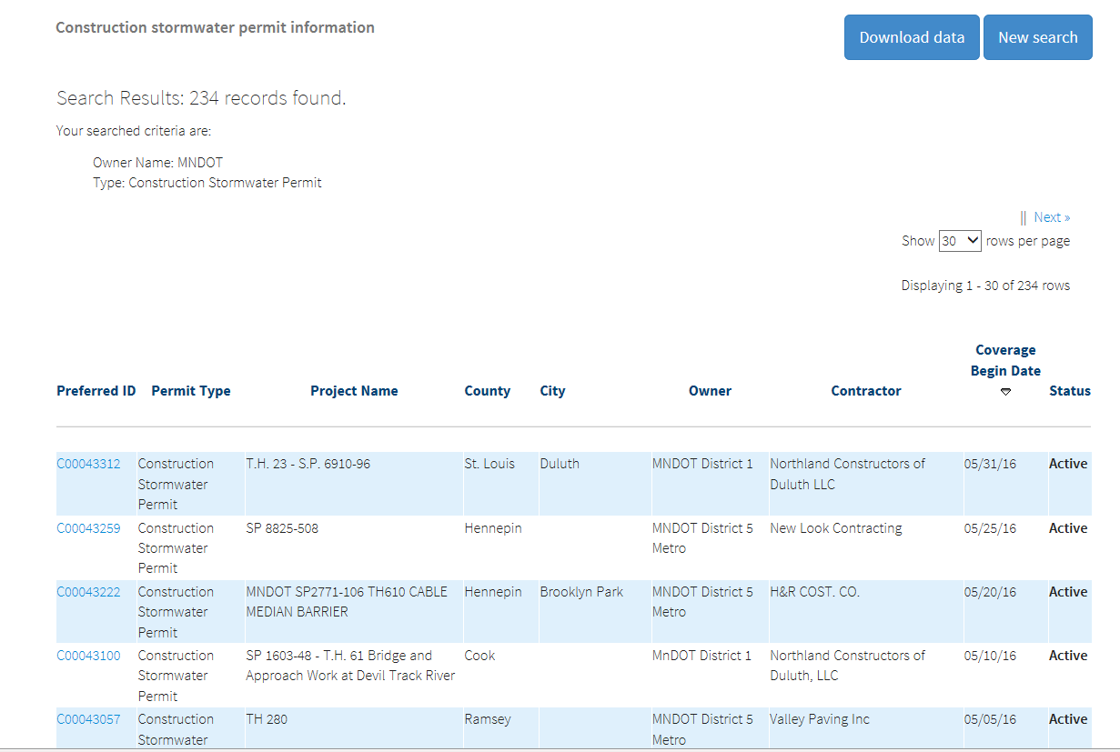
16:07, 25 May 2016
CSW search tool result set.PNG
(
file
)
58 KB
1
14:54, 25 April 2013
Calcareous fens list.xlsx
(
file
)
20 KB
1
17:29, 3 February 2016
Calculating parking lot areas.PNG
(
file
)
5 KB
1
20:58, 1 February 2016
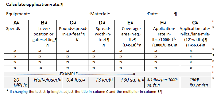
Calculation application rate.PNG
(
file
)
20 KB
1
20:40, 1 February 2016
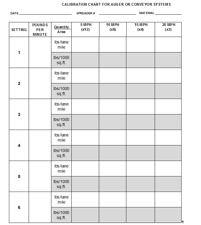
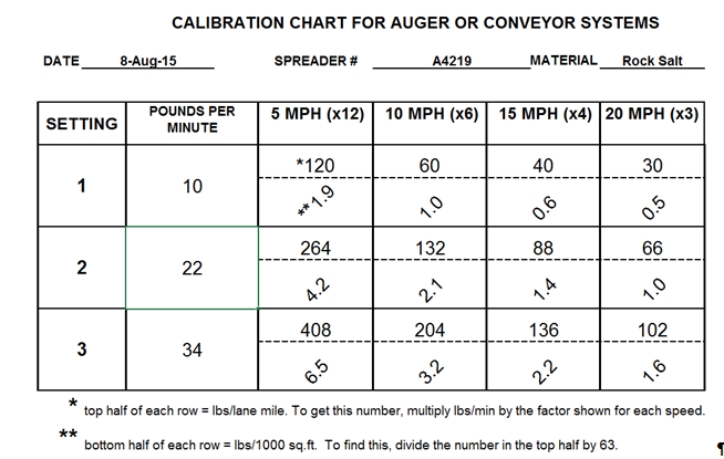
Calibration chart for auger or conveyor systems.PNG
(
file
)
34 KB
1
20:40, 1 February 2016
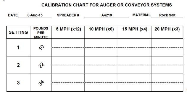
Calibration chart for auger or conveyor systems step 2.PNG
(
file
)
43 KB
1
20:41, 1 February 2016
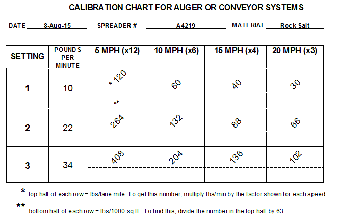
Calibration chart for auger or conveyor systems step 3.PNG
(
file
)
22 KB
1
20:52, 1 February 2016
Calibration chart for auger or conveyor systems step 4.PNG
(
file
)
82 KB
1
22:04, 1 February 2016
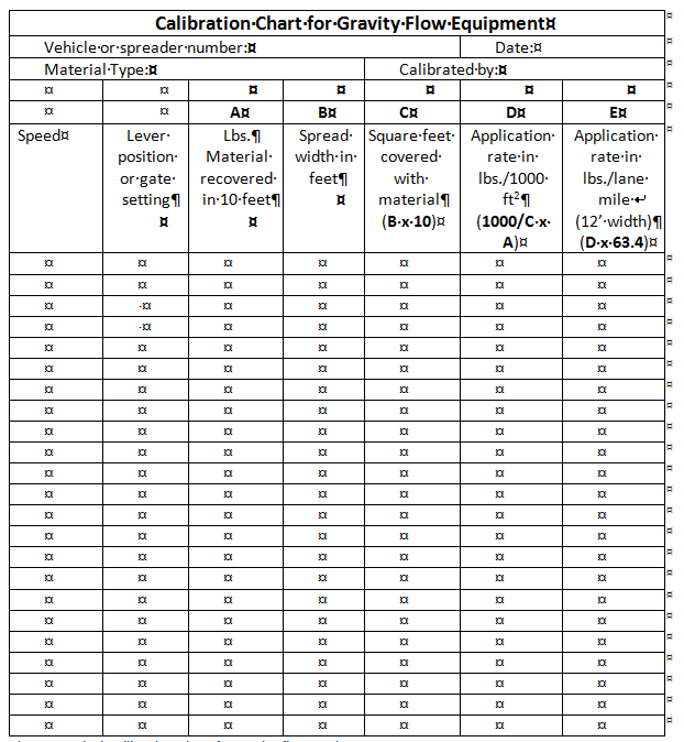
Calibration chart for gravity flow equipment.PNG
(
file
)
28 KB
1
16:41, 14 February 2017
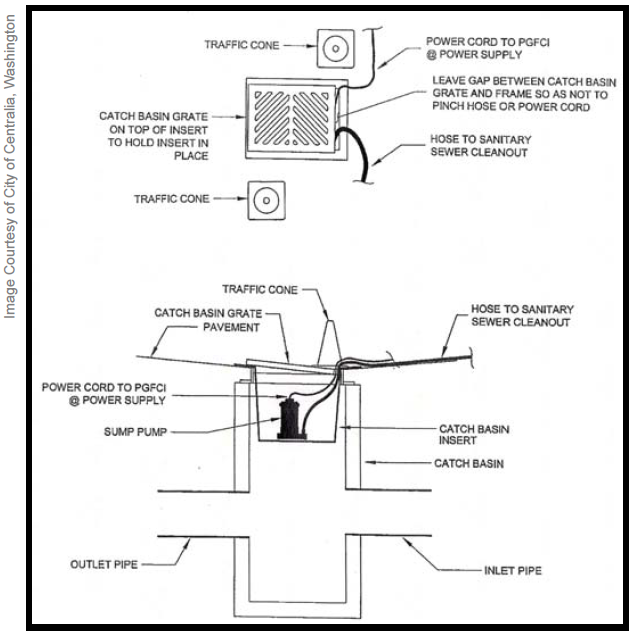
Car wash catch basin insert for diversion to sanitary sewer.PNG
(
file
)
155 KB
1
17:36, 14 February 2017
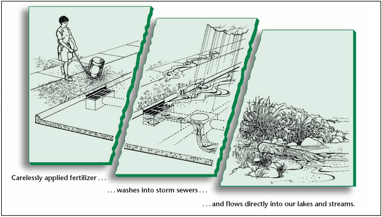
Carelessly applied fertillizer.PNG
(
file
)
823 KB
1
15:45, 17 January 2013
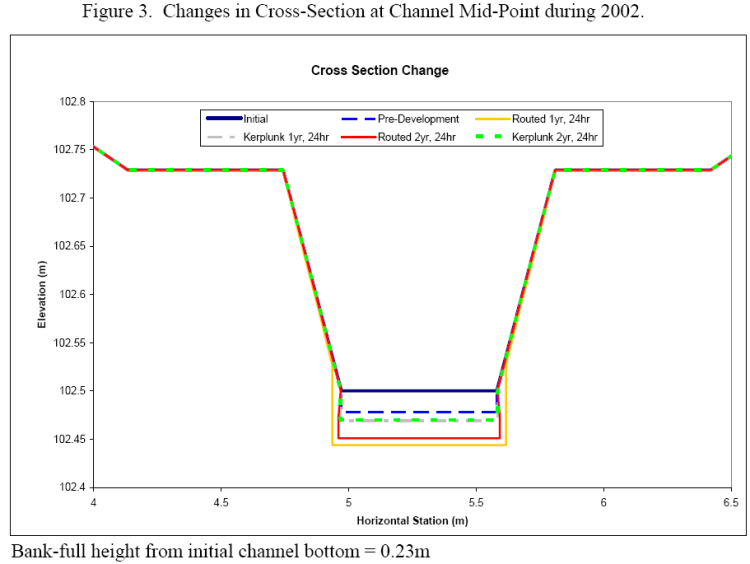
Changes in cross section during 2002.png
(
file
)
63 KB
1
16:16, 10 January 2013
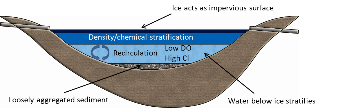
Character of water under ice.png
(
file
)
242 KB
1
17:40, 1 December 2017
Checker board.PNG
(
file
)
829 KB
1
15:54, 16 May 2016
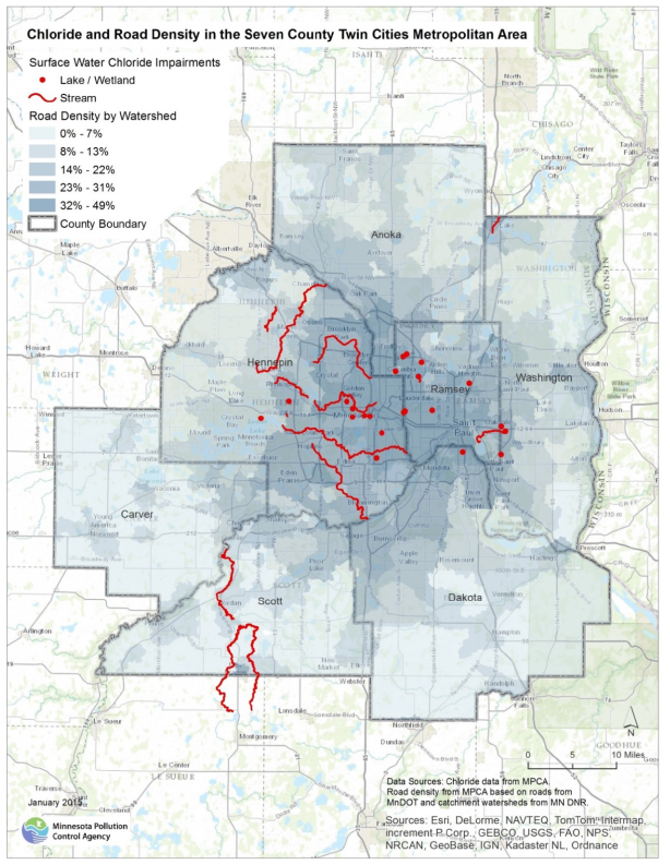
Chloride Impairments and Road Density in the TCMA.PNG
(
file
)
989 KB
2
16:27, 15 March 2016
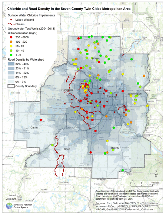
Chloride and Road Density in the TCMA.PNG
(
file
)
714 KB
1
15:04, 25 June 2015
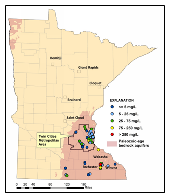
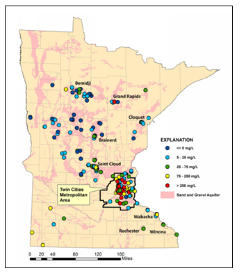
Chloride concentration in the ambient groundwater from select Paleozoic-age bedrock aquifers in Minnesota, 2007-2011.PNG
(
file
)
88 KB
1
15:47, 15 March 2016
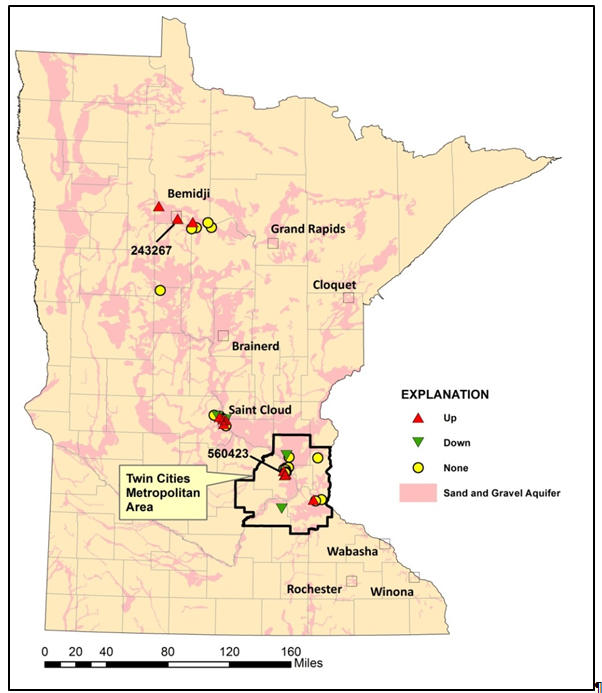
Chloride concentration trends in Minnesota’s ambient groundwater.PNG
(
file
)
397 KB
1
19:34, 14 March 2016
Chloride concentrations in ambient groundwater from the sand and gravel aquifers.PNG
(
file
)
374 KB
1
15:04, 25 June 2015
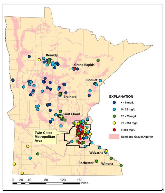
Chloride concentrations in the ambient groundwater from the sand and gravel aquifers, 2007 – 2011.PNG
(
file
)
121 KB
1
16:24, 15 March 2016
Chloride in Surface and Ground Water in the TCMA.PNG
(
file
)
614 KB
1
15:00, 18 August 2016
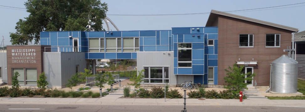
Cistern located at Mississippi Watershed Management Organization 1.jpg
(
file
)
67 KB
1
15:00, 18 August 2016
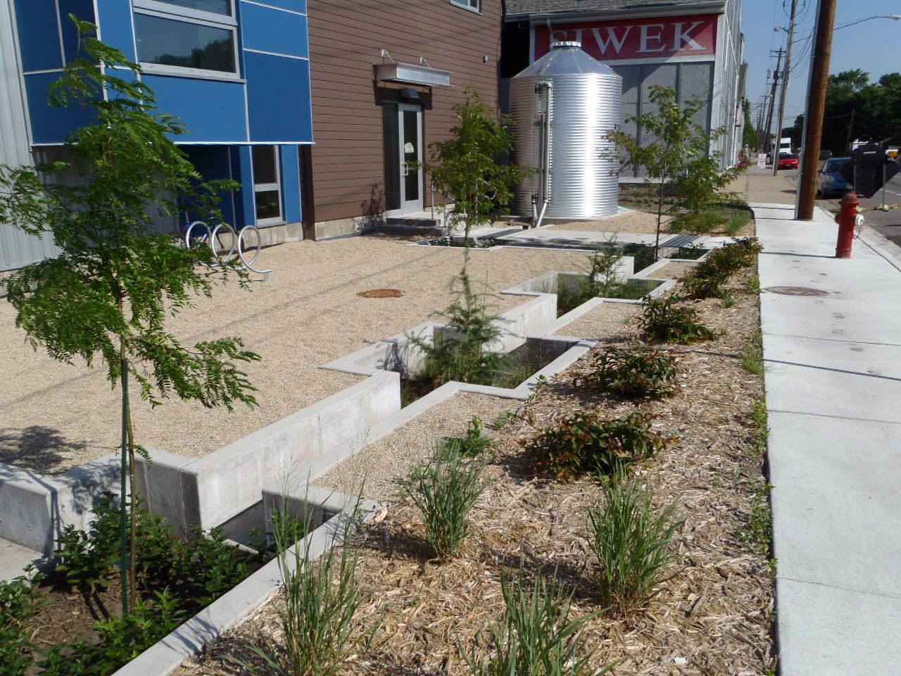
Cistern located at Mississippi Watershed Management Organization 2.jpg
(
file
)
290 KB
1
21:37, 31 October 2016
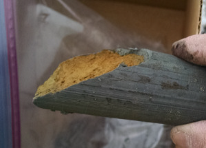
Close-up photo of hydromulch application.jpg
(
file
)
202 KB
1
20:06, 21 June 2016
Color.png
(
file
)
150 KB
1
20:12, 19 January 2017
Compactable containers.PNG
(
file
)
704 KB
1
16:47, 14 March 2016
Comparison of Impaired Lakes and Wetlands in the TCMA.PNG
(
file
)
61 KB
1
16:04, 16 May 2016
Comparison of Impaired Lakes and Wetlands in the TCMA from 2003-2013.PNG
(
file
)
48 KB
1
18:52, 14 March 2016
Comparison of Impaired Streams in the TCMA.PNG
(
file
)
56 KB
1
16:23, 16 May 2016
Comparison of Impaired Streams in the TCMA 2003-2013.PNG
(
file
)
45 KB
1
18:43, 2 July 2015
Completed MWMO backyard on Mississippi River.PNG
(
file
)
404 KB
1
14:40, 14 March 2017
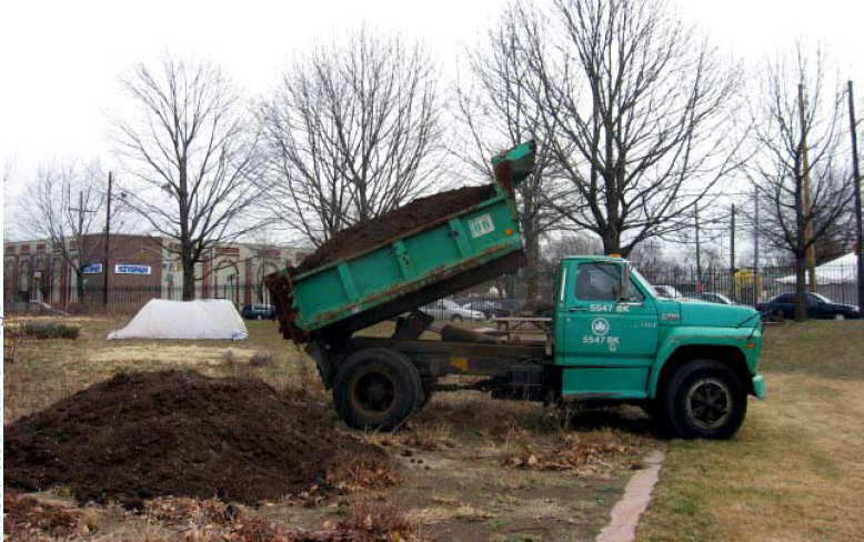
Compost delivery to a project site.PNG
(
file
)
905 KB
1
16:50, 24 January 2013
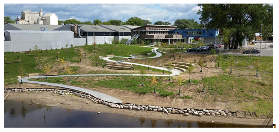
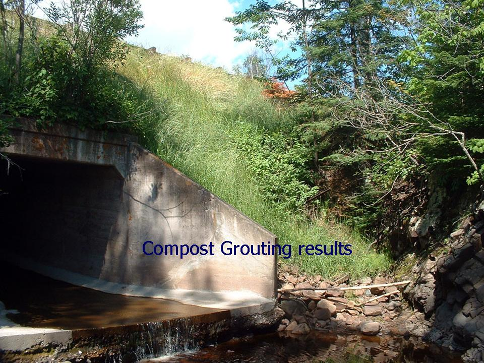
Compost grouting highway 61 after.png
(
file
)
1.78 MB
1
16:51, 24 January 2013
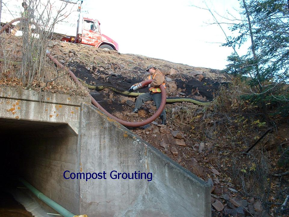
Compost grouting highway 61 before.png
(
file
)
1.56 MB
1
16:38, 1 February 2016
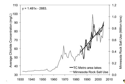
Concentration of lake chloride inTC lakes and rock salt purchases by MN.PNG
(
file
)
34 KB
1
19:38, 14 March 2016
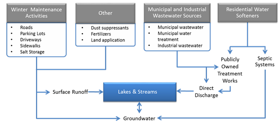
Conceptual model of anthropogenic sources of chloride and pathways.PNG
(
file
)
41 KB
1
19:01, 5 February 2013
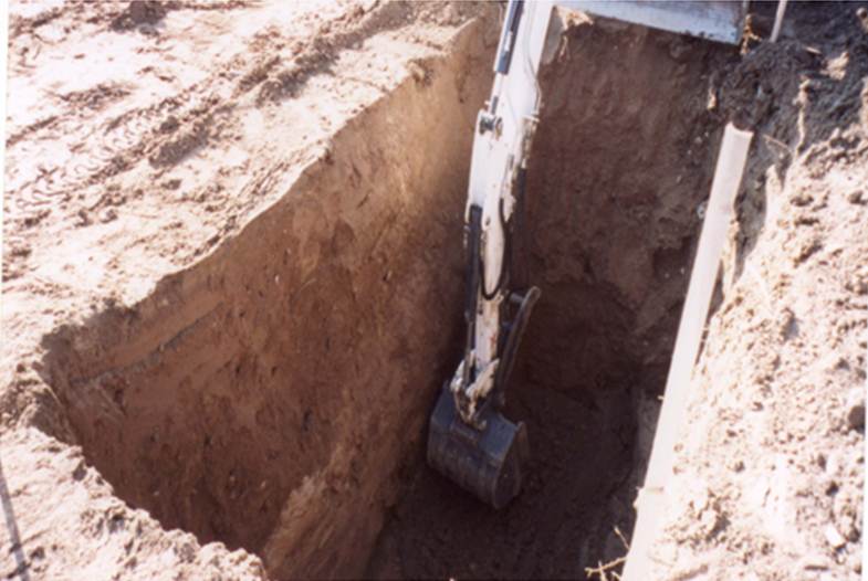
Construction of infiltration trench 1.jpg
(
file
)
55 KB
1
19:01, 5 February 2013
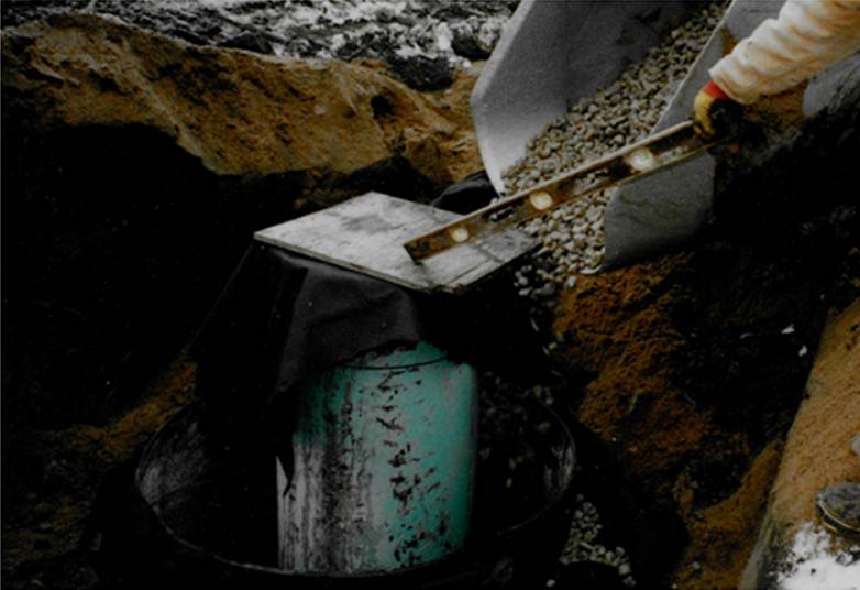
Construction of infiltration trench 2.jpg
(
file
)
46 KB
1
First page
Previous page
Next page
Last page
Search:
Search
Privacy policy


