Planning, scheduling, and sequencing for construction
Soil erosion and sediment runoff to waterways are significant problems in Minnesota. According to the Minnesota Pollution Control Agency (MPCA 2016), approximately 30 percent of the state’s rivers and streams are impaired by sediment. Poorly managed construction sites can be substantial sediment sources to these surface waters. Up to 100 tons of sediment per acre can be lost annually from unmanaged construction sites (EPA 1999). Regulations administered by the State of Minnesota through the construction stormwater permit program (MPCA 2013) seek to address these impacts by requiring
- carefully crafted sediment and erosion control plans designed to reduce polluted runoff;
- implementation and updating of the plan;
- operation and maintenance of runoff reduction measures until the site is stabilized; and
- significant penalties for negligence and willful violations.
This section provides general information on the process by which sediment is eroded from the land surface from rainfall events and the basic principles of erosion prevention and sediment control. Understanding this basic information and applying these principles in the field will reduce negative environmental impacts associated with erosion and sediment loss and help ensure compliance with Minnesota requirements and avoidance of violations and fines.
Contents
Construction site stormwater program compliance timeline
The progression of activities at a construction site is as follows.
- Evaluate and assess the construction site
- Collect site information (size, slopes, soils, drainage patterns)
- Identify sensitive areas – waters, vegetation, slopes, etc.
- Produce map or drawing of the existing site
- Create the final project design map or drawing
- Characterize the sequence of major construction activities
- Calculate area, infiltration, runoff, and drainage system sizing
- Select site-specific erosion, sediment, and housekeeping controls
- Review local and state permit requirements
- Identify erosion prevention field practices and site locations
- Select sediment control practices and field locations
- Determine housekeeping and pollution prevention practices
- Indicate location of best management practices (BMPs)
- Prepare a plan for inspecting and maintaining BMPs
- Complete permitting and notification tasks
- Identify all contractors and subcontractors
- Develop stormwater pollution prevention plan (SWPPP)
- Submit Notice of Intent to MPCA
- Apply for and obtain other local/state/federal permits
- Familiarize contractors and others with SWPPP requirements
- Construction and SWPPP implementation
- Install stabilized exit and initial downgradient perimeter controls
- Install and stabilize initial drainage system, traps, and basins
- Proceed with phased clearing and grading work
- Implement phased erosion/sediment BMPs as needed
- Stabilize disturbed areas within 14 days or as required
- Inspect and maintain BMPs, document activities
- Final stabilization and permit termination
- Stabilize all disturbed areas, slopes, and drainage systems
- Remove waste and unused materials
- Remove all temporary BMPs, stabilize BMP locations
- File Notice of Termination and other required notices
See here for more information.
Principles of erosion
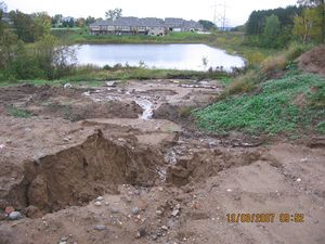
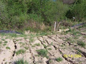
Erosion is the dislodgement and movement of soil and rock by water, wind, or ice. Erosion is a natural process but can be greatly accelerated by human activity, such as clearing and grading of the land surface or disturbance of conveyance channels (Pitt et al. 2007). Erosion begins when particles of soil and rock break away, and continues as that material is transported by natural forces. Erosion caused by water can take many forms. Raindrop or splash erosion often leads to sheet erosion and the formation of small rills or creases in the landscape, which can enlarge into gullies if not addressed. Flowing water and the action of waves and ice along the unprotected edge of rivers, streams, and lakes can also cause channel or bank erosion.
Major factors affecting soil erosion from precipitation events include soil characteristics, climate, rainfall intensity and duration, topography, vegetation or other surface cover, and conservation management practices. These factors can be quantified and used to predict erosion rates. Over the past few decades, they have been incorporated into the Revised Universal Soil Loss Equation (RUSLE), which is used worldwide to evaluate, predict, and address erosion challenges on farms, mines, and construction sites (USDA 2012). Understanding RUSLE provides a basis for selecting erosion prevention measures related to surface disturbance.
RUSLE calculates average annual soil loss in tons/acre/year using the equation
A = R * K *LS *C *P
where,
- A = average annual soil loss, in tons/acre/year
- R = rainfall-runoff erosivity factor
- K = soil erodibility factor
- L = length of the slope factor
- S = steepness of the slope factor
- C = cover management factor
- P = erosion control practice factor
A is expressed in the units selected for K and for the period selected for R (in common practice these are usually selected such that they compute A, soil loss, in U.S. tons per acre per year).
RUSLE factors are observable in the field and fairly simple to derive. The R and K variables are generally out of the hands of the construction site operator. Slope (S) and slope length (L) can sometimes be managed or impacted during the design phase of project development. Two RUSLE variables which can be controlled at active construction sites – the cover and practices factors (i.e., variables C and P) – are the focus of the erosion prevention measures. Erosion prevention practices, which mostly include soil preparation, vegetation, and the application of a mulch, blanket, mat, or other cover on bare soil, are the easiest, cheapest, and most effective approach for addressing runoff from construction sites. Sediment control – settling soil particles from temporarily ponded runoff water or filtering it using silt fencing or other materials – is more difficult, more expensive, and requires much more maintenance. The following tables provide additional information on how higher C factors in RUSLE, and lower P factors, are linked to increased erosion potential.
Examples of RUSLE cover management factors for construction sites. Source: Northwest California Resource Conservation and Development District 2016.
Link to this table
| Vegetative cover | C factor | Percent reduction of soil loss |
|---|---|---|
| None (fallow ground) | 1.0 | 0 |
| Native vegetation (undisturbed) | 0.01 | 99 |
| Temporary ryegrass, 90% (perennial) | 0.05 | 95 |
| Temporary ryegrass, 90% (annuals) | 0.1 | 90 |
| Permanent seedlings (90%) | 0.01 | 99 |
| Sod (laid immediately) | 0.01 | 99 |
| Mulching (for slopes 2:1 or less) | C factor | Percent reduction of soil loss |
| Hay (0.5 tons/acre) | 0.25 | 75 |
| Hay (1.0 tons/acre) | 0.13 | 87 |
| Hay (1.5 tons/acre) | 0.07 | 93 |
| Hay (2.0 tons/acre) | 0.02 | 98 |
| Wood chips (6 tons/acre) | 0.06 | 94 |
| Wood cellulose (1.75 tons/acre) | 0.10 | 90 |
| Other | C factor | Percent reduction of soil loss |
| Competent gravel layer | 0.05 | 95 |
| Rolled erosion control fabrics | for slopes > 2:1; variable C by type | |
Examples of RUSLE practice management factors for construction sites. Source: NYDEC, 2005.
Link to this table
| Surface condition | P factor | |
|---|---|---|
| Bare soil loose | 1.0 | |
| Freshly disked or rough irregular surface | 0.9 | |
| Compact smooth by equipment up and down hill | 1.3 | |
| Compact smooth by equipment across slope | 1.2 | |
| Contoured furrows | ||
| Slope (%) | Maximum downslope length (ft) | P factor |
| 1-2 | 350 | 0.6 |
| 3-5 | 250 | 0.5 |
| 6-8 | 200 | 0.5 |
| 9-12 | 125 | 0.6 |
| 13-16 | 75 | 0.7 |
| 17-20 | 60 | 0.8 |
| >20 | 50 | 0.8 |
Management practices at construction sites can be characterized as those intended to prevent erosion and those that control sediment loss from sheet runoff and concentrated flow discharges. Erosion prevention practices are generally those included in the “C and P” RUSLE factors, and also include planning approaches that can affect overall sediment losses from the site (see below). Sediment controls can be grouped as those that promote settling of soil particles or those that physically trap particles through filtration. Erosion prevention practices are preferred and are typically less expensive to implement compared to sediment control practices.
As noted above, planning and site management can also influence erosion and sediment transport on construction sites. Site-level prevention actions that can be implemented or controlled by the construction site operator include the following.
- Planning approaches that minimize the size of the bare soil area and the length of time disturbed areas are exposed to the elements, especially for long, steep slopes and easily erodible soils.
- Diverting or otherwise controlling the location and volume of run-on flows to the site from adjacent areas.
- Keeping concentrated flows in ditches stabilized with vegetation, rock, or other material.
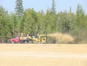
- Covering bare soil with vegetation, mulch, erosion control blankets, turf reinforcement mats, gravel, rock, plastic sheeting, soil binder chemicals, etc.
Site planning and erosion prevention measures are coupled with sediment control practices to prevent sediment laden discharges from construction sites. Sediment control practices focus on
- physical filtration of sediment by trapping soil particles as water passes through a silt fence, drop inlet screen, fiber roll, etc.; and
- settling processes, that allow sediment to fall out of flows that are slowed and temporarily impounded in ponds, traps, or in small pools created by berms, silt fencing, inlet protection dikes, check dams, etc.
Site cover greatly influences erosion processes. Relative to a disturbed site with no surface cover practice, sediment loss is reduced by 90 percent or more for the most commonly used soil covers, with the highest ratings associated with native undisturbed vegetation, a 90 percent cover of grass or sod, and hay mulch applied at the rate of two tons per acre. See the above tables for effect of different cover or management practices 1 and 2.
When developing a site’s erosion and sediment control plan, it is important to remember that large bare areas exposed to run-on and the elements will erode the most over time, especially where 1) rainfall is heavy, 2) soils are highly erodible, 3) slopes are long, and 4) slopes are steep. While construction managers typically have little control over these four factors, they are key inputs into decisions regarding what types of erosion prevention measures (which directly address cover management and erosion control practice factors) to employ. Other factors that influence the selection of erosion prevention are the proximity and type of nearby surface waters (rivers, lakes, streams, and wetlands), seasonal factors (rainy, freezing, etc.), the type of construction project (e.g., roadways, residential, commercial), and the construction setting (urban, suburban, rural, industrial).
When identified, assessed, and considered in an integrated manner, the factors listed above comprise a risk profile for your construction site. Crafting an erosion, sediment, and housekeeping plan that identifies and addresses risks represented by these factors through a carefully selected system of management practices will ensure minimal impacts to Minnesota’s waters and compliance with construction stormwater regulations.
Construction site best management practices for erosion prevention and sediment control
The preceding sections summarized key elements of erosion prevention and sediment control, the two primary types of activities that control sediment loss from construction sites. Each activity type can be characterized by a group of implementation measures or best management practices (BMPs). These BMPs are typically assembled into a system of erosion and sediment controls that are selected, sized, sited, installed, and maintained to address the specific risks posed by each drainage area on the site. Small sites with only one drainage pattern – such as a residential lot or small commercial site – will have a simple system, composed of just a few BMPs. Large sites with multiple discrete drainage areas will require assemblages of BMPs configured to handle the various erosion and sediment transport conditions associated with each. Similarly, if the site has highly erodible soils, long and steep slopes, and adjacent surface waters (i.e., a higher risk profile) the BMP mix will likely be even more complex. In developing an erosion and sediment control plan, it is helpful to think about the site from top to bottom, considering the following:
- the type of BMPs needed at the upslope perimeter, to control run-on to the site
- the erosion prevention measures required for disturbed soils
- the sediment controls for the downslope perimeter and drainage system, including protection of water bodies and other sensitive areas
Construction site BMPs and their function and control mechanisms
Link to this table
| BMP function | BMP types | Erosion prevention (EP) or sediment control (SC) mechanism |
|---|---|---|
| Planning | Planning, sequencing, and scheduling | Minimize bare area and exposure period (EP) |
| Preservation and protection designation | ||
| Land clearing planning and staging | ||
| Land grading planning and staging | ||
| Lot benching | Lengthen flow path and reduce velocity of runoff (EP) | |
| Borrow and stockpile area protection | Prevent soil detachment and transport (EP) | |
| Construction road stabilization | ||
| Trackout prevention | ||
| Temporary stream crossings | Protect stabilized channel from erosion (EP) | |
| Permanent stream crossings | ||
| Drainage management | Temporary run-on diversions | Protect bare areas from run-on flows (EP) |
| Temporary right-of-way diversions | ||
| Right-of-way diversions (water bars) | ||
| Temporary stream diversions | Redirect flow away from work areas (EP) | |
| Cofferdams and barriers | ||
| Ditch and channel protection | Protect channel from erosive flows (EP) | |
| Check dams | Prevent downcutting, settle sediment (EP, SC) | |
| Temporary slope drains | Protect slope from erosive flows (EP) | |
| Temporary outlet controls | Protect outlet area from scour erosion (EP) | |
| Sediment ponds | Slow flows and settle out sediment (SC) | |
| Sediment traps | ||
| Dewatering discharge management | Filter and settle out sediment particles (SC) | |
| Soil stabilization | Surface roughening | Increase infiltration, prevent soil transport (EP) |
| Soil binders | Prevent soil detachment and transport (EP) | |
| Topsoil application | Increase infiltration, support vegetation (EP) | |
| Soil fertility amendments | Promote vegetative growth (EP) | |
| Temporary seeding and stabilization | Prevent soil detachment and transport (EP) | |
| Permanent seeding | ||
| Mulches | ||
| Landscape mulches | ||
| Hydraulic mulches and tackifiers | ||
| Erosion control blankets | ||
| Turf reinforcement mats | ||
| Sodding | ||
| Slope protection | ||
| Sediment trapping | Sediment fences | Filter and settle out sediment particles (SC) |
| Fiber rolls/wattles/logs | ||
| Storm drain inlet protection | ||
| Flotation sediment curtains | ||
| Dust control | Prevent soil detachment and transport (EP) | |
| Sand and wind fences | Filter and settle out dust particles (SC) |
Construction site erosion and sediment control BMPs vary in nature and application but operate according to a few basic principles. Preventing soil detachment and transport is achieved by controlling the way rainwater, snowmelt, and concentrated flows interact with soil and move across the landscape. Soil detachment and transport is affected by a host of factors related to BMP selection, siting, sizing, design, installation, and maintenance, including the following:
- promptness in stabilizing ditches, ponds, traps, and disturbed areas after grading is complete;
- type and rate of coverage (e.g., grass, mulch, soil binders) on bare soil areas;
- proper choice of rolled erosion control products – temporary blankets vs. permanent turf mats;
- installation pattern, trenching practice, and staking/anchoring plan for blankets and mats;
- location, dimensions, and outlet configuration for sediment ponds and traps;
- silt fence placement, configuration (e.g., ends turned upslope), overall sturdiness; and
- trackout prevention pad length, width, and ability to remove mud from exiting vehicle tires
The figure to the right presents common construction site erosion and sediment transport risks conceptually and can be used to characterize the general risk profile of a site.
Selecting particular BMPs, adjusting them to specific site conditions, and arranging them into a system for preventing erosion and controlling sediment mobilized by site runoff is not a static process. Typically, the BMPs installed prior to initial clearing (e.g., upslope diversion ditch/berm, stabilized exit, downslope silt fence, sediment trap/pond) are adjusted as grading commences and supplemented by other needed practices. These practices may include ditch stabilization measures like blankets or mats, seeding and mulching of areas where grading is complete, storm drain inlet protection, and so on. Effective site management requires a continuous program of adaptive responses to changing conditions, including
- installing BMPs,
- monitoring their effectiveness,
- adjusting and augmenting them with other practices, and
- staying ahead of operation and maintenance issues
Considerations for construction scheduling
Link to this table
| Construction activity | Schedule consideration |
|---|---|
| Identify and label protection areas (e.g. buffer zones, filter strips, trees). | Site delineation should be completed before construction begins. |
| Construction access. Construction entrance, construction routes, equipment parking areas and cutting of vegetation (necessary perimeter controls). | First land-disturbing activity - Establish protected areas and designated resources for protection. Stabilize bare areas immediately with gravel and temporary vegetation as construction takes place. |
| Sediment traps and barriers. Basin traps, sediment fences, and outlet protection (necessary perimeter controls). | install principal basins after construction site is accessed. Install additional traps and barriers as needed during grading. |
| Runoff control. Diversions, silt fence, perimeter dikes, water bars, and outlet protection. | Install key practices after principal sediment traps and before land grading. install additional runoff control measures during grading. |
| Runoff conveyance system. Stabilize stream banks, storm drains, channels, inlet and outlet protection, and slope drains. | Where necessary, stabilize stream banks as early as possible. Install principal runoff conveyance system with runoff-control measures. install remainder of system after grading. |
| Grubbing and grading. Site preparation: cutting, filling and grading, sediment traps, barriers, diversions, drains, surface roughening. | Begin major grubbing and grading after principal sediment and key runoff control measures are installed. clear borrow and disposal areas only as needed. Install additional control measures as grading progresses. |
| Surface stabilization: temporary and permanent seeding, mulching, sodding, and installing riprap. | Apply temporary or permanent stabilization measures immediately on all disturbed areas where work is delayed or complete. |
| Building construction: buildings, utilities, paving. | install necessary erosion and sedimentation control practices as work takes place. |
| Landscaping and final stabilization: topsoiling, planting trees and shrubs, permanent seeding, mulching, sodding, installing riprap. | Last construction phase - stabilize all open areas, including borrow and spoil areas. Remove and stabilize all temporary control measures. |
| Maintenance. | Maintenance inspections should be performed weekly, and maintenance repairs should be made immediately after periods of rainfall. |
The following table provides general examples of BMPs appropriate for various site risk conditions. The BMPs are categorized as planning, drainage management, soil stabilization, and sediment trapping BMPs. This information can be used as a starting point for planning erosion prevention and sediment control, and to consider supplemental approaches as work progresses.
Examples of BMP selection options for various construction site risk conditions
Link to this table
| Functional activity | BMPs for lower risks | BMPs for moderate risks | BMPs for higher risks |
|---|---|---|---|
| Planning | One-step clearing, grading, and stabilization | Two-phase clearing and grading, and stabilization | Multiple phases for clearing, grading, road and utility installation, building construction, etc. |
| No mark-offs for critical areas needed | Infiltrative soils (i.e., for septic drainfields, rain gardens) marked off limits to traffic | Infiltrative soils, tree preservation area(s), stream buffers marked off | |
| One stabilized site exit, comprised of rock pad | Length and width of rock pad extended to deal with exit traffic and mud conditions | Shaker rack or wheel washer used to ensure minimization of trackout | |
| No crossings needed, or use of existing stabilized bridge or channel crossing | Installation of temporary culvert or other stabilized stream crossing | Installation of permanent stream crossing, e.g., moving up installation of planned bridge, etc. | |
| Drainage management | No upland flows to divert from active construction area | Diversion ditch or berm installed upslope to keep run-on off the site | Upslope run-on diversions installed; installation of stabilized channel to carry upland flows through site |
| Sheet flow only; no concentrated flows | Small, flat ditches double-seeded and lined with straw erosion control blanket | Larger, steeper ditches triple-seeded and lined with turf reinforcement mat | |
| No sediment trap or pond needed; sediment barrier suffices | One or more sediment traps needed to remove soil from site runoff flows | Multiple sediment traps and sediment ponds needed; use of flocculants to help remove very small particles | |
| Soil stabilization | No need for interim soil stabilization with one-step clearing / grading approach | All site areas are seeded after grading except for building pad and immediate area used for materials | Phased stabilization as project progresses; soil binders / blown straw used on bare areas idle > 14 days |
| Grass seed and blown straw mulch or hydroseeding used to stabilize site | Erosion control blanket installed over grass seed, with heavier seeding rate on slopes | Same as previous, with native mix and turf reinforcement mat or sod installed on steepest slopes | |
| Sediment traps | Fiber rolls / logs or Type C silt fence used for downslope perimeter control | Type B or Type C silt fence used for downslope perimeter control | Heavy duty silt fence used at multiple intervals on long slopes |
| Rock bags or other simple dike used for storm drain inlets | Filter fabric insert used for storm drain inlet protection | Catch basin insert used for maximum removal of sediment and other pollutants | |
| Dust control not necessary due to short duration of project | Dust control addressed via water truck as needed | Polymers or other soil binders applied on construction roads as needed for dust control |
Regulation of sediment runoff from construction sites
Operators of construction sites in Minnesota with a disturbed area of one acre or more, including smaller sites that are part of a common plan of development, are required to seek coverage under a general or individual NPDES State Disposal System permit. Most projects qualify for coverage under the General Permit, which was last issued on August 1, 2013. Permit holders are required to develop a stormwater pollution prevention plan (SWPPP) and submit a completed application and fee prior to commencing construction activities. For a copy of the permit and specific requirements, link here.
Costs associated with regulatory compliance
The costs associated with regulatory compliance vary widely in relationship to the type and size of the project, how it’s managed, location, site conditions (e.g., soils, slopes), drainage features, presence or absence of surface waters, materials used, and other factors. For example, erosion and sediment control costs for a quarter-acre urban house lot may range from $2,000 to $5,000. For large projects, construction stormwater costs can range up to five percent of the overall project cost.
Careful planning – especially breaking the project into logical phases for clearing, grading, and stabilization – can reduce compliance costs significantly. This is because all areas of the project will eventually be stabilized, with grass, landscaping, pavement, etc. Installing the final cover as portions of the project are completed – rather than at the end of the job – does not necessarily add significant costs. Likewise, installing and maintaining silt fencing, sediment basins, traps, inlet protection devices, and other BMPs on large, unstabilized, and relatively idle portions of the site represents an ongoing expense – as well as a regulatory liability. The following table summarizes the relative cost and effectiveness of several categories of construction site BMPs.
Relative cost and effectiveness for common construction BMPs. Source: Kentucky Division of Water.
Link to this table
| Practice | Cost | Effectiveness |
|---|---|---|
| Limiting disturbed areas through phasing | Low | High |
| Protected disturbed areas through mulching and revegetation | Low to moderate | Moderate to high |
| Installing diversion around disturbed areas | Moderate | Moderate |
| Sediment removal through detention of all site drainage | Moderate to high | Low to moderate |
| Other structural controls to treat sediment-laden flow | High | Low |
References
- EPA (U.S. Environmental Protection Agency). 1999. National Pollutant Discharge Elimination System—Regulations for Revision of the Water Pollution Control Program Addressing Storm Water Discharges. Federal Register 64, No. 235. Wednesday, December 8, 1999. Pages 68,722 – 68,851.
- Kentucky Division of Water Best Management Practices (BMPs) for Controlling Erosion, Sediment, and Pollutant Runoff from Construction Sites – Planning and Technical Specifications Manual.
- MPCA (Minnesota Pollution Control Agency). 2013. Authorization to Discharge Stormwater Associated with Construction Activity Under the National Pollutant Discharge Elimination System / State Disposal System Program. Issuance Date: August 1, 2013; Expiration Date: August 1, 2018. Permit Number MN R100001.
- MPCA (Minnesota Pollution Control Agency). 2016. 2016 Integrated Report on Water Quality, General Report to the Congress of the United States Pursuant to Section 305(b) of the 1972 Clean Water Act, Water Years 2014-2015. Saint Paul, MN. 62 pp.
- NYDEC (New York Department of Environmental Conservation). 2005. New York Standards and Specifications for Erosion and Sediment Control.
- Northwest California Resource Conservation and Development Council. 2016. 5C Program Stormwater Management Handbook.
- Pitt, R., S. Clark, and D. Lake. 2007. Construction Site Erosion and Sediment Controls – Planning, Design and Performance. DEStech Publications Inc. ISBN No. 1-932078-38-X. Lancaster, PA.
- USDA (U.S. Department of Agriculture). 2012. Revised Universal Soil Loss Equation, Version 2: Natural Resources Conservation Services, Minnesota State Office.
