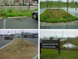
Better site design
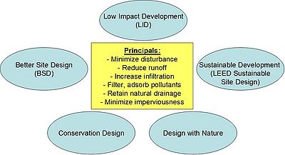
This section of the Manual provides guidance to designers on how to plan and apply better site design practices at new development sites. Better site design includes a series of techniques that reduce impervious cover, conserve natural areas, and use pervious areas to more effectively treat stormwater runoff (Center for Watershed Protection, 1998a) and promote the treatment train approach to runoff management.
Better site design techniques have been promoted in earlier state and regional stormwater manuals (MPCA, 2002 and Metropolitan Council 2001). As always, state and local regulations and design standards should be checked to assure that all requirements have been met.
When applied early in the design and layout process, better site design techniques can sharply reduce stormwater runoff and pollutants generated at a development site, and also reduce the size and cost of both the stormwater conveyance system and stormwater management practices (Center for Watershed Protection, 1998b).
More than a dozen different better site design techniques can be applied early in the design process at development sites. While not all of the better site design techniques will apply to every development site, the goal is to apply as many of them as possible to maximize stormwater reduction benefits.
Preserving natural areas:
- Natural area conservation
- Site reforestation
- Stream and shoreline buffers
- Open space design
Disconnecting and distributing runoff:
- Soil compost amendments
- Disconnection of surface impervious cover
- Rooftop disconnection
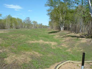
- Grass channels
- Stormwater landscaping
Reducing impervious cover in site design:
- Narrower streets
- Slimmer sidewalks
- Smaller cul-de-sacs
- Shorter driveways
- Smaller parking lots
Contents
- 1 Preserving natural areas
- 2 Disconnecting and distributing stormwater
- 3 Reducing impervious cover
- 4 The benefits of better site design
- 5 Overcoming barriers to Better Site Design
- 5.1 Step 1. Conduct research on local development codes and ordinances
- 5.2 Step 2. Identify stakeholders that will participate in the roundtable process
- 5.3 Step 3. Introduce stakeholders to the roundtable process
- 5.4 Step 4. Conduct the roundtable and facilitate consensus
- 5.5 Step 5. Implement code and ordinances changes
- 6 Specific applications
- 7 Thinking outside of the big box - An Example of Parking Lot Surplus and Retrofit Opportunities
- 8 References
Preserving natural areas
From a stormwater standpoint, it is desirable to maintain as much natural vegetative cover such as forest, prairie or wetland as possible. Natural areas generate the least amount of stormwater runoff and pollutant loads and establish and maintain the desired pre-development hydrology for the site. One of the first steps in the site planning involves identifying, conserving and restoring natural areas present at the development site. The overall strategy is to maximize natural area conservation beyond what is required under local or state resource requirements. Normally, an inventory of natural areas is conducted at the site, along with an assessment of potential areas for reforestation or restoration. Next, designers modify the layout of the development project to take advantage of natural features, preserve the most sensitive areas, and mitigate any stormwater impacts. Open space design is one of the most effective better site design techniques for preserving natural areas at residential sites without losing developable lots.
Natural area conservation
Natural area conservation protects natural resources and environmental features that help maintain the pre-development hydrology of a site by reducing runoff and promoting infiltration. Examples include any undisturbed vegetation preserved at the development site, such as forests, prairies, and riparian zone areas, ridge tops and steep slopes, and stream, wetland and shoreline buffer zones. Designers should also place a particular priority on preserving natural drainage pathways, intermittent and perennial streams, and floodplains and their associated wetlands. Buildings and roads should be located around the natural topography and drainage so as to avoid unnecessary disturbance of vegetation, soils and natural drainage ways. The undisturbed soils and vegetation of natural areas promote infiltration, runoff filtering and direct uptake of pollutants. Forested areas intercept rainfall in their canopy, reducing the amount of rain that reaches the ground. Vegetation also pumps soil water back into the atmosphere which increases storage available in the soil. Native vegetation also prevents erosion by stabilizing soil, filtering sediment and pollutants from runoff, and nutrient uptake. Preserving natural areas creates many economic benefits including decreased heating and cooling costs, higher property values and improved habitat (Cappiella, 2005). Generally a natural grassland area would have to be 5 acres or larger to approach full ecological function, and a forested site would have to be in the range of 20 to 40 acres (DNR written correspondence, 2005). Two resource tools for identifying natural forest or prairie areas include native plant community and biodiversity site polygons from the DNR Data Deli and natural element occurrences from the Natural Heritage Information System. Native plant communities can also be identified using the DNR plant community keys: Minnesota Department of Natural Resources, 2003; Minnesota Department of Natural Resources, 2005; Minnesota Department of Natural Resources, 2006. These guides also provide information on plant species to include in restoration efforts. (See the reference list at the end of this page).
Site reforestation or restoration
Site reforestation involves planting trees on existing turf or barren ground at a development site with the goal of establishing a mature forest canopy that can intercept rainfall, maximize infiltration and increase evapotranspiration. In some parts of the state, prairie is the desired vegetative community, and prairie restoration can provide similar hydrological benefits. Reforestation is accomplished through active replanting or natural regeneration of forest cover. Cappiella (2005) reviewed a range of research that demonstrated the runoff reduction benefits associated with forest cover compared to turf cover. The benefits include reduced annual runoff volumes, higher rates of infiltration, reduced soil erosion, and greater uptake removal of stormwater pollutants. Forest soils actively promote greater infiltration rates due to surface organic matter and macropores created by tree roots. Forests also intercept rainfall in their canopy, reducing the amount of rain that reaches the ground and increasing potential water storage in forest environments.
Stream and shoreline buffers
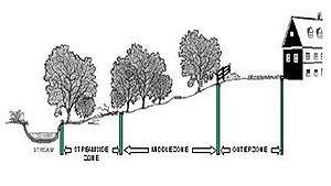
Many communities require buffers at development sites to provide a vegetative setback between development and streams, lakes or wetlands. The portions of a site reserved for buffers can present an excellent opportunity to practice better site design. The primary function of buffers is to physically protect a stream, lake or wetland from future disturbance or encroachment; however, with careful design they can also be used to capture and filter stormwater runoff from upland areas of the site. To optimize stormwater treatment, the outer boundary of the buffer should have a stormwater depression area and a grass filter strip. Runoff captured within the stormwater depression is spread across a grass filter designed for sheet flow conditions, and discharges to a wider forest or shrub buffer in the middle or streamside zones that can fully infiltrate and/or further treat stormflows. Buffers can provide many different environmental and economic benefits, including:
- reduced small drainage problems and complaints;
- reduced risk of flood damage;
- reduced stream bank erosion;
- increased adjacent property values;
- enhanced pollutant removal;
- location for greenways and trails;
- sustained integrity of stream ecosystems and habitat;
- protection of wetlands associated with the stream corridor;
- prevention of disturbance of steep slopes;
- mitigation of stream warming; and
- protection of important stream corridor habitat for wildlife
Open space design
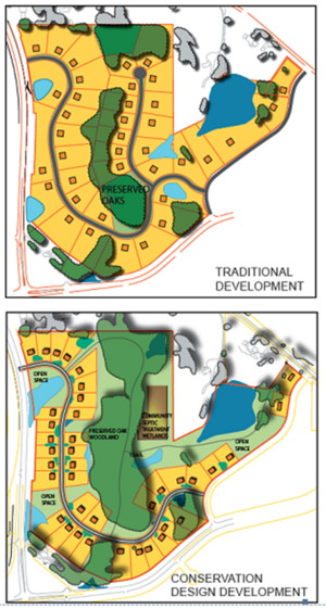
Open space design is a form of residential development that concentrates lots in a compact area of the site to allow for greater conservation of natural areas. Minimum lot sizes, setbacks and frontage distances are relaxed so as to maintain the same number of dwelling units at the site. This form of development may also be called cluster design or conservation design. If open space design is available as an option under local zoning codes, it can be an excellent tool to conserve more natural areas beyond the minimum required under local and state water resource protection ordinances. Open space design can also be used to reduce or disconnect impervious cover and provide for greater on-site stormwater treatment. The natural areas conserved are protected by easement and managed by a community or homeowners association.
Research has shown that open space designs can reduce overall site impervious cover compared to conventional subdivisions, and command higher prices and more rapid sales, as well (Zielinski, 2001). Other benefits include lower costs for grading, erosion control, stormwater and site infrastructure, as well as greater land conservation without the loss of developable lots.
Disconnecting and distributing stormwater
A better site design strategy seeks to maximize the use of pervious areas at the site to help filter and infiltrate runoff generated from impervious areas and to spread excess runoff from these surfaces over pervious areas. Most development sites have extensive areas of grass or landscaping where runoff can be treated close to the source where it is generated. Designers should carefully look at the site for pervious areas that might be used to disconnect or distribute runoff.
Compost and amended soils
Compost amended soils are used to recover soil porosity lost due to compaction as a result of past construction, soil disturbance and ongoing human traffic. The amendment process seeks to recover the porosity and bulk density of soils by incorporating soil amendments or conditioners into the lawn, such as compost, top soil, lime and gypsum (McDonald, 1999).
Soils can also be amended through the addition of fibers for structural support to prevent compaction, as well as the simple addition of sand to improve permeability or organic material other than compost (e.g. peat).
Soils are the foundation for successful planting, and the water holding capacity of soils can significantly reduce the volume of runoff from a site. What constitutes a “good” soil depends on the purpose it is to serve. For example, if you are planting prairie plants a high organic content in the soil is required. However, if you are planting Kentucky bluegrass a lower organic content soil can be used.
In addition to successful plant growth, soils can be engineered to improve water holding capacity. The humus materials or compost created from the compost process has a water holding capacity of up to 80 percent by weight. This quality is very significant when trying to decrease runoff and increase filtration. On-site soils can be amended by incorporating compost into the soils or by laying a 1 to 3 inch “blanket” of compost on top of the soils. Fiber amendments can assist in maintaining soil structure even with heavy surface loads. The method chosen depends on site characteristics and the purpose it is intended to serve, such as promoting infiltration or reducing nutrient and sediment loading to surface waters.
Disconnection of surface impervious cover
Surface disconnection spreads runoff from small parking lots, courtyards, driveways and sidewalks into adjacent pervious areas where it is filtered or infiltrated into the soil. Designers look for areas of the site where flow can be diverted into turf, lawns or a vegetated filter strip. When many small areas of impervious cover are disconnected from the storm drain system, the total volume and rate of stormwater runoff can be sharply reduced. Disconnections may be restricted based on the length, slope, and soil infiltration rate of the pervious area in order to prevent any reconnection of runoff with the storm drain system. In some cases, minor grading of the site may be needed to promote overland flow and vegetative filtering.
Rooftop disconnection
Disconnection of rooftops offers an excellent opportunity to spread runoff over lawns and other pervious areas where it can be filtered and infiltrated. Downspout disconnection can infiltrate runoff, reduce runoff velocity, and remove pollutants. Alternately, downspouts can be directed to a dry well, rain garden or surface depression. The stormwater benefits associated with rooftop disconnection can be significant, particularly when residential lot size is large and soils are relatively permeable. Note that building sub-drains generally intercept water from entering a building and do not lend themselves to the impervious disconnection category.
Grass channels
Curbs, gutters and storm drains are all designed to be hydraulically efficient in removing stormwater from a site. However, they also increase peak runoff discharge, flow velocity, and pollutant delivery to downstream waters. From a better site design perspective, grass channels are preferable to curb and gutters as a conveyance system, where development density, topography, soils and slopes permit their use. Grass channels provide on-site runoff storage, lower peak flows, reduce runoff velocities, and filter or infiltrate some portion of storm flows. While research has indicated that grass channels cannot remove pollutants reliably enough to qualify as a BMP (Winer, 2000), they have been shown to reduce runoff volumes during smaller storms when compared to curbs and gutters.
Stormwater landscaping
Traditionally, landscaping and stormwater management have been treated separately in site planning. In recent years, engineers and landscape architects have discovered that integrating stormwater into landscaping features can improve the function and quality of both. The basic concept is to adjust the planting area to accept stormwater runoff from adjacent impervious areas and utilize plant species adapted to the modified runoff regime. Excellent guidance on how to match plant species to stormwater conditions can be found in the MPCA publication Plants for Stormwater Design: Species Selection for the Upper Midwest (Shaw and Schmidt, 2003) and in Cappiella et al. (2005).
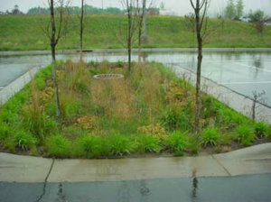
A landscaping area may provide full or partial stormwater treatment, depending on site conditions. An excellent example of the use of landscaping for full stormwater treatment is bioretention. In other cases, landscaping can provide supplemental treatment such as green rooftops and stormwater planters. Even small areas of impervious cover should be directed into landscaping areas since stormwater or melt water help to reduce irrigation needs.
Reducing impervious cover
The strategy of reducing impervious cover relies on several techniques to reduce the total area of rooftops, parking lots, streets, sidewalks and other types of impervious cover created at a development site. The basic approach is to reduce each type of impervious cover by downsizing the required minimum geometry specified in current local codes, keeping in mind that there are minimum requirements that must be met for fire, snowplow and school bus operation. Less impervious cover directly translates into less stormwater runoff and pollutant loads generated at the site. In most communities, local codes must be changed to allow the use of this group of better site design techniques.
Narrower streets
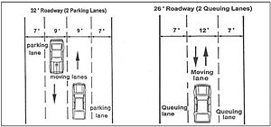
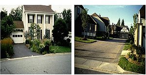
Many communities require residential streets that are much wider than needed to support travel lanes, on-street parking, and emergency access. Some communities currently require residential streets as wide as 32 to 40 feet and which provide two parking lanes and two moving lanes. Local experience has shown that residential streets can have pavement widths as narrow as 22 to 26 feet, and still accommodate all access and parking needs (ITE, 1997). Even narrower access streets or shared driveways can be used when only a handful of homes are served. Narrower streets help reduce impervious cover and associated runoff and pollutant generation. Significant cost savings occur in both road construction and maintenance. Narrower streets also help reduce traffic speeds in residential neighborhoods which, in turn, improve pedestrian safety. Snow stockpiles on narrow streets can be accommodated if parking is restricted to one side of the street or alternated between the sides. Alternatively, the right-of-way may be used for snow storage. Narrow snowplows are available. Snowplows with 8 foot width, mounted on a pick-up truck are common.
Slimmer sidewalks
Many communities require sidewalks that are excessively wide or are located adjacent to the street where the pedestrians are at risk from vehicles. A better site design technique modifies the width and location of sidewalks to promote safer pedestrian mobility. Impervious cover is reduced when sidewalks are required on only one side of the street, reduced in width and are located away from the street. Sidewalks can also be disconnected so they drain to lawns or landscaping instead of the gutter and storm drain system. Slimmer sidewalks reduce and/or disconnect impervious cover, and thus reduce the generation of runoff. Other benefits include greater pedestrian safety, lower construction and maintenance costs, and reduced individual homeowner responsibility for snow clearance.
Smaller cul-de-sacs
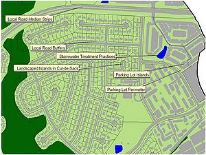
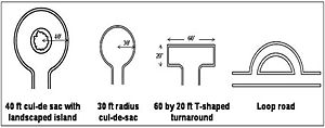
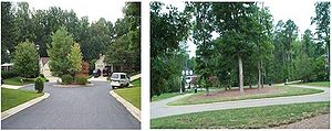
The large cul-de-sacs that enable vehicles to turn around at the end of a residential street provide a great opportunity for better site design. Impervious cover can be reduced by minimizing the diameter of residential street cul-de-sacs and incorporating landscaped areas into them. Many communities require cul-de-sacs that have a greater diameter than needed to allow emergency and large vehicles to adequately turn around. Alternatives to the traditional 80 foot diameter cul-de-sac include 60 foot diameter cul-de-sacs, hammerhead turnarounds and loop roads. In addition, the inside of the turnaround can be landscaped as a bioretention area to further reduce impervious cover and improve stormwater treatment. Trees and vegetation planted in landscaped islands can be used to intercept rain water and treat stormwater runoff from surrounding pavement. Each of these alternative turnaround options produces a more attractive and safe environment for residents.
Shorter driveways
Driveways present another opportunity to practice better site design. Most local codes contain front yard setback requirements that dictate driveway length. In many communities, front yard setbacks for certain residential zoning categories may extend 50 or 100 feet or even longer, which increases driveway length well beyond what is needed for adequate parking and access to the garage. Shorter setbacks reduce the length and impervious cover for individual driveways. In addition, driveway width can be reduced, and more permeable driveway surfaces allowed. Another way to reduce impervious cover is to allow shared driveways that provide street access for up to 6 homes. Shorter driveways help reduce infrastructure costs for developers since they reduce the amount of paving or concrete needed.
Smaller parking lots
The parking lot is an excellent place to apply better site design. In many communities, parking lots are over-sized and under-designed. Local parking and landscaping codes can be modified to allow the following better site design techniques to be applied within parking lots:
- Minimize standard stall dimensions for regular spaces
- Provide compact car spaces
- Use of pervious pavement (asphalt, concrete, blocks, sand amendments)
- Incorporate efficient parking lanes
- Reduce minimum parking demand ratios for certain land use
- Treat the parking demand ratio as a maximum limit
- Create stormwater “islands” in traffic islands or landscaping areas to treat runoff using bioretention, filter strips or other practices
- Encourage shared parking arrangements
Smaller parking lots can sharply reduce impervious cover and provide more effective treatment of stormwater pollutants. In addition, smaller parking lots reduce both up front construction costs and long term operation and maintenance costs, as well as the size and cost of stormwater practices. Parking lot landscaping makes the lot more attractive to customers, and promotes safety for both vehicles and pedestrians. In addition, trees and other landscaping help screen adjacent land uses, shade people and cars, reduce summertime temperatures and improve air quality and bird habitat.
The benefits of better site design
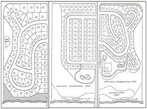
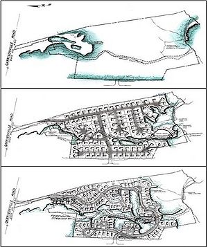
Several researchers have employed redesign comparisons to demonstrate the benefits of better site design over a wide range of residential lot sizes and commercial applications. For example, Center for Watershed Protection (1998b) demonstrated that better site design techniques could reduce impervious cover and stormwater runoff by 7 to 70 percent, depending on site conditions. A redesign analysis for a medium density residential subdivision (shown in the figure to the right) suggested that better site design techniques could reduce impervious cover and annual runoff volume by 24 percent, cut phosphorus loadings by half, and increase site infiltration by 55 percent, compared to a traditional subdivision.
Each better site design technique provides environmental and economic benefits to both the developer and the community at large. When techniques are applied together at a development site, they can result in tangible savings for the developer in the form of
- reduced infrastructure costs (e.g., paving and piping);
- reduced clearing and grading costs during construction;
- smaller and less costly structural stormwater BMPs;
- faster sales and lease rates;
- easier compliance with wetland and other resource protection regulations; and
- more land available for building since fewer structural BMPs are needed
Cost savings really start to add up when many better site design techniques are applied together. Research indicates that infrastructure savings alone can range from 5 to 65 percent, depending on site conditions, lot size and the extent that better site design techniques are applied (Cappiella et al, 2005; Center for Watershed Protection, 1998b; Liptan and Brown, 1996; Dreher and Price, 1994; and Maurer, 1996 see (Better site design#Reference|References]]). Better site design techniques continue to provide benefits to the community long after the developer has sold the lots. Some examples of these benefits include
- reduced operation and maintenance costs for roads and stormwater system;
- nncreased property values for homes and businesses;
- increased open space available for recreation;
- more pedestrian friendly neighborhoods;
- reduced annual cost for mowing;
- more pleasing and attractive landscaping;
- improved air quality (more forest cover); and
- less temperature fluctuation from paved surfaces
Overcoming barriers to Better Site Design
Despite the clear benefits of better site design techniques, it may be difficult to apply some of them in many communities across the state at the present time. The primary reason is that the geometry, location, and design of development projects is largely dictated by local subdivision codes and zoning ordinances. In some cases, these codes discourage or even prohibit better site design techniques. In other cases, development review authorities are hesitant to approve innovative better site design techniques because of fears they may create real or perceived problems. While potential barriers differ in every community, some frequently cited problems are that better site design techniques may
- restrict access for fire trucks and emergency vehicles;
- increase future municipal maintenance costs;
- drive up construction costs;
- make it more difficult to plow snow;
- generate future problems or complaints (e.g. inadequate parking, wet basements, etc.); or
- interfere with existing utilities
These real or perceived local problems must be directly addressed in order to gain widespread adoption of better site design techniques. Communities may also need to carefully reevaluate their local codes and ordinances to overcome barriers to better site design.
An effective method for promoting code change is a local site planning roundtable. Roundtables involve key stakeholders from the local government, development, and environmental communities that influence the development process.
The roundtable approach is but one of many different approaches that can be used for public participation in the development of improved local ordinances. Another example is the development of a good comprehensive plan that involves a local water or watershed component and that includes an inventory of natural amenities and a stormwater management plan. The roundtable discussion is included here as an option that might not be as familiar as the comprehensive planning approach. The roundtable is a consensus process to negotiate new development guidance in the context of local conditions. A site planning roundtable is normally conducted in 5 steps, as shown below.
Step 1. Conduct research on local development codes and ordinances
In the first step in a local roundtable, existing development codes and ordinances are assessed and then compared with the principles of better site design to identify which ones may need changing. Communities may use the codes and ordinances worksheet to facilitate this assessment (Center for Watershed Protection (1998a). The worksheet helps communities systematically compare their existing development rules to the better site design techniques by asking specific questions on how development actually happens in the community. To use the worksheet, communities assemble all of the local, watershed, state, and federal codes and regulations that collectively govern how development occurs in the community, including documents such as
- zoning ordinances;
- subdivision codes;
- street standards and road design manuals;
- building and fire codes;
- septic and sewer regulations;
- environmental regulations;
- stormwater drainage criteria;
- tree protection/landscaping ordinances;
- erosion and sediment control and grading requirements;
- public safety and access requirements; and
- other documents that influence how development occurs
In some cases, information on a particular development rule may not be explicitly articulated in local code or may be hidden in supporting design manuals, review checklists, or as an unwritten review policy. Once current development rules and regulations are identified, the codes and ordinances worksheet can be completed. The worksheet consists of 66 questions that compare local development rules against 22 national better site design benchmarks, as outlined in Center for Watershed Protection (1998a). Each question focuses on a specific site design practice, such as the minimum diameter of cul-de-sacs, the minimum width of streets, or the minimum parking ratio for a certain land use. Points are awarded if local development rules agree with the benchmark for a particular site design practice. In some instances, local codes and ordinances might not explicitly address a particular practice. In these cases, roundtable members should use appropriate judgment based on standard community practices.
Step 2. Identify stakeholders that will participate in the roundtable process
The next step involves assembling the stakeholders that will participate in the roundtable process, which should include representatives from all sectors that influence development in a community. For example, every local agency with development review authority should participate in the roundtable. Elected officials should also be invited since they must ultimately vote to adopt the proposed changes. The development industry including developers, realtors, homebuilders, design engineers and others who will be responsible for implementing better site design techniques, should also be actively involved. Finally, community input from environmental organizations and homeowners associations should be solicited, since they contribute an important perspective on what local residents would like to see in future development.
Step 3. Introduce stakeholders to the roundtable process
The first meeting of a roundtable focuses on educating stakeholders to ensure they have a firm grasp of its purpose and goals. The initial meeting introduces stakeholders to three key topics.
- Education on better site design techniques. Stakeholders initially may have different levels of understanding about better site design techniques, stormwater impacts or the development process. Stakeholders need to be educated on each topic so everyone starts off on a level playing field.
- Introduce them to the roundtable process. Roundtables are a structured process that consists of numerous facilitated meetings. Since participation entails a significant time commitment, stakeholders should clearly understand how the roundtable process works and the expectations for their participation.
- Review of the codes and ordinance analysis. Stakeholders should get a chance to review the codes and ordinances worksheet and help identify the real and perceived barriers that impede adoption of better site design techniques.
Step 4. Conduct the roundtable and facilitate consensus
The roundtable process may extend over an entire year. Subcommittee meetings are often used to focus the efforts of a smaller group of stakeholders on a limited number of topics, such as road and parking lot design. Several subcommittees work on their topics concurrently, and then report their recommendations during full roundtable meetings. An independent third party is often needed to manage stakeholders through the process and guide them toward consensus.
Step 5. Implement code and ordinances changes
The product of a roundtable is a list of specific recommendations on local code change that promote adoption of better site design techniques in new development projects. In addition, the roundtable may also recommend incentives, training, education or other measures to encourage greater use of better site design techniques. The full package of consensus recommendations is then presented to local elected officials and the larger community as well. In most cases, additional education of elected officials is needed to ensure that changes to local code and ordinance change are adopted or enacted.
Specific applications
In this section, specific information is provided for residential streets and parking lots, highway and road runoff management, and lot development.
Residential streets and parking lots
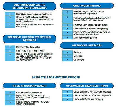
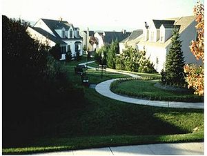
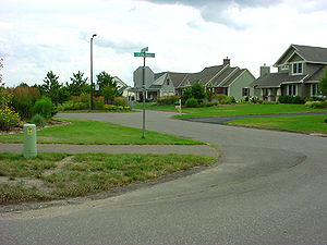
This residential conservation development uses minimum road widths and landscaped areas to reduce the amount of impervious surfaces and add to the rural character of the neighborhood. Vegetated channels and bioretention areas are used in the right-of-way to treat stormwater runoff. pollution. These development principles are not national design standards. Instead, they identify areas where existing codes and standards can be changed to better protect streams, lakes and wetlands at the local level. These principles are also highly suitable and effective in cold climates. Each principle is presented as a simplified design objective. Actual techniques for achieving the principle should be based on local conditions.
Examples
The key objective is to provide planners, developers, and local officials with benchmarks to investigate where existing ordinances may be modified to reduce impervious cover, conserve natural areas, and prevent stormwater pollution. These development principles are not national design standards. Instead, they identify areas where existing codes and standards can be changed to better protect streams, lakes and wetlands at the local level. These principles are also highly suitable and effective in cold climates. Each principle is presented as a simplified design objective. Actual techniques for achieving the principle should be based on local conditions.
- Fields of St. Croix - Lake Elmo
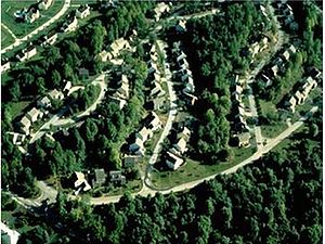
This residential conservation development uses minimum road widths and landscaped areas to reduce the amount of impervious surfaces and add to the rural character of the neighborhood. Vegetated channels and bioretention areas are used in the right-of-way to treat stormwater runoff.
- H.B. Fuller - Vadnais Heights
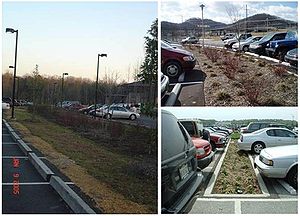
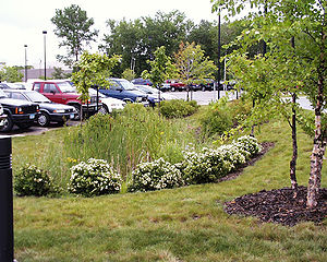
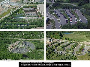
This parking lot incorporates bioretention strategies to treat stormwater runoff. The landscaped depressions provide stormwater treatment, snow storage, and improved parking lot aesthetics and climate. Low maintenance sedges are used in place of traditional turf grass to lower maintenance costs and pollution.
Use the following list as a tool to better site design (early on and throughout the design process) for street and parking lot development, redevelopment and retrofits.
- Design residential streets for the minimum required pavement width needed to support travel lanes, on-street parking, and emergency, maintenance, and service vehicle access. These widths should be based on traffic volume.
- Reduce the total length of residential streets by examining alternative street layouts to determine the best option for increasing the number of homes per unit length.
- Wherever possible, residential street right-of-way widths should reflect the minimum required to accommodate the travel-way, the sidewalk, and vegetated open channels. Utilities and storm drains should be located outside of the BMPs section of the right-of-way wherever feasible.
- Minimize the number of residential street cul-de-sacs and incorporate landscaped areas to reduce impervious cover. The radius of cul-de-sacs should be the minimum required to accommodate emergency and maintenance vehicles. Alternative turnarounds should be considered.
- Where density, topography, soils, and slope allow, vegetated open channels should be used in the street right-of-way to convey and treat stormwater runoff.
- Enforce the required parking ratio governing a particular land use or activity as both a maximum and a minimum, in order to curb excess parking space construction. Existing parking ratios should be reviewed for conformance, taking into account local and national experience to determine if lower ratios are warranted and feasible.
- Revise parking codes to lower parking requirements where mass transit is available or enforceable shared parking arrangements are made.
- Reduce the overall imperviousness associated with parking lots by providing compact car spaces, minimizing stall dimensions, incorporating efficient parking lanes, making use of vegetated parking islands, and using pervious materials in spillover parking areas where possible.
- Provide meaningful incentives to encourage structured and shared parking to increase economic viability.
- Provide stormwater treatment, wherever possible, for parking lot runoff using bioretention areas, filter strips, and/or other practices that can be integrated into required landscaping areas and traffic islands.
Highway and road runoff management
The construction and repair of the major road and highway system presents a major opportunity to incorporate new runoff management approaches throughout the State of Minnesota. Whether it is a Mn/DOT state highway, a county road or a municipal connector, the amount of runoff flowing off of the road surface and the pollutants it carries are a concern that can be managed with BSD/LID practices.
The challenges in dealing with potentially long linear road projects are numerous, and include
- limited space and right-of-way area to build/ retrofit and maintain BMPs;
- concentrated, high energy runoff from an impervious surface;
- safety of vehicles and maintenance workers;
- utility lines above and below the road;
- water entering the road right-of-way from adjacent sources;
- changing geologic, soil and receiving water conditions along the linear alignment;
- design changes that must be made to meet differing local requirements through which the road passes;
- intentional addition of pollutants to the road surface (salt and sand);
- the potential for hazardous material spills;
- the need for continual operation under all traffic and weather conditions; and
- different roadway design standards depending on state and local requirements
Although it is not simple, there are ways in which BSD/LID principles can be used to address the challenges noted above. The three key considerations that must always be kept in mind when dealing with highways and busy roadways are safety, BMP performance to meet expectations, and costs (capital and maintenance). This section of the Manual describes some approaches and directs users to additional resources that can further assist in meeting this goal. Emphasis is on the selection of BMPs that reflect a BSD/LID approach.
New and retrofit projects
When applied to a transportation corridor, the agency responsible for the BSD/LID design should follow the objectives contained in the Highway and Road BSD/LID Options sheet in mind. Although not typically thought of in the context of BSD/LID, highways do provide an opportunity because
- they are linear structures covering long distances, thus allowing for flow diffusion and long flow paths;
- they involve construction and maintenance, so incorporating small-scale distributed BMPs is not disruptive;
- capturing and routing water to treatment systems is possible as part of the overall drainage system; and
- financial resources from this less intense approach can be devoted to other related needs, such as maintenance or new treatment facilities.
The items contained in the Options sheet follow the BSD/ LID themes and include
- keeping or mimicking natural drainage paths and features;
- disconnecting impervious pavement from direct discharge to receiving waters;
- infiltrating as much clean water as possible;
- filtering and settling direct runoff water; and
- following a treatment train approach.
BMP options for highway and road runoff management
Link to this table
| BMP Type | Objective | BMP Examples | Safety Considerations |
|---|---|---|---|
| Diffuse flow energy from concentrated roadway surface before discharging over a slope; reinforce discharge point and slopes; promote sheet flow | Compost sock (see image), bio-slope, outlet reinforcement, spray mulch, compost rip rap matrix (between rocks) | May increase slipperiness of shoulder slope | |
| Filter litter and debris from flow as it enters catch basins; preferably with pollutant sorbents 2 | Catch basin insert (see image); hooded outlet pipe; oil and grease separator | Might become heavy for maintenance crews to lift; must be cleaned to prevent clogging | |
| Route runoff through a screen or filter material to remove litter and treat particulate, and the associated nutrients, toxics and hydrocarbons | Gross Solids Removal Device (GSRD) (see image), compost tube inside of rock weep, | Often contained in confined space; maintenance crew will need confined space training | |
| Diffuse heat from road and parking surfaces prior to discharge to sensitive waters | Geotextile wrapped rip rap thermal tube (see image), infiltration trench | None | |
| Provide vegetated swale drainage systems with low head grade breaks in rural sections | “Living ditch” (see image), check dams (rip rap, bio-weeper, bio-ditch filter) | Can hold water for a time after runoff occurs so need to keep design depths shallow; grade breaks can be obstruction hazard to recreational vehicles using swale | |
| Retrofit stored water BMPs with proper outlet and skimmer devices | Particulate skimmer (see image), baffle weir, Faircloth skimmer (proprietary device) | None | |
| Use pervious paving material in areas that will support it | Pervious asphalt and concrete (see image), paving blocks | None for pavement; blocks can pose walking problems if not designed properly; recommendation for minimal salt use could mean ice might be present for short periods | |
| Route water to bioretention, filtration or infiltration areas where conditions appropriate | Rain garden (see image) | Near-road locations could possibly impede vision at intersections if vegetation not kept low; water might collect adjacent to roadway | |
| Geomorphically stabilize channels | Cross vanes, fish steps, curvilinear channel restoration (see image), reinforced streambank, grade adjustments, revetments, root wads | None | |
| Use off-line storage in available floodplain, open space | Off-line pools (see image), enhanced floodplains, wetland restoration/preservation | None if kept away from areas where vehicles expected to travel or go off of the road | |
| Use sub-grade storage with or without perforations to allow for storage and infiltration where drainage determined not to impact road structure | Under street infiltration trenches (see image), vault storage to replace surface ponds, rest areas parking lots | Maintenance crew will need confined-space training |
1Use of proprietary devices or images merely for illustrative purposes and does not mean endorsement of a product
2Note that housekeeping practices like street sweeping and chemical use are discussed in the Pollution Prevention section
There are many focal points to concentrate upon when designing new and retrofit BMPs for highways and roads. Most of the runoff management issues associated with new highway construction today are addressed by the various construction permitting programs in place. Many of the practices displayed in this Manual are routinely used in this design and building process, and will not be further described here.
The focus of this section of the Manual is on the many other repair, maintenance and reconstruction projects that can and should incorporate retrofit BMPs. The discussion that follows focuses on these approaches. Many of these approaches were suggested by Mn/DOT (Dwayne Stenlund, personal communication) as simple ways to retrofit highway runoff projects.
Inlet controls
Keeping pollutants from entering the drainage system associated with highways, rest stops, maintenance facilities, and related structures makes the downstream job of protecting receiving waters easier. Basic housekeeping practices, like sweeping these surfaces and providing waste containers, is a first line of defense. Once entrained in runoff, however, keeping pollutants out of the drainage system gets more complex. It should be noted this discussion focuses on litter control.
Many varieties of catch basin inserts are available to screen or otherwise capture particulate debris on its way into the system. These inserts can be as simple as a bag or screen hanger that fills, to as complicated as a series of interlocking baskets each designed to capture a certain particle size. Recently, many of the insert vendors have begun to offer chemical sorbents that can be attached to the inserts to remove toxic materials, like oil and grease, heavy metals and various solvents. The key factor in successful use of any of these inserts is maintaining them such that they always operate as designed. That typically means emptying or replacing them when they fill and replacing sorbent products when they are saturated with the target pollutants. Some products even change colors as they reach the saturation point. Another very important feature of inserts is to make sure that high flows can by-pass the area where the debris gathers so that plugging and re-suspension does not occur.
Gross solids removal devices
A very large portion of the pollution coming off of highway and road surfaces is nothing more than litter. The cigarette butts, fast food wrappers, plastic packaging, dirty diapers and other debris all float very easily once enough runoff energy picks them up.
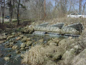
Gross Solids Removal Devices (GSRD) are BMPs that extend inlet pipes, dewater the inflow and leave the debris behind. There are also large mesh bags that fit over inlet pipes to hold back debris and swirl concentrators that concentrate and remove particulate material. All of these litter removal devices can easily be retrofit into existing drainage systems. Caution must be exercised, however, that these practices do not plug and result in flooding.
Runoff grade control
Perhaps the biggest problem associated with roadways is the concentrated runoff that comes off the impervious surfaces. Runoff can be intercepted before it becomes a problem by providing suitable grades, energy breaks and infiltration opportunities.
“Bio-slopes” or “Eco-slopes” are terms that describe the placement of amended soils material (like compost) on a slope to slow water down and allow it to soak in. The use of native vegetation in this amended soil or compost logs or slope terraces to divert flow where it can best be handled are all elements of slope protection. Diverting concentrated flow to a lateral flow spreader can turn that concentrated flow into sheet flow that can be spread out and more easily soaked into the ground. Caltrans (2006) reports on the success of using stabilized slopes for runoff treatment. Although grade control structures should be part of initial construction, they can also be retrofit after a project is complete.
Outlet controls
Highway drainage designers are ultimately left with the task of capturing runoff that does not infiltrate and then routing it via stormsewer to an outlet at some location. In the past, it was common to let this runoff discharge directly to a receiving water body, often resulting in an actively erosive area. Although riprap is still a very common solution to this problem, it is not always the most structurally sound nor is it the most aesthetic approach. Natural and synthetic geotextile reinforcements are often a suitable alternative and are available to fit a variety of needs. Choosing between these options depends to a great extent on the nature of the problem.
Product specifications for strength and applications should be examined to choose the proper material. Another option is compost-grouted riprap, in which compost is sprayed into voids and serves as a root medium for native plants. As with grade controls, these reinforcement methods can be part of an initial installation or easily retrofit if a problem is identified and in need of a solution.
Drainageways
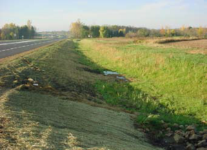
In most dense urban area applications, highway runoff is collected via the local stormsewer system, which is under the control of the highway agency or local MS4 community. In lesser developed urban and rural settings, however, water can be collected in a rural section with drainage via open water swales. Because of the narrow alignments that most highways follow, these swales by necessity are narrow and can extend for long distances before reaching any kind of receiving water.
A well drained swale can be a very effective BMP for both reducing volume through infiltration and for improving water quality through filtration, settling and vegetative uptake. Installed occasional low level grade control structures (possibly with some kind of organic filter media) can supplement the treatment ability of the swale, as can keeping them dry so that they are fully able to perform as soon as water enters them. Routing swales through occasional pools or wetlands also enhances their ability to treat runoff. Drainageways are an essential part of any highway design, but improvements can be retrofit at any time an improvement is needed.
Channel Stabilization
On many occasions, highway and road drainage is discharged into a stream. The energy associated with the volume and rate of runoff entering the channel can be disruptive and lead to environmental problems such as bottom and bank erosion, particle resuspension, habitat wash-out and high velocity.
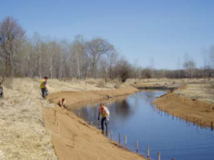
Past efforts to move drained water along quickly led to the installation of many straightened channels (ditches). Today, we realize that maintaining or restoring the natural or curvilinear channel character handles this increased flow in a more environmentally stable manner. Meanders, pools and riffles, vegetated banks, and adequate woody debris are all measures of a stable and healthy stream that can absorb much of the change that comes with increased runoff. Today many of these improvements are part of initial design, but retrofitting past less natural designs is also possible.
Thermal Protection
Runoff from paved surfaces during warm weather invariably leads to the introduction of warm water into receiving waters. If water temperature is an issue for the receiving water body, such as for cold water fisheries, this runoff should be cooled. Infiltration is perhaps the most direct and easiest way to accomplish this, provided the infiltrating water stays under ground long enough to cool.
Another technique used by Mn/DOT (Dwayne Stenlund, personal communication) is a BMP called a “riprap thermo-cooler”. This device is merely a geotextile wrapped riprap tube covered by soil that allows base flow to exit an outlet and flow underground and cool until outletting in a controlled manner. As with many of the other BMPs listed, thermal protection is best incorporated in initial design but can be retrofit when an improvement is needed.
Structural BMPs
Finally, when non- or minimum-structural controls are not available for an initial design or a retrofit or might not be capable of doing an adequate job, structural BMPs might be appropriate. Each of the Manual’s BMPs can be adapted for a retrofit situation. Particular emphasis should beplaced on sub-grade structures that can store and/or treatment water when available land is limited; filtration and infiltration techniques; stormwater wetlands; and supplemental treatment.
Conservation of natural areas
The key objective is to provide planners, developers, and local officials with benchmarks to investigate where existing ordinances may be modified to reduce impervious cover, conserve natural areas, and prevent stormwater pollution. These development principles are not national design standards. Instead, they identify areas where existing codes and standards can be changed to better protect streams, lakes and wetlands at the local level. These principles are also highly suitable and effective in cold climates. Each principle is presented as a simplified design objective. Actual techniques for achieving the principle should be based on local conditions. and environmental benefit.
Flexible design standards can allow for the conservation of a site’s natural areas and ecological function. Conservation design developments advocate preserving a site’s most distinguishing natural features and integrating them into the community of the new development. Open space should be consolidated to have the greatest recreational, aesthetic, Smaller lot sizes allow the same densities as a traditional development, with more open space dedicated as a community amenity. Flexible lot design allows less roads and stormwater infrastructure to be built, reducing imperviousness and infrastructure costs.
Use the following list as a tool to better site design (early on and throughout the design process) for development, redevelopment and retrofits.
- Create a variable width, naturally vegetated buffer system along all perennial streams and other water features that encompasses critical environmental features such as the 100-year floodplain, steep slopes and freshwater wetlands.
- Preserve or restore riparian stream buffers with native vegetation. Maintain the buffer system through the plan review delineation, construction, and post-development stages.
- Limit clearing and grading of forests and native vegetation at a site to the minimum area needed to build lots, allow access, and provide fire protection. Manage a fixed portion of any community open space as protected green space in a consolidated manner.
- Conserve trees and other vegetation at each site by planting additional vegetation, clustering tree areas, and promoting the use of native plants. Wherever practical, manage community open space, street rights-of-way, parking lot islands, and other landscaped areas.
- Encourage incentives and flexibility in the form of density compensation, buffer averaging,property tax reduction, stormwater credits, and open space development to promote conservation of stream buffers, forests, meadows, and other areas of environmental value. In addition, encourage off-site mitigation consistent with locally adopted watershed plans.
- Prevent the discharge of unmanaged stormwater from new stormwater outfalls into wetlands, sole-source aquifers, or ecologically sensitive areas.
Lot development
The key objective is to provide planners, developers, and local officials with benchmarks to investigate where existing ordinances may be modified to reduce impervious cover, conserve natural areas, and prevent stormwater pollution. These development principles are not national design standards. Instead, they identify areas where existing codes and standards can be changed to better protect streams, lakes and wetlands at the local level. These principles are also highly suitable and effective in cold climates. Each principle is presented as a simplified design objective. Actual techniques for achieving the principle should be based on local conditions.
Use the following list as a tool to better site design (early on and throughout the design process) for lot development, redevelopment and retrofits.
- Advocate open space design development incorporating smaller lot sizes to minimize total impervious area, reduce total construction costs, conserve natural areas, provide community recreational space, and promote watershed protection.
- Relax side yard setbacks and allow narrower frontages to reduce total road length in the community and overall site imperviousness. Relax front yard setback requirements to minimize driveway lengths and reduce overall lot imperviousness.
- Promote more flexible design standards for residential subdivision sidewalks. Where practical, consider locating sidewalks on only one side of the street and providing common walkways linking pedestrian areas.
- Minimize the number of residential street cul-de-sacs and incorporate landscaped areas to reduce impervious cover. The radius of cul-de-sacs should be the minimum required to accommodate emergency and maintenance vehicles. Alternative turnarounds should be considered.
- Reduce overall lot imperviousness by promoting alternative driveway surfaces and shared driveways that access two or more homes.
- Clearly specify how community open space will be managed, and designate a sustainable legal entity responsible for managing both natural and recreational open space.
- Direct rooftop runoff to pervious areas such as yards, open channels, or vegetated areas and avoid routing rooftop runoff to the roadway and the stormwater conveyance system.
- Restore the drainage and/ or biological capacity of damaged or lost soils through mechanical improvements or soil amendments.
Thinking outside of the big box - An Example of Parking Lot Surplus and Retrofit Opportunities
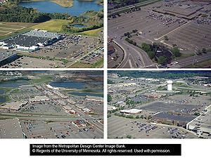
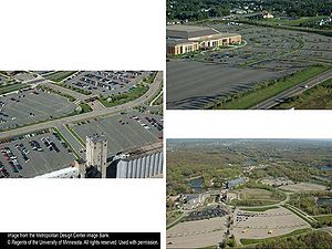
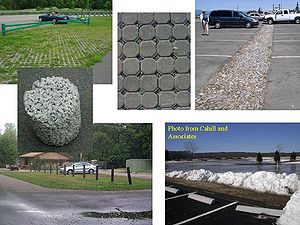
Excess parking lot stalls add a tremendous amount of impervious surface that is unnecessary for almost every day of the year except the day after Thanksgiving. This is just one of many situations where Minnesota stormwater managers can make a difference. The following figures provide examples for one of many land uses that substantially increase the amount of impervious area within a watershed. It provides some example alternatives that are possible to those who want to “think outside of the big box” and create resource oriented solutions.
The use of some simple solutions can reduce the amount of runoff and the pollution it carries. If every city in Minnesota approached stormwater with these ideas in mind, just think of the runoff we could reduce! For every ten acres of impervious parking lot replaced with a pervious surface, runoff is reduced by about eight million gallons of water.
References
- Arendt, R. 1997. Designing Open Space Subdivisions. Natural Lands Trust. Media, PA
- Caltrans, 2006. Final Summary Report: Roadside Vegetated Treatment Sites (RVTS) Study. Caltrans Division of Environmental Analysis, Stormwater Program, Report CTSW-RT-06- 127-01-2. Sacramento, CA.
- Cappiella, K. 2005a. Urban Watershed Forestry Manual Part 1: Conserving Trees at the Watershed Scale. Prepared for: USDA Forest Service. Center for Watershed Protection. Ellicott City, MD.
- Cappiella, K., T. Schueler, and T. Wright. 2005b. Urban Watershed Forestry Manual Part 2: Conserving and Planting Trees at Development Sites. Prepared for: USDA Forest Service. Center for Watershed Protection. Ellicott City, MD.
- Center for Watershed Protection (CWP). 1998a. Better Site Design: A Handbook for Changing Development Rules in Your Community. Center for Watershed Protection. Ellicott City, MD.
- Center for Watershed Protection (CWP). 1998b. Nutrient Loading From Conventional and Innovative Site Development. Prepared for: Chesapeake Research Consortium. Center for Watershed Protection. Ellicott City, MD.
- Wilderness and Northeastern Illinois Planning Commission, 2003. Chicago Conservation Design Resource Manual.
- Delaware Department of Natural Resources and Environmental Conservation (DE DNREC). 1997. Conservation Design for Stormwater Management. Dover, DE.
- Dreher, D, and T. Price. 1994. Reducing the Impact of Urban Runoff: The Advantages of Alternative Site Design Approaches. Northeastern Illinois Planning Commission. Chicago, IL.
- Glanville, T.D., T.L. Richard and R.A. Persyn. 2003. Final report: Impacts of Compost Blankets on Erosion Control, Revegetation and Water Quality at Highway Construction Sites in Iowa. Iowa State University of Science and Technology, Contract report #00-G550-02-TCG.
- Illinois Conservation Foundation and Chicago Wilderness, 2005.Changing Cost Perceptions: An Analysis of Conservation Development. Prepared by the Conservation Research Institute.
- Institute of Transportation Engineers Transportation Planning Council Committee 5P-8 (ITE). 1997. Traditional Neighborhood Development Street Design Guidelines. Institute of Transportation Engineers. Washington, DC.
- Liptan, T. and C. Brown. 1996. A Cost Comparison of Conventional and Water Quality-based Stormwater Designs. City of Portland. Portland OR.
- Maurer, G. 1996. A Better Way to Grow: For More Livable Communities and a Healthier Chesapeake Bay. Chesapeake Bay Foundation. Annapolis, MD.
- McDonald, F. 1999. Ecologically Sound Lawn Care for the Pacific Northwest: Findings from the Scientific Literature and Recommendations from Turf Professionals. City of Seattle Public Works. Seattle, WA.
- Metropolitan Council. 2001. Urban Small Sites Best Management Practice Manual. St. Paul, MN.
- Minnesota Department of Natural Resources. 2003. Field Guide to the Native Plant Communities of Minnesota: The Laurentian Mixed Forest Province. Ecological Land Classification Program, Minnesota County Biological Survey, and Natural Heritage and Nongame Research Program, MNDNR St. Paul, MN.
- Minnesota Department of Natural Resources. 2005. Field Guide to the Native Plant Communities of Minnesota: The Eastern Broadleaf Forest Province. Ecological Land Classification Program, Minnesota County Biological Survey, and Natural Heritage and Nongame Research Program, MNDNR St. Paul, MN.
- Minnesota Department of Natural Resources. 2006. Field Guide to the Native Plant Communities of Minnesota: The Prairie Parkland and Tallgrass Aspen Parklands Province. Ecological Land Classification Program, Minnesota County Biological Survey, and Natural Heritage and Nongame Research Program, MNDNR St. Paul, MN.
- Minnesota Pollution Control Agency. 2000. Protecting Water Quality in Urban Areas: Best Management Practices for Dealing with Storm Water Runoff from Urban, Suburban, and Developing Areas of Minnesota. St. Paul, MN.
- National Cooperative Highway Research Program (NCHRP), 2006a. Evaluation of BMPs and LID for Highway Runoff Control: LID Design Manual. NCHRP, Transportation Research Board, National Research Council, Washington, D.C.
- National Cooperative Highway Research Program (NCHRP). 2006b. Evaluation of BMPs for Highway Runoff Control. NCHRP Report 565. Transportation Research Board. National Research Council. Washington, D.C.
- Puget Sound Action Team, 2005. Low Impact Development Technical Guidance Manual for Puget Sound. PSAT and Washington State University, Pierce County Extension. Available at www.psat.wa.gov/LID.
- Roseen, R.M., T.P. Ballestero, J.J. Houle, P. Avelleneda, R. Wildey and J. Briggs, 2006. Storm Water Low- Impact Development, Conventional Structural and Manufactured Treatment Strategies for Parking Lot Runoff: Performance Evaluations under Varied Mass Loading Conditions. Transportation Research Record: Jour. of the Transportation Research Board, No. 1984, Transportation Research Board of the National Academies, Washington, D.C., pp. 135-147.
- Santa Clara Valley Urban Runoff Pollution Prevention Program (SCVURPPP), 2002. An Update of runoff flowing off of the road surface and the pollutants it carries are a concern that can be managed with BSD/LID practices.
- Schueler, T. 1995. Site Planning for Urban Stream Protection. Center for Watershed Protection. Ellicott City, MD
- Shaw, D. and R. Schmidt, 2003. Plants for Stormwater Design - Species Selection for the Upper Midwest. Edited by S. Brungardt, Designed by R. Harrison, Minnesota Pollution Control Agency, St. Paul, MN.
- Winer, R. 2000. National Pollutant Removal Performance Database for Stormwater Treatment Practices, 2nd Edition. Prepared for: U.S. EPA Office of Science and Technology. Center for Watershed Protection. Ellicott City, MD.
- Zielinski, J., 2001. The Benefits of Better Site Design in Residential Subdivisions. Watershed Protection Techniques, 3(2):633-646. Center for Watershed Protection. Ellicott City, MD.
