Minnesota GreenStep Cities Stormwater Assessment guidance and supporting information
Contents
- 1 Introduction
- 2 SECTION ONE - PLANNING & PRESERVATION
- 3 SECTION TWO - STORMWATER MANAGEMENT STANDARDS & PRACTICES
- 3.1 Impervious Cover Management
- 3.1.1 14. Minimum roadway pavement width
- 3.1.2 15. Proof-of-parking or shared driveways
- 3.1.3 16. Off-street parking lot/ramp
- 3.1.4 17. Parking space dimensions
- 3.1.5 18. In lieu of curb-and-gutter
- 3.1.6 19. Drain to vegetated areas
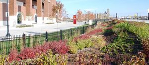
- 3.1.7 20. Parking area landscaping
- 3.1.8 21. Pervious/permeable surfaces
- 3.1.9 22. Native vegetation and turf alternatives
- 3.1.10 23. Green roof installations
- 3.2 Stormwater Management Policies
- 3.2.1 24. New impervious surfaces
- 3.2.2 25. Baseline-condition
- 3.2.3 26. Total-suspended solids and total phosphorous
- 3.2.4 27. Downstream water resources
- 3.2.5 28. Runoff volume
- 3.2.6 29. Erosion and sediment control
- 3.2.7 30. Pretreatment sizing standards
- 3.2.8 31. Redevelopment
- 3.2.9 32. Water reuse and conservation
- 3.2.10 33. Maintenance agreements
- 3.1 Impervious Cover Management
- 4 SECTION THREE - STORMWATER POLLUTION PREVENTION
Introduction
The Minnesota GreenStep Cities Stormwater Assessment, formerly called the Blue Star Assessment, is a self-assessment for cities to complete based on their current stormwater program. The assessment asks questions related to green infrastructure that are generally not covered by regulatory programs. Make sure to click "save" each time so you can return to your previous work as needed before May 1, 2020. After you have finished the assessment a score between 1 and 100 percent will be reported. A new web link will be sent out to all GreenStep cities, and to other interested cities, on July 1, 2020 for the next assessment year, which ends on May 1, 2021.
Taking this assessment and receiving a score can be used in several ways:
- To quickly learn about a wide range of stormwater management options, via the questions and associated informational links to the MPCA’s Stormwater Manual site
- To see how your city’s efforts compare to other cities across Minnesota (a GreenStep web page showing this will be released in summer 2020)
- To gather a baseline measure of actions, and to compare that to a subsequent year (which could be 2 or 3 years later) when you retake the assessment
- To report your score, and subsequent improvement, to community members and to your city council
- To claim credit for the GreenStep best practice # 17, under BP action 17.2
- To claim credit for GreenStep Metric # 9, which is required for recognition at Step 4 and Step 5 in the GreenStep program
Feel free to ask any questions via the GreenStep Cities contact page at https://greenstep.pca.state.mn.us/contact
SECTION ONE - PLANNING & PRESERVATION
This section focuses on four areas including planning and preservation in respect to development, redevelopment and water resources.
Water Friendly Development Patterns
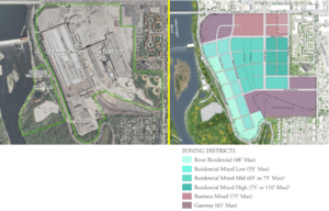
This part includes two areas that address sprawl-limiting strategies and strategies for redevelopment, including brownfield redevelopment.
1. Sprawl-limiting strategies
- Does your community comprehensive plan allow the following sprawl-limiting strategies? (Select all strategies that apply)
- Mixed-use development by right (1 pt)
- Compact development outside of the downtown zoning district (greater than 3 residential units/acre) (1 pt)
- Transfer of development rights (1 pt)
- Other applicable (1 pt)
- No (0 pts)
- I don’t know / not specified (0 pts)
- Wikipedia defines urban sprawl as "the expansion of human populations away from central urban areas into low-density, monofunctional and usually car-dependent communities". "Low-density" is an arbitrary term typically defined in local ordinances. Housing densities lower than 1 home per acre are often considered to be low density.
- Urban sprawl has many negative environmental impacts, including habitat loss and fragmentation, increased water use, and increased energy consumption. The relationship between urban sprawl and stormwater has not been extensively studied. Sprawl may reduce imperviousness on a per acre basis, but increases overall impervious acreage. High density, mixed-use development, allows for more efficient stormwater management than low density development.
- Mixed-use development: neighborhoods or buildings that include multiple uses, such as residences, shops, restaurants, and businesses. Mixed use development provides more efficient service delivery and results in reduced resource consumption.
- Compact development (greater than 3 units/acre): compact development provides for more efficient delivery of services and resources, resulting in less consumption
- Transfer of development rights: transfer of development rights (TDR), sometimes known as transfer of development credits (TDC), is a market-based tool that allows communities to channel development toward designated growth areas and away from natural areas, drinking water sources and farmland (Smart Growth America).
- Redevelopment of underutilized previously developed sites: underutilized or unused sites (e.g. Brownfields) represent an opportunity to implement mixed use, compact development (discussed above).
- Further reading
2. Redevelopment and brownfields
- Does your community have any of the following incentives specifically targeted to ‘brownfield’ development and redevelopment sites? (Select all that apply)
- Density bonus (1 pt)
- Funding for remediation (1 pt)
- Streamlined permitting (1 pt)
- Reduced impact fees (1 pt)
- Tax increment financing (1 pt)
- No (0 pts)
- I don't know / not specified (0pts)
- A brownfield is an abandoned site with an industrial or commercial past that has left behind a legacy of contamination. The contamination is due to the release of a hazardous substance onto the land and in certain cases the groundwater. These sites are often seen as undesirable but there are many benefits of redevelopment (EPA). To stimulate development at these sites different incentives have been created to encourage reinvestment in these areas. Along with these incentives there are societal benefits as well which include: increases in local tax base, job growth, utilizes existing infrastructure, takes pressure off undeveloped land and improves the environment (EPA).
- Further reading
3. Green infrastructure
- In your stormwater ordinance is there a definition of green infrastructure -- better management of stormwater while aiming to achieve other environmental, public health, social, and economic benefits? (Select one)
- Yes (1 pt)
- No (0 pts)
- I don’t know / not specified (0 pts)
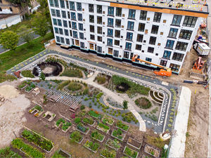
- Green infrastructure is an approach to water management that keeps the water close to where it falls and mimics the natural water cycle. The multiple benefits of green infrastructure make it a flexible practice for use in many areas including stormwater management.
- Environmental benefits: filters pollutants found in stormwater and then water is able to infiltrate into the ground. They as can be places for wildlife to flourish.
- Public health benefits: green infrastructure provides shade, green spaces for public gatherings and a walkable community.
- Social benefits: serves as a means to educate and engage the public in stormwater management and enhances the community aesthetics.
- Economic benefits: public investment in neighborhoods across a city including transportation corridors and business districts plus the costs to install and maintain are lower (Raincheck).
- Further reading
4. Climate adaptation
- Does your community have a climate adaptation plan in place to address potential impacts of climate change on community water resource management? (Select one)
- Yes (1 pt)
- No (0 pts)
- I don’t know / not specified (0 pts)
- Climate adaption is defined as a response to climate change that seeks to reduce the vulnerability of social and biological systems to relatively sudden change and this offset the effects of global warming (Wikipedia). Climate change will affect society in multiple ways including water resources. In order to plan for future changes in water resource availability communities are developing climate adaption plans and looking at water resource management under future circumstances.
- Further reading
Natural Resource Preservation & Management
This part of the assessment includes six areas that address high quality natural resource areas, floodplains, wetlands, buffers, steep slopes and urban forests.
5. Natural resource inventory
- Does your community comprehensive plan include an inventory of high quality natural resource areas and are land-use decisions guided by the inventory in order to protect these areas from development?
- Yes, a Natural Resource Inventory or Natural Resource Assessment is incorporated into the subdivision or development process (4 pts)
- Yes, high quality natural resource areas have been inventoried (1 pt)
- No (0 pts)
- I don’t know / not specified (0 pts)
- A Natural Resource Inventory is a statistical inventory of natural resources in a given area that is documented and used to assess the change in natural resources in a given area. The inventories or assessments can range from general to detailed depending on the land area that is being evaluated. They inform governmental units how to plan new buildings in their communities in order to protect those areas that are considered high quality natural resource areas. Examples of these areas are as follows: native ecosystems, habitat for endangered species, sensitive plants and animals, and scenic landscapes (Washington State Department of Natural Resources).
- Further reading
6. Filling in floodplain areas
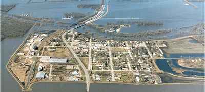
- Does your community allow filling for development within the floodplain and if so, are restrictions imposed excluding storage of hazardous materials and requiring compensatory storage for fill? (Select one)
- No fill within FEMA and locally defined floodplain allowed (3 pts)
- No fill within FEMA floodplain allowed (2 pts)
- Fill allowed with the above restrictions (1 pts)
- Fill allowed without restrictions (-1 pt)
- I don’t know / not specified (0 pts)
- Not applicable in my community (N/A)
- A floodplain is an area of land adjacent to a body of water such as a river or stream and when a body of water exceeds capacity the flood plain will flood with the excess water. There are multiple benefits of floodplains from ecosystem services, erosion control and flood services. In some cases the floodplain will be filled in and precautions are taken to minimize the impact on the floodplain.
- Further reading
7. Wetlands
- Does your community protect high quality or sensitive wetlands through a Resource Management Plan or Wetland Management Plan? (Select one)
- Yes, plan exceeds state standards (2 pts)
- Yes, plan meets state standards (1 pts)
- No (0 pts)
- I don’t know / not specified (0 pts)
- Not applicable in my community (N/A)
- Wetlands are areas that collect water, some are flooded seasonally and others are flooded year round. There are different types of wetlands: emergent marshes, hemi-marsh, sedge meadows, wet prairie, fens, bogs and swamps (What is a Wetland). A Resource Management Plan or Wetland Management Plan is a plan created to document the protection status of wetlands in accordance with state standards.
- Further reading
8. Buffer standards
- Do your buffer standards include any floodplain, steep slope, vegetation or resource quality considerations? (select all that apply)
- Additional buffer width to encompass 100-year floodplain (1 pt)
- Additional buffer width in areas with slopes 9% or greater (1 pt)
- Buffer language clearly specifies vegetated cover requirements (1 pt)
- Expanded stream buffer requirements for sensitive resources, such as trout streams and/or ORVWs (1 pt)
- No (0 pts)
- I don’t know / not specified (0 pts)
- Not applicable in my community (N/A)
- Further reading
9. Steep slopes
- Does your community have land use protections and/or development restrictions that preserve slopes 18% or greater in a stable, undisturbed vegetated state? (Select one)
- Yes (2 pts)
- No (0 pts)
- I don’t know / not specified (0 pts)
- Not applicable in my community (N/A)
- Slope in the landscape is important to consider because these areas are more susceptible to erosion. Land use protections and/or development restrictions are in place to help prevent erosion on these steep slopes. Vegetation on these slopes helps to capture some the water, pollutants and sediment that runs across the surface before it enters a storm drain which eventually leads into a lake, river or stream.
- Further reading
10. Urban forests
- Does your community encourage the establishment and sustainability of urban forests through the following strategies: (select all strategies that apply, then check appropriate score box below)
- Insect & disease control, including ash preservation
- Increased care during establishment
- Increased indigenous diversity
- Tree protection and replacement ordinance
- Design, construction, and maintenance standards for urban forests
- Street reconstruction (including road diet lane conversions) that increases width of boulevard tree right-of-way
- Standards that address soil compaction during and after development/redevelopment of private land, and of public land like street boulevards
- Stable funding for shade tree program, goals for increasing canopy coverage, or Tree City USA
- At least 5 of the above strategies including soil compaction standards: (8 pts)
- At least 4 of the above strategies including tree program/goals/Tree City: (5 pts)
- At least 4 of the above strategies: (3 pts)
- At least 3 of the above strategies: (2 pts)
- At least 2 of the above strategies: (1 pt)
- None (0 pts)
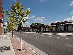
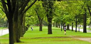
- Urban forests are a strategy used in urbanized cities to bring shade, reduce air pollution, filter stormwater and add beauty to public spaces. Urban forests include parks, street trees, landscaped boulevards, gardens, river and coastal promenades, greenways, river corridors, wetlands, nature preserves, and shelter belts of trees according to USDA. In order to take advantage of the benefits urban forests provide they must be maintained and cared for. Maintenance includes insect and disease control, establishment, indigenous diversity, tree protection and replacement ordinance, maintenance standards, street reconstruction, soil compaction and shade tree programs.
- Further reading
- Benefits of Urban Trees
- Planning for Urban and Community Forestry
- Urban Forest BMPs
- Urban Forest Management Plan Toolkit
- Native Trees of Minnesota
- Tree Ordinance - Seattle, WA
- Urban Forestry Compliance - Forth Worth, TX
- Urban Forests Management Program - Encinitas, CA
- Urban Forestry Policy - Minneapolis, MN
- Tree City USA
Stormwater Management Funding & Incentives
This part of the assessment includes three areas that address stormwater management funding and incentives.
11. Funding
- Does your community have any of the following stable, ongoing, yearly stormwater management funding mechanisms? (Select one)
- Stormwater Utility User Fee (3 pts)
- Other mechanism (3 pts)
- No (0 pts)
- I don’t know / not specified (0 pts)
- Stormwater programs need funding to install and maintain BMPs, distribute educational materials and staff time. Communities tend to have a stormwater utility fee charged to a resident's bill each month, yearly or otherwise determined by the City. The monetary amount charged to residents varies from City to City but the revenue gained will be used for stormwater program needs.
- Further reading
12. Incentives
- Does your community provide incentives (e.g., a reduced stormwater utility fee for sites that reduce their impervious surface) for retrofitting stormwater best management practices in previously developed sites? (Select one)
- Yes for commercial, industrial, institutional and residential (3 pts)
- Yes for only commercial, institutional and industrial (2 pts)
- Yes for only residential (1 pts)
- No (0 pts)
- I don’t know / not specified (0 pts)
- Incentives to stormwater management are used to help increase stewardship of stormwater runoff from residents as well as in the commercial, institutional and industrial sectors. There are different types of incentives including monetary incentives and recognition incentives. Examples of incentives include awards, grants, rebates, financing and discounts.
- Further reading
13. Land acquisition
- Has your community adopted a stable funding mechanism for land acquisition of high quality natural resource and/or riparian buffer areas? (Select one)
- Yes, land is placed in a trust (5 pts)
- Yes (1 pts)
- No (0 pts)
- I don’t know / not specified (0 pts)
- Land acquisition is the process of the government purchasing land for public use. A land trust is when one party agrees to hold property for another property. There are multiple benefits to land acquisition including protection and conservation of natural resources, enhance opportunities of recreation, and restore trout streams. Read more at the Minnesota Department of Natural Resources.
- Further reading
SECTION TWO - STORMWATER MANAGEMENT STANDARDS & PRACTICES
This section focuses on three areas including impervious cover, policy and green streets.
Impervious Cover Management
This part of the assessment includes five areas that address impervious cover, parking and vegetation.
14. Minimum roadway pavement width
- For public, residential access and sub-collector streets (with fewer than 500 annual average daily trips) what is the minimum roadway pavement width allowed in your community? (Select one)
- 24 feet or less (4 pts)
- 25-26 feet (2 pts)
- 27-28 feet (1 pt)
- Greater than 28 feet (-1 pt)
- I don’t know / not specified (0 pts)
- Roadways make up a large portion of impervious surface. Community road pavement widths vary by community and some provide for infiltration before directly discharging into the storm sewer. Infiltration allows for pollutants to be filtered out and it also helps replenish the aquifers.
- Further reading
- Does your community allow proof-of-parking or shared driveways to minimize impervious surface? (Select one)
- Yes (1 pt)
- No (0 pts)
- I don’t know / not specified (0 pts)
Impervious surfaces continue to increase especially in urban areas. Urban communities are taking a mixed-use approach to reduce the amount of impervious surfaces, an example of this is shared driveways.
Further reading
16. Off-street parking lot/ramp
- Does your community have any of the following off-street parking lot/ramp regulations (for example, number of required parking spaces per 1000 sq. ft. or per seat) in its zoning/development code? (Select one)
- Parking space maximums exist and there are no parking space minimums city-wide (8 pts)
- Parking space maximums exist city-wide and there are no parking space minimums in select zoning districts/for select development types (6 pts)
- Parking space maximums and parking space minimums exist in select zoning districts/for select development types (4 pts)
- City has parking space minimums city-wide, or in select zoning districts/for select development types, AND gives a parking stall reduction credit for installed bicycle parking (2 pts)
- City only has parking space minimums city-wide, or in select zoning districts/for select development types (1 pt)
- I don’t know / not specified (0 pts)
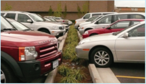
Parking maximums limit the number of spaces that a developer can construct, while refers to the opposite. Off-street parking refers to parking vehicles anywhere but on streets. These include public and private lots, garages and driveways. Off-street parking is typically utilized for limited time periods, meaning there are considerable periods when the parking area is not being used. Like any impermeable surface, off-street parking generates runoff and pollutants carried in the runoff. Ways to minimize the amount of impermeable surface generated from off-site parking include the following.
- Assessing parking demand to limit parking to a minimum acceptable amount.
- Reducing stall sizes
- Covering impermeable surface to limit or prevent runoff
- Use permeable surfaces for part or all of the parking area
Further reading
- Assessing Street and Parking Design Standards to Reduce Excess Impervious Cover in New Hampshire and Massachusetts
- Driving Urban Environments: Smart Growth Parking Best Practices
- Green Parking Lot Resource Guide
17. Parking space dimensions
- What are your standard parking space dimensions (Select one)
- Stalls 8.5' x 18' with 22' maximum aisle and driveway widths (3 pts)
- Stall width 9 feet or less (2 pts)
- Stall width 9.1 to 9.9 feet (1 pt)
- Stall width greater than 9.9 feet or dimensions not regulated (0 pts)
- I don’t know / not specified (0 pts)
Impermeable surface created from parking areas can be minimized through correct sizing and use of impermeable areas. Some techniques for minimizing impervious surface through approrpiate sizing include the following.
- Utiliize a variety of sizes based on anticipated users (e.g. X percent of compact spaces)
- Use permeable areas for overhangs (the area in the front of the car that overhangs the parking area)
Further reading
- LID Parking Lots
- Assessing Street and Parking Design Standards to Reduce Excess Impervious Cover in New Hampshire and Massachusetts
- Driving Urban Environments: Smart Growth Parking Best Practices
18. In lieu of curb-and-gutter
- Does your community encourage curb-cuts, ribbon curb, roundabouts, or right-of-way swales for infiltration and conveyance of stormwater runoff in lieu of curb-and-gutter along residential roadways? (Select one)
- Yes, allowed and encouraged (5 pts)
- Yes, allowed (2 pts)
- No (0 pts)
- I don’t know / not specified (0 pts)
Eliminating curbs or adding curb cuts allows runoff to be directed into pervious areas and filtered through LID features such as swales and bioretention practices. A typical curb and gutter system will concentrate runoff volumes and curbs should only be installed when necessary to convey runoff to a treatment area. Permeable conveyance systems, such as swales, may be used in place of impermeable curb and gutter systems. Generally, curb and gutter is more expensive than other systems that retain or slow runoff.
Further reading
- Lake Tahoe BMP manual
- [Reducing Stormwater Costs through Low Impact Development (LID) Strategies and Practices https://www.epa.gov/sites/production/files/2015-10/documents/2008_01_02_nps_lid_costs07uments_reducingstormwatercosts-2.pdf]
- Environmental Protection Agency (EPA) Stormwater Management Preferred Practices
19. Drain to vegetated areas
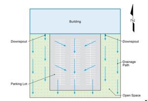
- For new residential lots, does your community require or encourage impervious surfaces like roofs and drive ways to drain to vegetated areas? (Select one)
- Required (3 pts)
- Encouraged (1 pt)
- No (0 pts)
- I don’t know / not specified (0 pts)
Further reading
20. Parking area landscaping
- Does your community require or encourage parking area landscaping with vegetated practices (e.g. bioretention, curb-cuts, ribbon curb, tree trenches, or swales) for stormwater volume and/or water quality management? (Select one)
- Required (3 pts)
- Encouraged (1 pts)
- No (0 pts)
- I don’t know / not specified (0 pts)
- Parking areas are usually large areas of impervious surfaces so when it rains all the water runs directly into a City's stormwater system without any filtration or infiltration. To combat this excess stormwater runoff different vegetated practices are in place to reduce stormwater volume.
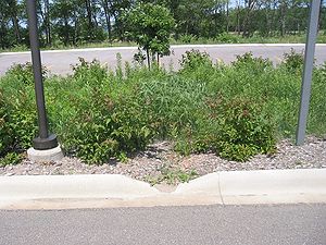
- Bioretention is a process of removing pollutants through a treatment area which can consist of grass, mulch, soil, plants or a ponding area (Wikipedia). This practice is designed to filter, slow and store water as the stormwater moves through the system.
- Curb-cuts allow water flowing in the street and gutter to be diverted into a biorentention system, swale or tree trench.
- Ribbon curb:
- Tree trenches according to the Philadelphia Water Department is a stormwater system of trees connected by a stormwater infiltration structure under the sidewalk where stormwater runoff is stored and waters the trees if there is excess stormwater it will drain into the street.
- Swales are designed to remove pollutants out of surface water runoff. They are commonly found in parking lots where swales capture and treat stormwater runoff before it enters the storm sewer system (Wikipedia).
- Further reading
21. Pervious/permeable surfaces
- Does your community allow & encourage pervious/permeable surfaces on residential/commercial area sidewalks, and residential/commercial parking lots? (select all that apply)
- Yes on residential/commercial sidewalks (1 pt)
- Yes on residential/commercial parking lots (1 pt)
- No (0 pts)
- I don’t know / not specified (0 pts)
- Pervious or permeable surfaces allows for the infiltration of stormwater. As the stormwater passes through the permeable surface stormwater pollutants are filtered out and water can infiltrate back into the ground. Permeable or pervious surfaces can be used as a way to minimize stormwater runoff from impervious surfaces such as a parking lot or driveway.
- Further reading
22. Native vegetation and turf alternatives
- How does your community address native vegetation and turf alternatives on residential and commercial sites? (Select one)
- We incentivize native plantings, including turf replacement (3 pts)
- We promote native plantings, including turf replacement (2 pts)
- We allow native plantings, including turf replacement (1 pt)
- Not addressed (0 pts)
- I don’t know / not specified (0 pts)
- Native plants have been found to have multiple benefits to the natural landscape. These benefits have made it attractive to plant these in all types of areas including residential and commercial.
- Further reading
23. Green roof installations
Does your community encourage green roof installations as part of its building permit process? (Select one)
- Yes, green roofs (with or without a cistern) are incentivized by financial and/or regulatory measures (3 pts)
- Yes, green roofs are encouraged and allowed by-right if they meet certain engineering standards (2 pts)
- Yes, green roofs are allowed and information about green roofs is made available to developers (1 pt)
- No mention/encouragement of green roofs (0 pts)
- I don’t know / not specified (0 pts)
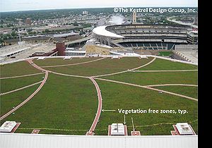
- Green roofs are installed on roofs of commercial buildings or on homes. Green roofs are particularly suitable for urban areas and play an important role in the beginning of a treatment train as means a to filter rainwater, provide rate control and decrease volume to the downstream Best Management Practices (BMPs). Not only do green roofs aid in stormwater management but they assist buildings in energy use by helping cool and providing insulation which helps to reduce the urban heat island. Given green roofs are usually in urban areas they are ascetically pleasing to the public and a habitat for plants and animals.
- Further reading
Stormwater Management Policies
This part of the assessment includes ten (10) areas that address stormwater policies including rate, volume, pretreatment and maintenance.
24. New impervious surfaces
- For new development, does the permitting agency apply community stormwater management standards to all new impervious surfaces, or is a minimum threshold (de minimis) included? (Select one)
- Standards apply to all new impervious surfaces (10 pts)
- Standards apply to 10,000 sq. ft. or more of new impervious surface (8 pts)
- Standards apply to .5 acres or more of new impervious surface (4 pts)
- Standards apply to 1 acre or more of new impervious surface (1 pt)
- Standards apply to any net increase of impervious surface in a development project (1 pt)
- No (0 pts)
- I don’t know / not specified (0 pts)
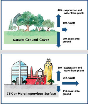
Minnesota's Construction Stormwater General permit applies to new developments that are 1 acre or more in size. Many local government units have stormwater requirements that apply to areas smaller than 1 acre (e.g. 10,000 ft2). Bellvue, Washington, for example, has requirements that apply to new developments exceeding 7,000 square feet. A United States Geological Survey study shows that sediment loss from small construction sites can be significant when taken cumulatively across an area.
25. Baseline-condition
- For new development, does the permitting authority apply community stormwater standards requiring rate control based on the difference between a baseline-condition and post-development runoff condition? (Select one)
- Yes, our baseline condition is Pre-European settlement (5 pts)
- Yes, our baseline condition approximates woods/prairie grass in good condition (3 pts)
- Yes, our baseline is pre-development (existing) conditions and it is consistent with MIDS (2 pt)
- Yes, our baseline is pre-development (existing) conditions (1 pt)
- Yes, our baseline is consistent with MIDS (1 pt)
- No (0 pts)
- I don’t know / not specified (0 pts)
- A baseline condition generally refers to a performance target. It most often applies to matching or achieving hydrologic conditions with the specific target. The most aggressive hydrologic target is matching pre-European settlement hydrologic and pollutant loading conditions. This would match a completely undisturbed condition. Matching forest or prairie conditions is another target, but sometimes this refers only to hydrologic conditions and not pollutant loading. The MIDS goal attempts to mimic hydrologic conditions for native vegetation and soils. Pre-development can be a confusing term since it is not clear if this refers to prior to any development or to some recent development condition. For example, converting row crop agriculture to residential land use may assume the agricultural condition represents pre-development, even though it is a highly modified system. The closer we can approximate hydrologic conditions to match native vegetation and soils, the more water we retain on the landscape and the more pollutants are also retained.
26. Total-suspended solids and total phosphorous
- Does your community require best management practices (BMPs) for all new development that will result in at least 90% reduction in total-suspended-solids (TSS) and/or at least 60% reduction in total phosphorous (TP)? (Select one)
- Yes, my community follows MIDS (3 pts)
- Yes (2 pts)
- No (0 pts)
- I don’t know / not specified (0 pts)
- Total-suspended solids (TSS) and total phosphorous (TP) are pollutants found in stormwater that effect rivers, lakes and streams. TSS includes sediment particles from erosion, dust, litter and other particles from impervious surfaces. Solids that end up in water bodies accumulate on the bottom and can disrupt aquatic life and aquatic plant growth. TP refers to phosphorus which comes from fertilizers that are applied to lawns and get washed away when it rains and carried into the nearby storm drain or rain garden. When phosphorus enters lakes and rivers it increases the amount of minerals and organic nutrients found in the water. The increase in minerals and organic nutrients is not healthy and is a major contributor to impairments in Minnesota surface waters.
- Further reading
27. Downstream water resources
- Are post-construction sediment and nutrient loading requirements customized to downstream water resources, such as critical habitat, impaired waters, ORVW? (Select one)
- Yes (3 pts)
- No (0 pts)
- I don’t know / not specified (0 pts)
- Discharge of similar quantities of water and/or pollutants may have different effects on the receiving water depending on the type of receiving water. For example, stormwater runoff at 20 degrees C may have minimal impacts on warm water lakes, but have detrimental effects to fish in a cold water lake or stream. Adjusting water and pollutant loads to the most sensitive receiving waters offers the greatest environmental protections. These include cold water fisheries and habitat, Outstanding Resource Value Waters, impaired waters, wetlands, critical habitats, and other similar receiving waters.
Further reading
- Special waters and other sensitive receiving waters
- Trout lakes
- Trout streams
- Calcareous fens
- Wild Scenic Rivers
- Impaired waters
28. Runoff volume
- Are there post-construction runoff volume requirements for downstream river erosion protection? (Select one)
- Yes, no runoff volume increase for the 10-yr, 24-hr event (6 pts)
- Yes, no runoff volume increase for the 5-yr, 24-hr event (4 pts)
- Yes, no runoff volume increase for the 2-yr, 24-hr event (2 pts)
- No (0 pts)
- I don’t know / not specified (0 pts)
- High intensity storms cannot be treated with typical stormwater BMPs. However, practices can be installed on the landscape to slow the rate of runoff for these larger events. It is these larger events that result in scouring or rivers and streambank erosion. Erosion can therefore be minimized by implementing practices that slow the rate of runoff for these larger storms. Examples include stormwater ponds and wetlands that have sufficient storage to hold back and slowly release runoff. For the Minneapolis-St.Paul International airport, the 24 hour events for recurrence intervals of 10, 5, and 2 years is 4.24 inches, 3.54 inches, 2.83 inches.
Further reading
29. Erosion and sediment control
- [for non-MS4s only] Has your community adopted an erosion and sediment control ordinance that align with MS4 permit requirements? (Select one)
- Yes (10 pts)
- No (0 pts)
- I don’t know / not specified (0 pts)
- If an MS4, select not applicable in my community (N/A)
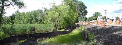
- Erosion and sediment control is important because it helps reduce the amount of pollutants that enter our water bodies. Communities have developed their own ordinances or they have adopted something similar to the model ordinances (see further reading below). The purpose of an erosion and sediment control ordinance is to not only comply with MS4 permit requirements but to help keep the water bodies in your community free of pollutants so they remain safe for recreation and a habitat for wildlife.
- Further reading
30. Pretreatment sizing standards
- Do your community stormwater management standards specify pretreatment sizing standards for stormwater prior to discharge into all permanent structural best management practices (BMPs)? (Select one)
- Yes (2 pts)
- No (0 pts)
- I don’t know / not specified (0 pts)
- Pretreatment is important in stormwater because it not only helps filter pollutants but is critical when considering the downstream structural BMP and drainage area. There are multiple methods to allow for pretreatment but it is important to consider the easy maintenance so the device can function properly and continue to filter out pollutants.
- Further reading
31. Redevelopment
- Do your community stormwater management standards apply to all redevelopment, which includes reconstruction of linear projects? (Select one)
- Yes, we apply MIDS to all redevelopment (9 pts)
- Yes, standards apply to all redevelopment (7 pts)
- Yes, standards apply only to redevelopment projects with a net increase in impervious surface (4 pts)
- No (0 pts)
- I don’t know / not specified (0 pts)
- Linear projects include road projects and utility projects. In order to trigger the Construction Stormwater Permit one acre or more of land must be disturbed.
- Further reading
32. Water reuse and conservation
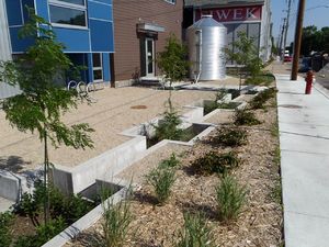
- Does your community encourage or require any of the following water conservation strategies: (select all that apply)
- Stormwater water reuse incentives (5 pt)
- Stormwater water reuse standards (3 pt)
- Encourage or require irrigation systems to be retrofitted with Smart irrigation systems that track weather patterns and mitigate unnecessary watering (2 pt)
- Use of low-water vegetation (1 pt)
- Water Conservation Rate Structure that exceeds DNR minimum requirements (1pt)
- Other water conservation strategies (1pt)
- No (0 pts)
- I don’t know / not specified (0 pts)
- Water is an important resource and communities are recognizing the importance of water conservation strategies. The strategies can be in the form of incentives, standards, retrofitting or some other strategy a community has found to be successful in conserving water in their community.
- Stormwater water reuse incentives promote voluntary action on behalf of residents and businesses to practice water reuse while receiving recognition in the form of money, award or other determined by a community.
- Stormwater water reuse standards unlike incentives are not voluntary. Standards must be followed in order to comply with a City's rules so they are able to construct the reuse standard practice.
- Encourage or require retrofitting or retrofit is defined by Wikipedia as the addition of new technology of features to older systems. When relating retrofitting to stormwater practices an example is a raingarden or swale.
- Low-water vegetation consists of plants that do not require lots of water and can survive with little water.
- Water Conservation Rate Structure is rate structure from the DNR on how the water utility fee should be constructed.
- Further reading
33. Maintenance agreements
- Does your community require & enforce maintenance agreements for privately maintained stormwater facilities? (Select one)
- Yes (3 pts)
- No (0 pts)
- I don’t know / not specified (0 pts)
- Maintenance agreements also known as long-term maintenance agreements are used to create a legal agreement between two parties. One party is agreeing to conduct maintenance of a stormwater practice including documenting date(s) of inspection as well as necessary maintenance performed as a result of inspection findings. It is important each party is aware of their role in this agreement and the proper documentation is kept on record.
- Further reading
SECTION THREE - STORMWATER POLLUTION PREVENTION
This section focuses on two areas including education and source control.
Education & Community Programs
This part of the assessment consists of four areas that address education and outreach, and training.
34. Education & outreach programs
- Does your community participate in stormwater pollution prevention education & outreach programs such as: (Select all that apply)
- Metro Blooms educational workshops (within last 3 years) (1 pt)
- The NEMO Program (within last 3 years) (1 pt)
- The Clean Water Minnesota Media Campaign (annually) (1 pt)
- The Blue Thumb Program (annually) (1 pt)
- Other similar programs (1 pt)
- No (0 pts)
- I don’t know / not specified (0 pts)
- There are various stormwater education and outreach opportunities for the public to participate in. These opportunities allow for individuals to become more informed citizens when it come to stormwater. Some of these programs include:
- Metro Blooms is a non profit promoting raingardens, native planting to reduce runoff and improve water quality. They do this by providing workshops for the public to attend.
- The NEMO Program (Non-point Education for Municipal Officials) is a program hosted by the University of Minnesota and the National Sea Grant College Program. The program provides education and research to local appointed and elected leaders (city council, watershed boards, county commissioners etc.) so they can make informed decisions on water resources within their community.
- The Clean Water Minnesota Media Campaign is a program through the Metro Watershed Partners, a coalition of 70 public, private and non-profit organizations. Metro Watershed Partners is a project of Hamline University.
- The Blue Thumb Program is coordinated by Metro Blooms. The program similarly to Metro Blooms promotes clean water through planting efforts (rain gardens, turf alternatives, native planting and shore stabilization). Blue Thumb is a public/private partnership.
- Further reading
35. Residential and business education efforts
- Does your community have residential and business education efforts such as: (Select all that apply)
- Educational stormwater pollution prevention workshops for residents (2 pts)
- Education and outreach program for local businesses (2 pts)
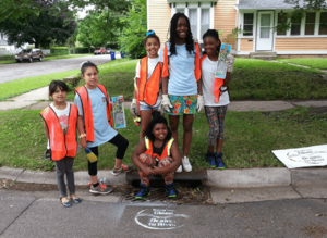
- A storm drain stenciling program (2 pts)
- Sponsorship of community education events and/or clean ups (2 pts)
- Adopt-a-Storm Drain program (2 pts)
- Stormwater BMP demonstration sites with educational signage (2 pts)
- Regular utility bill inserts with stormwater educational messages (1 pt)
- A city newsletter that regularly includes a variety of stormwater pollution prevention messages at least 4- 6 times each year (1 pt)
- A city website with that regularly includes a variety of stormwater pollution prevention messages at least 4- 6 times each year (1 pt)
- No (0 pts)
- I don’t know / not specified (0 pts)
- There are a variety of opportunities to educate the public on stormwater whether that be in the City's newsletter, an adopt-a-drain program, utility bill insert or others. These education tools give opportunity for the public to learn about stormwater. It is the discretion of the City to decide what is most beneficial for education but ultimately the idea beyond the education piece is that this is a meaningful interaction and will invoke some environment stewardship of stormwater from an individual.
36. Financial assistance
- Does your community promote and/or provide financial assistance for the implementation of stormwater pollution prevention & treatment practices and projects for residents or businesses? (Select one)
- Yes, promotion & financial assistance (3 pts)
- Yes, promotion only (1 pt)
- No (0 pts)
- I don’t know / not specified (0 pts)
- Stormwater projects can be costly in order to gain the benefit of cleaner water. There are different types of funding, grants and loans available for those interested in stormwater projects. Check out the MPCA webpage for more information of stormwater financial assistance.
37. Certification and training
- Which of the following certification and training opportunities does your community make available to municipal staff on a regular basis? (select all that apply)
- MIDS training (e.g. MIDS calculator, ordinance and BMP trainings) (1 pt)
- Erosion & sediment control certification (1 pt)
- Illicit Discharge detection & elimination training (1 pt)
- NEMO “Stormwater U” (1 pt)
- None (0 pts)
- I don’t know / not specified (0 pts)
- There are certification and training programs available to stormwater professionals. There are a variety of the programs available and are often required to be refreshed annually and/or maintain the certification when applicable. An example of a certification that expires every three years is the erosion and sediment control certification. On the other hand, Illicit discharge detection and elimination training is recommended to be refreshed yearly in accordance with the MS4 Permit.
- Further reading
Inspection & Enforcement
This part of the assessment consists of two areas that address mapping and inspections.
38. Stormwater system map
- [for non-MS4s only] Is your community’s stormwater system mapped? (Select one)
- Yes (1 pt)
- No (0 pts)
- I don’t know / not specified (0 pts)
- If an MS4, select not applicable in my community (N/A)
- A stormwater map is helpful in order to understand and be able to find areas in your storm sewer system that need repair or maintenance. Depending on what is used for the mapping tool, some computer programs have the capability to track maintenance and inspections. This may or may not be a beneficial tool depending on the size of the system and resources available. Items that can be included in a stormwater map may include flow direction, all pipes 12 inches or greater, outfalls, ponds, unique identifiers and any other information that may be useful.
- Further reading
39. Inspection & maintenance
- [for non-MS4s only] Does your community have an inspection & maintenance schedule for stormwater management practices - including catch basin sumps & stormwater ponds? (Select one)
- Yes (2 pts)
- No (0 pts)
- I don’t know / not specified (0 pts)
- If an MS4, select not applicable in my community (N/A)
- It is important to inspect all stormwater management practices to ensure proper function. If the stormwater practice is not functioning upon inspection then maintenance will need to be conducted. Inspection and maintenance is important to ensure continued function of the stormwater management practice. The frequency of inspections can vary based on the stormwater management practice and/or is based on the discretion of the institution performing inspections. During inspections, there is a checklist used to guide what to look for as well as provide for documentation that the inspection was completed and what the inspection findings are.
- Further reading
Source Control
This part of the assessment consists of six areas that address staff training, salt management, street sweeping, yard waste, inspections and yard waste.

40. Certification and training
- Which of the following certification and training opportunities does your community make available to municipal staff on a regular basis? (Select one)
- MPCA Smart Salting Level 2 Training (2 pts)
- MPCA Smart Salting Level 1 Training (1 pt)
- Other Smart Salting Training (1 pt)
- Fertilizer & pesticide use minimization training for staff, and/or for institutional, parks, residential or commercial property managers (1 pt)
- None (0 pts)
- I don’t know / not specified (0 pts)
- There is a Smart Salting training for professional who are salt applicators. The training teaches participants how they can reduce their salt use when maintaining roads and as a result save money. There are two trainings: Level 1 and Level 2. Level 1 is geared towards the individual while Level 2 is geared towards the organization.
- Further reading
41. Salt management
- Which of the following salt management strategies does your community use? (Select one)
- Salt Savings Assessment tool (SSAt) to track BMPs related to chloride use (3 pts)
- 5-year BMP implementation plan to improve salt or chloride management practices (3 pts)
- Salt or Chloride Management Plan (2 pts)
- Salt use tracking (1 pt)
- No (0 pts)
- I don’t know / not specified (0 pts)
- Salt or chloride is a problem in Minnesota's water bodies. The Smart Salting Assessment Tool was created to help organization (private and public) track their salt usage. The goal of the tool is to find opportunities where an organization can improve their salt management. The tool is free to use and is available to any organization. Communities can also develop a BMP Implementation Plan or Salt/Chloride Management Plan as a way to continue to track and improve their salt management.
- Further reading
42. Street sweeping program
- Does your community street sweeping program include the following? (Select all that apply)
- Sweep four or more times per year, OR (2 pts)
- Sweep two or three times per year (1 pt)
- Utilize vacuum sweeping technology (1 pt)
- I don’t know / not specified (0 pts)
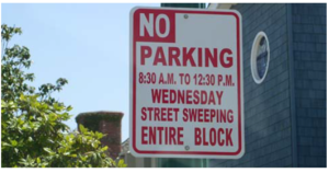
Street sweeping helps communities keep roads free of debris and dirt that accumulate in the gutter, and eventually leads to the storm drain and into the lakes and rivers. A street sweeping program varies per community which means the area swept, the frequency, type of equipment and the cost will vary largely per community. Regular street sweeping reduces the amount of litter, organic material (leaves, grass etc.) and other materials that will make their way into the nearby lake or river.
Further reading
43. Prioritize street sweeping
- Does your community prioritize street sweeping in areas that are directly tributary to lakes, streams, wetlands and Wellhead Protection Areas? (Select one)
- Yes (2 pts)
- No (0 pts)
- I don’t know / not specified (0 pts)
- Street sweeping is a strategy used by many communities to help reduce the about of dirt and debris on their streets. One of the benefits of this cleaner streets means less dirt and leaves getting into the storm sewer system and ending up in Minnesota's water bodies. The frequency of sweeping is based on the discretion of that community, for some it might be once in the fall after the leaves have fallen and once in the spring to collect any salt and sand from routine winter maintenance.
- Further reading
44. Prioritize inspections of permitted businesses
- Does your community prioritize inspections of permitted businesses storing/using hazardous and/or toxic chemicals that are in areas where water flows directly into lakes, streams and wetlands, and to Wellhead Protection Areas? (Select one)
- Yes (2 pts)
- No (0 pts)
- I don’t know / not specified (0 pts)
- Communities have a variety of businesses from commercial to industrial. It is important to be aware these types of businesses, the practices of these businesses and the proximity to a body of water. In order to prevent illicit discharge it is recommended to inspect these areas because they are more prone to illicit discharge. Further, routine inspection will ensure businesses are in compliance with city ordinances.
- Further reading
45. Yard waste collection
- What type of residential yard waste collection program does your community have? (Select one)
- Community-wide curbside pick-up (5 pts)
- Elective pick-up (3 pts)
- Collection site at which residents dispose yard waste (2 pts)
- None (0 pts)
- I don’t know / not specified (0 pts)
- Yard waste is something every homeowner has to deal with. Each community has different procedures on how to dispose of yard waste, they include:
- Community-wide curbside pick-up: the community has one refuse hauler for the whole commnuity
- Elective pick-up: residents are able to choose who is their refuse hauler
- Collection site at which residents dispose yard waste: a designated site within a community for residents to drop off their yard waste.
- The above mentioned programs provide ways for residents to dispose of their yard waste in an organized manner with the intention to help reduce yard waste entering the storm sewer.
