Navigation
Main page
Table of contents
Index (Categories)
What's new
Response to comments
Future updates
Events
In the News
Funding
Recent changes
Help
Export to pdf
Tools
User contributions
Logs
View user groups
Special pages
Printable version
MPCA Links
MPCA Homepage
Stormwater
Policies / Disclaimers
Minnesota Stormwater Manual
Search Help
Log in
Search:
Search
Uploads by PLeegar
Special:ListFiles
This special page shows all uploaded files.
File list
Items per page:
20
50
100
250
500
Search for media name:
Username:
Include old versions of files
Go
First page
Previous page
Next page
Last page
Date
Name
Thumbnail
Size
Description
Versions
16:37, 21 September 2016
Maintenance inspection report for dry swale with check dams.docx
(
file
)
14 KB
1
16:23, 21 September 2016
Maintenance inspection report for underground infiltration facilities.docx
(
file
)
12 KB
1
15:52, 21 September 2016
Maintenance inspection report for dry well.docx
(
file
)
14 KB
1
15:43, 21 September 2016
Maintenance inspection report for infiltration trench.docx
(
file
)
14 KB
1
15:36, 21 September 2016
Maintenance inspection report for bioinfiltration basins.docx
(
file
)
14 KB
1
15:13, 21 September 2016
Maintenance inspection report for infiltration basins.docx
(
file
)
14 KB
1
19:08, 22 August 2016
MPCA Stormwater Harvest and Use System Example Inspection Report.docx
(
file
)
25 KB
1
20:58, 18 August 2016
Settling.jpg
(
file
)
28 KB
1
20:54, 18 August 2016
Separators.jpg
(
file
)
24 KB
1
20:51, 18 August 2016
Gutter Guards - Leaf Screens.jpg
(
file
)
57 KB
1
20:48, 18 August 2016
First Flush Device.jpg
(
file
)
44 KB
1
20:43, 18 August 2016
Debris Screens.jpg
(
file
)
7 KB
1
20:39, 18 August 2016
Manufactured screens and filters.jpg
(
file
)
11 KB
1
20:33, 18 August 2016
BMPs with an underdrain.jpg
(
file
)
55 KB
1
20:29, 18 August 2016
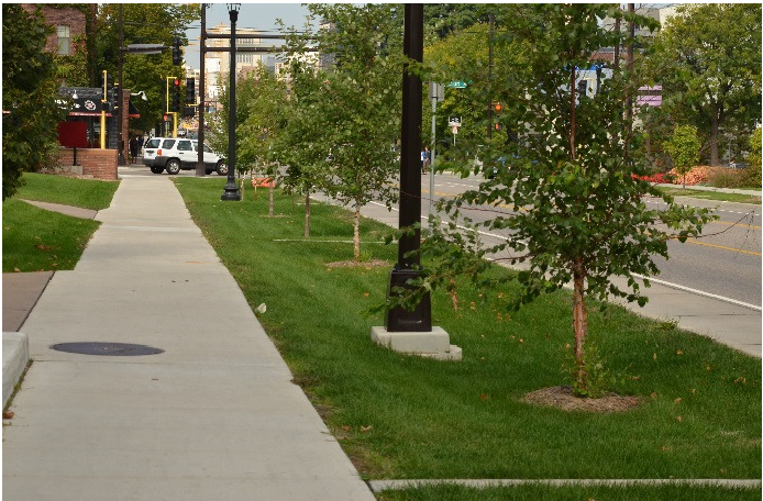
Grassed Swales.jpg
(
file
)
33 KB
1
15:00, 18 August 2016
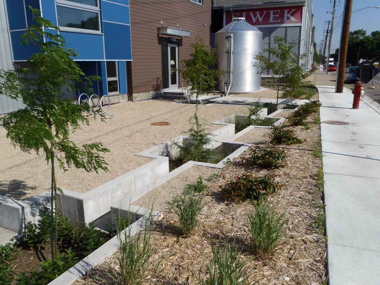
Cistern located at Mississippi Watershed Management Organization 2.jpg
(
file
)
290 KB
1
15:00, 18 August 2016
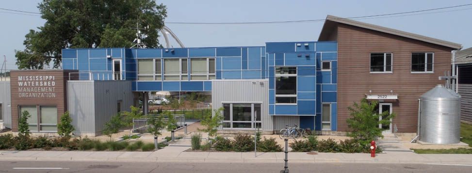
Cistern located at Mississippi Watershed Management Organization 1.jpg
(
file
)
67 KB
1
19:07, 17 August 2016
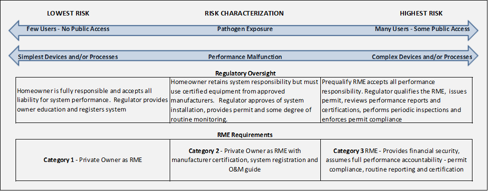
Risk characterization stormwater reuse.png
(
file
)
38 KB
1
14:31, 17 August 2016
Post-Storm Inspection Form Stormwater Harvesting and Use.docx
(
file
)
17 KB
1
14:28, 17 August 2016
Treatment System Maintenance Log Stormwater Harvesting and Use Systems.docx
(
file
)
17 KB
1
14:25, 17 August 2016
Spring Inspection & Maintenance Form Stormwater Harvesting and Use Systems.docx
(
file
)
22 KB
1
19:14, 15 August 2016
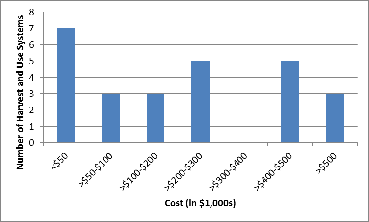
MPCA survey responses of total stormwater harvest and use system costs.png
(
file
)
19 KB
1
16:07, 15 August 2016
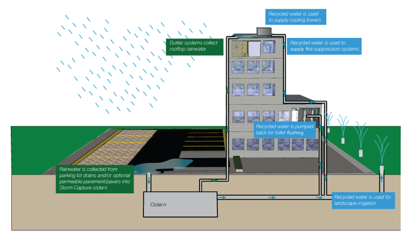
Example Stormwater Harvesting and Use System Schematic.jpg
(
file
)
182 KB
1
22:12, 19 July 2016
Dry swale with check dams complete with trees.png
(
file
)
762 KB
1
22:10, 19 July 2016
Dry swale with check dams complete with.png
(
file
)
762 KB
1
22:06, 19 July 2016
Dry Swale with check dams.png
(
file
)
779 KB
1
21:54, 19 July 2016
Dry swale infiltration area excavated and finished with hand tools.png
(
file
)
839 KB
1
21:50, 19 July 2016
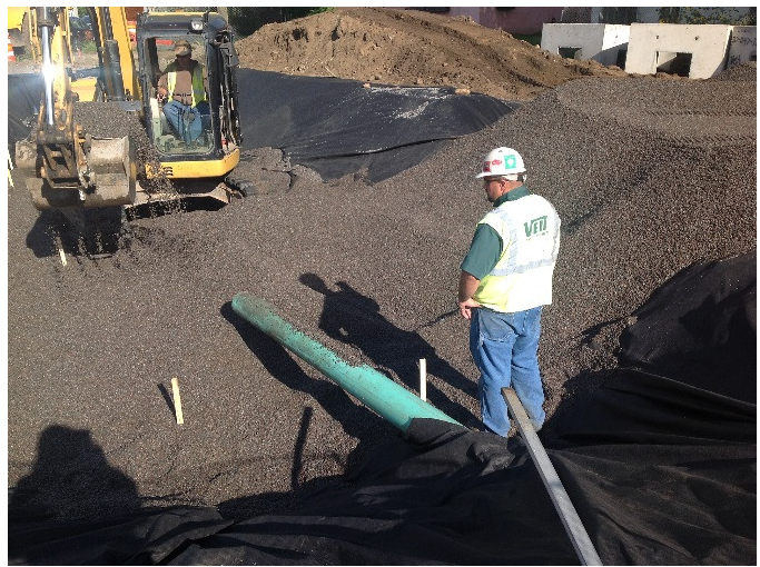
Infiltration media being placed in infiltration area with tracked backhoe.png
(
file
)
832 KB
1
21:41, 19 July 2016
Tracked backhoe and hand laborer in infiltration area during excavation.png
(
file
)
703 KB
1
21:37, 19 July 2016
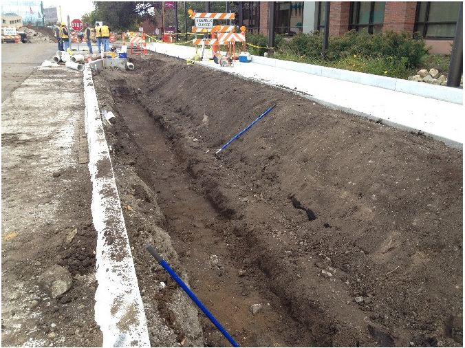
Partial excavation for future dry swale.png
(
file
)
864 KB
1
21:28, 19 July 2016
Retaining wall constructed infiltration basin is fully excavated and has infiltration media in place.png
(
file
)
882 KB
1
21:24, 19 July 2016
Partial excavation for retaining wall infiltration basin is not excavated.png
(
file
)
890 KB
1
20:57, 19 July 2016
Dry swale with check dam inlet pipe.png
(
file
)
433 KB
1
20:49, 19 July 2016
Pretreatment inlet structure to dry swale with check dam.png
(
file
)
421 KB
1
20:31, 19 July 2016
Infiltration basin before planting.png
(
file
)
2.1 MB
1
20:27, 19 July 2016
Infiltration basin with rough grading complete.png
(
file
)
2.64 MB
1
20:05, 19 July 2016
Modular Block Sediment Trap.png
(
file
)
2.9 MB
1
20:01, 19 July 2016
Plan and section view of the infiltration basin.png
(
file
)
156 KB
1
19:35, 19 July 2016
Finished basin with simple groupings of shrubs grasses and trees.png
(
file
)
4.07 MB
1
19:26, 19 July 2016
Riverside Stormwater Plaza Concept Plan.png
(
file
)
317 KB
1
19:20, 19 July 2016
Infiltration soil being carefully placed to avoid compaction.png
(
file
)
3.64 MB
1
19:15, 19 July 2016
Infiltration soil being carefully placed to avoid compaction.docx
(
file
)
3.56 MB
1
18:56, 19 July 2016
StormTrap underground storage vault for water stormwater reuse as irrigation.png
(
file
)
4.3 MB
1
18:38, 19 July 2016
Contech infiltration system in native sandy soils.png
(
file
)
4.06 MB
1
18:30, 19 July 2016
Plan layout of infiltration and reuse systems.png
(
file
)
141 KB
1
19:51, 29 June 2016
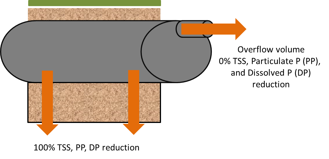
Schematic showing pollutant load reduction for infiltrated and overflow water 2.png
(
file
)
91 KB
1
19:05, 29 June 2016
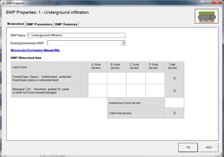
BMP Properties 1 - Underground infiltration.jpg
(
file
)
47 KB
1
19:02, 29 June 2016
Symbol for underground infiltration in MIDS calculator.png
(
file
)
50 KB
1
18:52, 29 June 2016
Schematic showing pollutant load reduction for infiltrated and overflow water.png
(
file
)
88 KB
1
18:48, 29 June 2016
Screenshot from MIDS calculator showing user inputs needed for stormwater disconnection.png
(
file
)
76 KB
1
First page
Previous page
Next page
Last page
Search:
Search
Privacy policy


