Information: This page contains the following map showing Minnesota's ecoregions:
An ecoregion, is a geographical area where the land use (agriculture, forest, prairie, etc.), underlying geology, potential native plant community, and soils are relatively similar.
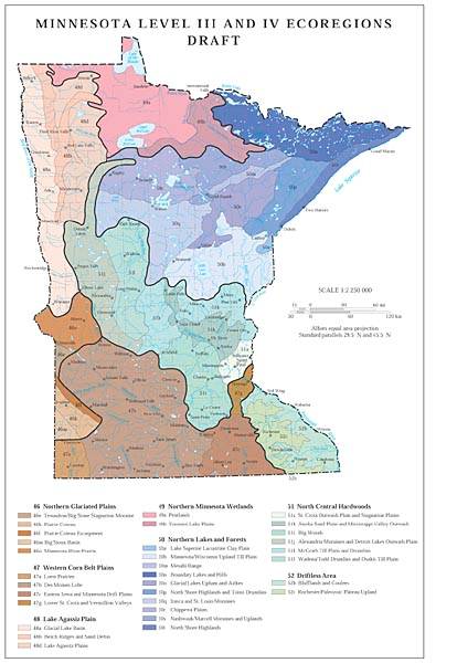
The map above replaced previous maps of Minnesota ecoregions. The following maps have been archived.
- Map showing MPCA's ecoregions
- Map showing Minnesota's ecoregions
- Map showing the DNR's ecoregion provinces