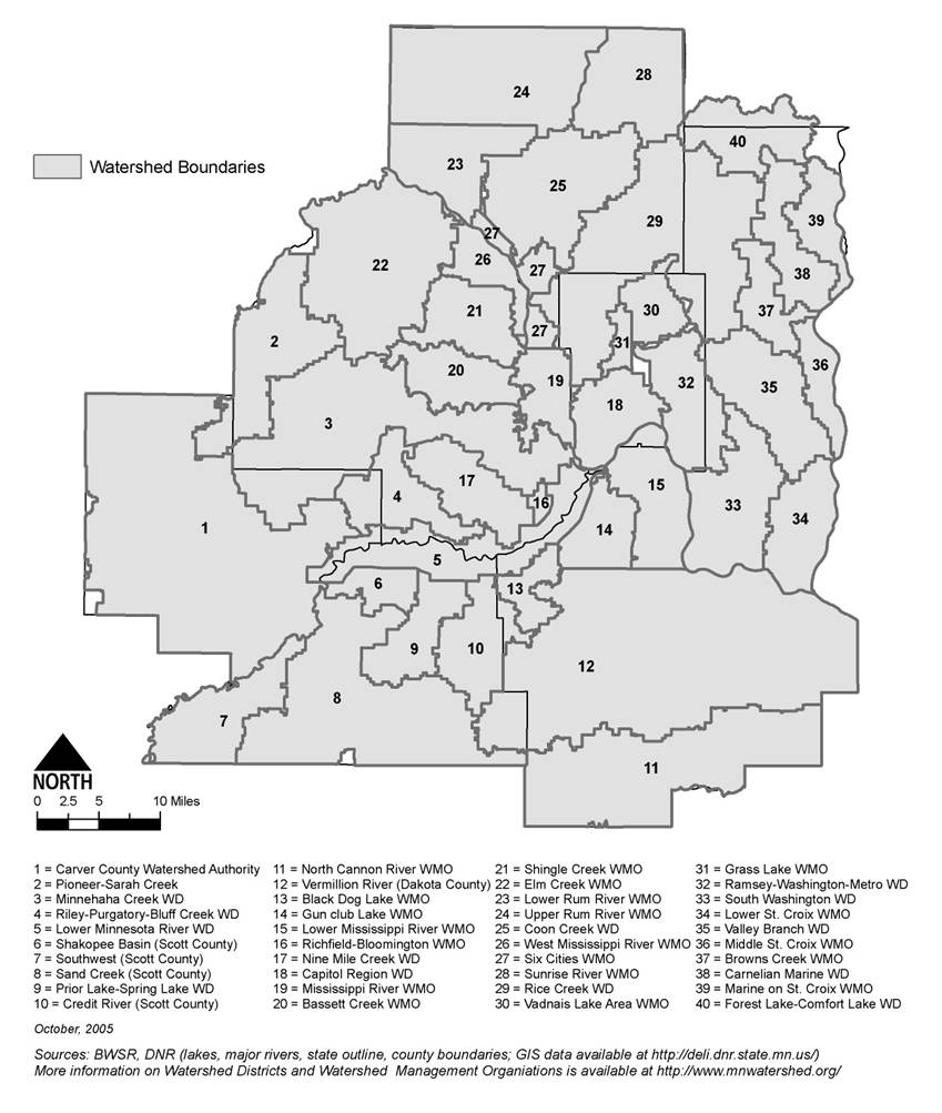
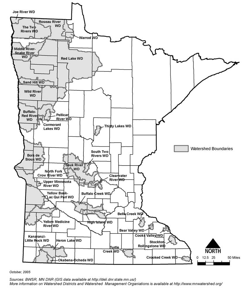
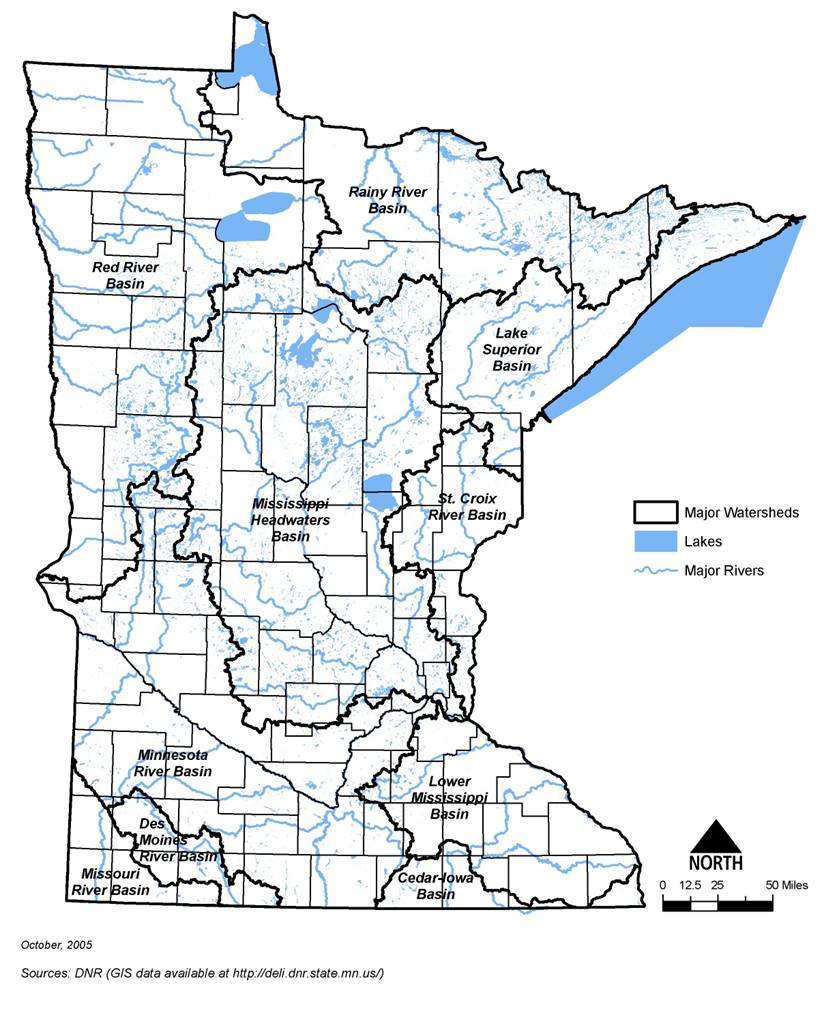
Information: This page contains the following maps showing watershed information for Minnesota:
- Location of watershed districts and watershed management organizations in the seven county Metropolitan Area
- Location of out-state watershed districts in Minnesota
- Map showing location of major river basins in Minnesota
Information: To view the title of an image hold the mouse over the image. To view the image click on the image. Most views show higher resolution depictions of the image.